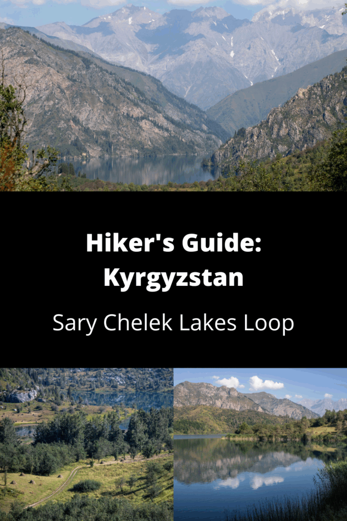
Kyrgyzstan: Sary-Chelek Lakes Loop (Jalalabad)
Exceedingly popular among domestic tourists, Sary-Chelek Biosphere Reserve is something of a niche destination for international visitors. If you do make the long drive up, try to set aside three or four hours to make this pleasant little loop through the seven small lakes that are dotted among the rolling hills here, which an option to tack on a few hundred meters of additional vertical elevation to climb up to a high viewpoint that sweeps across the valley.
Total km: 11 km
Elevation gain/loss: 416m+/ 416m-
Start point: Sary-Chelek Road End
Endpoint: Sary-Chelek Road End
GPS Files
Though not challenging, this short loop hike wanders far off the main road and lakeshore which the vast majority of visitors stick to – a nice chance to experience the nature and solitude of the Biosphere Reserve away from the crowds, and with considerably better views.
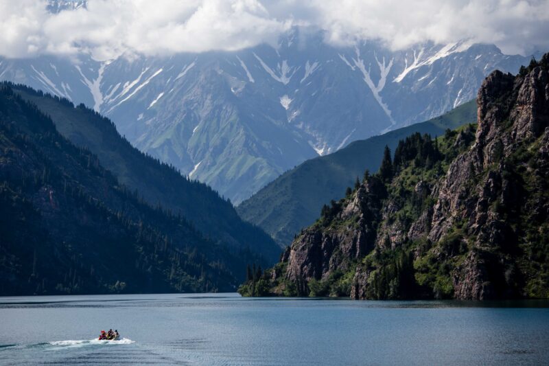
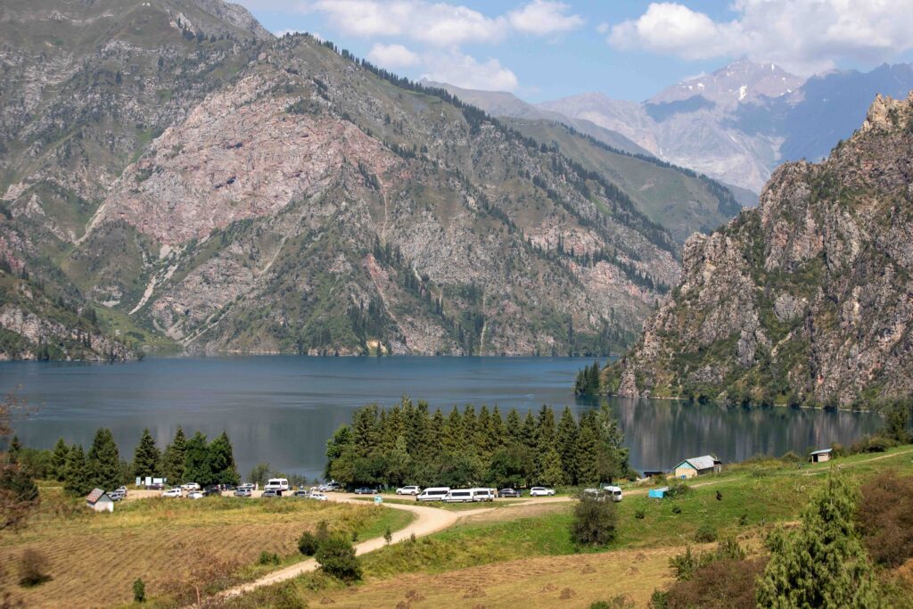
The trailhead is the main parking lot on the shore of the main Sary Chelek lake, where on most days you’ll find a dozen or more cars and marshrutkas disgorging passengers for swimming and picnicking. Follow the main road back down from the lake for about 400m, looking to where the road turns to cross a small bridge, and take the left-hand footpath to leave the road (and crowds) behind.
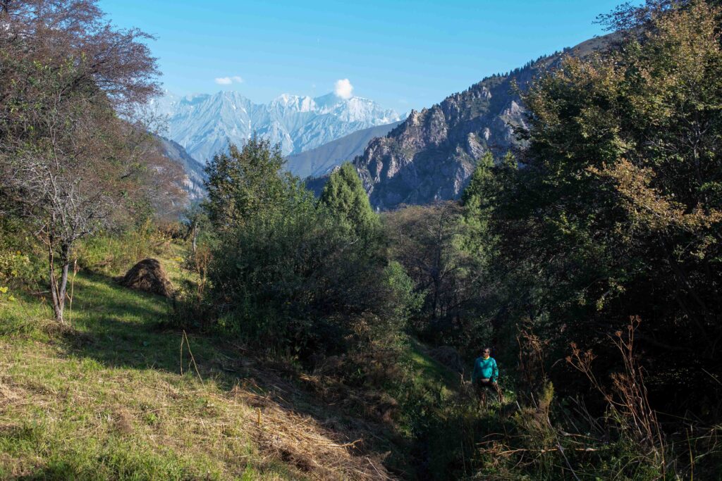
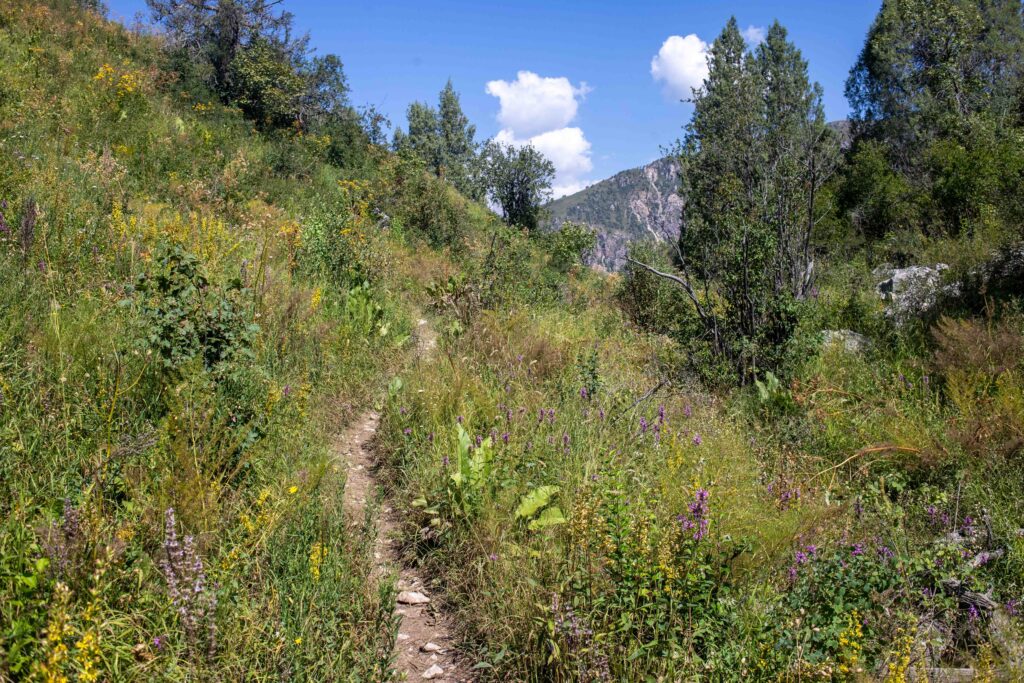
The trail quickly turns to single-track footpath, rolling up and down small hills as it runs south towards Kyz Kol, the first of the small lakes that this looping walk winds through along its course. While the first looks at the lake are pleasant enough, the best views are from the far southern shore, as the trail climbs a little above to frame Kyz Kol beneath the mountains the hug the larger lake beyond.
Beyond Kyz Kol the path begins to rise more steeply, dipping into the forests between open hilltops, past tiny Kely Kol lake to eventually join a jeep road that climbs the hillside just south of the lakes. For the current trail we follow the jeep road to just above 2000m, where the walking loop drops to the left and down the hill, but the jeep road continues on a little further to peter out into a track that climbs all the way to the saddle to the east, to which it’s possible to continue climbing a further 500m for sweeping sidelong views of the full valley – well worth the effort if you have the time and energy to spare.
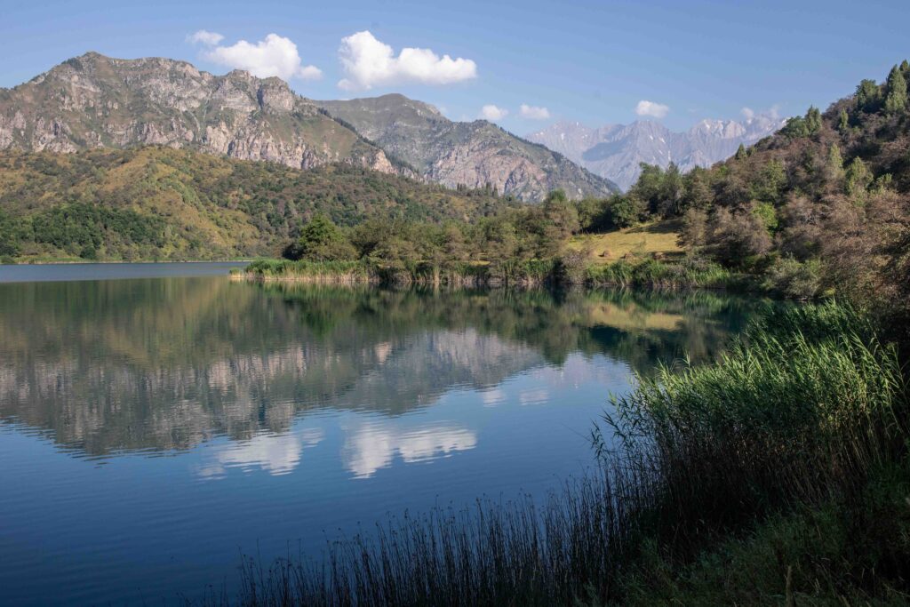
For the main trail, drop down the walking path as it cuts through the hillside to the shore of Iri Kol, for our money the most beautiful of the small lakes and an excellent place to stop for a break or a picnic lunch along the shaded shoreline somewhere past where the walking trail rejoins a distinct dirt road.
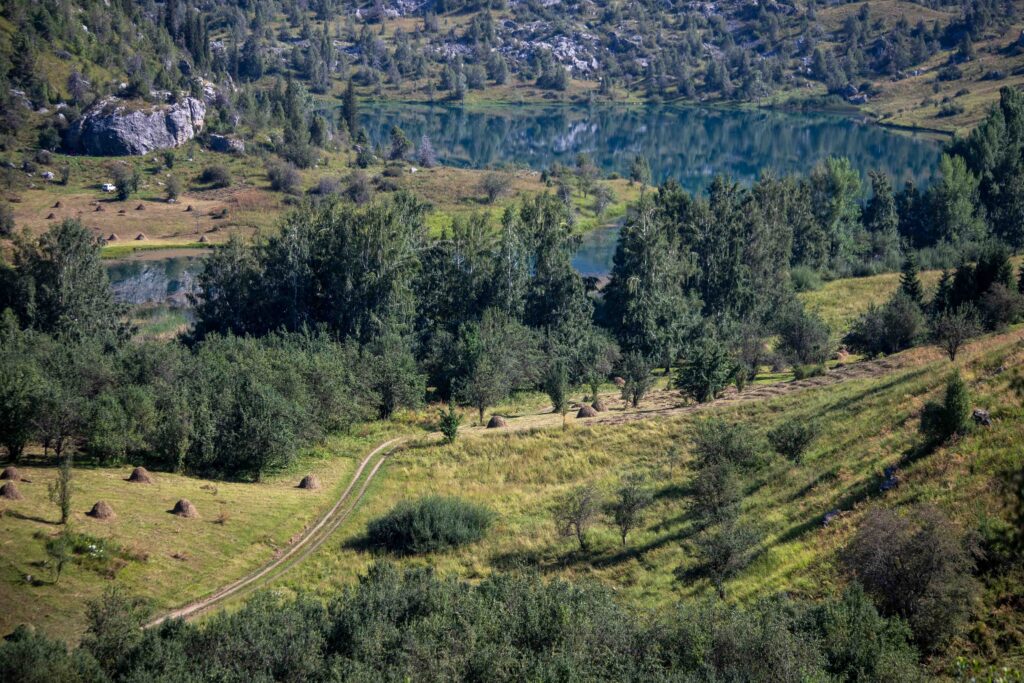
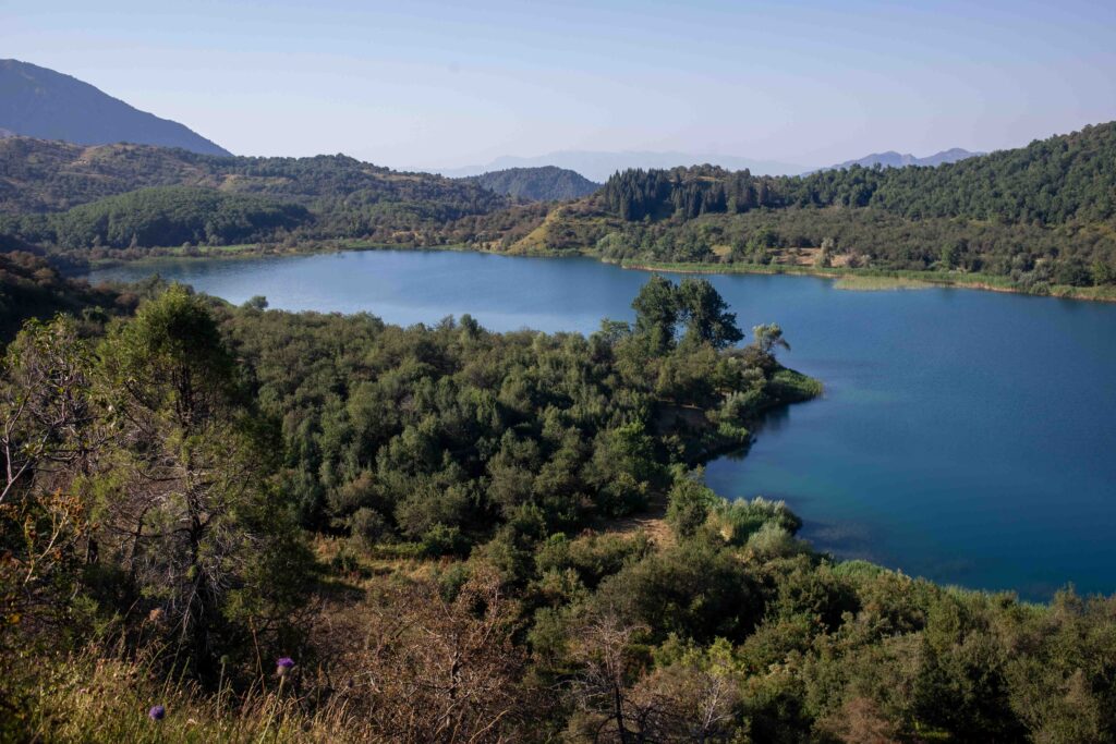
Leaving Iri Kol, follow the dirt road back to where the trail turns up to another much smaller lake – the old Soviet maps have this as Kely Kol and the previous small lake as Chacha Kol, while another source puts this as Aram Kol, but as we didn’t pass any locals along the middle of the hike here we never got a chance to ask for clarification. At any rate, this is probably the least impressive of the valley’s small lake, and you may end up blowing right past it as we did.
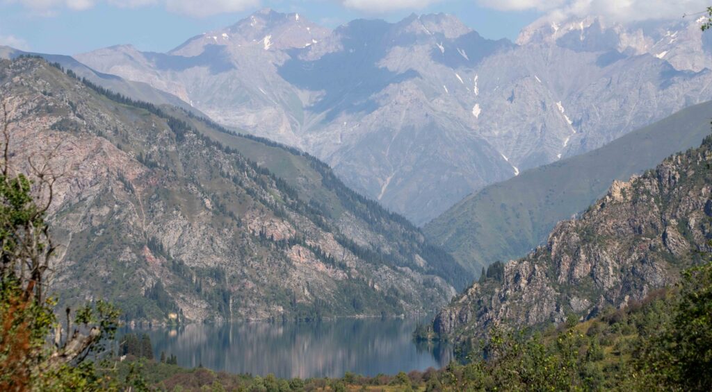
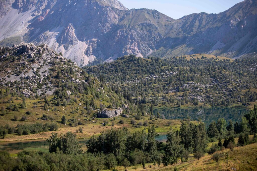
Push onwards up the grassy hillside to the highest point of the trek at 2024m (assuming you’ve opted not to climb to the saddle as previously described) and a little further on the most stunning views of large Sary Chelek that you’ll have all day long. A tree-shaded patch of grass up here also makes an excellent break point, though if there are more than two or three of you it may be a struggle to keep everybody in the shade.
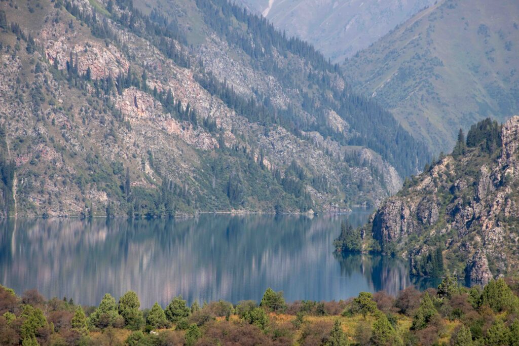
While it’s not exactly all downhill from here, it does conceptually feel that way as you descend from the viewpoint. The route dips and climbs a bit, including past one last small lake Tuyuk Kol sunk deep into the hillside, but quite soon the large Sary Chelek lake and lakeside parking lot trailhead from which you set out come back into view, the trail dropping steeply in the last few hundred meters to meet back up with where it began.
Good To Know
In addition to the optional pass climb mentioned herein, it is also possible to continue down from the pass to the next valley to the east, camping on the shore of Karasu lake before descending back down to the village of the same name and onwards to the highway. Transportation will be a challenge, so the smart move will often be to find a ride up to Karasu and then hike over to Sary Chelek proper, which you’re far more likely to find a spare seat in a car to carry you back down to the village.
Getting to the Sary-Chelek Lakes Loop
Public minibuses run from Bishkek (!) and Osh once daily to Arkyt, the last village on the main road that leads into Sary Chelek. No regular transport runs further from Arkyt into the reserve, but typically private taxis are parked out in front to offer rides up to the lakeshore – it’s over a dozen kilometers and a bit of a climb, so it’s typically better to spring for a ride than try to walk it out – however travelers who don’t mind a bit of hitching (at your own risk) may have some luck getting a seat with local tour groups in private minivans – and will likely make a few new friends along the drive as well.
Where to Stay and Eat
The only ‘proper’ accommodation is in Arkyt, where a handful of guesthouses have rooms for rent in family homes. One may also unofficially pay a small fee to camp within the reserve, or super-unofficially pay some cash directly to the forestry service employees at the cabin above the lake shore to camp for the night in their garden. Any travelers planning to to any hiking would be well-advised to avail themselves of the opportunity, as the lake is most peaceful in the early evening and mornings when visitors are few.