Kyrgyzstan Topographic Trekking Maps
топографические карты Кыргызстана
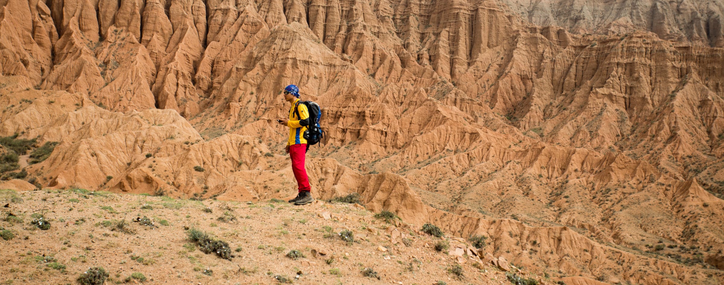
In partnership with national tourism brand Discover Kyrgyzstan, the USAID Business Growth Initiative recently helped design a set of topographic trekking maps covering their partner destinations across the country of Kyrgyzstan. Each map includes detailed descriptions, distance, and difficulty information along with photos of every route.
[2022 Update: these Kyrgyzstan topographic trekking maps are now mostly unavailable on Amazon, but can still be found locally in Kyrgyzstan at the DMO, CBT, and TUK offices as noted throughout the text.]
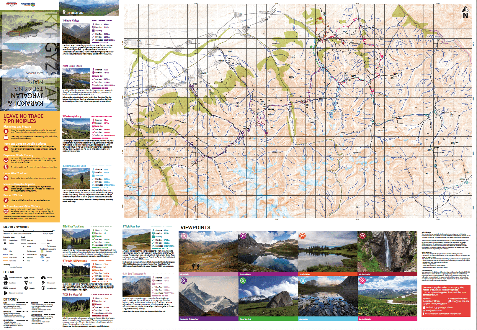
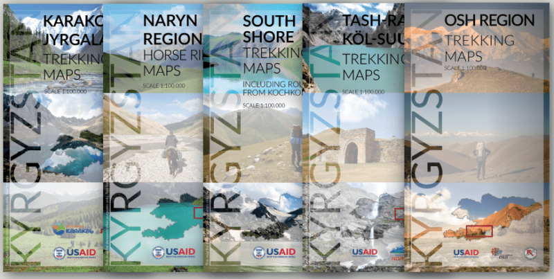
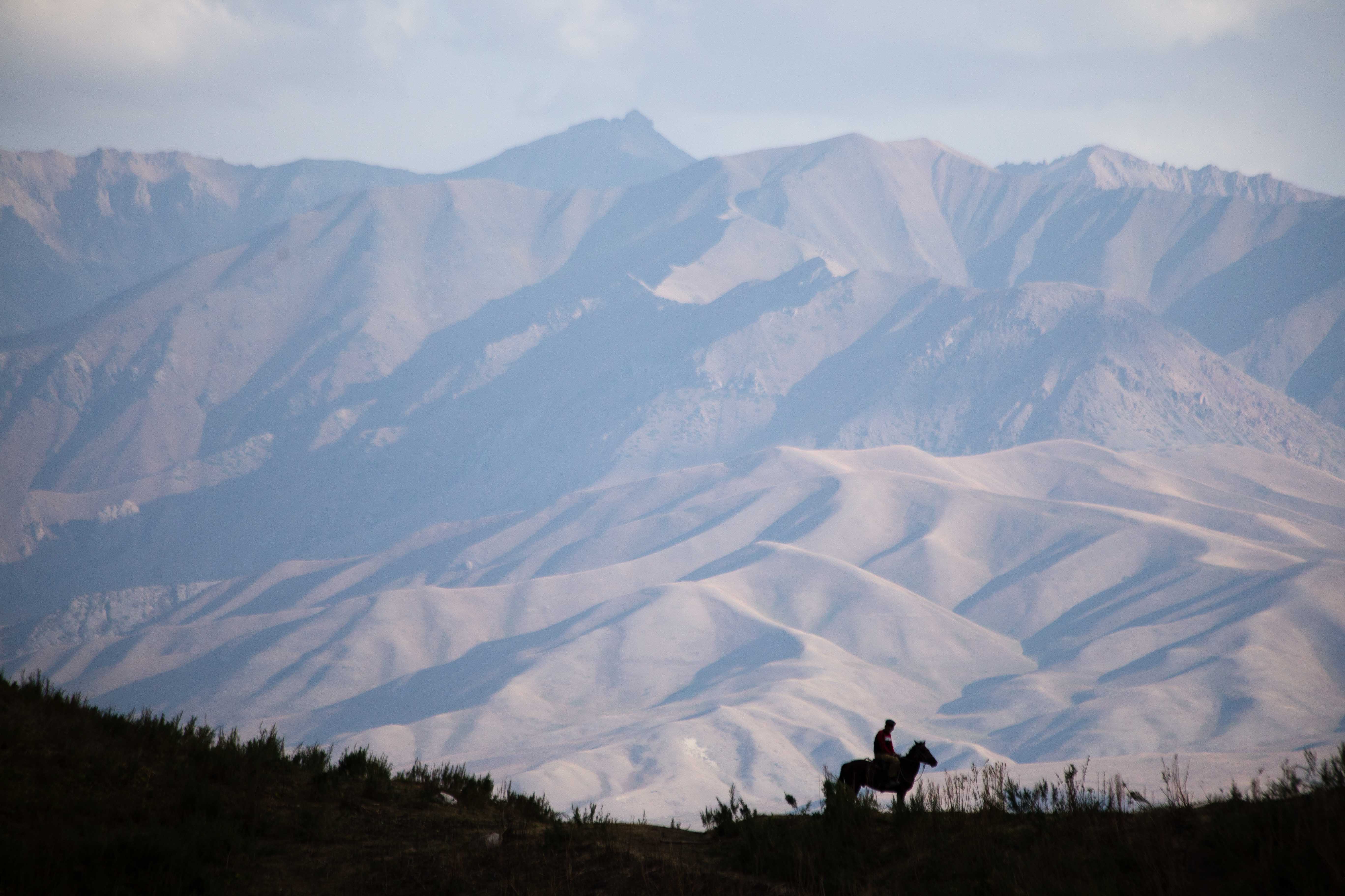
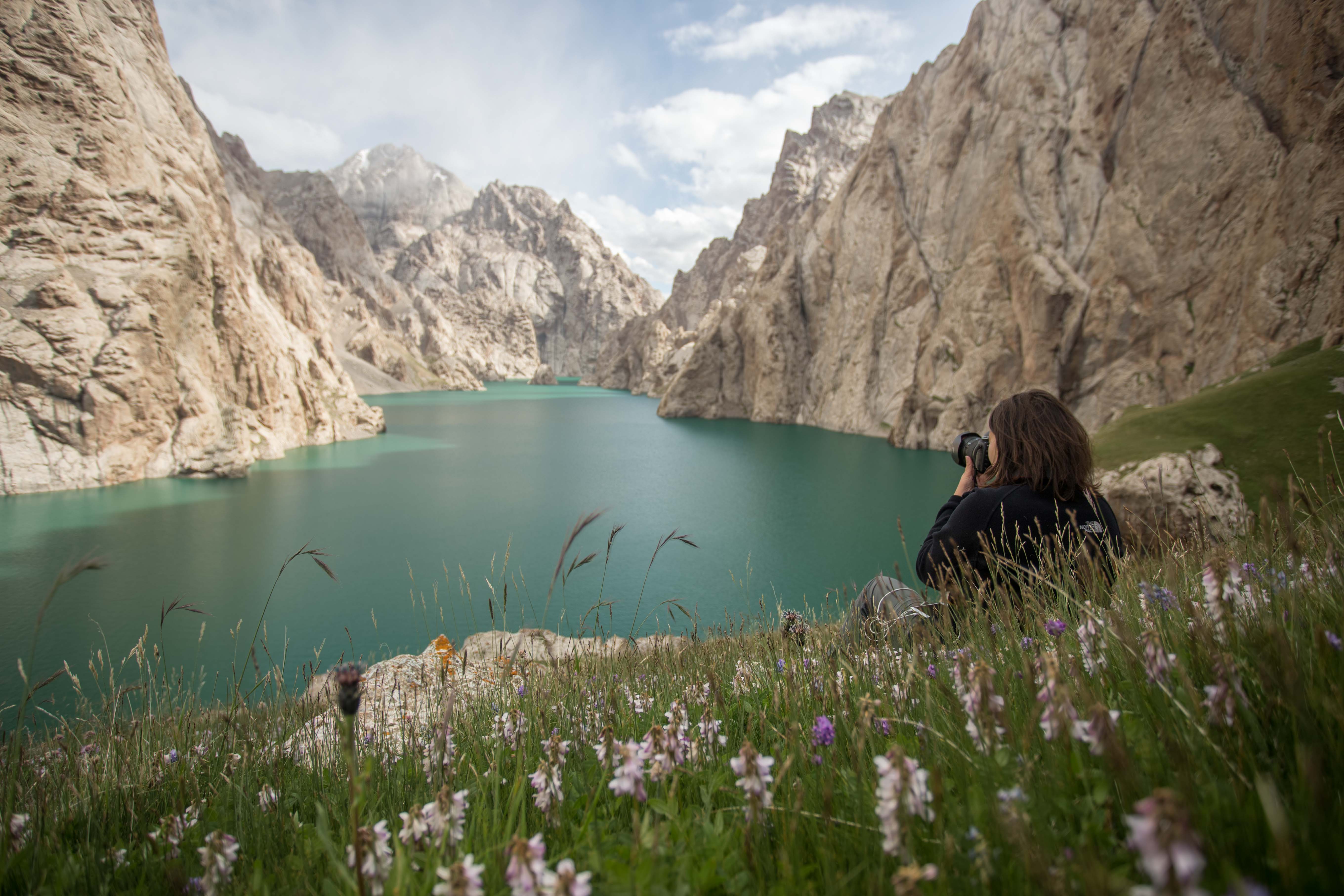
This series of hiking maps published in partnership with the Discover Kyrgyzstan national tourism brand and regional Destination Management Organizations covers a range of the country’s most popular trekking areas in 1:100,000 scale. Each double-sided map covers a total area of approximately 4,400km². Maps includes additional tourism information such as the locations of guesthouses, yurt camps, and popular tourist attractions throughout the area. Contact details are included for local partners in each region who can arrange transportation, gear rental, guide hire, and horse rental.
Osh / Alay Region Trekking Maps
Osh/Alay Region Trekking Maps. Hiking trail information on ten routes across the Alay Region of Kyrgyzstan’s Osh Oblast, from half-day hikes off the Pamir Highway to the 5-day Heights of Alay Loop trail circling from Sary-Mogol village over the Jiptik (4185m) and Sary-Mogol (4303m) Passes. Included is contact information for ‘Community Based Tourism Osh/Alay’ and ‘Destination Osh’, both of which can assist in arranging transportation to trailheads and guide or gear hire to support any route.
Included Routes:
Adventure from Osh (3 days, 43km)
Daroot-Korgon Loop (3 days, 41km)
Descent into Sary-Tash (1 day, 17km)
Heights of Alay (5 days, 79km)
Kara-Shagyl Gorge (1 day, 13km)
Kolduk Lakes (2 days, 29km)
Kosh-Kol Lakes (1 day, 22km)
Pamir Highway Dayhiker (1 day, 13km)
Shepherds Loop (1 day, 16km)
Truly Nomadic Land (4 days, 66km)
For more information on each route see Destination Osh or Visit Alay. To purchase a copy, visit these organizations in person or Osh/Alay Topographic Trekking Maps on Amazon.
Karakol & Jyrgalan Trekking Maps
Karakol & Jyrgalan Trekking Maps. Hiking trail information on fourteen trekking routes across the Ak-Suu Region of Kyrgyzstan’s Issyk-Kul Oblast, from half-day hikes on the outskirts of Karakol city to the 7-day Ak-Suu Transverse route across the most scenic stretch of the area. Included is contact information for ‘Destination Jyrgalan Valley’ and ‘Destination Karakol’, both of which can assist in arranging transportation to trailheads and guide or gear hire to support any route.
Included Routes:
Ailampa Glacier Loop (3 days, 41km)
Ak-Suu Arboretum (1 day, 13km)
Ak-Suu Highlights (4 days, 65km)
Ak-Suu Transverse (7 days, 115km)
Alternate Arashan (2 days, 18km)
Archa-Tor Pass (3 days, 33km)
Boz-Uchuk Lakes (3 days, 46km)
Eki-Chat Yurt Camp (1 day, 17km)
Glacier Valleys (3 days, 47km)
Keskenkyia Loop (4 days, 53km)
Kok-Bel Waterfall (1 day, 12km)
Nomad Valley (4 days, 56km)
Triple Pass Trek (5 days, 63km)
Turnaly-Kol Panorama (1 day, 13km)
For more information on each route, contact Destination Karakol or Destination Jyrgalan Valley. To purchase a copy, visit these organizations in person or Karakol & Jyrgalan Topographic Trekking Maps on Amazon.
Issyk-Kol South Shore Trekking Maps
Issyk-Kol South Shore Trekking Maps. Hiking trail information on eight trekking routes across the Southern Sore of Kyrgyzstan’s Issyk-Kul Lake stretching from Barskoon in the east to Kochkor in the west. Routes range from half-day panorama hikes on the outskirts of Bokonbaevo city to the 5-day Tranquility Valley route from Boz-Salkyn jailoo to the Barskoon Valley. Included is contact information for ‘Destination South Shore’ and local Kochkor tourism operators, all of whom can assist in arranging transportation to trailheads and guide or gear hire to support any route.
Included Routes:
Ak-Kyia Trail (3 days, 45km)
Ak-Sai Petroglyphs (1 day, 9km)
Shatyly Overlook (1 day, 3km)
South Shore Panorama (3 days, 33km)
Teshik-Kol Lake (5 days, 44km)
Tranquility Valley (5 days, 67km)
Treasures of the Tian-Shan (4 days, 54km)
Ulahol Pass (3 days, 57km)
For more information on each route, contact Destination South Shore of Issyk-Kol. To purchase a copy, visit the organization in person or Issyk-Kol South Shore Topographic Trekking Maps on Amazon.
Tash-Rabat – Eki-Naryn Trekking Maps
Tash-Rabat – Eki-Naryn Trekking Maps. Hiking trail information on nine routes across the best of Kyrgyzstan’s Naryn Oblast, include the immediate environs of Naryn city to Eki-Naryn village and popular Tash-Rabat Caravansary along with nearby Chatyr-Kol lake. Routes range from one-day hikes to peaks on the edge of Naryn city to week-long horse trekking itineraries connecting Tash-Rabat to popular Kol-Suu lake. Included is contact information for ‘CBT Naryn’, who can assist in arranging transportation to trailheads and guide or gear hire to support any route.
Included Routes:
40 Knights’ Loop (3 days, 69km)
Along the Silk Road (4 days, 112km)
Chatyr-Kol Panorama (1 day, 24km)
Mountains of Gold (4 days, 105km)
Panorama 360 (1 day, 10km)
Shepherd’s Life (3 days, 82km)
Tash-Rabat Circle (2 days, 50km)
Tash-Rabat – Kol-Suu (7 days, 193km)*(1 day, 11km)
(* Note that this route is shared across the ‘Eastern Naryn Horse Riding Map’ and the ‘Tash-Rabat – Eki-Naryn Trekking Map’)
For more information contact CBT Naryn. To purchase a copy, visit the organization in person or Tash-Rabat – Eki-Naryn Trekking Maps on Amazon.
Eastern Naryn Horse Riding Maps
Eastern Naryn Horse Trekking Maps. Horse trekking trail information on six routes across the east of Kyrgyzstan’s Naryn Oblast, including the Naryn State Nature Reserve and popular Kol-Suu (Kel-Suu) lake. Routes are primarily intended for horse riders, covering long daily distances, but the terrain on most is suitable for trekking as well. Included is contact information for ‘CBT Naryn’, who can assist in arranging transportation to trailheads and guide or gear hire to support any route.
Included Routes:
Eki-Naryn National Park (4 days, 97km)
Kol-Suu Lake Loop (5 days, 160km)
Nomad’s Home (4 days, 101km)
Pastoral Lands (5 days, 113km)
Shaar Waterfall (2 days, 28km)
Tash-Rabat – Kol-Suu (7 days, 193km)*
(* Note that this route is shared across the ‘Eastern Naryn Horse Riding Map’ and the ‘Tash-Rabat – Eki-Naryn Trekking Map’)
For more information contact CBT Naryn. To purchase a copy, visit the organization in person or Eastern Naryn Horse Trekking Maps on Amazon.

Son-Köl & Jumgal Trekking Maps
Son-Köl & Jumgal Trekking Maps. Trekking trail information on thirteen routes across Kyrgyzstan’s Naryn Oblast, including the Jumgal region and Son-Köl lake. Routes range from one-day hikes near Son-Köl lake and Ak-Köl village to three-day itineraries connecting Son-Köl and Ak-Köl to Kazarman, Jumgal, and beyond as well as several nice loops around small mountain lakes. Included are contact details for Destination Naryn and Destination Jumgal, both of which can assist in arranging transportation to trailheads and guide or gear hire to support any route.
Included Routes:
Three Lakes (3 days, 45km)
Sary-Köl Lopp (3 days, 49km)
Starry Son-Köl Nights (2 days, 34km)
Tuz-Ashuu Pass (1 day, 12km)
Shepherd’s Way (1 day, 12km)
South Shore Panorama Loop (3 days, 43km)
Bridge Between the Lakes (2 days, 28km)
Climb to Kazarman (3 days, 38km)
Ak-Köl Loop (1 day, 19km)
Ak-Köl Panorama (1 day, 3km)
Mines of Ming-Kush (1 day, 19km)
Secret Mountains of Ming-Kush (3 days, 43km)
Son-Köl’s Southern Treasures (3 days, 57km)
For more information contact CBT Naryn. To purchase a copy of the map, visit the organization in person or Son-Köl & Jumgal Trekking Maps on Amazon.

As an aside, we’ve also published a quick and dirty guidebook to show tourists around for their first few days in Bishkek. If you’re headed towards Kyrgyzstan and expect to need some help getting around, consider our Unanchor: Bishkek guide. Additionally, we contributed the Kyrgyzstan chapter to the most recent Lonely Planet: Central Asia guidebook. If you’re looking for more help than that, consider reaching out to our friends at Feel Nomad to organize a tour to the country.
Like it? Share it!
Hello,
Any idea where I could purchase the hiking maps please?(no stock on Amazon)
SEB
Hi Seb, until they show up on Amazon, they’re only available in Kyrgyzstan at the partners noted and linked to within the article. So, if you’re not able to get it before you’re arrival, stop by and say hi to one of the DMOs and they’ll help you out.
Why are these maps still not available for sale at Amazon or anywhere else online? It makes trip planning before arrival much more difficult than it should be. It is 2019 not 1989. 🙁
Anyone know if they are available anywhere online? Cheers!
My contacts in Kyrgyzstan tell me it’s an issue with Amazon not paying to Kyrgyz-based bank accounts, so they’ve all but given up on the idea. Luckily they still sell them in many places in Kyrgyzstan, so you should have no trouble picking one up once you arrive.
in which places (offices?) exactly do they sell these maps? for example, of the jyrgalan and alay valley areas?
Hi Robert, please see the links to the destination websites throughout the article.
Hi,
As I checked many times Amazon does not have available the maps. Is it possible to buy online the maps from other source
Thanks
Hi Sav – if that’s the case, you’ll probably need to buy them in-country from the locations mentioned at the end of the article.
Can I buy it online somewhere? Are the maps available somewhere in Karakol?
As of this past summer the maps were still available at the Destination Karakol office, but you’ll have to check with them directly to verify their current stock.