Nepal: Tamang Heritage Trail Trek
The Tamang Heritage Trail is not one of the most popular treks in Nepal – it doesn’t hit the highest peaks in the region, doesn’t have a long history of foreign trekkers, and (horror of horrors!) it’s hard to find a slice of apple pie. Situated just west of the far more famous Langtang National Park, just south of the Tibetan border, the Tamang Heritage Trail was in fact developed only in 2004 as a way to encourage the spread of tourism income through communities in Nepal that had rarely seen trekkers.
While much of the Langtang region was heavily damaged by the massive 2015 Nepal earthquakes the Tamang area escaped relatively unscathed, and was among the first areas to reopen to trekkers. With plenty of mountain panoramas, countless cultural interactions, and friendly homestays in beautiful villages; this trail is well worth a trekkers’ time. Whether as a short trek out of and back to Kathmandu or a warm-up before the longer Langtang Trail, the Tamang Heritage Trail is well worth the time and effort for trekkers in Nepal, and could be condensed further than the laid-back 5 days we decided to hike it in.
Total Km: 52.7km
Total Days: 5
Elevation Gain/Loss: 4718m
Start/End Point: Syarbrubesi
GPS Files
Expect a fair amount of daily elevation change along the Tamang Heritage Trail, though nothing particularly unusual for the Nepalese Himalaya. Out of shape hikers may consider the climb up to the Nagthali Ghyang La pass demanding, but it’s also a good excuse to break there for a night and admire the views. The only real concern is the occasionally unclear directions for following the trail – it’s not always well signposted at trail and road junctions, so having a GPS-enabled device along can help considerably with navigation.
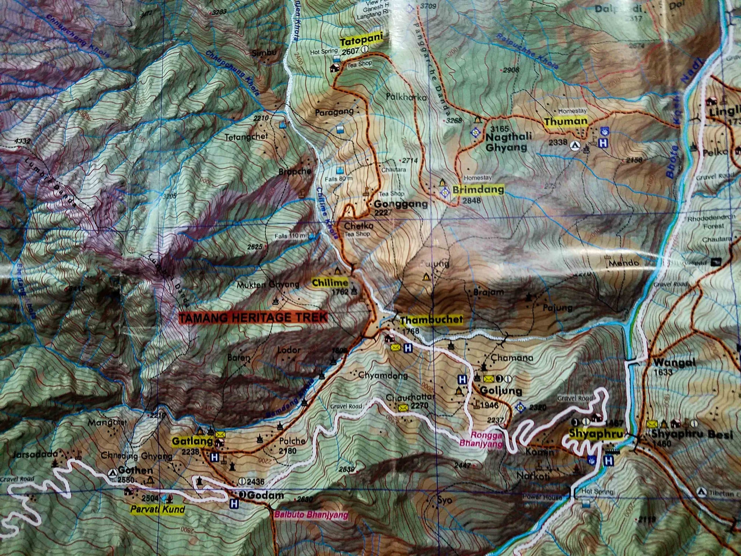
Tamang Heritage Trail Stage 1:
Syarbrubesi to Ghatlang
Total km: 16.5km
Walking time: 5h
Total time: 6.5h
Elevation Gain/Loss: 1981m+ / -1129m
Starting from Syarbrubesi, follow the dirt and gravel road that rises to the west at what is the upper village’s primary junction. The road gently switchbacks through the village before settling into a long slow climb that loops around the exposed hillside north of the village, presenting great views west up the valley towards Langtang and northwards to the border with Tibet. This pattern of long flat stretch and switchbacks repeats itself until the final set of switchbacks before the day’s pass. Entering the last set of switchbacks, look for a stone staircase built into the hillside. This more direct, though much steeper, route climbs directly to the pass and a pair of teahouse. Expect about an hour and a half of walking from the village, plus time for photo stops.
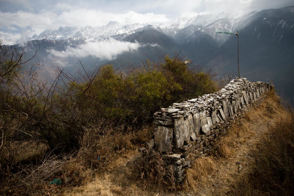
From the pass a concrete staircase climbs for around 15 minutes to the Tsamkhang Stupa (built in 2016) and a lovely viewpoint offering a top down view of the next few days route up the Chilime Khola valley, though a communications tower does mar the view a bit. Lonely Planet describes a path descending from here to Goljung village, but most hikers will want to head back down to the pass to continue and avoid the backtrack from Goljung to the main road.
Continuing down from the pass, follow the road 500m as it descends to a junction where the Goljung road rejoins the main road. Take the left hand side and carry on around 2km to the hamlet of Chaurhattar, where a pair of guesthouses make a good lunch stop.
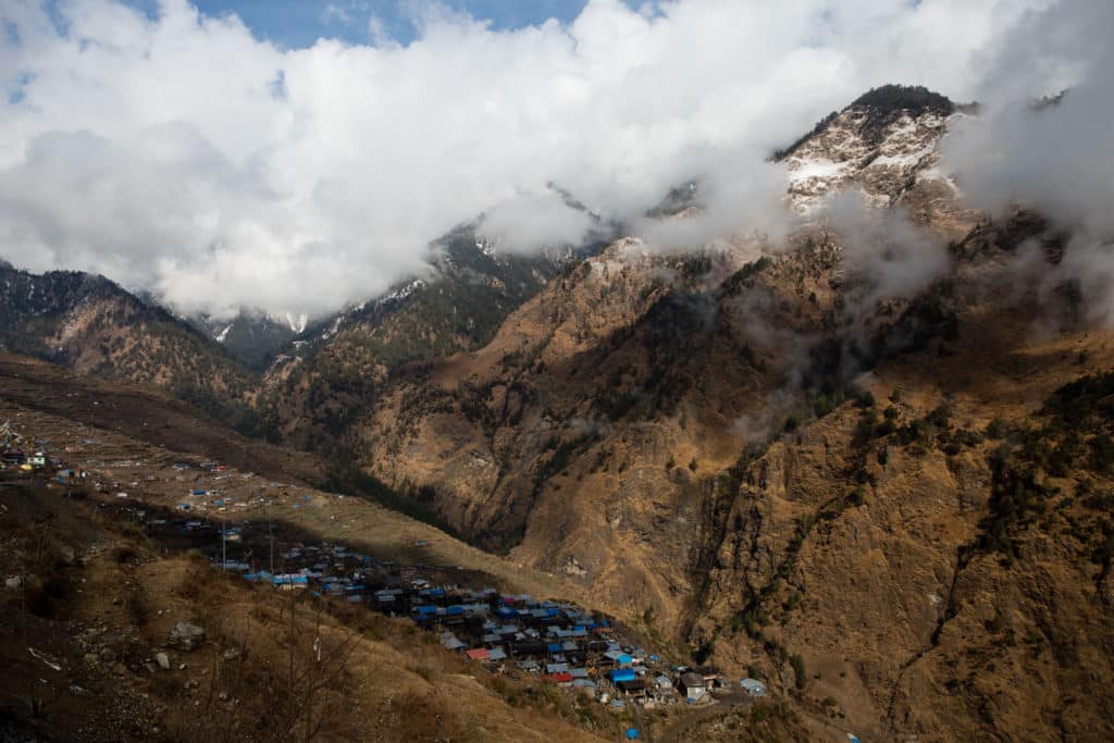
The road carries on gently for another 6 or 7km to Gatlang, with nice views of the village and surrounding mountains of the Bamdang Khola valley along the last half.
Just above Gatlang, in the hamlet of Godam, the road splits. While the right-hand leads obviously to Gatlang, the left-hand tracks runs up to small Parvati Kund lake (around 7km RT by the road) and beyond to several small hamlets.
Several guesthouses have beds for trekkers in the village, but it’s hard not to recommend Tamang Home just at the entrance to Gatlang for the fantastic views that stretch out from the porch and common room.
Tamang Heritage Trail Stage 2:
Gatlang to Tatopani
Total km: 12.8km
Walking time: 3h
Total time: 4h
Elevation Gain/Loss: 1173m+ / -914m
Sunrise on a clear morning presents a fantastic panorama of Gatlang and the surrounding mountains – well worth crawling out of warm blankets for.
Leaving Gatlang, take any of several tracks down through the center of the village until they reach the road at the bottom of town. This road curves slowly down the valley until it reaches the topmost section of Chilime town, where you’ll need to keep an eye out for a pedestrian bridge or risk following the road as it bypasses Chilime. The walk between the two villages only takes around 1 or 1.5 hours, so the two guesthouses here are probably not of much interest (unless, like us, you need to shelter from the rain for several hours). Instead, cut across the top of the village to the road that climbs up the Chilime Khola valley beyond. In the uppermost section of the village, look for either of a pair of staircases that descend east to the river to a suspension bridge.
From the bridge it’s a steady 500m climb up to the village of Gonggang (2227m) and beyond the couple of home stays there to the Tatopani road, which the trail rejoins above the village.
As the road curves around the ridge, it’s possible to continue following it all the way to Tatopani. However, inside the first switchback on the far side of the ridge, look for a walking path that descends briefly before climbing towards Tatopani; a much more pleasant walk of around 3km. Where the path enters the village, a handful of guesthouses are clustered. Do note, though that the eponymous hot spring of Tatopani are no more – they stopped flowing with 2015 earthquake that wrecked havoc across Nepal.
Tamang Heritage Trail Stage 3:
Tatopani to Nagthali Ghyang La
Total km: 4.8km
Walking time: 2h
Total time: 3h
Elevation Gain/Loss: 793m+ / -172m
Leaving Tatopani, the path climbs past the former hot spring and into a forested stretch of trail that climbs lazily along the curvature of the ridge back to the south. As it rolls up and down through the first, make sure to look back occasionally for fine views of the Ganesh Himal ridge across the valley to the west. In around an hour, just after turning past the curve of the ridge, the path enters the small village of Brimdang.
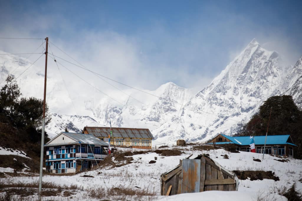
Though there do not appear to be any guesthouses here, two small teashops on a small open area above the village prepare hot drinks and simple meals to accompany the fine views to the south and west. Continuing from the shops, the path climbs first to the east and then swings back on itself to the top of the Nagthali Ghyang La pass (3228m), a climb of around 600m total from Tatopani. Expect 2 hours with no major stops.
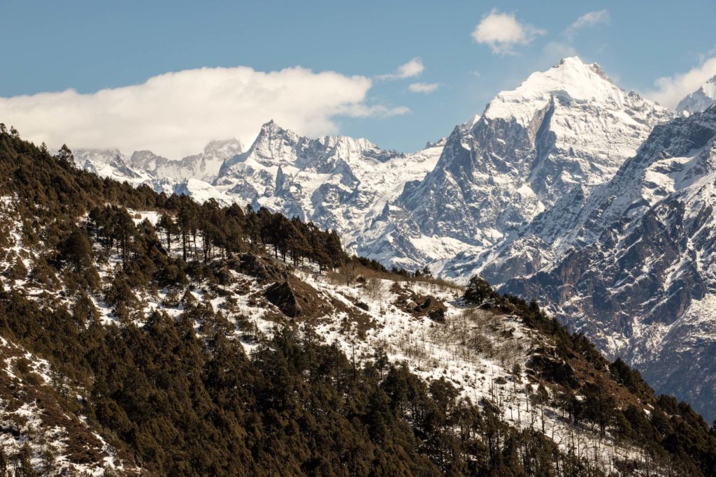
At the pass, trekkers have two options. A radial side hike leaves from the pass to climb due north up the connecting ridge, presenting panoramic views of the Ganesh Himal, Langtang Himal, and into Tibet; on a clear day this is very well worth the effort. Hikers electing this option would be best advised to have lunch at a guesthouse on the pass, leave any non-essential kit in a guesthouse room, and return here to bed down for the evening. Alternately, trekkers can head down directly to Thuman via the trail that drops to the northeast from the top of the pass; but before doing so it’s worth wandering around the top of the pass for a bit to explore the views in each direction.
Tamang Heritage Trail Side Trip:
Radial hike to panoramic viewpoint
Total km: 7km (return)
Walking time: 4h
Total time: 5h
Elevation Gain/Loss: 512m+ / -512m
From the lodges atop the pass, head due north around the east side forested copse above the path to Thume and then up the hillside just beyond. This rises slowly through the forest – very slowly early or late in the season, when snow blankets the trail – until it breaks out onto the barren hillside and rises more quickly towards the top. Views along the way are fantastic to both the Ganesh Himal to the west and Langtang Himal to the east. During our mid-February visit snow drifts on the higher reaches of the hillside prevented our reaching the top, but views from the top of the rise should be fantastic in every direction. After taking in the views and quite a few photos, head back to the pass along the same trail you took to get here.
Tamang Heritage Trail Stage 4:
Nagthali La to Thume
Total km: 3.6km
Walking time: 1.5h
Total time: 2h
Elevation Gain/Loss: 33m+ / -876m
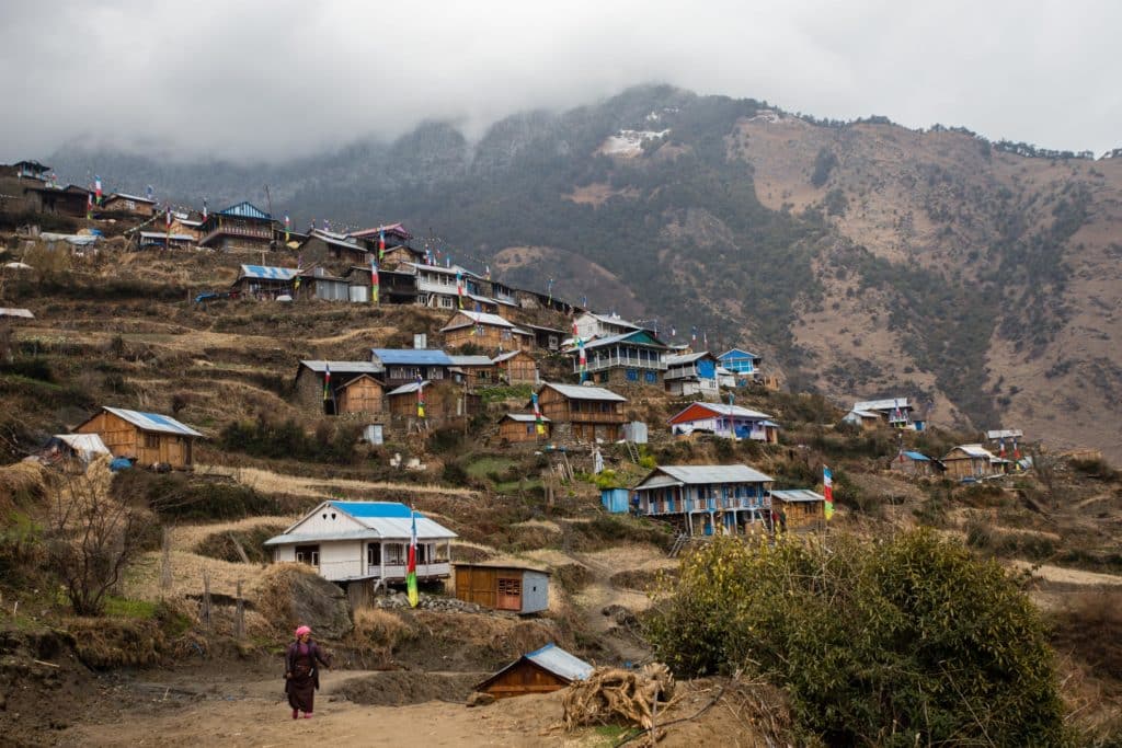
Returning from the radial hike to the panorama, it will still be early enough to carry on to the beautiful little village of Thume. Carry on along the main path that drops down the northeast shoulder of the Nagthali La, descending at a fairly constant slope through verdant forests. Around 1.5km before arriving to Thume a large open pasture has great views of surrounding peaks across the valley to the east, a small stream, and a couple of ruined stone buildings that are quite photogenic; it makes a great place for a lunch or snack stop.
Just above the village, passing the large school, a confusing tangle of paths lead in several directions from several intersections of walkways. Descend generally to the east and you should find your way to the village, but if it’s too much try to wave down a schoolkid and ask; at any rate, once the full village comes into view just below (a nice viewpoint overlooking a large stupa), you’ll know you’ve chosen well.
Right at the entrance to the village is a police checkpoint where you’ll be asked to show your passport. From there, follow the level path northwest to north for the Sunshine Guesthouse or continue down into the village for a handful of others that cluster along the main path through Thume. Though this is still a rather short day of walking, the village is lovely and a nice place to linger, so it’s worth breaking overnight here if you can spare the time.
Tamang Heritage Trail Stage 5:
Thume to Syarbrubesi
Total km: 8km
Walking time: 2.5h
Total time: 3h
Elevation Gain/Loss: 226m+ / -1162m
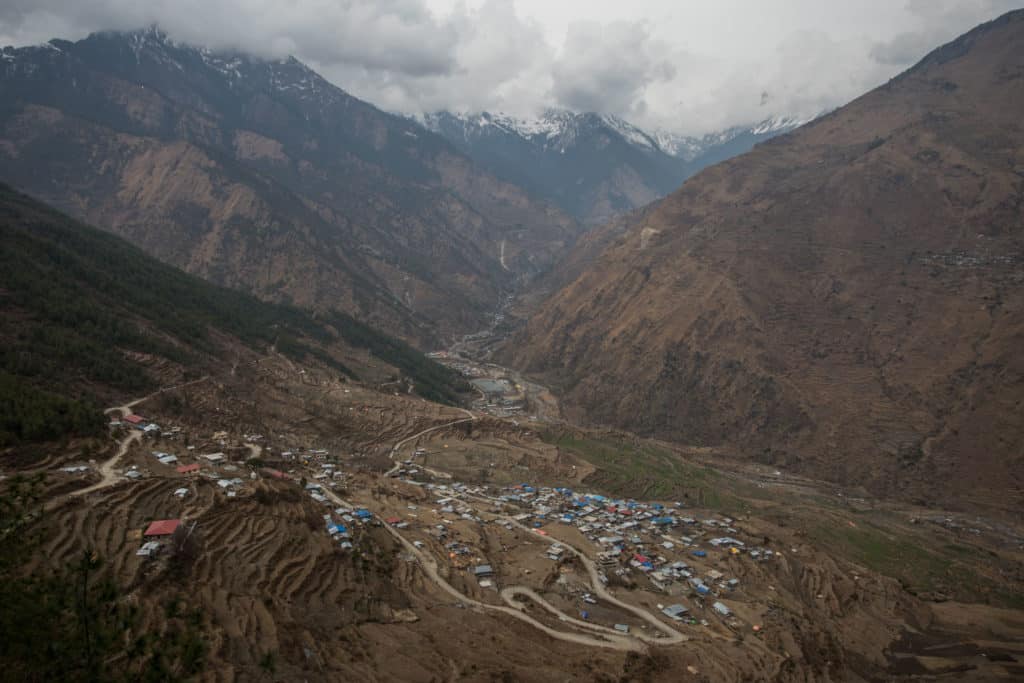
The trail continues down through Thume on a well-defined path that passes above some of the most beautifully terraced fields of the trip, descending to two large stupas lined with mani walls at the apparent junction for the direct descent to Lingling. From the stupas, continue south (at one point crossing the new dirt road that runs up to Thume) until the next small hamlet of Mendo. Though it’s hard to follow, a trail does drop through the village to pick up an old footpath through the fields below. If you miss it you’ll end up having to take the dirt road south out of Mendo which, while not awful, isn’t quite as pleasant and adds somewhat to the length of the route.
Eventually you’ll rejoin the road either way, switchbacking down to the Bhote Koshi Nadi river below and rejoining the main highway between Kathmandu and Tibet. The last kilometer and a half back to Syarbrubesi is along the highway, so it’s a bit dusty and not very interesting, but even if you can’t find a ride it’s a quick return to the village to find a bed and await the bus the next morning.
Alternate Options for the Tamang Heritage Trail
While the Tamang Heritage Trail as-mapped descends from Thume to the village of Lingling along the Tibet highway and then climbs the far ridge to Briddhim, we elected to cut directly back to Syarbrubesi via several less-visited villages along the western side of the valley. The most compelling argument for the original routing is those who want to continue from here on to the Langtang region, as a high trail connects Briddhim to the start of the Langtang trek without having to descend all the way back to Syarbrubesi.
Good to Know
As with most treks in Nepal, one of the great things about the Tamang Heritage Trail is the presence of accommodation and sustenance throughout the entire route. Unlike many other routes, few visitors here means little competition for guesthouse beds – it’s unlikely you’ll show up to a guesthouse in Tamang and be unable to find a space for the night.
Though guides aren’t really necessary for the Tamang Heritage Trail as the paths are generally easy to follow, having one can often lead to deeper cultural interactions with your homestay hosts and with strangers met along the way, so at least consider hiring a guide. If you don’t want to do this from Kathmandu, it’s also possible to arrange directly in Syarbrubesi.
Costs and Practicalities
As with many of Nepal’s rural trekking routes, costs along the Tamang Heritage Trail are quite low and the route can fit into any travel budget. Independent travellers would be hard-pressed to spend more than around 2000 NPR per day on food/drinks and 500 NPR per night on a bed – a total of 2500 NPR or ~US$22 / €20 per day – unless perhaps they were drinking heavily (beer is sometimes available) or hitting the Snickers hard. Note though that you’ll want some extra cash, as even the ATMs in Syarbrubesi are unreliable and beyond that there are none.
Trekkers anywhere in Nepal are required to register for a TIMS card, which can be done with minimal hassle at the Nepal Tourism Board office in Kathmandu. The permit costs 2000 NPR (and you’ll need your passport plus a photocopy and two passport photos) and if you want to do the full mapped Tamang Heritage Trail you’ll also need a Langtang National Park permit for 3000 NPR. You can register one TIMS for all your treks in Nepal at once, so try to plan ahead and register everything at once instead of having to visit repeatedly for multiple cards.
Getting to and from Kathmandu
Getting from Kathmandu to Syarbrubesi is likely to be the least enjoyable part of the entire experience. Buses leave from Kathmandu’s Machha Pokhari bus stand in the ugly hours of the morning, around 5-7am. The trip typically lasts around 7-9 hours depending on traffic backups along the way, and while the views are often stunning the buses are also uncomfortable (particularly for long-legged trekkers). It may be possible to arrange a private jeep to make the run, but those will certainly be more expensive than the 600 NPR bus tickets. Aside from walking back via the Langtang trail or Gosainkund, bus/jeep are the only ways back to Kathmandu as well. As at the bus stop in Syarbrubesi the night before your depart for bus times the next morning.
Where to Stay and Eat
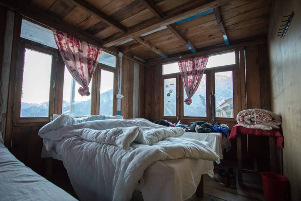
Small family-run guesthouses are the only accommodation option along the Tamang Heritage Trail, and the experience is made far richer for it. Though we found many hosts to be initially shy, they often opened up over the course of the afternoon and even with language difficulties we often had wonderful experiences.
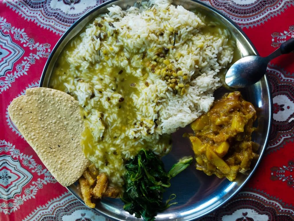
Rooms are generally quite simple (a bed and mattress, a couple of hooks on the wall to hang stuff) and with shared drop toilets, but it’s more comfortable than camping and there’s always a common room (with a hot stove lit in the colder months) to drink tea and hang out. Every guesthouse will have a menu of simple Nepali and sometimes Western foods, and in several villages there are small restaurants as well that have the food but not a guesthouse space. Typically, though, a meal or a bed is only as far as the next village no matter where you are.
What to Pack
As an example, here is what we carried on most treks in Nepal. We slept in a teahouse every night and bought all of our food during the trek, aside from a handful of snacks picked up in Kathmandu beforehand.
– Light hiking daypack to carry all gear.
– A summer sleeping bag for cold nights (throughout the year).
– Two hiking shirts, two pairs hiking socks, two pair quick-dry underwear (one set for daytime wear while hiking, the other for evenings in the guesthouse).
– Quality trekking boots (though you could get by on this route with mid-ankle boots as long as there’s no snow).
– Camera, batteries, and memory cards.
– Kindle (books are heavy!) and charger, or a mobile phone’s Kindle app
– Langtang Trekking Map (easily purchased in Kathmandu)
– Nepalese Rupees