
Kyrgyzstan: Ak Suu Transverse Trek
Кыргызстан: Ак Суу Трансверсе
The Ak Suu Transverse trek is the peak hiking experience in Kyrgyzstan’s Ak-Suu region, starting from the small ecotourism village of Jyrgalan and crossing the whole of Ak-Suu to end at the Soviet-era health resort at Jeti-Oguz, crossing along the way past brilliant lakes and snow-capped mountain peaks and glaciers. If you have the time and inclination, this is THE independent trek for travelers trekking in Kyrgyzstan‘s Issyk-Kol region.
Total Km: 109km
Total Days: 7
Elevation Gain/Loss: 7155m+ / 7465m-
Start Point: Jyrgalan village
End Point: Jeti-Oguz Resort
GPS Files
Though physically strenuous, the Ak Suu Transverse trek doesn’t offer any undue navigational or technical challenges along the 109km route. Campsites each night are at or near water sources and there are frequent fill-up opportunities along the way. The extended length of the trek may lead to a heavy pack in the beginning stages for independent travellers, but if this is a problem it can be offset by hiring porters or pack animals for either the first sections or the entire trip – though pack animals will have trouble with the steep sections beyond the Ak-Suu Almaluu from Stage 4 and after.
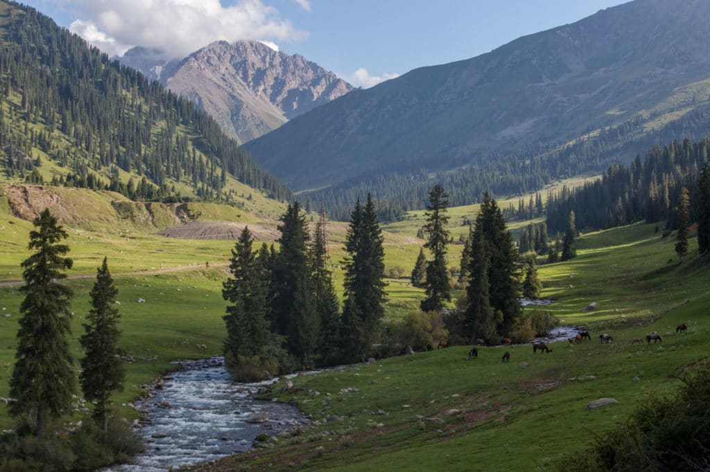
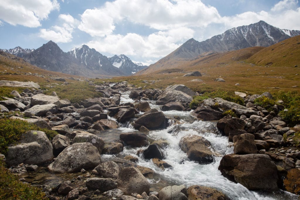
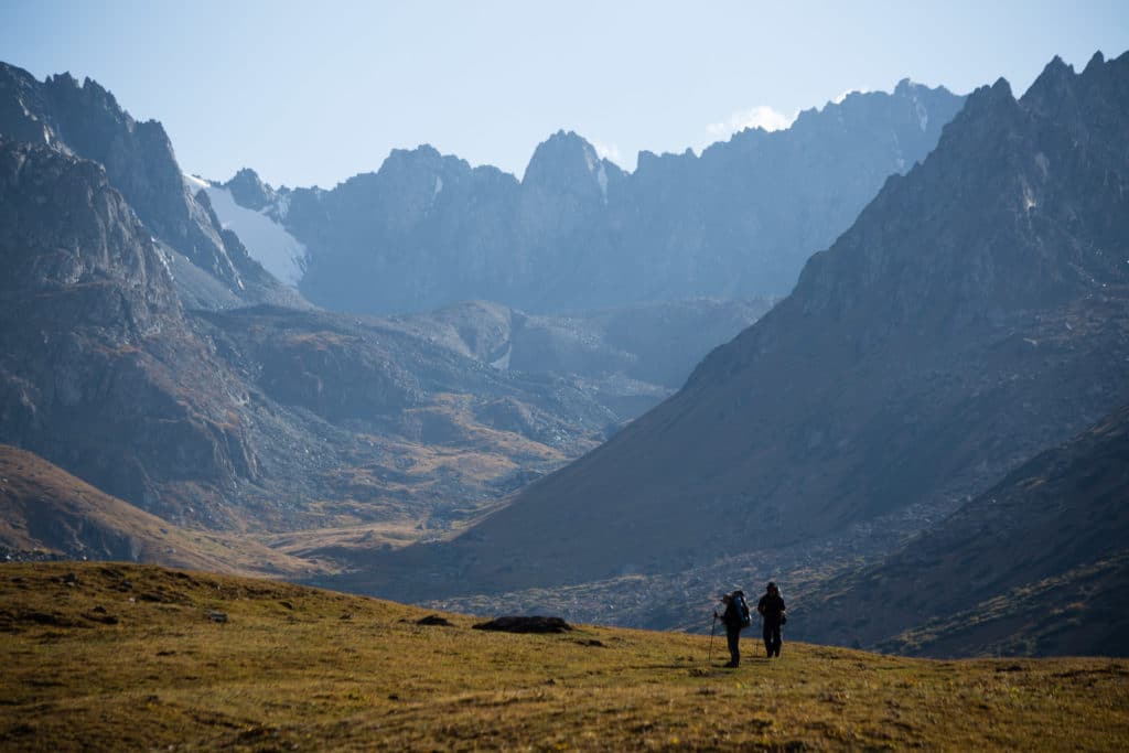
The trail takes in a variety of landscapes, from the verdant greens of the Jyrgalan and Terim-Tor Bulak Valleys in the beginning to the rocky desolate shore of Ala-Kol and all the windswept (and occasionally snow-bound) passes in between. It really is a tour of all the best that the Ak-Suu region of Issyk-Kol has to offer.
Ak Suu Transverse: Stage 1
Jyrgalan Village to Terim-Tor Bulak Valley
Total Km: 13.5km
Walking time: 4h
Total time: 5h
Elevation Gain/Loss: 947m+ / 84m-
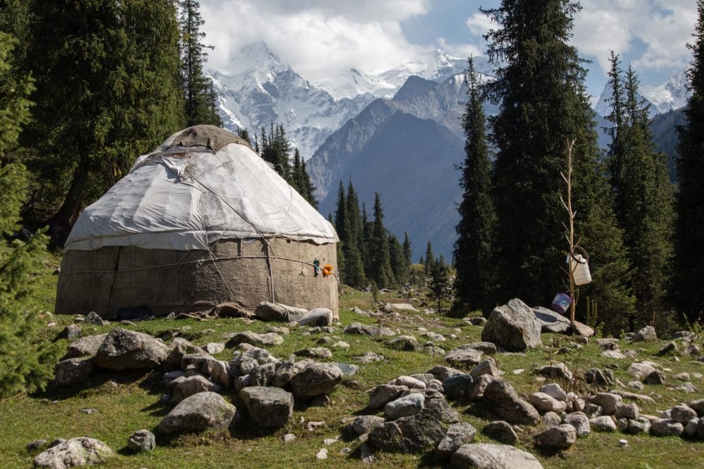
The Ak Suu Transverse trek starts immediately outside the village of Jyrgalan – ideally you’ll have spent a night or more in the village beforehand, and can pack up and walk straight out the guesthouse door.
Head southwest out of the village up the wide and green Jyrgalan valley. For better views climb the heights just west of the village and follow that up the valley all the way to Eki-Chat Yurt Camp, where several guesthouse-managed yurts stay through the summer to provide beds and meals to travelers who don’t want to bed down in the village itself.
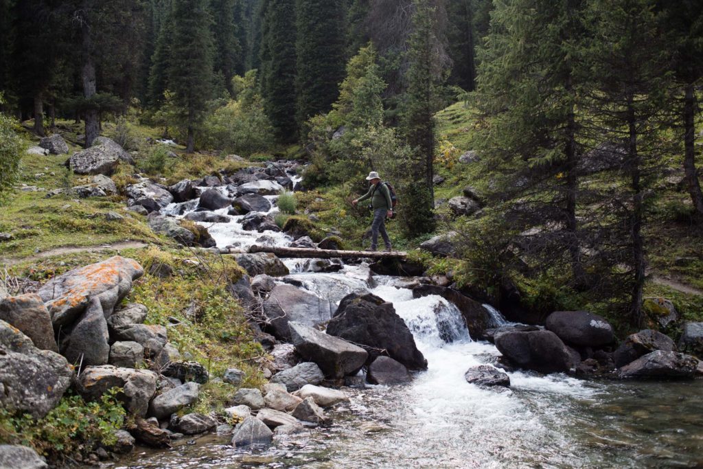
Passing Eki-Chat, turn southwest up the smaller Terim-Tor Bulak Valley, first following an old jeep track that quickly deteriorates into a dirt track and then an obvious horse trail. Continue along the valley, passing occasional seasonal ponds and likely herd after herd of free-range horses that may occasionally be accompanied by shepherds who live down at Eki-Chat or higher up in the valley.
Continue up the Terim-Tor Bulak Valley until about 4km before the large rock face at the end, setting up camp and the base of the Terim-Tor Pass to facilitate a quick climb up and over the next morning. Time and energy permitting, do head up to the end of the valley in the afternoon for nice mountain views or even climb up the Bulak-Ashuu pass to have a look at the small mountain lakes there.
Ak Suu Transverse: Stage 2
Terim-Tor Bulak Valley to Boz-Uchuk Lakes
Total Km: 14.5km
Walking time: 5h
Total time: 6h
Elevation Gain/Loss: 1317m+ / 1128m-
Though Stage 2 doesn’t cover an undue distance, it does bring in two passes for a combined total of over 1300m of vertical elevation throughout the day – and it starts right after breakfast.
Packing up camp in the Terim-Tor Bulak Valley, turn immediately west and begin the gradual ascent to the Terim-Tor Bulak Pass at 3467m. It’s about an hour from the foot to the pass, and nothing terribly difficult, though without spectacular views here compared to the rest of the Ak Suu Transverse’s major passes. Continue down the far side of the pass into the Turgon Ak-Suu Valley and the highway to Enilchek.
While the road here runs from Issyk-Kol (via Boz-Uchuk and Ak-Bulak villages) all the way up to the abandoned mining town at the foot of the Enilchek glacier, we’ll stay with it just long enough to cross over and beeline towards the Turgon Ak-Suu river. The bridge right between the passes here has washed out, but you can either charge across (or flag down a horseman) if the water is low enough or detour upstream about 600m to another small bridge besides a group of yurts. In what seems like a flash, the route has crossed the valley and begins to climb once more.

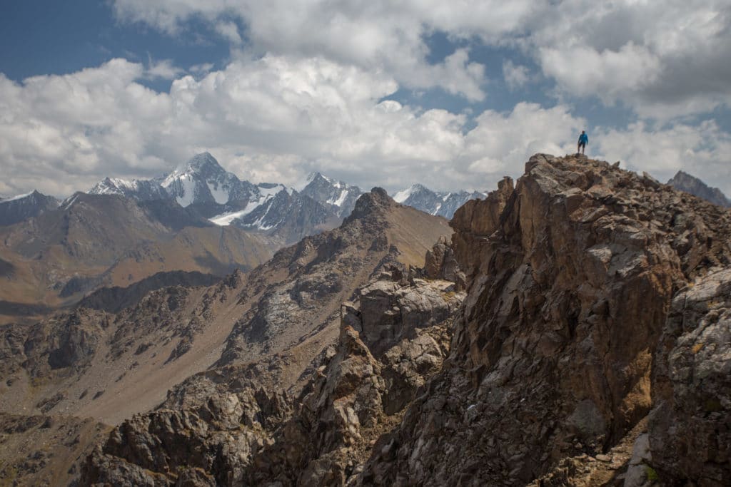
Boz-Uchuk Ashuu Pass
It should still be fairly early in the day, so knock out most or all of the climb up the day’s second pass before lunch. The walk up the Boz-Uchuk Ashuu Pass (3363m) is far more gradual than the first of the day, gaining about 700 vertical meters gradually over a stretched four kilometers of lateral distance. Push up the valley as far as you can, breaking for lunch either partway up or at the top, and putting the bulk of the day’s climb behind as you do so. Where the valley angles sharply to the southwest, the pass is just ahead of you.
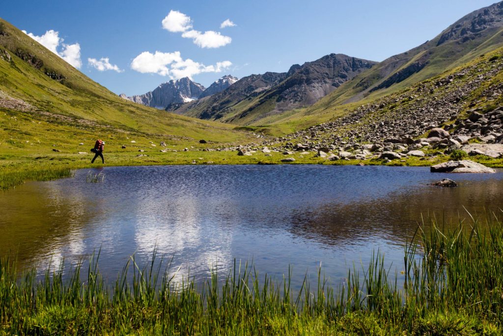
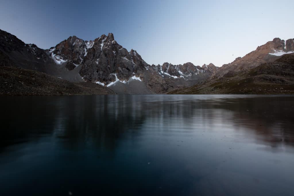
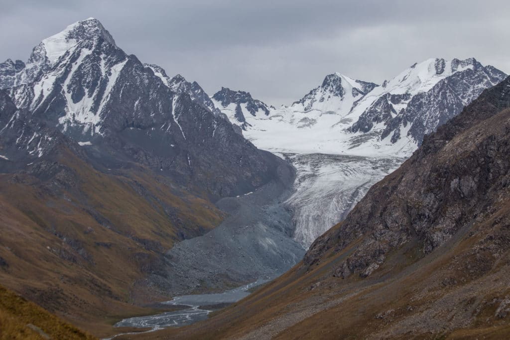
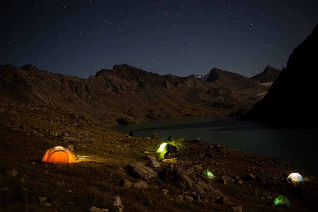
From the pass, look for the two parallel mountain bowls just to the south. The first and northeastern of the two is higher and thinner, with one small lake at the center. The second and southwestern is wider, a little lower, and holds two incredibly beautiful mountain lakes – the route overnights on the foreshore of the first and larger of these two lakes.
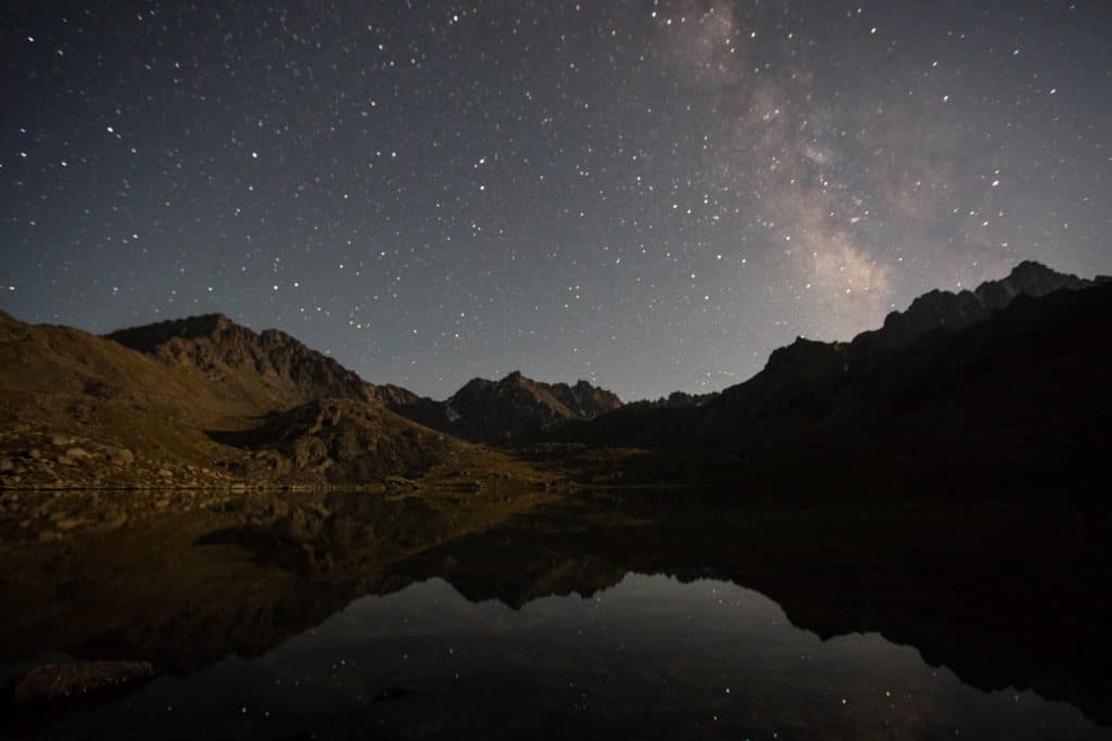
Boz-Uchuk Lakes
The obvious and easier route drops down from the pass to the valley floor and climbs briefly back up to the level of the first of these two lakes and a wide flat campsite. A less-obvious route from the pass swings to the northern mountain bowl and then over a small saddle to angle down to the larger bowl and the northern side of the two lakes – the terrain quality here is far worse and particularly after wet weather the way can be a little hazardous, but if you’re traveling light and want to do a little extra walking it can be a nice alternative.
Finally, after setting up camp, spend some time to check out the smaller of the two main lakes. Though an additional bit of climbing from the campsite, the stunning craggy backdrop and peaceful location make it a wonderful excursion – also beautiful for sunrise photos, if you can drag yourself out of bed early enough the next morning.
Ak Suu Transverse: Stage 3
Boz-Uchuk Lakes to Ak-Suu Almaluu
Total Km: 18km
Walking time: 8h
Total time: 10h
Elevation Gain/Loss: 853m+ / 1465m-
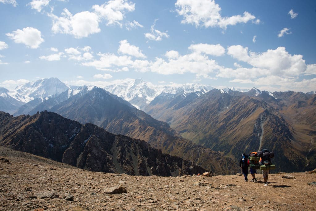
On the map, Stage 3’s double passes looks to be another long and difficult day, but in reality the relatively easy ascents combined with incredible views from both of the day’s passes make this one of the most attractive along the entire Ak Suu Transverse route.
Packing up camp (ideally after a sunrise excursion around the Boz-Uchuk Lakes, descend from the lip in front of the lakes to the valley floor, and then turn immediately to the southwest across and up the far side of the small valley, heading up towards the unnamed 3516m pass there. The climb is of little note, mostly gentle switchbacks till the very last stretch, but there are fine views of the Boz-Uchuk are the whole way up and the view from the pass itself is fantastic.
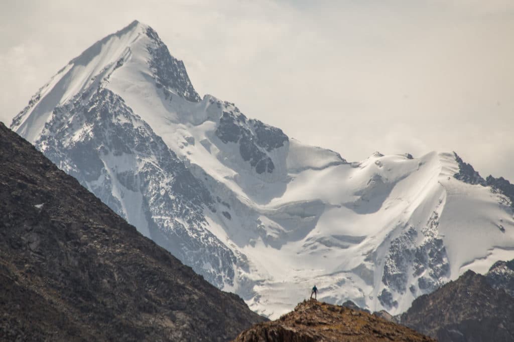
The bent pyramid of the 4463m Tashtambek-Tor-Bashi dominates the view from the top, and this permanently snowcapped peak presents one of the finest backdrops of the entire trail. Spend some time up here enjoying the view – on clear days, this is one of several massive peaks poking out on the southern horizon, and the relatively flat area surrounding the pass makes it easy to wander around in search of additional viewpoints.
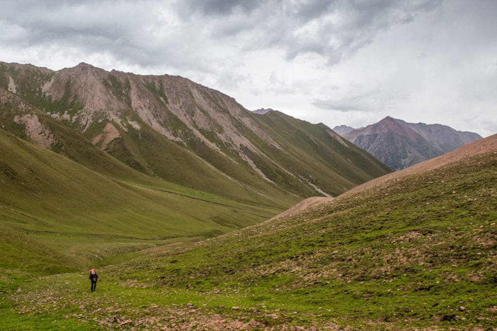
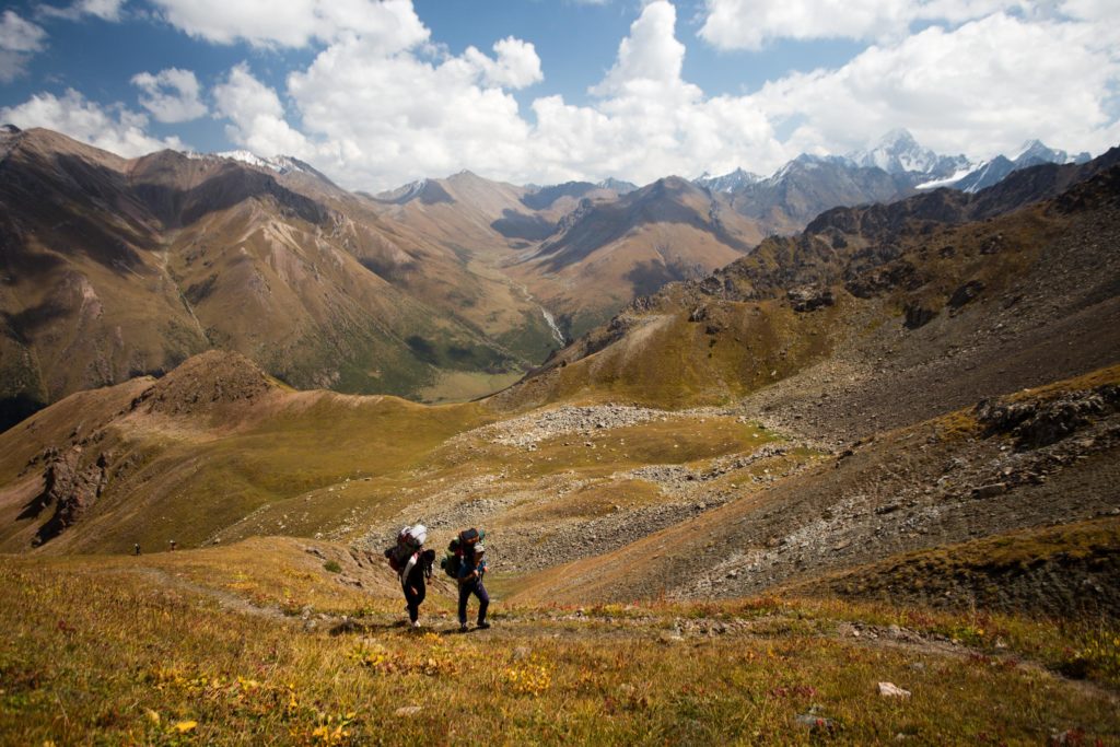
Descending from the pass, follow any of numerous horse tracks down to the wide and green Jergez Valley below – the area is popular with shepherds, so you’ll likely encounter a few folks along the way or at the far foot of the pass.
Jergez and Ailanysh Valleys
The wide and flat Jergez valley is a popular pasturage (and also the home to an excellent tourist yurt camp at Kara-Kyz further north, though it isn’t convenient to the Ak Suu Transverse route), so expect to see shepherds and their herds throughout the area.
There are several small side valleys along here that make for excellent dayhikes, so hikers with time to spare should consider breaking Stage 3 into two days to accommodate the extra exploring. Those continuing to Ak Suu Almaluu, however, will cross the valley near the foot of the previous pass and continue southwest across the main Jergez valley past the Ailanysh lakes and on to the Ailanysh pass.
Ailanysh Pass (3671m)
The small Ailanysh lakes make an attractive stop and a nice potential campsite, though most parties will continue the Ailanysh Pass at 3671m. The Ailanysh Pass continues the day’s theme of incredible scenery with the views that spread out from the top, including new angles on Tashtambek-Tor-Bashi peak.
From the pass, the trail descends steeply down a rocky grade until leveling out somewhat onto a grassy hillside, from which views open progressively wider of the small glacier that falls from the west face of Tashtambek-Tor-Bashi peak, eventually descending to travel alongside the stream which feeds off the glacier melt as it descends into the larger Ak-Suu Almaluu Valley.
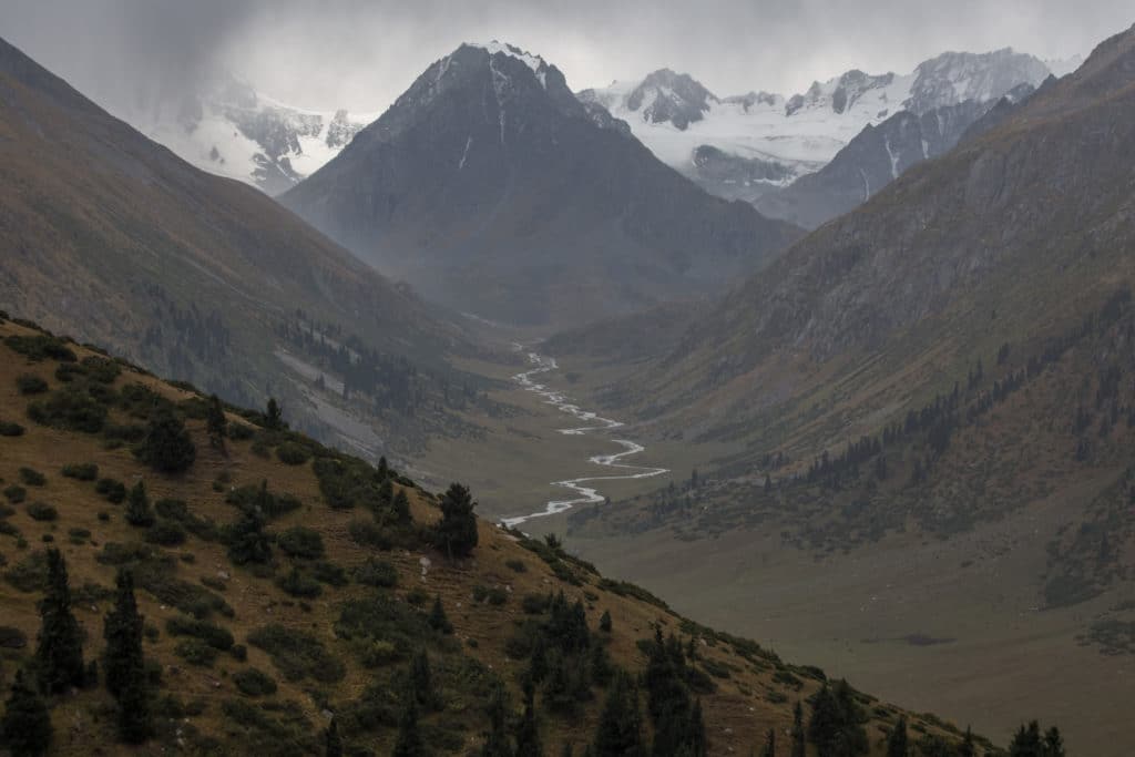
Ak-Suu Almaluu Valley
Upon reaching the main Ak Suu Almaluu, follow the valley downstream a short distance to the north until reaching a bridge that crosses the river. There are useable camping sites on both sides of the bridge here, though they’re largely either not flat or are quite moist, so pick out the most comfortable spot to bed down and prepare for another pass climb in the early morning.
Ak Suu Transverse: Stage 4
Ak-Suu Almaluu to Altyn Arashan
Total Km: 12km
Walking time: 5h
Total time: 7h
Elevation Gain/Loss: 943m+ / 1182m-
Another day on the Ak Suu Transverse, another steep pass immediately after breakfast. From the west side of the bridge over the Ak Suu river, look for a beaten path that runs up the hillside to the southwest through the small forested areas just above the campsites and continues over what appears from below to be a low ridge.
This low ridge is not the pass, unfortunately, but the lip of a small bowl that makes a nice rest about halfway up to the pass. Struggling onwards to the unnamed 3609m pass, views of the surrounding valley grow progressively wider – including a clear shot across the valley to the previous day’s pass for much of the walk. Finally arriving at the top, the views are panoramic and stunning.
The craggy, rocky area surrounding the pass offers lovely wandering, with a new view from every successive turn of the ridge and scramble around large boulders. Expect to spend some time playing up here, if the weather is cooperating.
Descending to Altyn Arashan
The trail from the pass descends steeply into the Anyr-Tor Valley and levels out briefly along the river before another sharp descent down the final stretch to Altyn Arashan. Overall the route drops over 1100m in under 8km, including the fairly level stretch of the Anyr-Tor Valley in the middle.
Unlike much of the Ak-Suu region, Altyn Arashan (and the following day’s trail to Ala-Kol) are heavily touristed by both Russian- and English-speaking tourists, and so many of the shepherds in this area are oddly inhospitable – don’t expect the warm invitations for tea or kumis in the yurt that you might have experienced elsewhere along the trail thus far.
All is forgotten upon arrival to Altyn Arashan. Warm beds, hot meals, steamy hot springs, and cold beers all await – at least for those that want them. If, somehow, none of that sounds appealing it’s also possible to continue across the river and past the hot springs area to camp on the far bank a little further up the valley.
Ak Suu Transverse: Stage 5
Altyn Arashan to Ala-Kol Lake
Total Km: 12km
Walking time: 5h
Total time: 6h
Elevation Gain/Loss: 1416m+ / 414m-
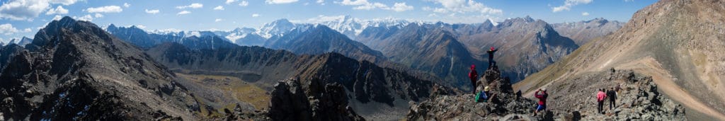
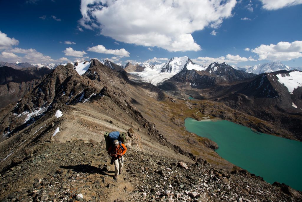
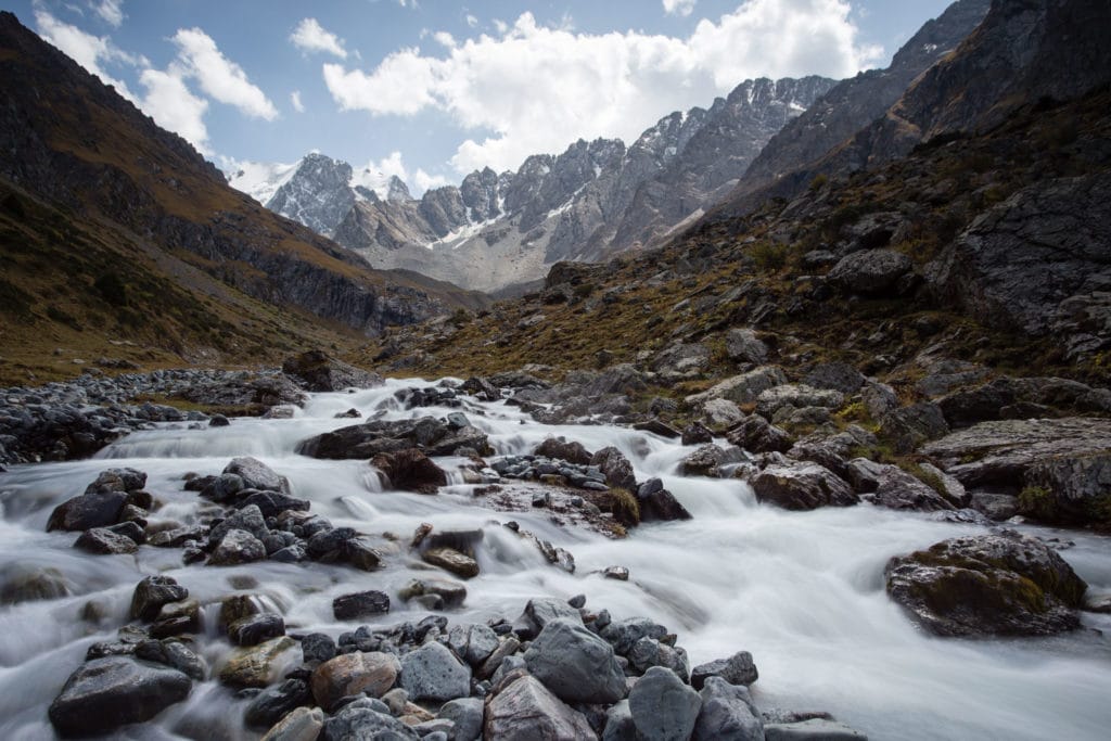
Most hikers consider Stage 5 the most physically strenuous of the entire Ak Suu Transverse, climbing over 1400m along an unremitting 10km, growing increasingly steeper as it goes on. However, the payoff here is one of the most magnificent mountain panoramas in all of Kyrgyzstan, unveiling the unbelievable view of Ala-Kol lake all at once rather than the gradual reveal afforded by the eastern approach.
Following the west bank of the Arashan river, continue upstream around 2km (Peak Palatka dominating the head of the valley beyond the elevation of which given from various sources anywhere from 4260-4730m). The trail, possibly the most popular hiking route in the entirety of Kyrgyzstan, is easy to follow where it turns out of the Arashan Valley and climbs up the Keldike Valley for 8km towards the 3907m Ala-Kol Pass, crossing the Keldike river once along the way opposite a nearly-permanent shepherd encampment.
Ala-Köl Pass
The last little but of climbing up to the 3907m Ala-Kol Pass is actually pretty brutal – a steep and loose section of scree that seems to slide backwards one step for every two you take. It will leave you literally breathless by the time you reach the top, leaving you unable to immediately appreciate the otherwise-breathtaking view of Aka-Kol Lake and the peaks beyond.
It seems, from the top, as if the whole Turgen Ak-Suu range is stretched out before you – and indeed it is. The three peaks that ring the eastern side of Ala-Kol are between 4100 and 4300m, with a range of 4700m+ peaks along the next ridge and the massive lines of 5170m Peak Djigit and 5216m Peak Karakol further on.
Continuing down from the pass, catch the obvious trail down the scree-heavy slope as it descends towards the lake shore. Ak-Sai Travel operates a trekkers’ camp along the shore just at a large bend on the western side in summer, though often they book up early, but it should be possible either to pitch just beyond their site or continue to the western edge and pitch there (staying well away from the shore and waterfall, of course).
Ak Suu Transverse: Stage 6
Ala-Kol to Telety Valley
Total Km: 14km
Walking time: 8h
Total time: 10h
Elevation Gain/Loss: 989m+ / 1362m-
From wherever you’ve camped along the shore, loop around the western corner of the lake and then back south about 1km to the foot of the 3781m Panorama Pass. En route, where the obvious stream drains out of the lake, a small but attractive waterfall starts just out of view – it may be worthwhile to drop packs and descend briefly to enjoy the waterfall and views down the valley before returning to the lake shore to continue the route.
[Note that in summer 2021 the bridge over Karkaol River below Panorama Pass has been washed away and not replaced as of summer 2023. The pass is still well worth the detour, but you’ll either have to head downstream to the Sirota bridge or just take the main trail down from the lake through Sirota.]
The climb to the 3781m Panorama Pass is fairly quick, under 200m of vertical gain, though it does get steep for several extended sections. While views of the lake are surprisingly lackluster (especially in comparison to the Ala-Kol pass in Stage 5), panoramic views from the eponymous pass more than make up for it. Take some time at the pass to climb a little further along the rocks that run to the east for a slightly elevated viewpoint that isn’t blocked by the high ridge to the west. Directly across from the pass to the west is the Telety Valley and tonight’s eventual campsite – but there’s a lot of elevation to lose and gain before arriving there.
Descending to Karakol Valley
Prepare your knees. From Panorama Pass, get ready to descend a little over 1200m vertical in just over 4km of lateral distance. We passed a group of independent travellers tackling this pass in the opposite direction, and they did not at all appear to be enjoying the experience. It’s a lot of pounding on the knees, but the way remains relatively clear all the way down to an obvious wooden bridge across the Karakol River in the Karakol Valley below. You’ll want a rest by then, so it’s a good place to have lunch, but beware of the uber-silty water Karakol River as it feeds of the many glaciers further upstream.
Climbing to Telety Valley
Follow the Karakol River upstream for around half a kilometer, crossing several smaller side streams along the way, until an obvious side-trail turns west at the foot of a large clearing and climbs into the trees. The path climbs to regain more than half of the elevation it lost on the descent from Panorama, eventually leveling out in a wide and beautiful open meadow with rugged mountaintops all around. Push as far as you can up the valley until the level section begins to incline once more before pitching camp – if you’re a small party of just a couple of tents, another small rocky site is available a little distance before the pass, though water access this high is seasonal.
Stage 7 is not a terribly difficult day but it does cover a lot of ground, so any extra kilometers underfoot today make for an easier go of it tomorrow. Pushing as far as you can, then, pitch camp and settle in for one final night on the trail.
Ak Suu Transverse: Stage 7
Telety Valley to Jeti-Oguz Resort
Total Km: 25km
Walking time: 9h
Total time: 11h
Elevation Gain/Loss: 690m+ / 1830m-
The final climb of the trip, to the 3801m Telety Pass, should go pretty quickly if you’ve pushed well up the Telety Valley. It’s a gentle cruise compared to previous days on the trail, along an easy without any real complications and with nice views back down the Telety and Karakol Valleys.
From the top, the initial descent to another small valley (also referred to locally as Telety) is pleasant, though occasionally overgrown vegetation my snip at your ankles. Tour company Eco-Trek maintains a trekker base camp here through part of the summer, so don’t be surprised to meet other trekkers or camp staff along the valley floor.
Continue downstream until the Telety creek joins the much larger Jeti-Oguz river and the jeep road the runs along it. You’ll see a foresters’ hut at the junction, though in our experience there is rarely anybody in residence.
Follow the jeep road for around 10.5km down the valley until it eventually reaches the Jeti-Oguz Resort, passing several pasturages along the way which are popular with domestic tourists and a handful of foreigners as an escape into nature or a chance to drink local fermented horse milk beverage kumus.
After a week on trails the incessant road walk can be a bit hard on the feet and the spirit – if you’re arranging private transportation to collect you at the end of the hike there’s no real reason to walk the full distance back to Jeti-Oguz. If you’re reliant on public transport, however, that’s the surest show in town – try to flag down passing cars for a ride back there if you just want to finish, though.
Alternate Options for Ak-Suu Transverse
In principle, there’s no real reason hikers couldn’t extend the Ak-Suu Transverse further towards the Kazakh border or Enilchek Glacier in the east or the remainder of the way across Issyk-Kol and into Naryn oblast in the west. Most of the Ak-Suu mountain range is just a series of parallel valleys linked by trekkable passes – however if you intend to do this, be sure to obtain updated Kyrgyzstan trekking maps that show current glacial conditions as the Soviet-era maps tend to be inaccurate for both this information and as regards bridge locations.
Good To Know
There are no entrance fees for the Ak-Suu Transverse at the time of writing, though technically the Karakol National Park charges an entry of 250som per person; don’t be surprised if eventually there’s a checkpoint for this along the route.
You won’t need any special equipment for this hike and it’s all non-technical trekking. However, be prepared for cold nights even in the middle of summer, as well as the possibility of infrequent rain showers or even snow at any time of year.
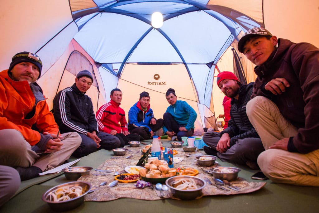
Many travelers will want guides and/or porters and cooks for a hike this long. The DMO offices of Destination Karakol and Destination Jyrgalan can arrange these for travelers, along with transportation to and from trailheads, as can any of the private tour agencies based in Karakol.
Getting to the Ak Suu Transverse
From Karakol to Jyrgalan, the eastern trailhead of the hike, marshrutka (minibus) #311 departs three times per day from the Ak-Suu bus stand in the Ak-Tilek bazaar – the trip takes around an hour and a half and costs 80 Kyrgyz som per person, though you may be charged an additional price for large backpacks.
From the Jeti Oguz Resort on the western trailhead, minibuses run infrequently back to Karakol for 100 som. If not appears, find a ride for 60 som to the village of Jeti-Oguz about 12km down the valley. From here there are far more frequent departures back to Karakol or westwards towards Bokonbaeva. Private transportation can eliminate the final 5km hiking down the Jeti-Oguz valley and arrange a pickup at Kok-Jaiyk jailoo. It may be possible to hitchike this stretch as well depending on the amount of traffic passing through.
Where to Stay and Eat
Jyrgalan village is a delightful ecotourism village, and it’s well worth planning a few days there before the trek starts. Make warm-up dayhikes into Jyrgalan Valley and the surrounding region. Ala-Kol Guesthouse is the most popular place to stay in the village. However, any of the six options in town will offer a friendly reception and a comfortable place to sleep.
At Jeti-Oguz, it’s possible to stay in the Soviet-era health resort (from 2000som) or in the homes of several families (by negotiation) just outside the gate.
In both Jeti-Oguz and Jyrgalan, any accommodation can also whip up meals (though for non-guests it’s best to give a few hours’ notice). In between these two villages, however, there are no shops or guesthouses anywhere along the hike with the exception of at Altyn Arashan. Be prepared to be entirely self-sufficient through most of the route.
Altyn Arashan is a small hot-springs development with a handful of cabins that serve as guesthouses. Hikers can normally find a dry bed (from 400som) or a warm meal. Most of the time a semi-cold bottle of beer as well. By the time you’re halfway through the hike, these may well be tempting indeed.
We’ve also published a quick and dirty guidebook to show tourists around for their first few days in Bishkek. If you’re headed towards Kyrgyzstan and expect to need some help getting around, consider our Unanchor: Bishkek guide. Additionally, we contributed the Kyrgyzstan chapter to the most recent Lonely Planet: Central Asia guidebook. If you’re looking for more help than that, consider reaching out to our friends at Feel Nomad to organize a tour to the country.
Absolutely brilliant. Not for beginners or seriously rusty ex-Scouts like me, but this is a route worthy of setting as a fitness/practice goal!
Lots of interim routes for you to try out before then, too!
Thank you for all the information! Any advice for a solo hiker finding a tour company?
Check out the ‘Good to Know’ section at the end of the article for links!
Pingback: 26 Amazing Ecotourism Destinations to Visit | Tale of 2 Backpackers
Pingback: Cooking Classes, Tours and Meals: The Best Food Experiences in Asia
Pingback: Best hiking in Asia & Pacific Adventure: Off-the-beaten-track travel revealed by experts - Paula Pins The Planet
Pingback: Best Soups of the World You'll Want to Try...Mmmm!
Pingback: 13 Utterly Awesome Cheap Countries to Visit in Asia!
Pingback: Trekking Ala-Kul Pass to Altyn-Arashan | Kyrgyzstan | Wanders Miles
Thank you for trek description! I’m going to make it in two weeks. Also I want to add 2 day trekking to OguzBashi/Yeltsin Peak view point. On map seems that walking along Aylanish river will give you better view at the end, but most maps show way along Telety river. Do you know with one is better or accessible? Thank you fot help !
From what I remember the best views of Yeltsin really start at the turnoff where the main Jeti Oguz valley intersects with the Telety valley – just after you cross the bridge and climb up the hill the views really open, and in summer there are typically a few yurts around that make it even more scenic.
Pingback: Kyrgyzstan: Alakol Lake Trek - Asia Hikes
Pingback: 63 Best Hikes in the World: The Ultimate off-the-beaten-path Revealed by Travel Experts - Paula Pins The Planet
Thanks so much for this guide, it was so helpful out on the trail!
Just a small note for anyone planning to attempt it this summer – the small dilapidated bridge you mention between the passes on day two wasn’t there. We had to do a pretty sketchy river crossing and lost our flip flops in the process 🙁
Hi Abby – great point! The bridge has been rebuilt a bit further upstream – we’ll update the write-up accordingly.
Hello. I plan to do this tour in early June. I wonder what the weather is like in the mountains then. is there still a lot of snow? what are the temperatures at night? does it often rain or snow? I’d like to get the right equipment. Bartek
Hi Bartek, yes, still usually cold at night and with decent chances of precipitation basically anytime of year. Pack warm and dry.
Hey, I play to do it this June, starting the 2nd or the 4th, how did it go for you?
Hi,
Thanks a lot for such detailed guide!
I am thinking of doing this hike in December. Do you think it would be feasible or it is not recommended due to snow?
Also, do you need to go through an agency and hire a guide or can you do the hike solo?
Thanks.
Jo
Really snowy – it’s more of a climb than a trek at that point. In summer it can easily be done solo if you have the mountain skills, but if you’re not sure there are lots of good guides from Karakol that you can contact.
Hey
Planning on doing this in June. Is it possible to stay in Yurts along the way or do you need a tent? I’m going solo.
The only touristy yurts are between Arashan and Ala-Kol and then in the Jeti-Oguz valley. There are actual shepherds’ yurts along the way elsewhere, but they’ll be surprised to see tourists asking for a place to stay.
Very helpful thank you very much for the detailed walkthrough.
question, If you had to chose between Ak Suu Transverse Trek and 7 days around the Alay Mountains what would be your personal opinion?
What are some more objective differences between the 2?
Hi, Does anyone know if there’s any way to shorten this route by a day or two? I would love to do the whole trek but I only have limited time in Kyrgyzstan. Any suggestions would be appreciated.
Thanks
Hi John – the valleys are basically all parallel. Just cut early and head down the mountain wherever you want, you’ll end up in a village right at the bottom of any of them except Turgen.
Great amount of detail here- was able to easily trace along the route in maps.me & FatMaps considering I’m not paying for a GPS app. Some things to note if you are doing this completely unsupported is day 2 & 5 are severely underplayed by multiple hours. Turn to maps.me for more accurate route times on all of the days before beginning this traverse. Also on day two don’t dip back down into the valley & switchback up the scree hill to reach Boz Utchuk lake?! It’s much easier & faster to keep high in the valley & stick to the left, following the grassy side of the hill right to the lake.. forgoing both the instruction of this blog & maps.me. Day 5 should also be broken into 2 days – camping around the touristy yurt camp right before the pass so that you can enjoy Ala Kul & are more likely to hit the mid day good weather patch during the pass crossing. As someone who is an experienced thru hiker & built hiking trails for years I can safely say this itinerary caring 7 days worth of food was either written for a horse, by someone really embellishing his physical fitness & unaware of how most humans hike, or someone with a day pack hiring others to carry the heavy gear for him. Do what the locals say – take 10 days or break this bad boy up!
Hi Rachel – all the times are accurate measurements from when we did the routes (though you’ll have had to detour a bit in Turgen to catch the rebuilt bridge), but yes we resupplied from a cache in Arashan to avoid carrying the whole food load.
Thanks for this guide!
However as of July 2023, the bridge over the Karakol river between Panorama pass and Telety pass was not there.
Ah good point, yea it got swept away a few summers ago, will update the text!
Pingback: Top Destinations to Experience the Best Hikes in Asia
Thank you for the insights! The Ak Suu Transverse is undoubtedly an insider tip that has been on a bucket list for some time.
Hi. Thanks for å great guide. Did you use the gps map/file listed at the top of the article for navigation or did you bring actual maps? I’m planning on doing this trek by myself next summer, and I dont want to get lost. (Not my first solo thru-hike)
Hi Marthe – we created and used the file as linked!
Pingback: Hiking Along the Ak-Suu Traverse in Kyrgyzstan - Coddiwomple Chronicles
Hi there – we are planning to do this Ak-Suu traverse middle of August this year, planning max 7 days. We are unsure which sleepin bag would be recommendable, eiter a really warm one (up to -5°C comfort temperature) or a lighter down sleeping bag (upt to +2 comfort temperature). As we will carry everything on our own, we would like to save some grams 😉 Not sure how cold it will get on the camp sites?
Be prepared for below freezing any time of year.
Pingback: Central Asia’s First Yurt-to-Yurt Hiking Hut Network Opens in Kyrgyzstan | travelerdestination
Get this is super late but thank you so much for this guide. My friends and I used it when we completed the walk in 2023 and found this invaluable as a resource .
Glad it was useful for you!
Hello,
i just had a read of your guide it was great. We were planning to do this trek middle of September but are having second thoughts as we are worried the weather by then will be too extreme to do the full hike? what are your thoughts on this?
Thanks heaps Ellie
Should be fine, and anyways at this elevation you should prepare for rain and snow anytime so you should be carrying the right gear even if it does turn bad.
Hi, we will be doing the trek in two days. We were wondering how much water we should bring and if there are enough rivers and creeks to fill our water bottles (using a filter).
Yep, water in every valley
Many thanks for this guide! A friend and I are planning to do this trek end of August.
We are used to hike and do self-supporting treks but we wonder if 7 days to complete the transverse is considered optimistic or realistic? As we will drive from Bishkek on 24th of August and our return flight will be on September the third. So the schedule is rather tight. Many thanks for the feedbacks
Doable but with no time for mistakes. Keep in mind though that you can always bail down any of the big valleys.
Hi y’all,
Planning this for August.
Can’t seem to find information on water sources, saw there are a couple of lakes, is it easy to find, how much were you all carrying?
Thank you in advance,
Sílvia, Portugal
Rivers in every valley, you’re only really carrying what you need up and over the passes.