Kyrgyzstan: Alakol Lake Trek
Кыргызстан: Озеро Алаколь
Alakol Lake is quite likely the most popular overnight trek in Kyrgyzstan. An incredible mountain lake, backed by mesmerizing rugged peaks and a glacier that drops right down to the shore. It’s an unbelievably beautiful hike, made better by a handful of yurt camps and a hot spring resort that provide a bit of infrastructure along the way.
Total Km: 45.5km
Total Days: 3
Elevation Gain/Loss: 2094m+ / 2219m-
Start Point: Karakol Valley Entrance Gate
End Point: Teploklyuchenka village
GPS Files
While the Alakol lake trek is not technically demanding – the worst of it comes on the steep scree slopes surrounding the Alakol Pass – it can be somewhat physically demanding for those that are out of shape and/or not acclimatized to elevation in the Tien Shan. It’s thoroughly possible – though extremely demanding – to cover the entire route from Karakol Valley to Altyn Arashan in one very long day. More often trekkers will break it into three days, as discussed herein, overnighting along the climb up to the lake and then continuing all the way over the pass and down to Altyn Arashan for one night before making the final descent down to the Ak Suu plain. It’s quite doable in two days, more likely overnighting day one by the lake shore and then making a very long push the rest of the way down, but then you miss the chance to sleep at the Altyn Arashan hot springs cabins and soak your weary bones at the end of day two.
If you have more time to spare, it’s also worth considering the week-long Ak Suu Transverse trek, which includes Altyn Arashan and Ala Kol lake in a fantastic itinerary that explore the very best of the entire Ak Suu range.
Alakol Lake Trek: Stage 1
Karakol Valley to Sirota Hut
Total Km: 16.5km
Walking time: 3h
Total time: 4h
Elevation Gain/Loss: 1046m+ / 91m-
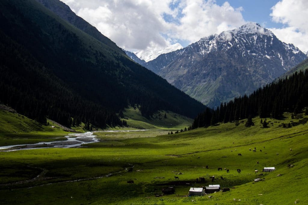
The trek to Ala Kol lake typically starts at the entrance gate to Karakol National Park (3.5km into the GPS trail linked above), a short drive from Karakol city. Following the dirt road into the park a further 3.5km on an easy level path, where it crosses a large wooden bridge. (This is known locally as the ‘second bridge’ – if you’re hiring a taxi from Karakol they will typically take you to here and no further.)
From the bridge the way begins to climb, still quite gently, for the next 9.5km above the western bank of the Karakol river. The trail climbs through forest cover, over open pastures, above the detritus of several old landslides, and along wide peaceful stretches of river where horses graze all summer long. It’s an idyllic stretch of trail, made even more remarkable by proximity to the city of Karakol. Finally, just beyond the bottom of the Aytor Valley, the trail cross a footbridge over the Karakol river and begins to climb to Sirota Hut.
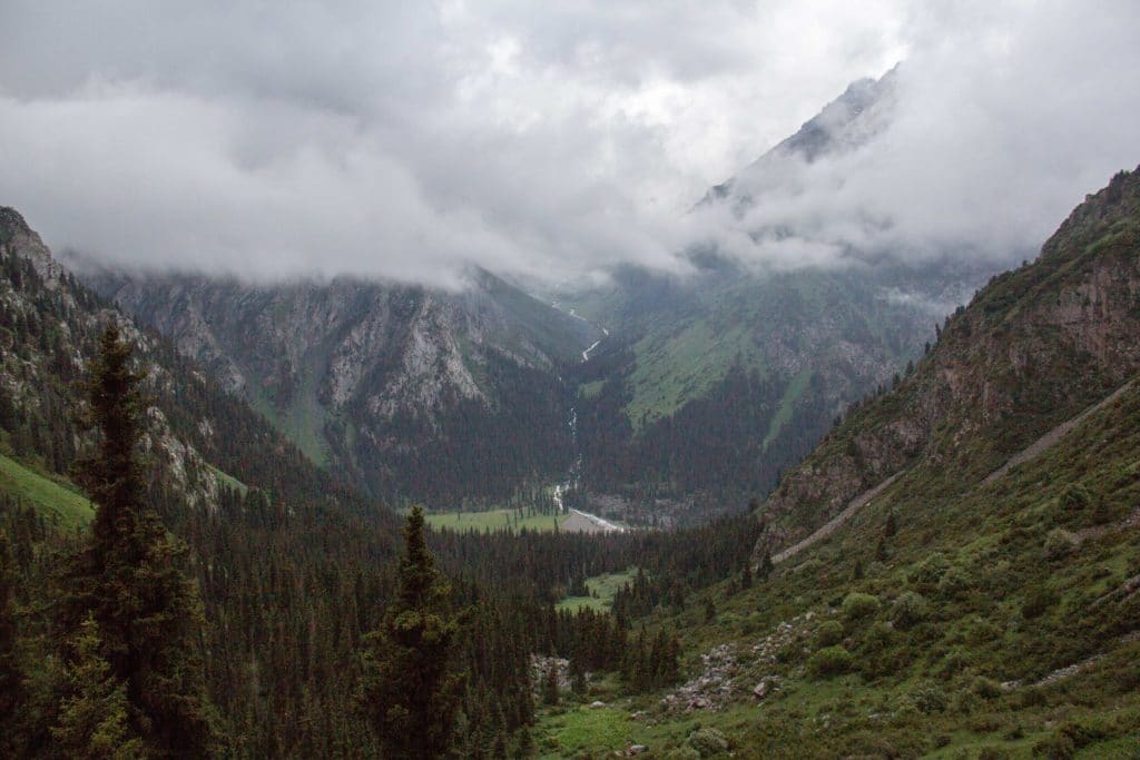
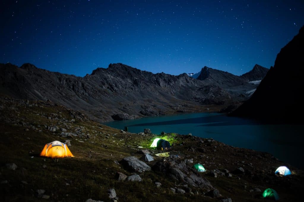
This is the first steep section of the Alakol Lake hike, gaining around 440m of elevation over 2.5km of lateral distance. A little more than the first half remains in tree cover, climbing in zigzags up a lush green hillside, before eventually emerging into a more open plain for the last kilometer or so to the hut itself. Along the way the rugged terrain leading up to the lake itself comes progressively into view, sharp peaks and tumbledown rock piles that will be the first stretch of trekking on day two. Just before the path angles more deeply into this rocky section, Sirota Hut appears, and with it the night’s campsite.
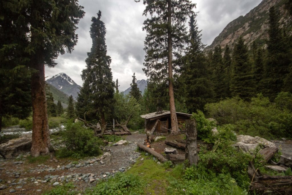
Note that this area can become quite busy in high season, and the few truly flat and open tent spots are snapped up quickly, so if you’re planning to camp at Sirota it’s worth trying to get an early start on the day to get here in time to find a good spot. There are also no facilities for campers, so be aware that at times the area can get quite littered with both refuse and human waste, particularly late in the season. If there are no open places to put a tent or it’s just too dirty, some trekkers elect to continue onwards and upwards to the lake shore and find a spot there.
Alakol Lake Trek: Stage 2
Sirota Hut to Altyn Arsahan
Total Km: 14km
Walking time: 7h
Total time: 9h
Elevation Gain/Loss: 827m+ / 1268m-
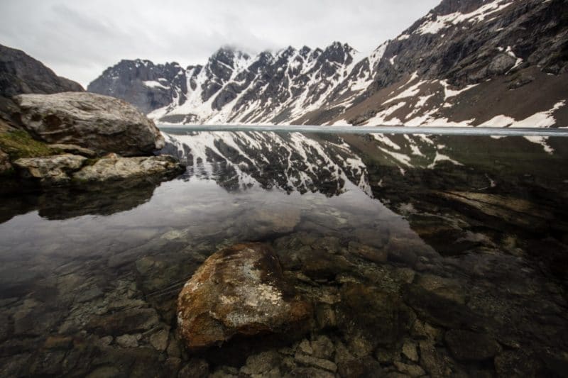
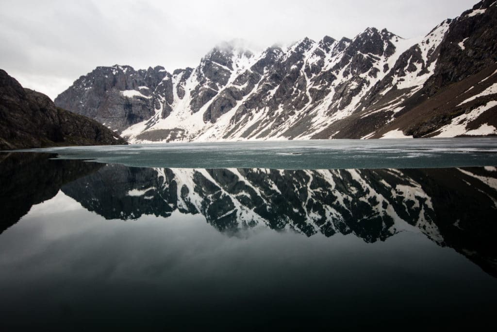
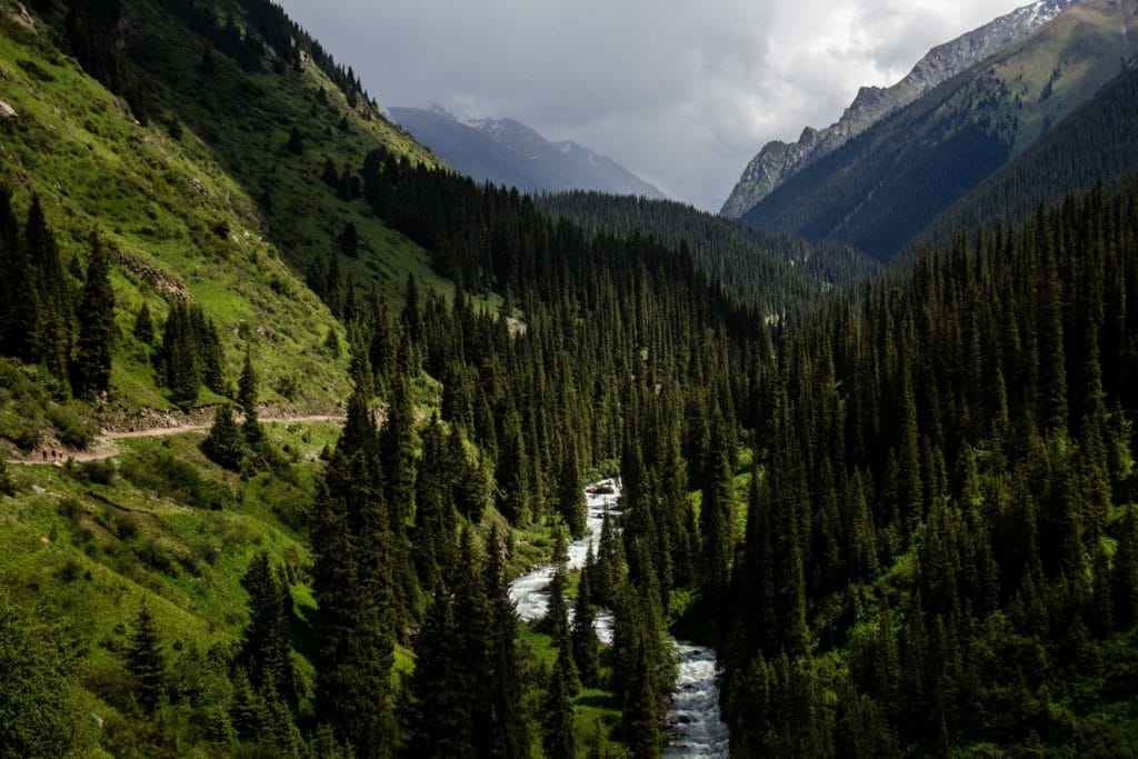
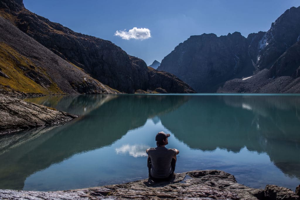
From Sirota Hut, the trail begins to climb. The two kilometer stretch between Sirota and the final hill before the lake passes over rocky terrain above a raging river that flows down from a waterfall fed by Ala Kol’s outflow. It’s steep, rough, and trying; but the payoff at the top is well worth the effort. Just above the waterfall, the trail crosses an open rocky area and the lake finally comes into view, a beautiful boulder-strewn shoreline that curves off to the east and out of view, blocked by the next hill. It’s quite easy to go right down to the shore from here, and the spot where water flows out of the lake and down the waterfall is a particularly serene place to have a break – just be careful as you hop across, and be sure to stick the landing.
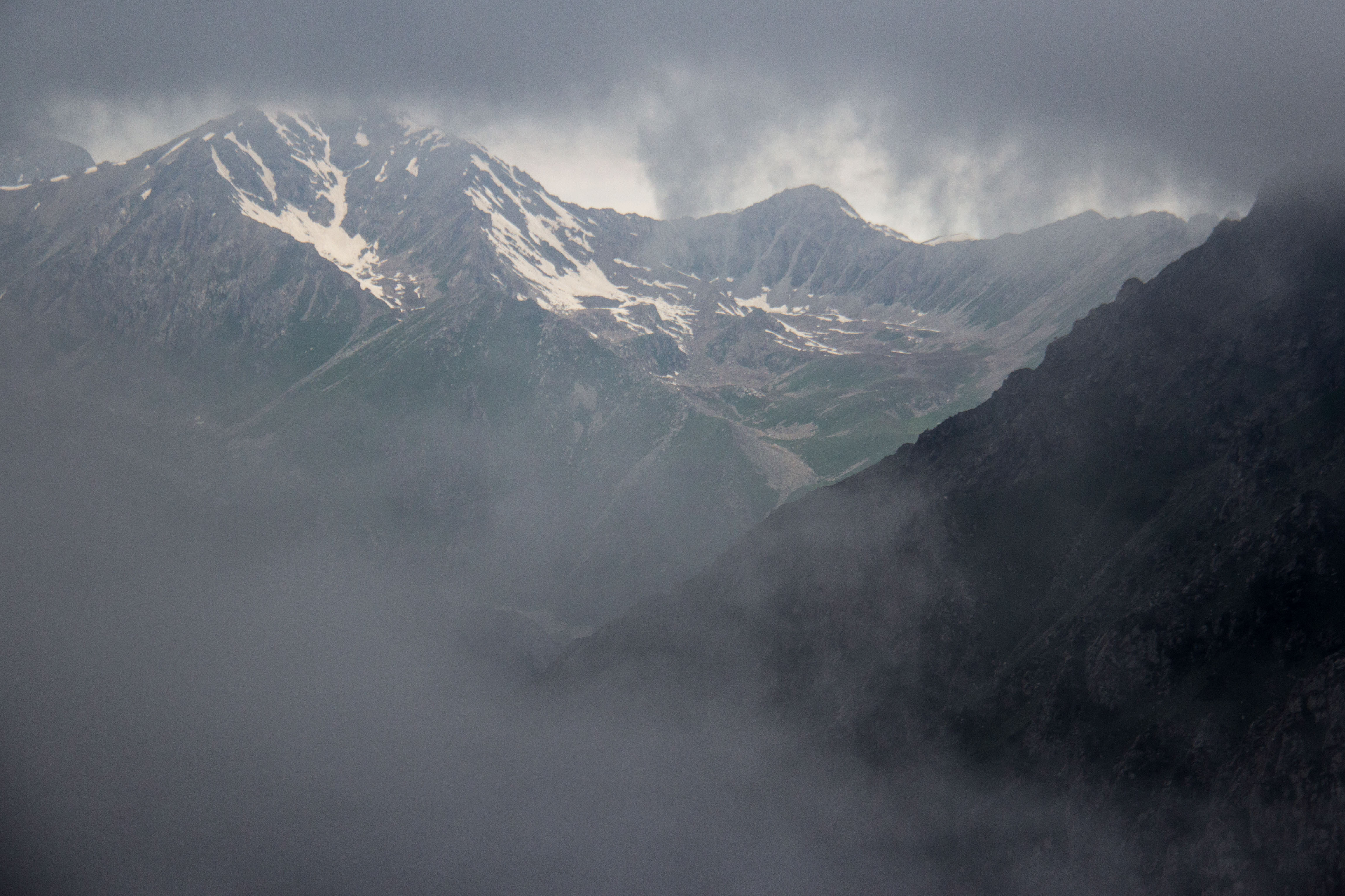
As tends to be the case in the mountains, however, there’s still some climbing left to do. The trail is particularly well-defined between here and the Ala Kol Pass at 3907m, climbing at a fairly gentle slope around the curve of the terrain and then increasingly steeply up the final stretch to the pass itself. Along the way, you’ll spot several flat-ish sections of the shore that could serve as alternate campsites – in the past the Bishkek-based tour company Ak Sai Travel has run a semi-permanent tent camp at the biggest of these, another option for those who might like to make the trek with minimal weight in their packs. The final 500m or so towards the pass is particularly exposed and has been the site of small landslides previously, so take particular care in this section and do your best not to traverse it during inclement weather.
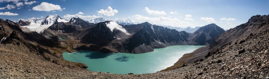
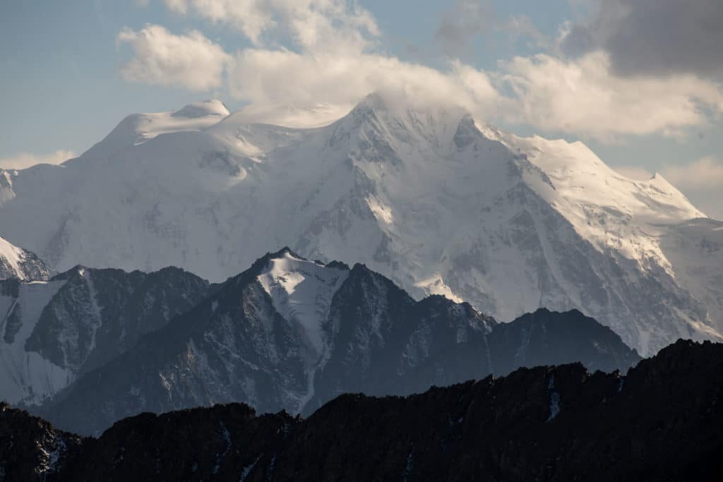
Not to oversell it, but the views from Ala Kol Pass are something extraordinary. The large glaciers that feed the lake are on full display from the pass, as are a range of 5000m+ peaks beyond the first ridge that tower above even these first impressive mountains surrounding the lake basin. It’s truly one of the most impressive views even amongst the many contenders in Kyrgyzstan and elsewhere in Central Asia, and a major part of what makes this the most popular multiday trek in the country.
Some trekkers do elect to hike the Alakol Lake route in reverse, starting from Altyn Arashan and ending in the Karakol Valley, the major benefit of which is the incredible reveal here at the pass when the entire lake comes bursting into view all at once.
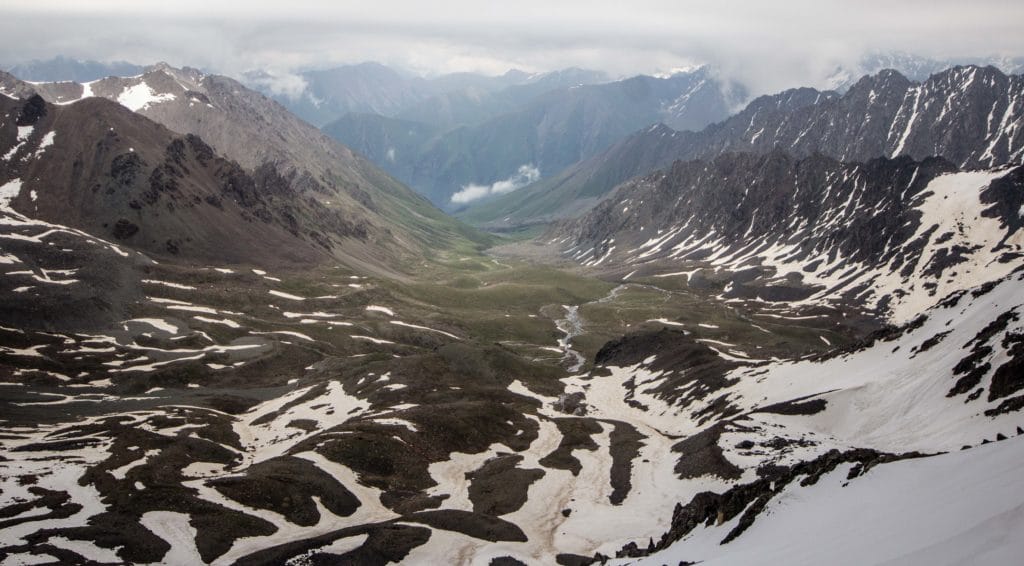
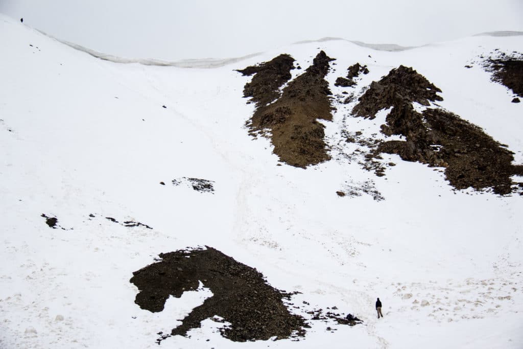
From the Ala Kol Pass, the route continues northeast down into the Keldyke valley. The initial drop is extremely steep scree – not fun whichever direction you’re hiking from. In the shoulder season there is often snow on the lee side, away from the lake, and some travelers elect to slide down with their packs behind. This isn’t necessarily the most cautious option, of course, but it will save considerable time. In mid-summer, after the snow has gone, it’s a frustrating plod downwards with every step skidding down atop a hail of small stones.
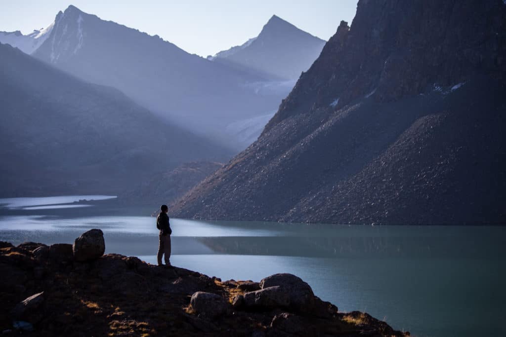
Below the first and steepest section, it’s an easy cruise down the rest of the Keldyke Valley, often to the sounds of marmots barking and birds calling. Around 5km down the trail hops across to the southern side of the river. This is typically the site of a shepherd’s yurt in summer, and he’s often willing to take trekkers across on horseback for a few hundred som, but it’s not so deep as to make this necessary. A little further on, about another 1.5km, the Keldyke Valley meets the much larger Arashan – having dropped approximately 1250m of vertical elevation from the top of the pass.
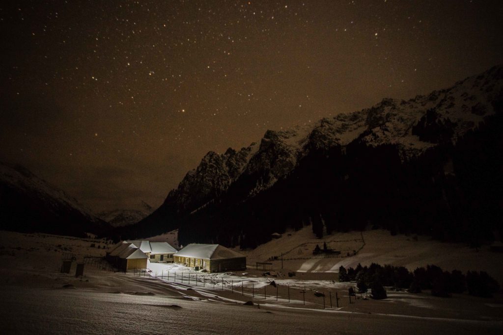
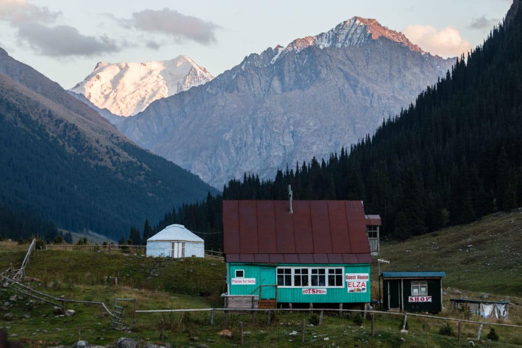
There is a bridge across the river just near here, but most trekkers ignore it and follow the western bank of the Arashan river for the final ~3.5km into the Altyn Arashan resort, crossing the bridge just south of the resort complex and choosing a guesthouse to stop at for the night.
Most of these guesthouses charge a token amount to camp on their territory, a few hundred som for a dorm bed in the cabin, and a few hundred more for a hot meal. Even if you camp outside the resort territory, it’s worth heading over for a soak in one of the resort’s numerous hot spring-fed soaking pools – we prefer the ones down beside the river, for the full hot-to-cold-to-hot experience that combines the two.
Alakol Lake Trek: Stage 3
Altyn Arashan to Teploklyuchenka village
Total Km: 15km
Walking time: 3h
Total time: 3h
Elevation Gain/Loss: 221m+ / 860m-
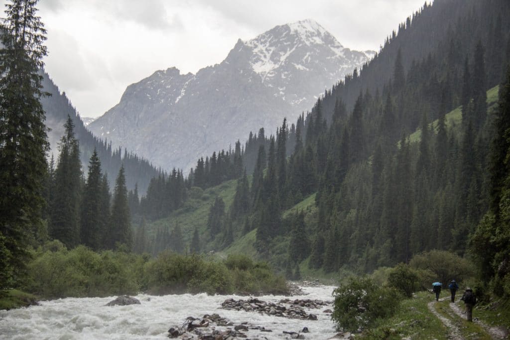
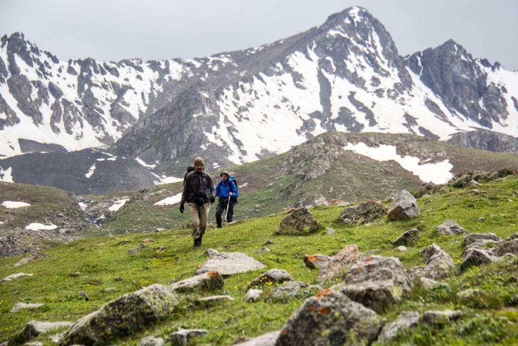
The final stretch, down from Altyn Arashan to the villages of the Ak Suu region, is the quickest and easiest of the whole route. In fact, it follows an old jeep road (still navigable by the brave and those driving old Soviet-era monsters that never seem to die) the entire 15km, open to foot traffic even in the middle of winter (and a worthwhile hike at the time of year as well). Though road hiking doesn’t have quite the same appeal as a wild mountain trail, the landscapes are still pretty enough to enjoy and the kilometers seem to fly right past as the road undulates gently along above the Arashan river and it’s often-mighty rapids below. Do turn back on occasion for views of the Arashan valley and the dense forest growth on either side of the river.
When the road crosses over a small bridge (ignore the handful of foot bridges just off the main road, which mostly lead to forestry huts or private territory) you’ve just about reached the modern dirt road up from Teploklyuchenka village. Another 3.5km or so onwards, passing a handful of homes and ranches, is the intersection of the Arashan dirt road with the paved road running out from Teploklyuchenka to the Ak Suu resort, and the point at which it’s possible to pick up public transportation back to Karakol.
Alternate Options for Alakol Lake Trek
Just before the Arashan dirt road reaches the paved highway is the trailhead for the Ak Suu Arboretum path, and a possible return to the outskirts of Karakol by foot after another 13km.
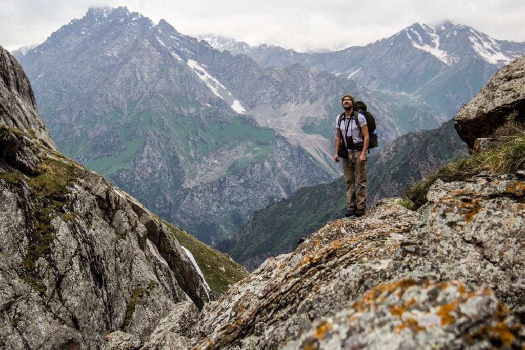
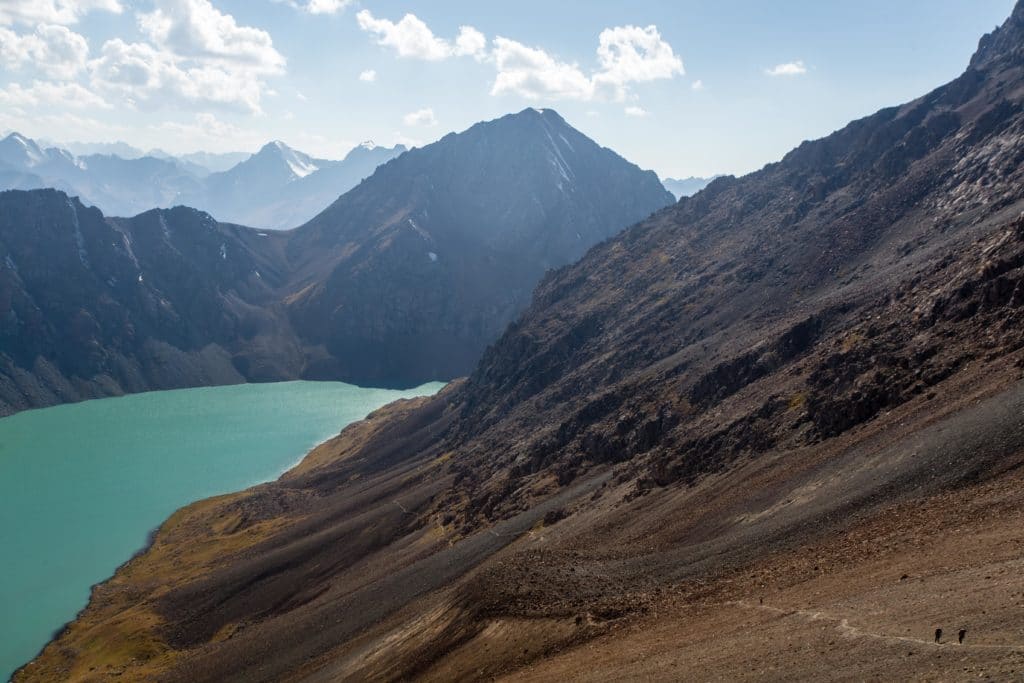
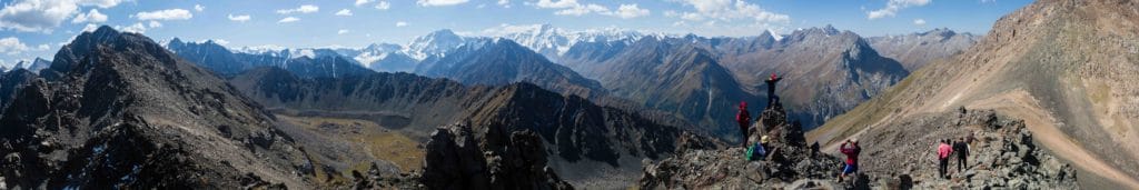
It’s also possible to reach Ala Kol from the Karakol Valley via the more ambitious (read: more difficult) Panorama Pass, pictured below. This route continues past the Sirota turnoff to just before the Telety Valley, turning up towards the 3781m Panorama Pass and then descending to the lake shore.
More ambitious trekkers might further consider the Ak Suu Transverse, a fantastic seven-day route that include Arashan and Ala Kol along with a string of other fantastic valleys and lakes across the Ak Suu range.
Good To Know
The Alakol hike is perhaps the single most popular among foreign tourists visiting Kyrgyzstan, so visiting in the shoulder season can go a long way towards mitigating crowds and offering a more relaxed experience. In mid-summer, it’s worth making any yurt camp or cabin bookings in advance through a tour agency, or trying to arrive to your campsite early in the day to ensure a decent spot to put up a tent. No matter what, always keep in mind the basic Leave No Trace principles and be sure to pack out everything you’ve packed in, as the high impact of tourism on the environment here is already easily felt.
Getting to the Alakol Lake Trek
From Karakol city, Marshrutka 101 runs into Karakol Valley as far as the park gate, or a private taxi will typically take trekkers to the second bridge for 600som. Returning to the city from Altyn Arashan, the 350 Marshrutka passes by the intersection of the Arashan dirt road and the paved Ak Suu road that goes south to Ak Suu Resort and the Ak Suu Kench hot springs. Hiring a regular car to pick you up from the Arashan trailhead can save the final 2-3km of road walking here, or tour agencies and guesthouses in Karkaol can arrange old lumbering Soviet-era monstrosities to make a transfer directly from the Altyn Arashan cabins (but it’s not cheap).
Costs and Practicalities
The Karakol Valley is a National Park, and charges a 250 som entrance fee for foreigners plus an additional 50 som per vehicle. There are no other mandatory fees for the Alakol hike, though discerning hikers will probably pack an extra couple hundred som to pay for the hot springs at Altyn Arashan and a touch more if they plan to overnight in the cabins there or buy a warm meal or cold beer.
Where to Stay and Eat
Trekkers who prefer to hike to Ala Kol without having to carry food and tents can book accommodation along the way, either at the Sirota Hut yurt camp or at a tent camp on the lake shore for the first night and potentially overnighting at Altyn Arashan on day two if extending the hike into three separate stages. While it’s possible to show up and sort something out on the spot, it’s better to arrange in advance through Destination Karakol or EcoTrek, both of whom have offices in Karakol city and can sort out arrangements on quite short notice.
![]()