
Kyrgyzstan: Chok-Tal Valley
An easy hike up a wide beautiful valley, proximity to the north shore of Issyk-Kul belies the rugged and remote feeling of Chok-Tal valley. To top it off, two pretty lakes (one atop a steep scree slope) cap the adventure.
Total Km: 14km
Total Days: 1
Elevation Gain/Loss: 462m+ / 462m-
Start Point: Chok-Tal Jailoo
End Point: Chok-Tal Jailoo
GPS Files
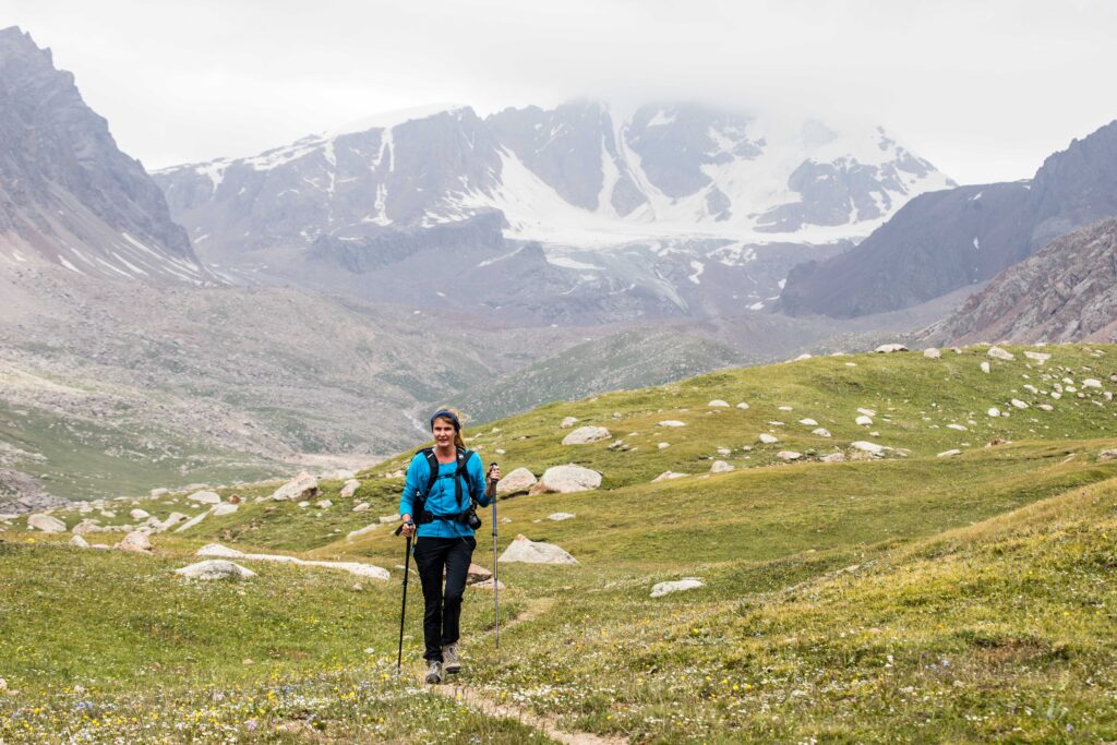
This straightforward hike along the Chok-Tal river doesn’t present any technical difficulties whatsoever, though the final scramble up a steep scree slope to the upper Chok-Tal lake could be difficult for some (and isn’t included in the distance, elevation, or GPS data above).
From near the end of the jailoo road (it does continue a little further along both the main valley and across the Chok-Tal river up towards the lakes, but gets rougher and steeper from here in both directions), start along the south side of the river.
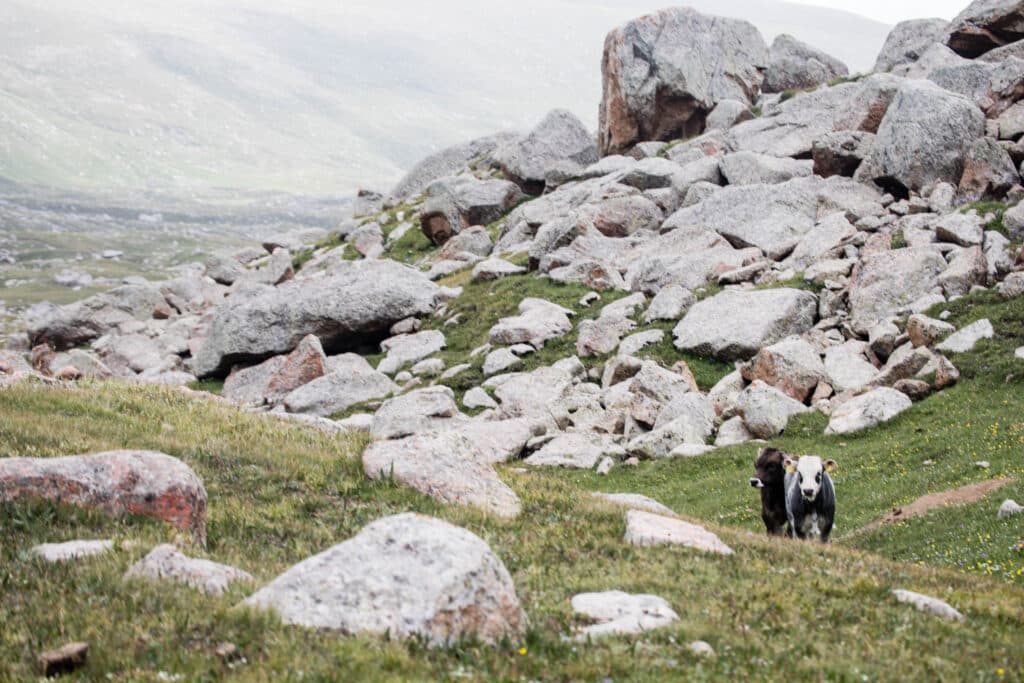
The first three kilometers up the valley wanders up and over the hilly terrain that stretches from the river bank to the mountains that define the valley’s southern side, passing a handful of shepherds’ yurt camps along the way. There are a series of interlacing livestock and horse trails through here – any given route is fine as long as it heads generally up the valley, though for preference we like the handful that follow just above the river as they offer a combination of nice views and relatively stable slopes for the slow climb up the valley.
After three kilometers, as the valley begins to curve more sharply to the north, you’ll probably want to descend briefly through the relatively wide banks rather than taking the hillier and more circuitous route that stays high. Somewhere along this area, you’ll have cleared the Chakyr-Tash ridge edge enough to start seeing to the north the small side valley that hides the two small lakes at the end of the trek.
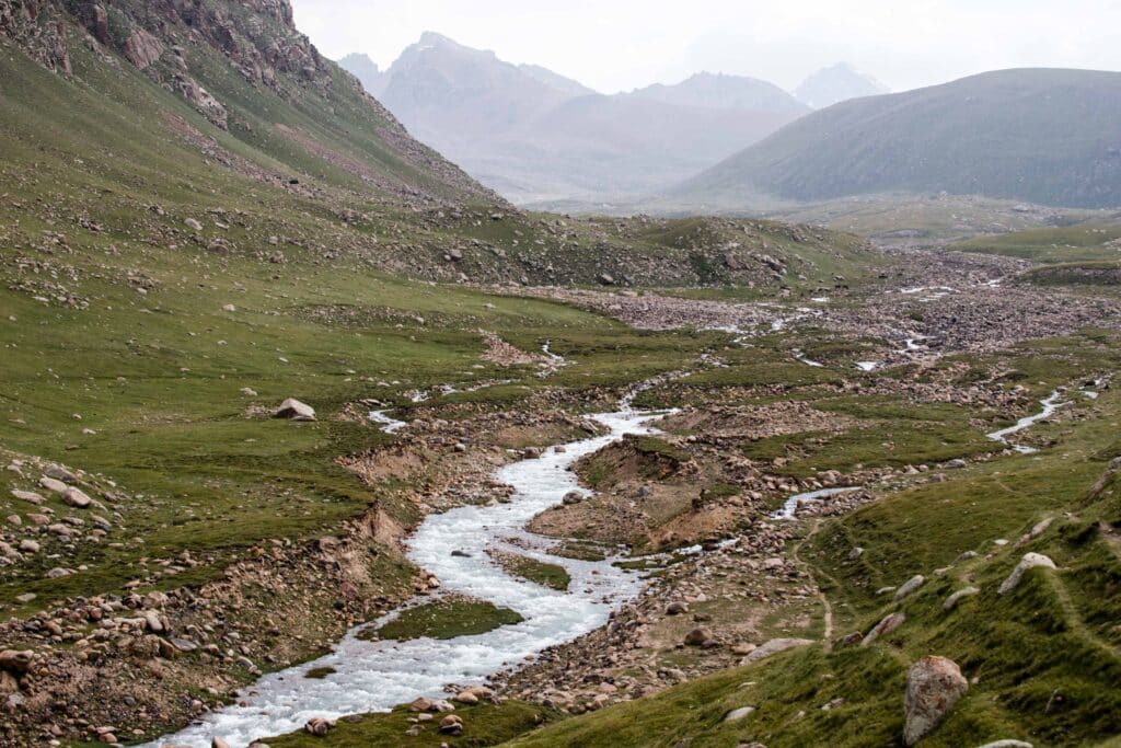
Around 4km beyond the start of the route cross a small stream – it’s a good place to fill up with water at about the halfway point, though given the prevalence of livestock in the valley you’ll certainly want to treat it before drinking. Old Soviet-era maps show the name of the 4193m peak from whose slopes this stream flows as Zhar-Bulak, though with no yurt camps about when we visited we weren’t able to confirm whether this was also the name of the side valley and jailoo here.
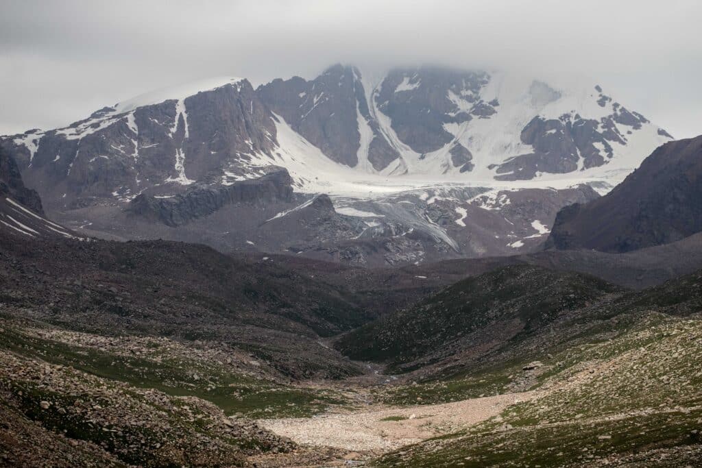
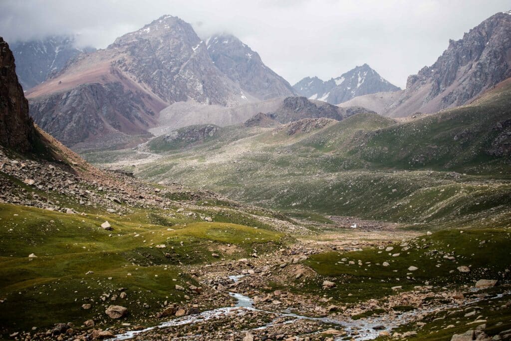
Beyond this small stream, the way continues to the north and curves slowly into the top of the Chok Tal Valley as it bends westwards. Around halfway through this section, the full rocky face of the peaks at the top of the valley opens up into a magnificent panorama of dramatic glaciated ridges.
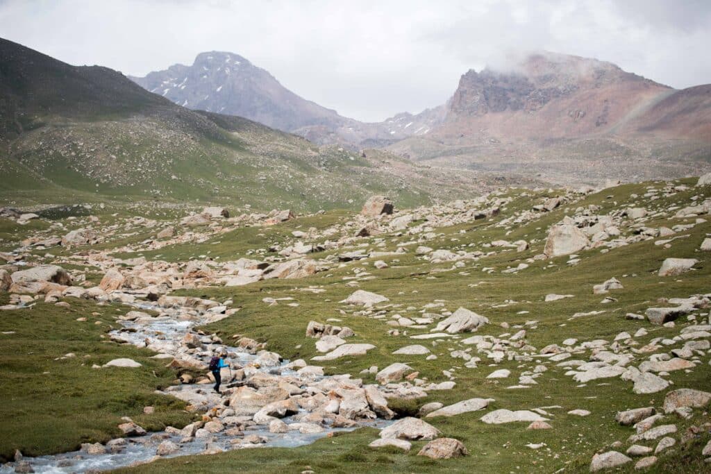
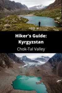
Finally, after crossing an open rocky pass and wide stream bed below the mountain folds that hold the higher lake, the path ends at the small lower lake and a flat wide area that would be well-suited to camping if on a long exploration of the area.
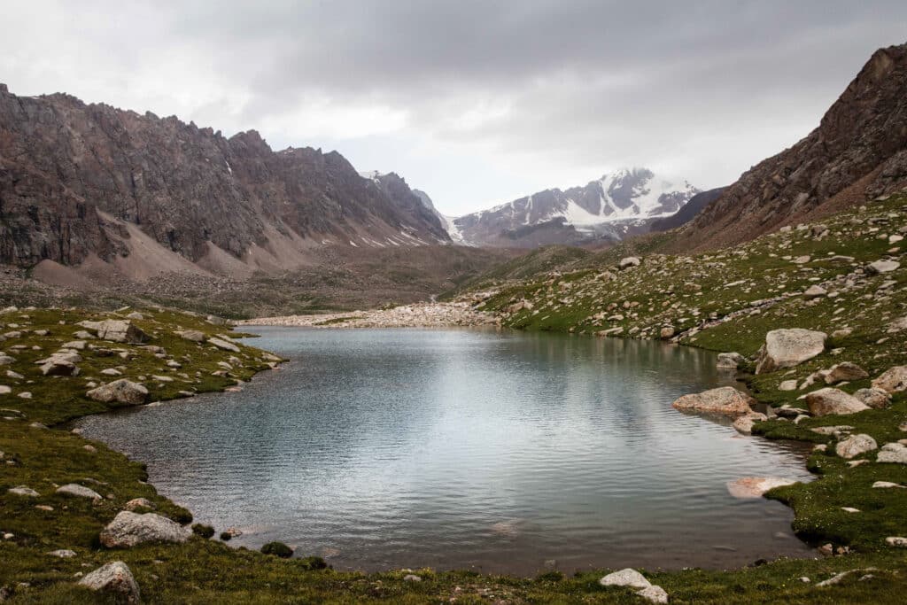
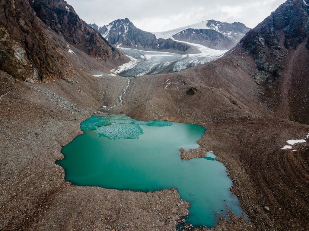
While our route ends here (we weren’t sure of a safe path up to the higher lake), further inspection of photos from the hike indicate that it should be possible to climb the scree slop above to reach the shore of the higher lake. Follow the path of the stream as it climbs along the spree slope on the left if looking from the lower lake – expect roughly another 1.5km and 270m of elevation from the shore of the lower lake to the higher. It *may* also be possible to continue around the shore of the higher lake to the stop of the next scree slope above, which should provide an incredible viewpoint over the Chok-Tal glacier beyond. We’re less sure of this path, however, so proceed with caution and don’t fear to turn around if the route seems unsafe.
Alternate Options for Chok-Tal Valley
Not included in the GPS and trip data here is the ascent to the second (higher) lake, and to the glacier beyond. While during our visit we were unsure if there was a route up the scree slop, further thought based on photos suggests that it should be passable to the lake shore and most likely around the lake to the edge of the glacier just a little above.
Alternatively, the same trailhead (and campsite) is also the start of the Chok-Tal Seven Lakes hike, worth another day to explore if you’ve already made it all the way up to the jailoo here.
Good To Know
Chok-Tal valley is just east of Tamchy International Airport, and during summer it’s possible to watch flights land at the airport from most of the road up and from the hills just above the campsite – an unusual experience while trekking in Kyrgyzstan. Up in the jailoo, though, there’s genuinely nothing but a handful of shepherds’ yurts around – bring everything you’ll need to be self-sufficient for the whole time you’re up here, as the only alternatively is the long slow drive all the way back down to the Issyk Kol shore.
Getting to the Chok-Tal Valley
Start hiking from near the end of the Chok-Tal jailoo road – it’s a short but slow drive up from the village of Chok-Tal on the Issyk Kol north shore highway, starting at 1610m asl and ending around 2980m. There’s certainly no public transport that makes it up here, and you’d struggle to hitchhike on most days – it’s the kind of place you’ll really want your own 4WD.
Where to Stay and Eat
Most visitors will be best served by camping at the trail head in the Chok-Tal Valley, but one could conceivably drive up as a daytrip from the North Shore of Issyk Kol. Tamchy and Cholpon-Ata are both full of guesthouses and hotels. We like Panorama for a more budget stay in Cholpon-Ata or Evrazia for a more upscale option, but shop around and see what you can find. In Tamchy, we quite like the funky little Caravan guesthouse.
Pingback: Kyrgyzstan: Chok-Tal Seven Lakes - Asia Hikes