
Kyrgyzstan: Chok-Tal Seven Lakes
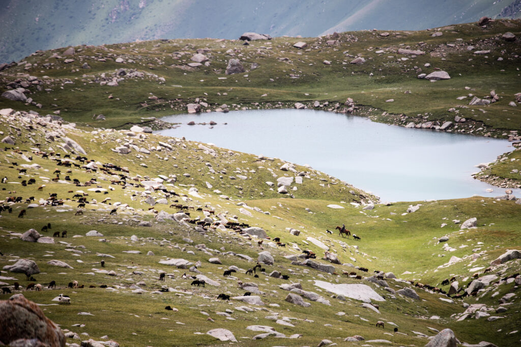
Chok-Tal Seven Lakes offers a pleasant stroll through wildflower-filled pastures up to a string of seven lakes atop a small plateau above the main Chok-Tal valley. Local shepherds and the occasional marmot are likely the only company you’ll come across in this little-known valley high above the shores of Issyk Kol.
Total Km: 11km
Total Days: 1
Elevation Gain/Loss: 595m+ / 595m-
Start Point: Chok-Tal Valley
End Point: Chok-Tal Valley
GPS Files
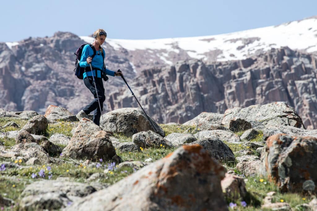
This straightforward hike to the Chok-Tal Seven Lakes doesn’t present any technical difficulties whatsoever, though the final scramble up a steep scree slope to the upper lake could be difficult for some (and isn’t included in the distance, elevation, or GPS data above). Do note that for some reason Wikiloc has processed the starting point incorrectly here – start from the bottom before the river crossing and loop up to the lakes and back, obviously.
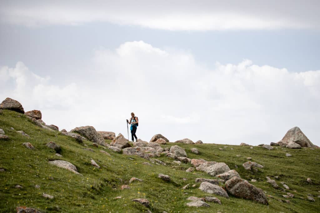
From the campsite at the end of the Chok-Tal jailoo road, cross the small bridge over the Chok-Tal river and head northwest away from the bend of the main valley. The path climbs briefly to a small rise that runs down from the Chakyr-Tash ridge, then descends into a large meadow towards the seven lakes plateau which is obvious just across the valley.
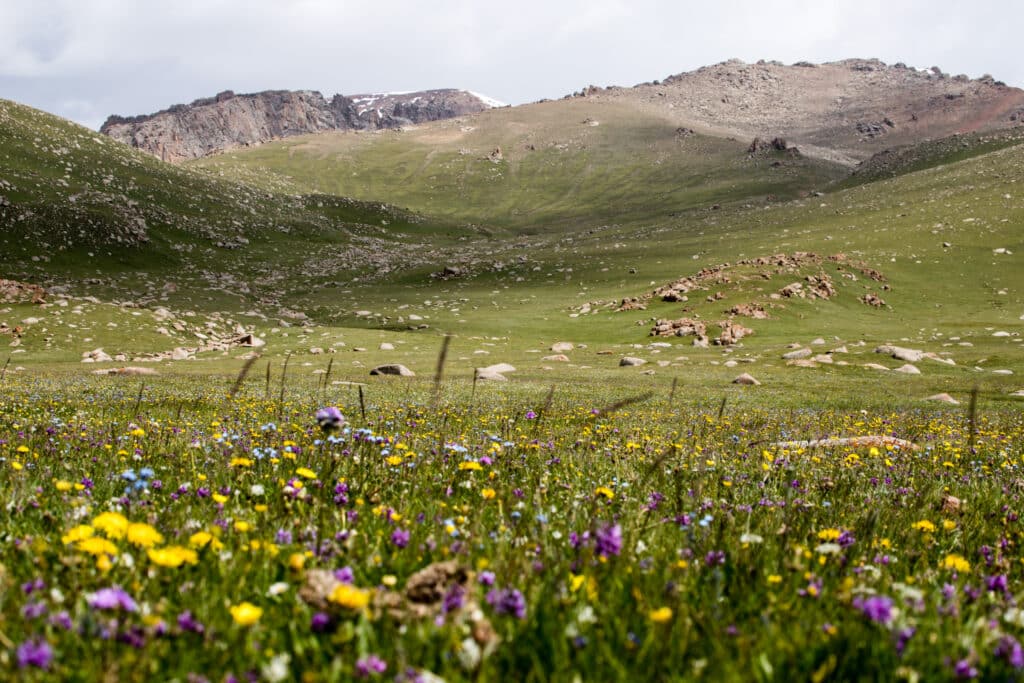
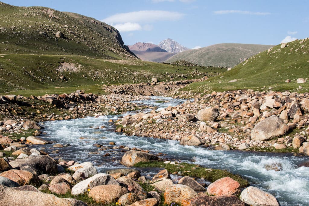
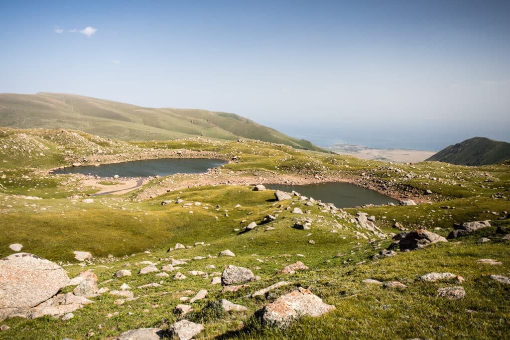
Crossing the small streambed (already dry in early July when we visited) at around 3020m, the way then continues up the center of the open valley opposite to a small clearing at 3390m from which the lower lakes first become visible. Along the way, wildflowers and birdlife fill hikers’ vision while the near-constant calls of marmots sets the soundtrack for the walk.
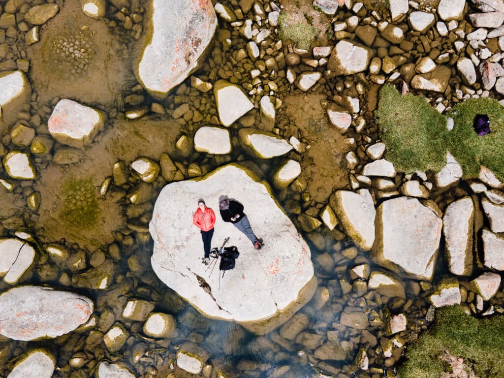
After a brief break to admire the view, continue on along the obvious path that hugs against the ridge and continues climbing slowly towards the top of the valley. About 300m on is a small stream – the first truly reliable water source since the beginning of the hike, and a good place to break for lunch if you haven’t already by this point.
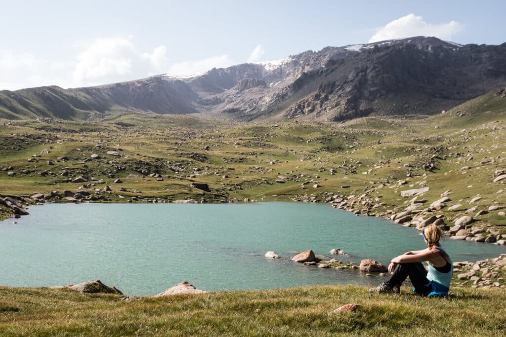
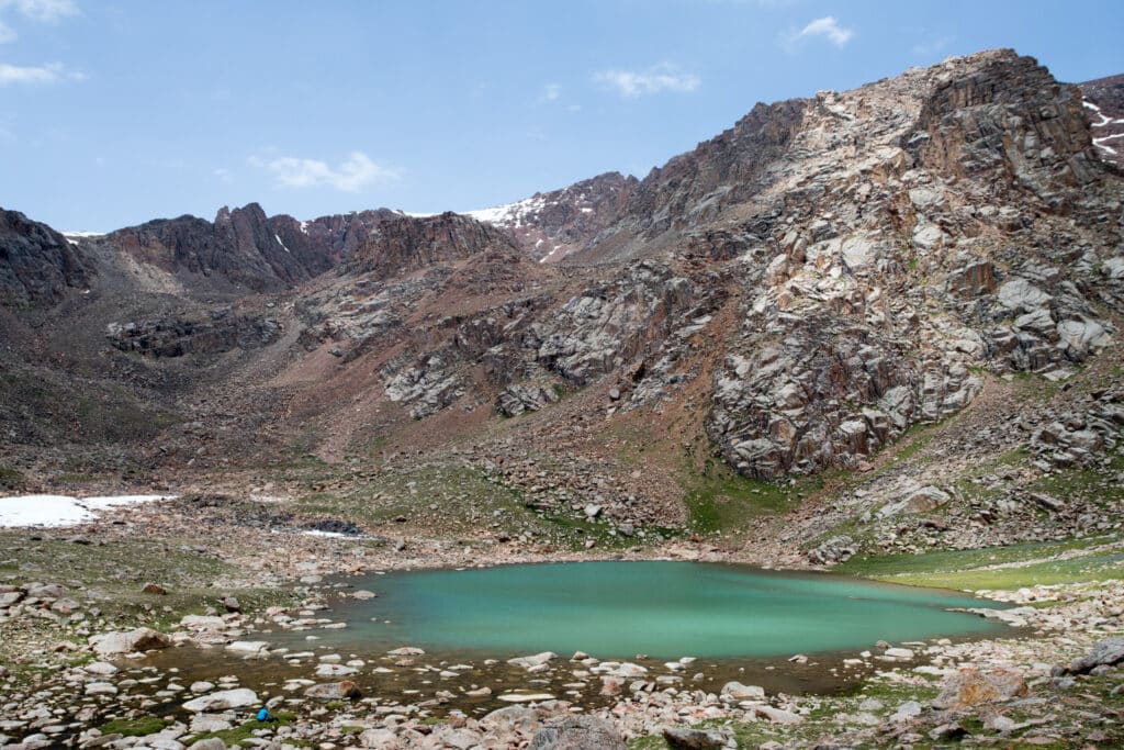
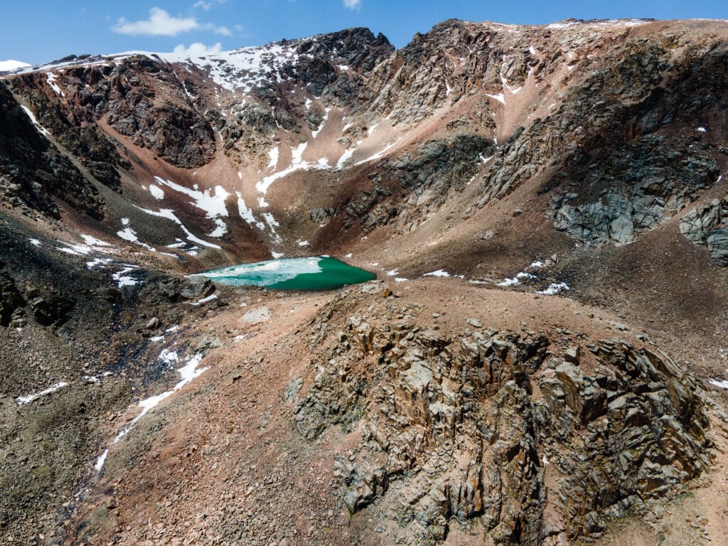
Only about 150m higher and 1.5km onward, the next-to-highest lake is tucked behind a quick curve of the ridge. We stopped hiking here, unsure whether there was a viable path up the scree slope to the last and highest of the Chok-Tal Seven Lakes, but on further review of drone photos from the day it does seem like it should be accessible. Just take care on the final section of the ~270m & 1.3km climb, as the scree drops steeply to a sheer cliff and a mistake here would be disastrous. [Also remember that the distance and elevation to the top lake isn’t included in the day’s summary at the top of the post here.]
From the topmost point of the Seven Lakes, whichever of these two lakes you elect for that to be, proceed down to the south along the western side of the plateau to loop back along the lower lakes. From the southeasternmost of these, look for a trail that drops just over the side of the plateau and cuts down more sharply back to the valley below. From here, follow the morning’s path back over the Chok-Tal River bridge and ending point of the walk.
Alternate Options for Chok-Tal Seven Lakes
Not included in the GPS and trip data here is the ascent to the final (highest) lake. While during our visit we were unsure if there was a route up the scree slop, further thought based on photos suggests that it should be passable to the lake shore at least.
Alternatively, the same trailhead (and campsite) is also the start of the Chok Tal Valley hike, worth another day to explore if you’ve already made it all the way up to the jailoo here.
Good To Know
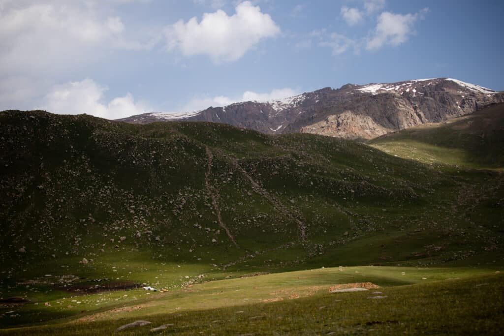
Chok-Tal valley is just east of Tamchy International Airport, and during summer it’s possible to watch flights land at the airport from most of the road up and from the hills just above the campsite – an unusual experience while trekking in Kyrgyzstan. Up in the jailoo, though, there’s genuinely nothing but a handful of shepherds’ yurts around – bring everything you’ll need to be self-sufficient for the whole time you’re up here, as the only alternatively is the long slow drive all the way back down to the Issyk Kol shore.
Getting to the Chok-Tal Seven Lakes
Start hiking from near the end of the Chok-Tal jailoo road – it’s a short but slow drive up from the village of Chok-Tal on the Issyk Kol north shore highway, starting at 1610m asl and ending around 2980m. There’s certainly no public transport that makes it up here, and you’d struggle to hitchhike on most days – it’s the kind of place you’ll really want your own 4WD.
From near the end of the jailoo road (it does continue a little further along both the main valley and across the Chok-Tal river up towards the lakes, but gets rougher and steeper from here in both directions), start along the south side of the river.
Where to Stay and Eat
Most visitors will be best served by camping at the trail head in the Chok-Tal Valley, but one could conceivably drive up as a daytrip from the North Shore of Issyk Kol. Tamchy and Cholpon-Ata are both full of guesthouses and hotels. We like Panorama for a more budget stay in Cholpon-Ata or Evrazia for a more upscale option, but shop around and see what you can find. In Tamchy, we quite like the funky little Caravan guesthouse.
Pingback: Kyrgyzstan: Chok-Tal Valley - Asia Hikes