Kyrgyzstan: Merzbacher Lake and Enilchek
Кыргызстан: Озеро Мерцбахера и Энилчек
Merzbacher Lake is one of the strangest natural phenomena in the mountains of Kyrgyzstan, and the Enilchek Glacier one of the most spectacular and rugged landscapes. Taken together, this hike makes for one of the most memorable experiences of all the treks of Central Asia. The incredible glaciers, towering peaks, wide Enilchek valley, and uniquely beautiful Merzbacher lake make this a trek you’ll never forget.
Total Km: 78km
Total Days: 5
Elevation Gain/Loss: 2005m+ / 2005m-
Start Point: Enilchek Valley
End Point: Enilchek Valley
GPS Files
Trekking to Merzbacher Lake along the Enilchek Glacier does require some small technical knowledge, as your party will need to cross several small glaciers and descend several times onto the Southern Enilchek Glacier along the way, including over a few dodgy patches where the trail has been mostly taken away by landslides. However, with a local guide or some glacier walking experience this shouldn’t pose any major problems.
Aside from the glacier crossings, this is a surprisingly easy hike. It doesn’t gain much elevation, there are no big passes to cross, relatively regular water access along the way, and in the main tourist season there are even permanent camps set up that obviate the need to carry food and tents. It’s very pleasant walking in an unbelievable landscape, and easily one of the best treks in Kyrgyzstan.
The Merzbacher Lake trek starts from the same trailhead as the At Jailoo Lakes (another excellent and considerably shorted route), so consider building a few extra days into your itinerary to add that to your route as well.
[Also note that the total elevation gain and loss in the linked GPS file differs significantly from the totals used in here. The totals here were based on the original daily track recordings, which were then traced over in Google Earth to create one complete track that Wikiloc would recognize, but we consider the original recording data more accurate for elevation purposes.]
Merzbacher Lake and Enilchek Glacier: Stage 1
At Jailoo Trailhead to Iva Camp
Total Km: 18.7km
Walking time: 6h
Total time: 7h
Elevation Gain/Loss: 359m+ / 182m-
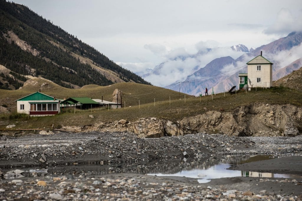
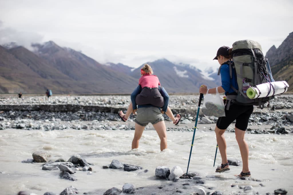
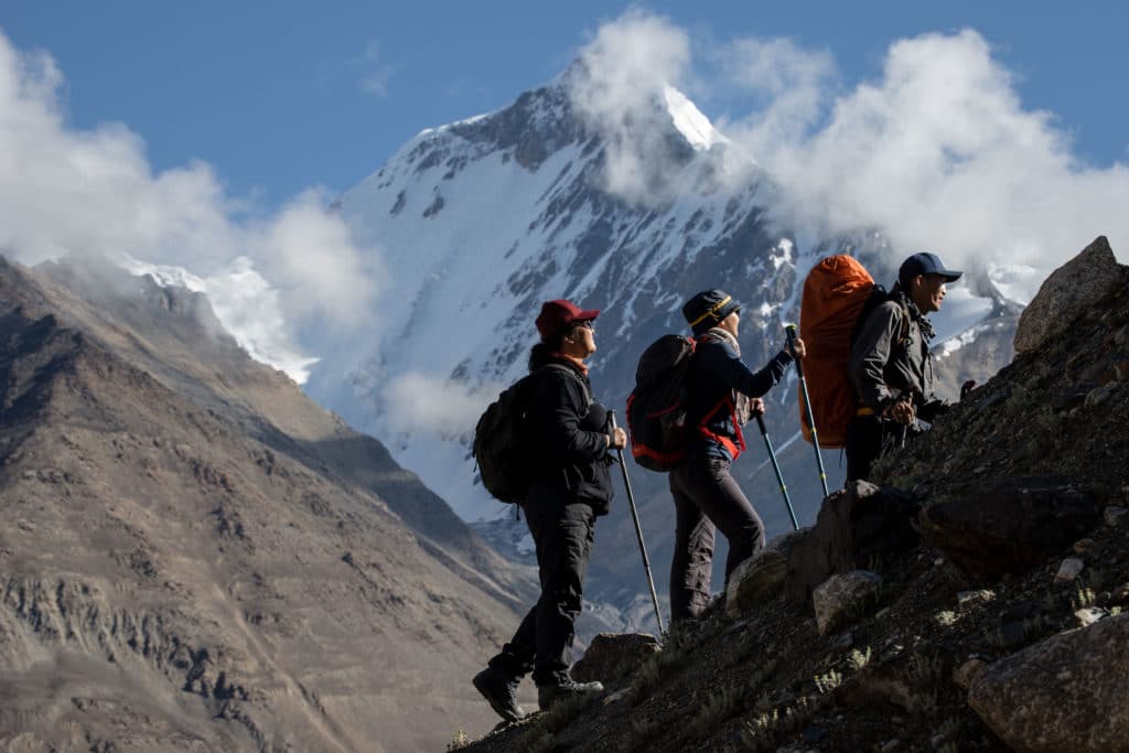
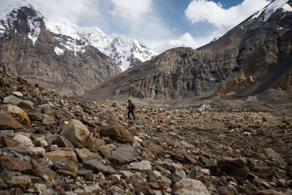
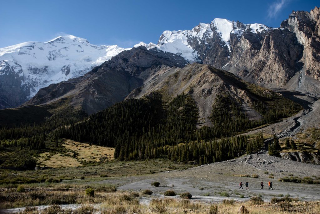
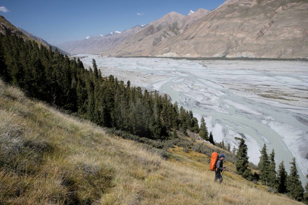
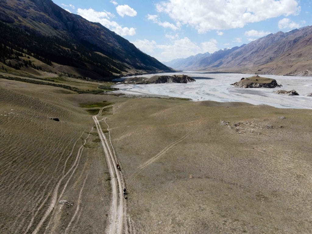
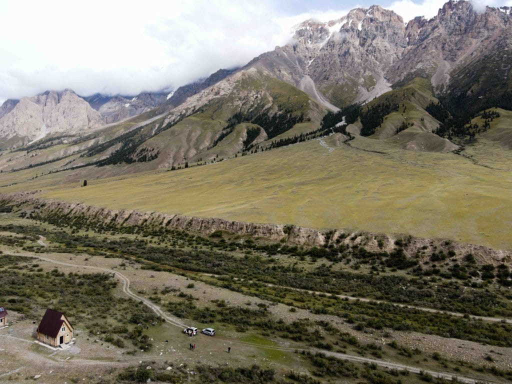
Day one of the Merzbacher Lake trek follows the Enilchek River up the valley towards Iva Camp, just in sight of the end of the Enilchek Glacier. From the tourist base camp at At Jailoo (pictured above), head northeast up the valley and towards the massive peaks beyond. The jeep road there winds lazily through the surrounding hills while a path cuts directly across to the bank of the At Jailoo River – regardless of which you choose, after just a couple kilometers you’ll be shedding your pack and shoes to cross the glacial-fed river that pours forth from the At Jailoo Valley above.
On the far side of the river, carry on along the grassy hillside until paths start cutting off to the left down to the rocky riverbed. It’s easy going through here, with flat ground and comparatively little vegetation, so the only thing that really needs attention is the larger rocks that shift underfoot.
After around three kilometers (depending on where you’ve cut down to the riverbed), the southernmost branch of the Enilchek River pulls quite close to the wall of the riverbed. If the river is fairly low, it’s really much easier to cross the first branch twice to get past this section, but if water levels are high you’ll have to scramble up above the river here back onto the grassy plateau and then down again along the remains of a small landslide with lots of loose terrain underfoot. Either way, just past this section the trail cross the mouth of a small tributary where you can hike up a little to see a small but pretty waterfall dropping from the rocks pinned against the valley walls above.
Shortly after, another much deeper stretch of the river pulls in close once more, necessitating the day’s only real climb to bypass this section of the river by heading up the hillside above. Climb up through grass and flowers until the path plunges into the wild shrubbery beyond (Monty Python fans will be delighted to know it’s around “Ni!” height). Carry on through the shrubs and small stands of forest cover, crossing a stream about halfway along that has cool clean water perfect for refills, and then sharply down the far end to rejoin the riverbed at roughly the halfway point of the day’s hike.
It’s an easy cruise from here on to Iva Camp, continuing up the Enilchek River Valley in parallel to the river itself over wide open terrain with fantastic mountain views all around. About four kilometers past the end of the descent, the first far views of 7010m Peak Khan Tengri open up on a clear day.
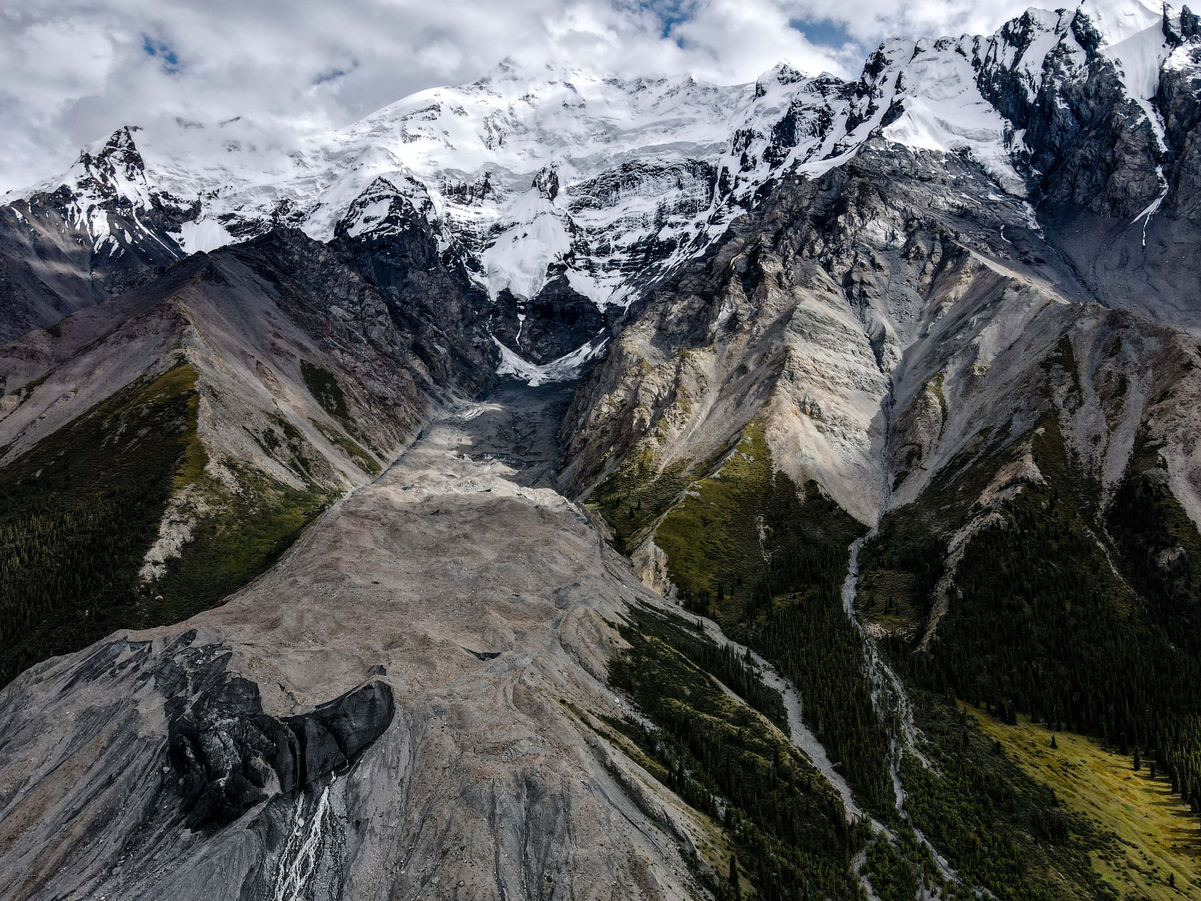
Much nearer, and even more spectacular, are the massive glaciers that pour down the flanks of 5697m Peak Nansen for the last two kilometers or so before arriving to Iva Camp. This beautiful peak, which dominates the near ridge for much of the day, makes its presence most strongly felt by the massive glacial tongue that reaches all the way down to the bed of the Enilchek River as you round the final bend towards camp – you’ll need to go around it, which just means you get to enjoy it from every angle and in all splendor.
Just after you’ve done so, as you make the final few minutes towards Iva Camp, the snout of the Enilchek Glacier itself comes slowly into focus – an alluring proposition for the start of Stage 2.
Merzbacher Lake and Enilchek Glacier: Stage 2
Iva Camp to Gliny Camp
Total Km: 9km
Walking time: 5h
Total time: 7h
Elevation Gain/Loss: 572m+ / 312m-
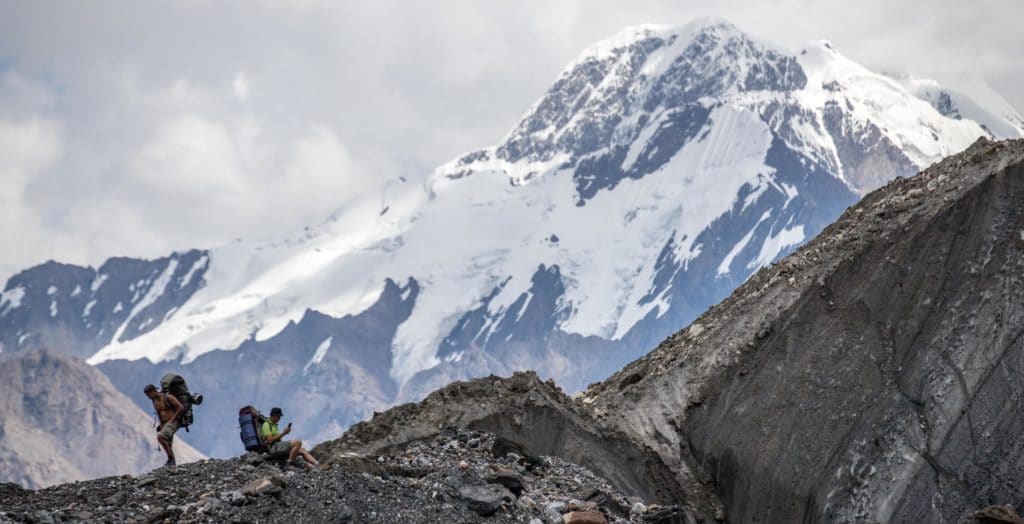
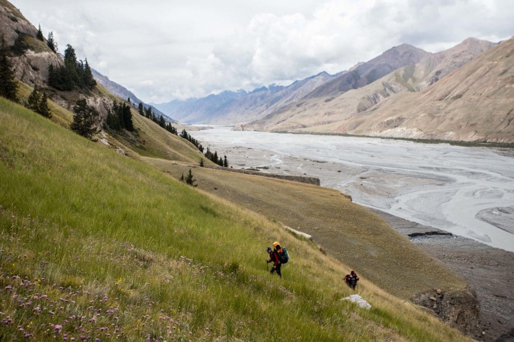
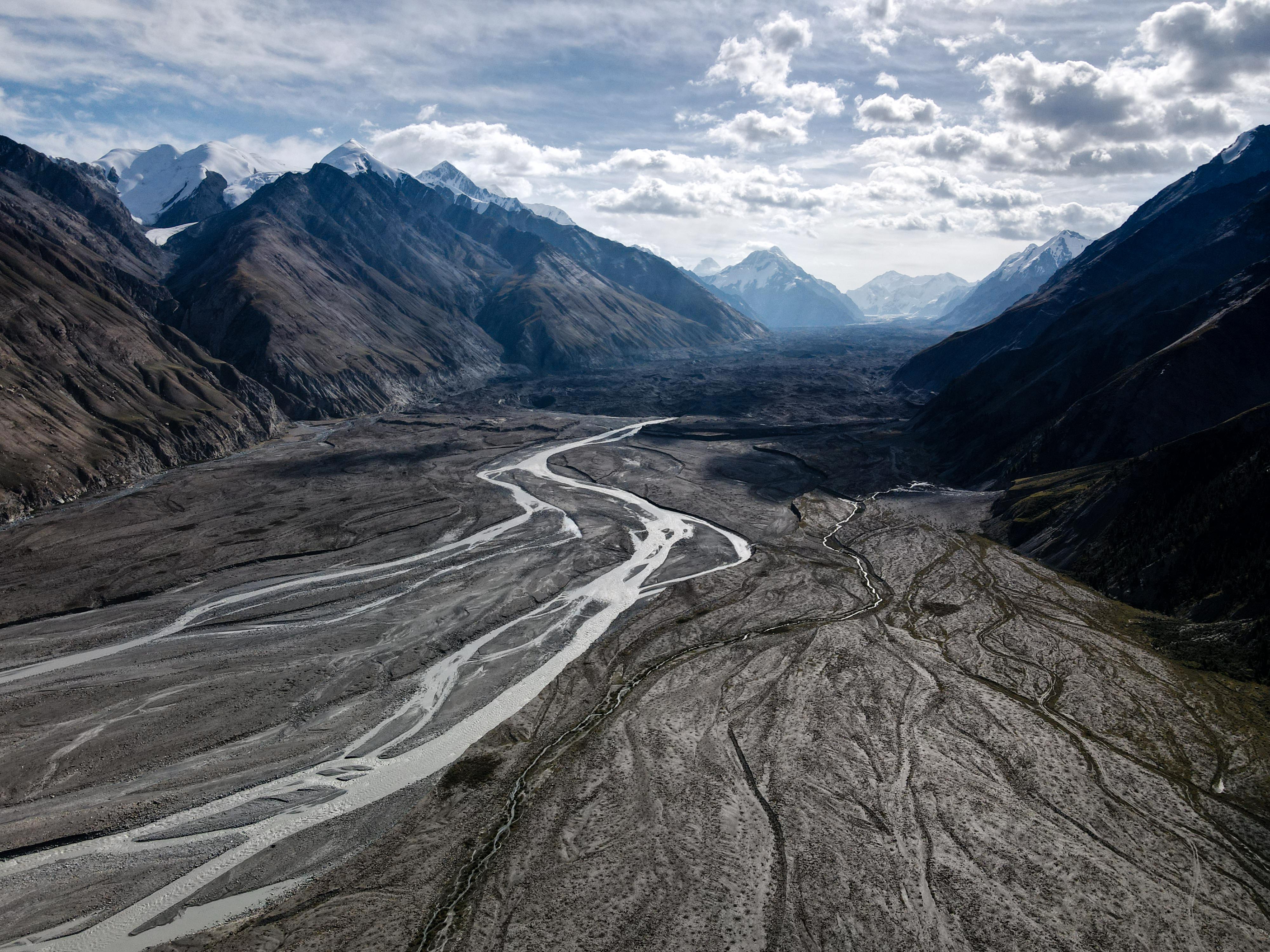
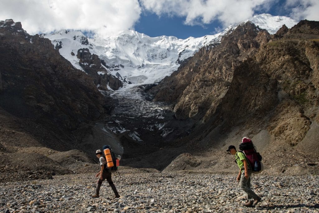
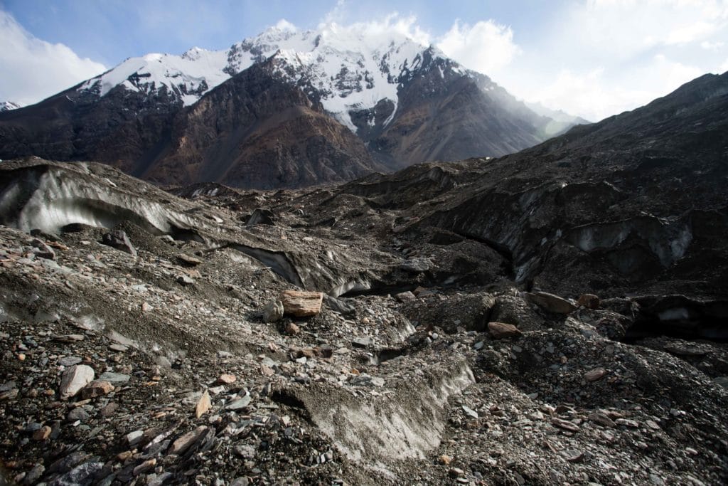
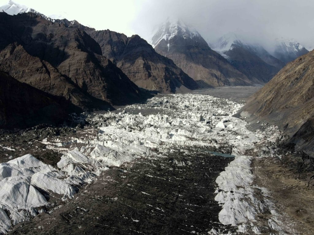
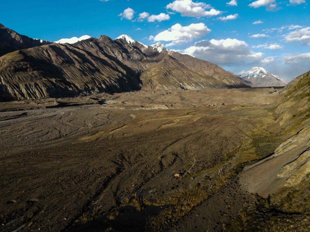
Day 2 of the Merzbacher Lake hike is where the Enilchek Glacier excitement begins. It’s around 2km from Iva Camp to the moment where you first climb onto the snout of the Southern Enilchek Glacier, an easy stroll over flat grassy terrain until briefly dropping into the river bed. Almost immediately after is the first of many small lakes atop the glacier – this one a good swimming spot en route back to At Jailoo on Day 4, so just admire the views as you pass alongside for now, and soon the trail with angle back up to the south and onto more stable ground.
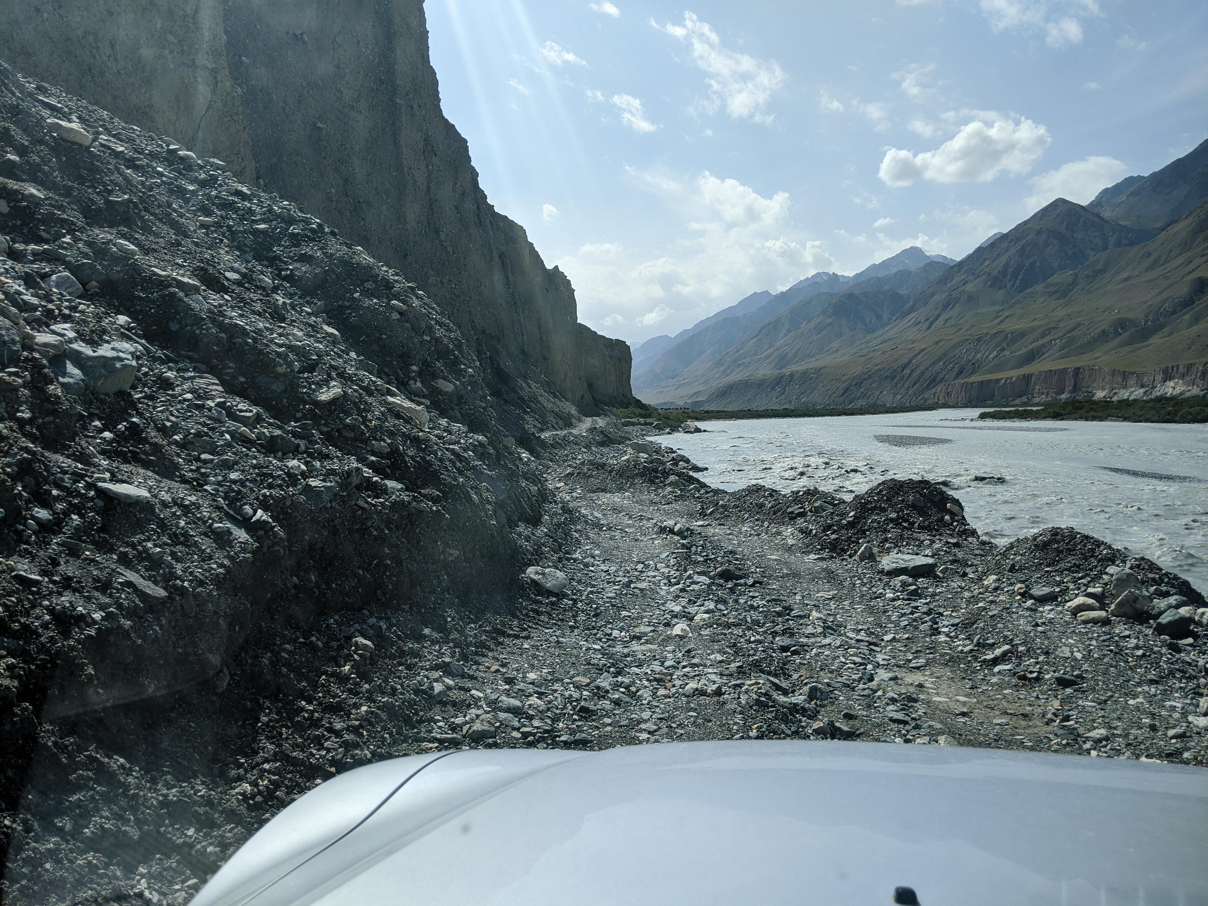
The first two kilometers alongside the glacier are pretty easygoing – largely the trail keeps on well-trodden paths that are easy to follow, and the climbs remains fairly gradual throughout. The path dips briefly up a small side canyon to cross a stream fed by a small glacier just above, and almost immediately encounters a screen section that has been mostly cleared out by a landslide. This isn’t necessarily dangerous to cross, but there’s a big drop and with a bad misstep it could be, so do your best as a trekking party to help one another across.
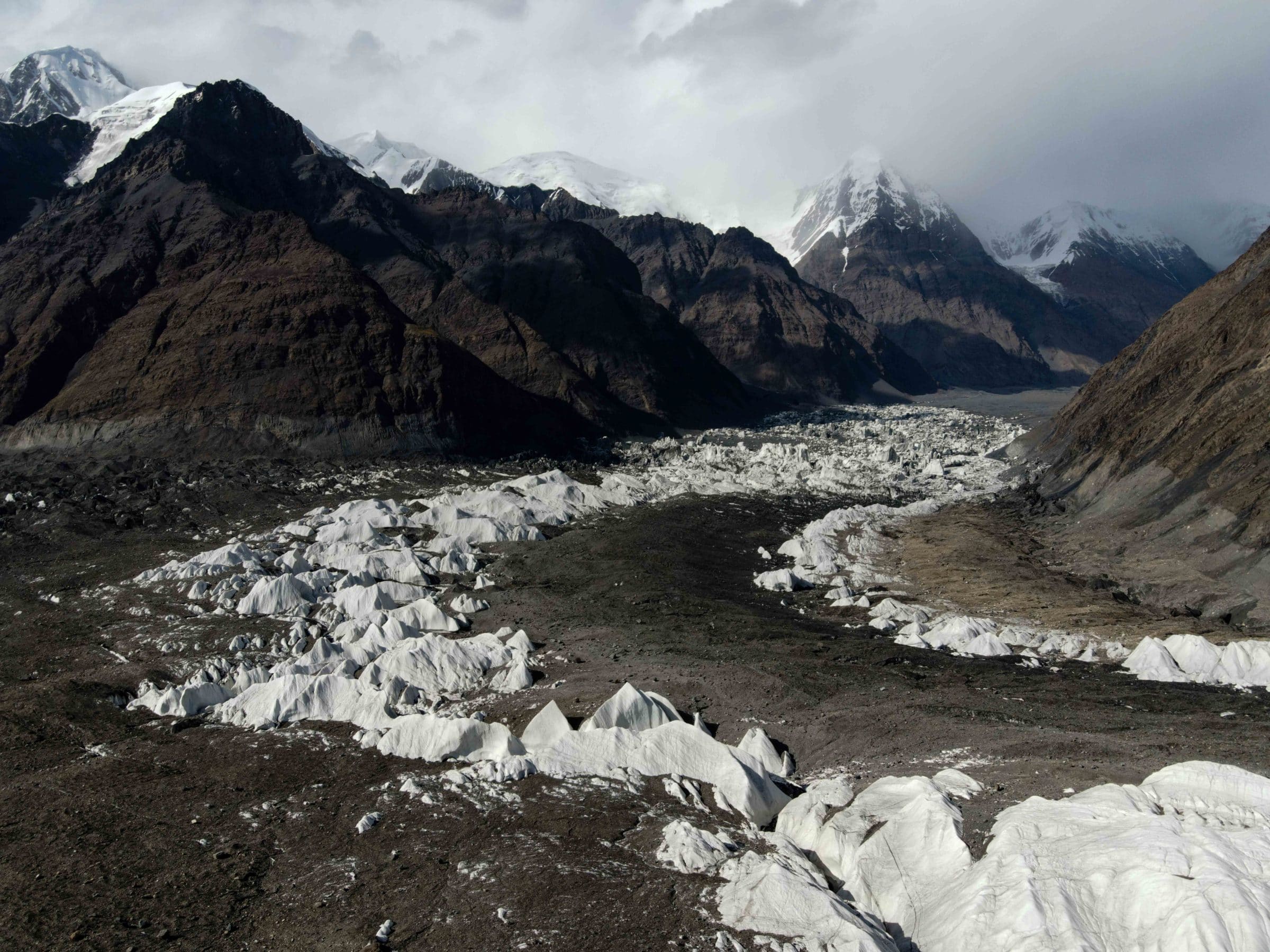
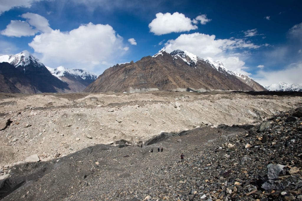
Another kilometer and a half of smooth sailing leads to another stretch of trail that has been washed away – and this time there’s no easy route to hop across. Instead, you’ll need to descend via a steep scree slope back onto the glacier, and into what it probably the trek’s trickiest stretch of route-finding.
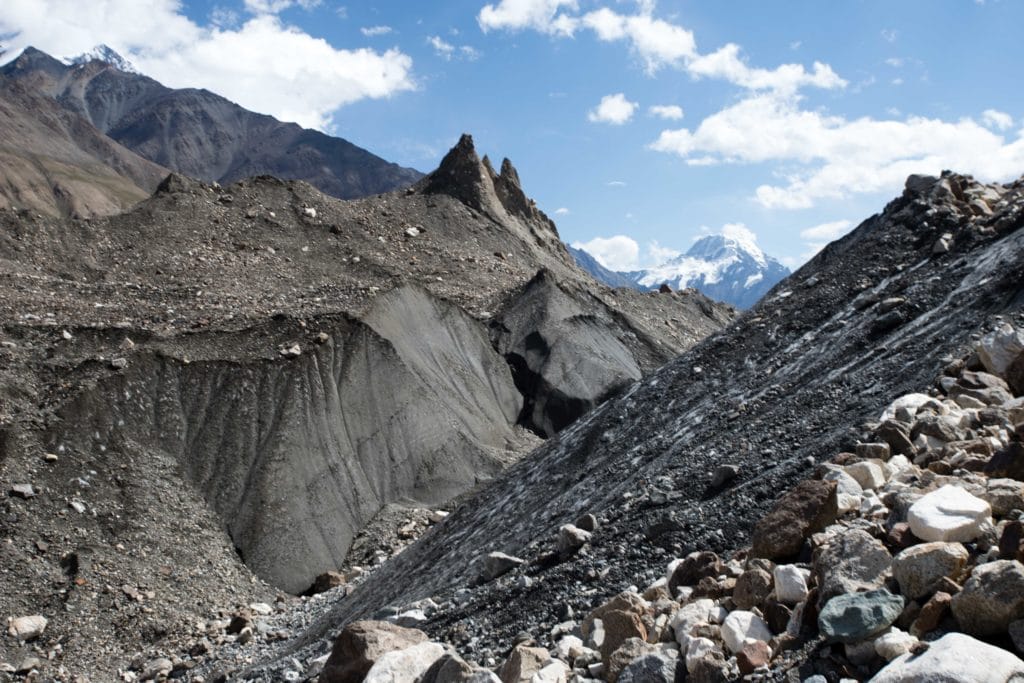
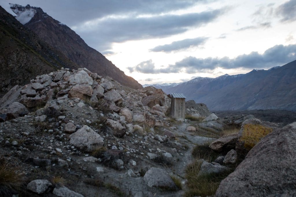
Unless foot traffic is particularly high in the period you’re visiting, there’s no clearly-defined trail across the glacier here. Pick what seems to be the most direct route around major obstacles, adjust as necessary, and keep going until past the open mouth of the large glacier to the south that converges into the Enilchek. Once the path finally rejoins solid land, after around three kilometers of winding in an out among the glacial rocks, it’s only another half kilometer or so to Gliny Camp – so named for the claybed that defines this little campsite and spring. On a clear evening there’s quite nice golden light around here, and the camp toilet has some of the most spectacular views of any toilet we’ve ever seen.
Merzbacher Lake and Enilchek Glacier: Stage 3
Gliny Camp to Merzbacher Glade
Total Km: 8.8km
Walking time: 4h
Total time: 4h
Elevation Gain/Loss: 322m+ / 45m-
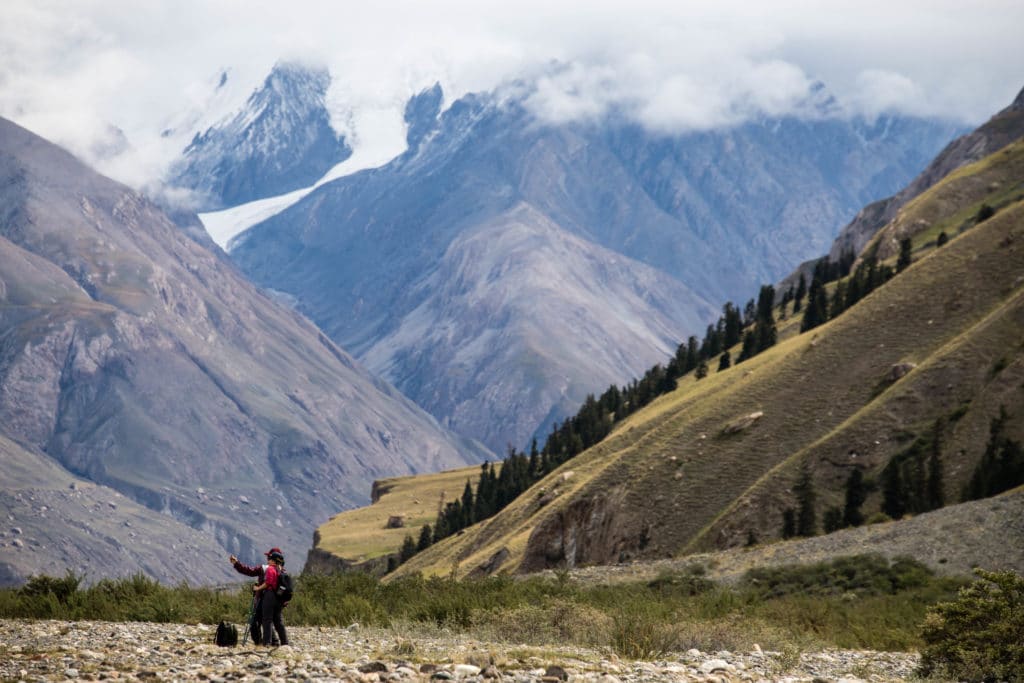
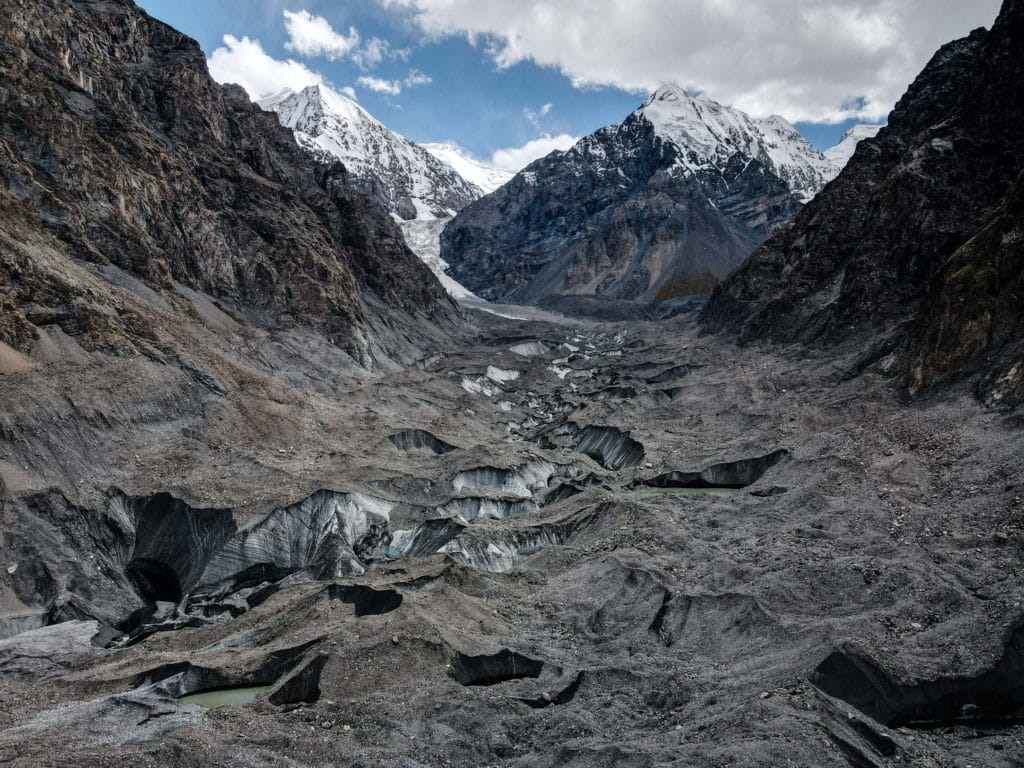
Stage three of the Merzbacher Lake hike is short and sweet, a quick and easy walk on stable ground above the edge of the Inilchek Glacier and crossing occasional open ground below the tongues of smaller glaciers that once connected to the Inilchek but have now retreated.
You shouldn’t have any trouble with route-finding through here, as the path never descends onto the Enilchek Glacier itself, and after a couple hours of easy walking and one last push to climb up to the green grassy meadow of Merzbacher Glade the stage is done. Don’t linger too long getting started this morning, however, as you’ll almost certainly want to continue onto stage 3.5 immediately after setting up camp.
Merzbacher Lake and Enilchek Glacier: Stage 3.5
Merzbacher Meadow to Merzbacher Lake
Total Km: 5km
Walking time: 3h
Total time: 4h
Elevation Gain/Loss: 213m+ / 213m- (62/151)
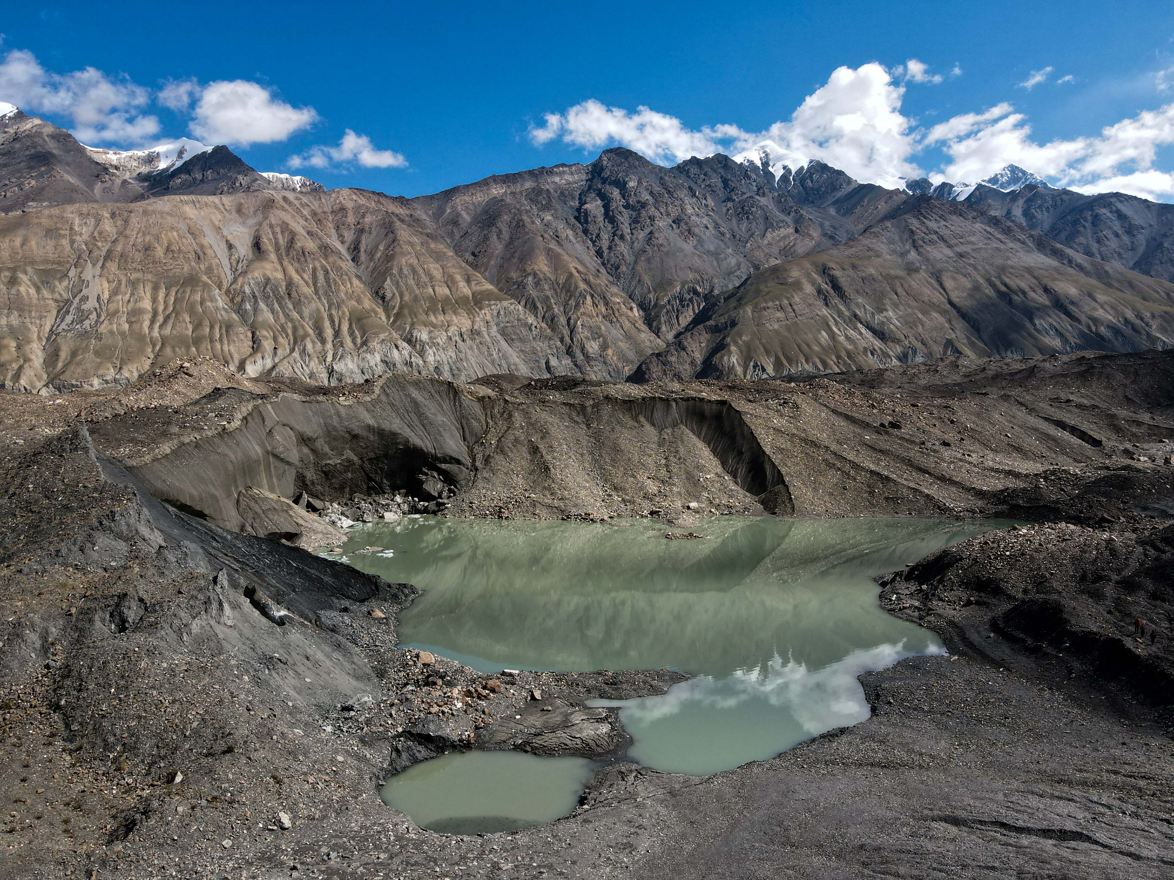
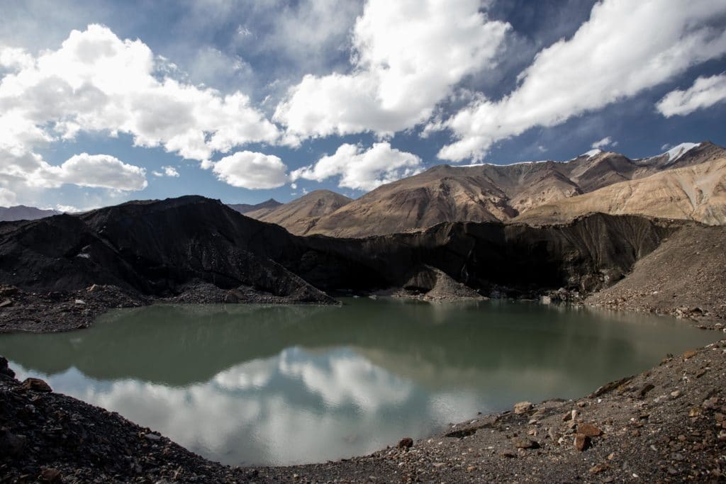
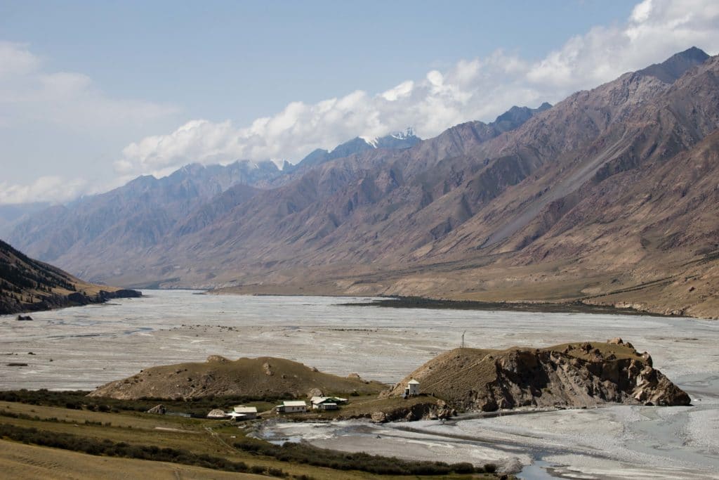
This is what you came here for: Merzbacher Lake. Merzbacher is a ‘proglacial lake’, or a lake dammed by a glacier, but what makes it truly unique is that unlike the vast majority is empties and refills each year as the snowmelt slowly grows it larger and larger then the ice damn breaks and the water floods underground through the Enilchek glacier in a series of massive tunnels that have only barely been explored by geologists. The timing of the drainage is unpredictable – all the photos in this post were taken in late August, and it had drained just a few weeks before, but it has been previously reported as early as mid-July.
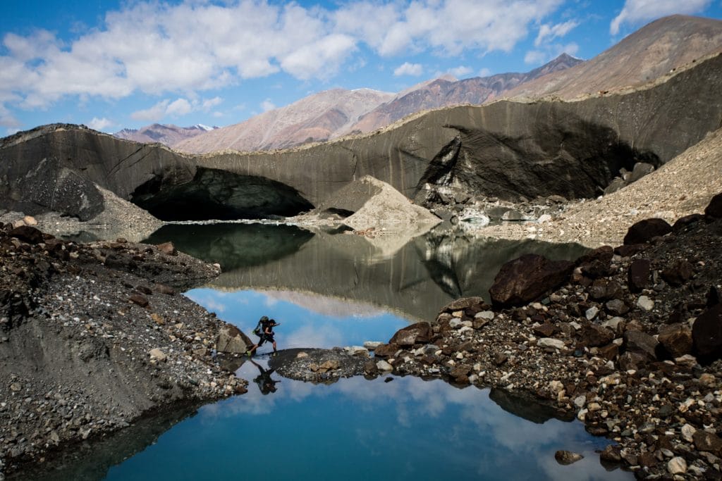
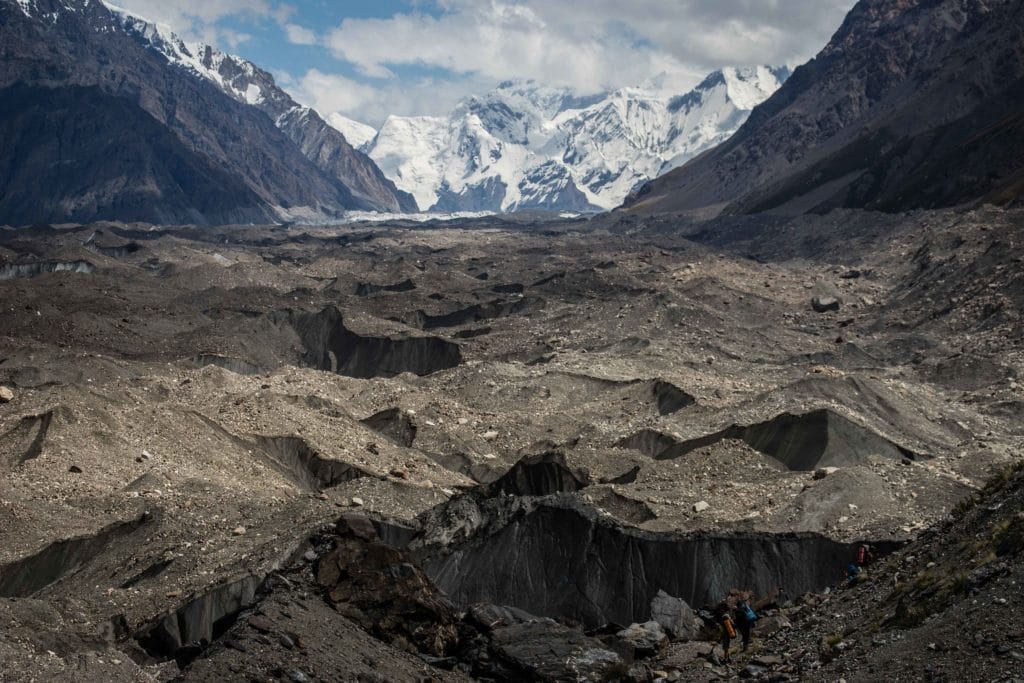
The final short 2.5km stretch from Merzbacher Glade to Merbacher Lake climbs up the hill just east of the campsite and then descends precipitously back to the Enilchek Glacier. As before, the going is quite slow and you’ll need to pick a path along the glacier that avoids the obvious deep pitfalls and circumvents deep pits and tall spires of rock and ice that jut above the rough surface. Eventually, though, you’ll wind your way to the northern side of the North Enilchek and a white wall of ice will appear in the distance.
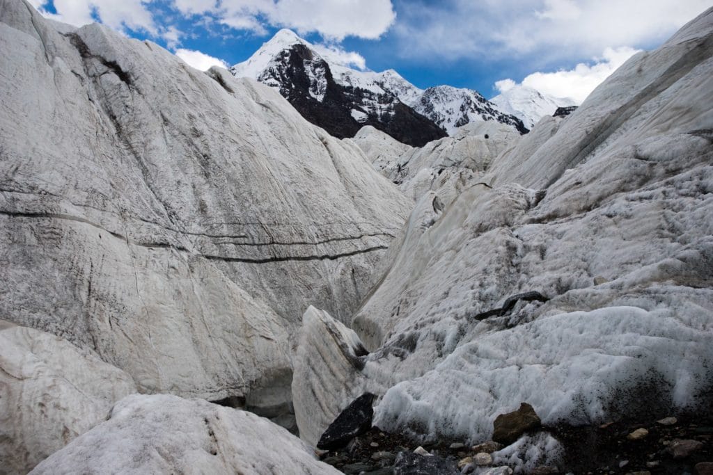
It’s not possible to trek to the lake itself, as the confluence of the North Enilchek Glacier (upon which Merzbacher Lake actually sits) and the South Enilchek (the main arm) creates a massive uplift of ice that forms an impressive barrier wall. There are a few spots where you can scramble up to the top of the wall – do take care not to fall down the far side of course – but also plenty of areas when the meltwater rushing along the ice’s surface has carved deep canyons into the darkness of the canyon below. As always, don’t hike around here alone and take care to pick a safe path through the glacier.
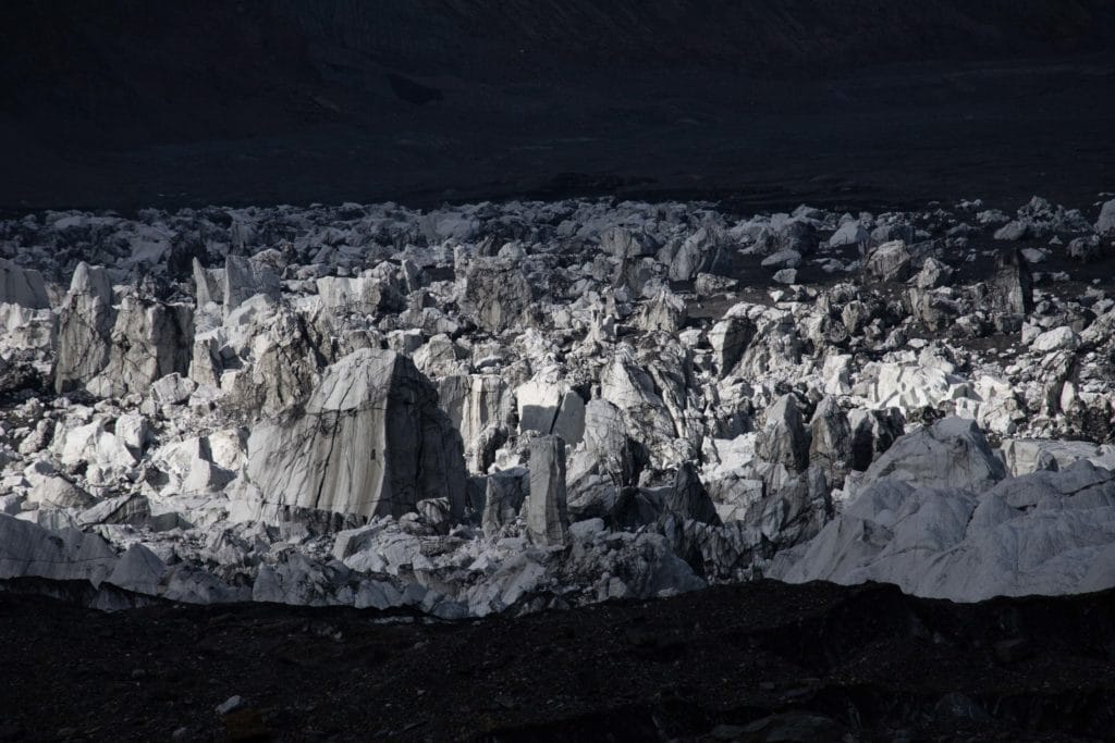
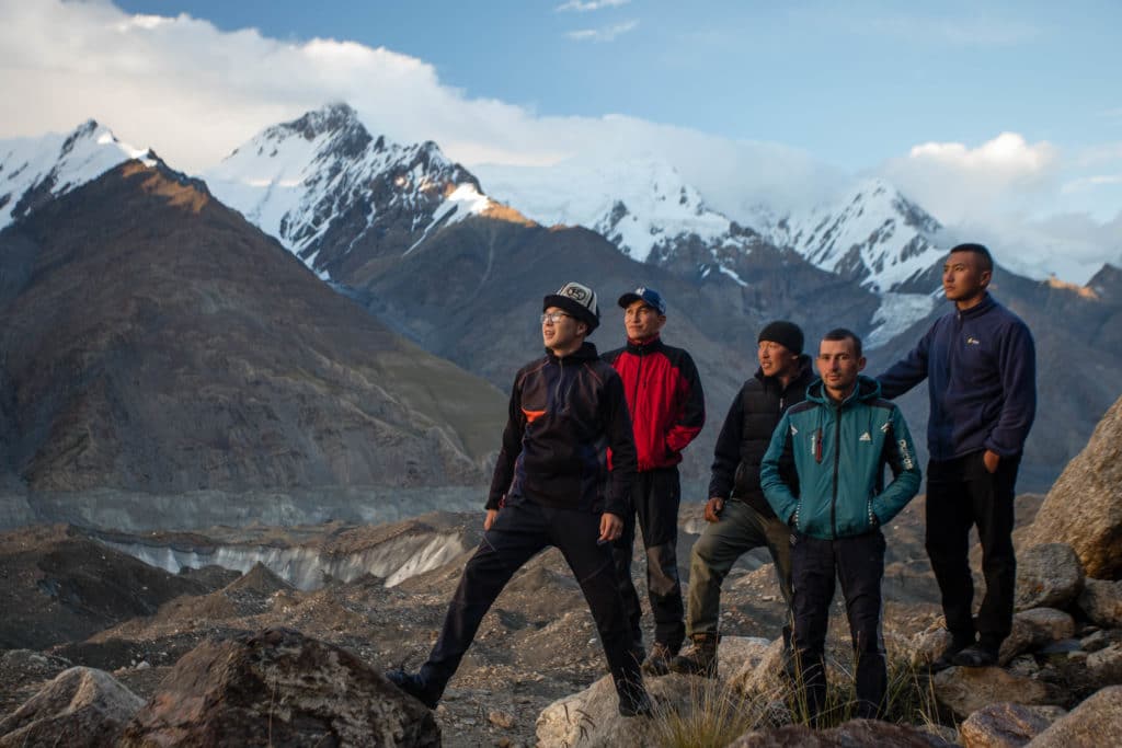
The ice wall is itself astounding and, even after Merzbacher Lake has melted, the icebergs-turned-pillars scattered across the top of the North Enilchek Glacier are an impressive sight. Eventually, either as darkness falls or once you’ve had enough of the Merzbacher views, thread your way back to Merzbacher camp for the night.
Merzbacher Lake and Enilchek Glacier: Stage 4
Merzbacher Meadow to Iva Camp
Total Km: 17.8km
Walking time: 7h
Total time: 8h
Elevation Gain/Loss: 357m+ / 894m-
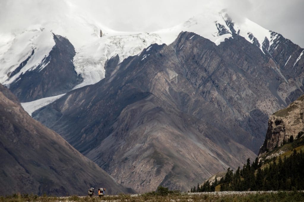
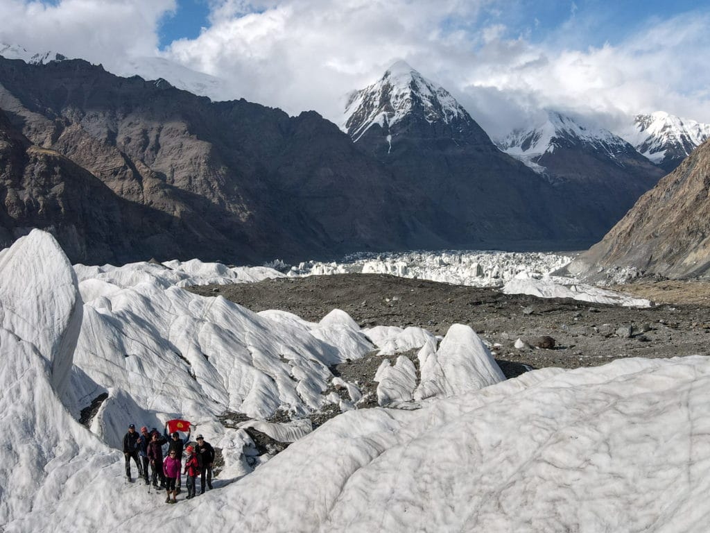
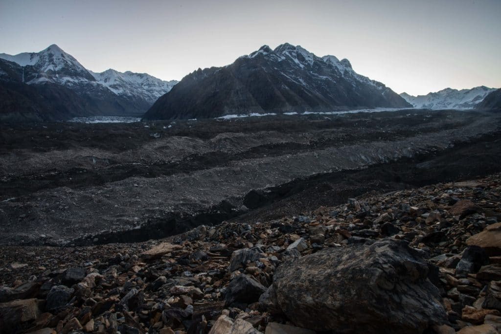
Though it’s somewhat of a long day ahead, it’s well worth getting up for sunrise from Merzbacher Glade, as the campsite has excellent and quite open views along both the North and South Enilchek Glaciers. After enjoying the sunrise and putting together breakfast, it’s time to strike camp and head back down the glacier towards the trailhead. Mostly downhill and on a more familiar trail – having already walked it once, of course, this stage combines Stages 2 & 3 into one long day, finishing back up at Iva Camp just beyond the end of the glacier.
Despite having just trekked this terrain a day or two before, it’s no less beautiful for being revisited, the peaks still as epic and the glaciers still as magnificent all along the way. The two slow and difficult stretches are still slow and difficult, but at least having crossed the glacier here once already you should have some idea of the best route to wind back through without getting too lost this time.
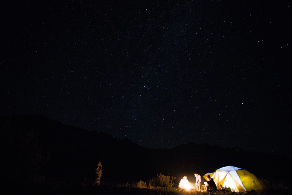
By the time you get to the last little lake, right before the terminus of the glacier, consider hopping in for a swim in the refreshingly chilly water – it’s the perfect way to refresh after a long day of walking, and you’ll glide the last few kilometers into camp afterwards. Set up camp in Iva once more and enjoy one last night of a vast star-filled sky.
Merzbacher Lake and Enilchek Glacier: Stage 5
Iva Camp to At Jailoo Trailhead
Total Km: 18.7km
Walking time: 6h
Total time: 7h
Elevation Gain/Loss: 182m+ / 359m-
One final and very straightforward day of trekking, retracing the first day’s path down from Iva Camp to the trailhead at At Jailoo. There’s still the one short climb just after the halfway point, but do check the river’s depth again to see if it’s possible to avoid the second short climb by just crossing the smaller side branch of the Enilchek River and continuing along the wide riverbed until At Jailoo.
![]()
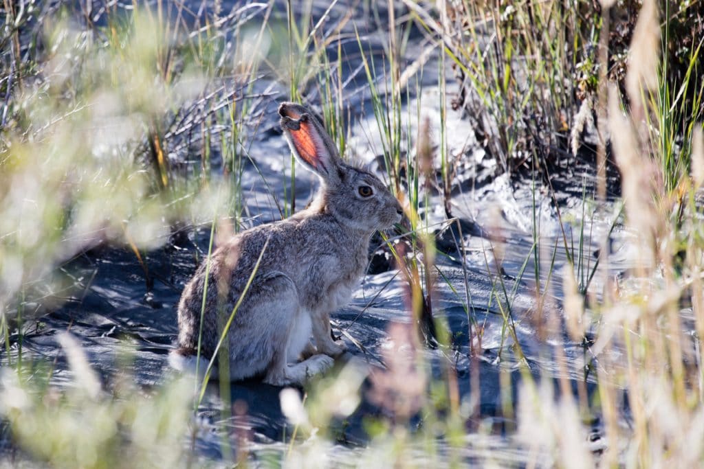
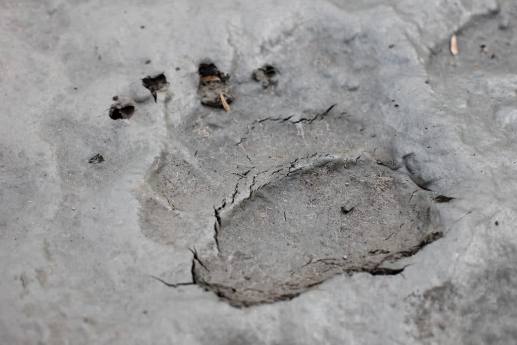
The mountain views are no less amazing, but also keep an eye out for signs of wildlife. You’re likely to see countless birds, a fair few small mammals, and perhaps even a few signs of the larger animals that call this region home. Because of the relative lack of pasturage in this region, it’s wild in a way that Kyrgyzstan’s less-remote mountain areas rarely are.
Soon enough, the end is in site: the At Jailoo Tourist Base. With it, the trek to magnificent Merzbacher Lake along the South Enilchek Glacier comes to an end. It’s a long drive back to Karakol from here.
Alternate Options for Merzbacher Lake and Enilchek Glacier
Many travelers who visit the Enilchek Glacier continue onwards to Khan Tengri Base Camp, and then hire a seat on a helicopter to return back to the shores of Issyk Kol. If that’s a little out of budget (or, as occasionally happens, they helicopters just aren’t operating) you can also add on the two-day At Jailoo Lakes trek from the same trailhead as Merzbacher Lake. Further options exist for extending the Merzbacher and Enilchek Glacier route to as far as the village of Jyrgalan not far from Karakol – you’ll probably need either porter or horse support to make that long of a journey, so ask at tour operators for more info.
Good To Know
Khan Tengri National Park is one of the few areas in Kyrgyzstan where you’ll need an entrance fee. Officially that’s 150 som per tent per day plus 300 som per foreign tourist plus at least 50 per vehicle. However, as in many things in Central Asia, these costs may be negotiable.
To even get here, you’ll need a ‘border zone permit’ to get through the two border posts at the Sary Jaz Valley turnoff and just before the entrance to Khan Tengri National Park. It’s possible to arrange this yourself for around $15, but you’ll need a couple weeks in Bishkek and another in Karakol. Save the hassle any pay a tour operator, who will charge you somewhere between $35 and $50.
The good news is that once you’re here, you’re here. Rather than hiking just At Jailoo, we’d really suggest to combine the trip with the trek along the Enilchek Valley either to Merzbacher Lake or all the way to Khan Tengri Base Camp. This is a wide, wild, beautiful region; if you’re making the effort to get all the way out here, try to spend absolutely as much time as you can.
Getting to Merzbacher Lake and Enilchek Glacier
The main difficulty with basically the entire Enilchek region is access. No public transportation runs here at all, the only shared taxis possible are *maybe* to Enilchek village if you get lucky enough to find a local coming home, and anywhere beyond the village is basically a complete lottery of whether there are and cars and whether they are willing/able to take you. Unless you really have all the time in the world to wait and hope, this is really a region to hire a guide and driver.
We quite like Kyrgyzstan Tourism and Kyrgyz Life for this part of the country, as their owners and guides know the region well and are mostly local. They can also arrange Merzbacher Lake, Khan Tengri Base Camp, trips up the Kuylu Valley, or exploring Sary-Jaz. There’s really quite a lot to do in this area, none of it easy to get to unless you have your own wheels, so this is a place we’d absolutely recommend going with a guide/driver.
Where to Stay and Eat
The Tur Khan Tengri hunting lodge at the trailhead has a large pleasant meadow for tent camping beside a small spring, but will ask some money for the privilege – you’ll need to negotiate, and the price goes up depending on whether the owner are around or just the caretaker. If you’d prefer to wild camp, you can do so just below the At Jailoo Valley – the only real tradeoff is having to walk to the river for water, which is sometimes quite gritty from glacier runoff.
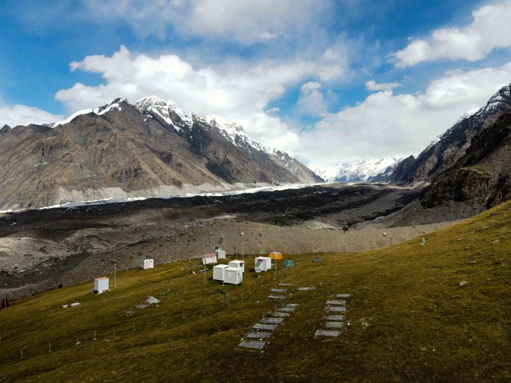
Further along the South Enilchek Glacier, Ak Sai Travel operates paid tent camps from July 5th to August 30th each year at Iva, Gliny, and Merzbacher Glade (as well as onwards to Enilchek Base Camp). Currently they charge $60 per day with three meals. Typically travellers with their own tents and food can negotiate a nominal rate to pitch on those territories and make use of their facilities, or you can wild camp elsewhere along the glacier.