Tajikistan: Fann Mountains Trekking Guide
Таджикистан: путеводитель по Фанский Горы
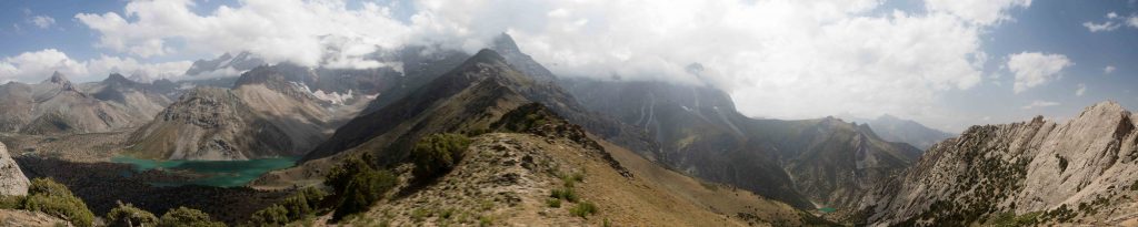
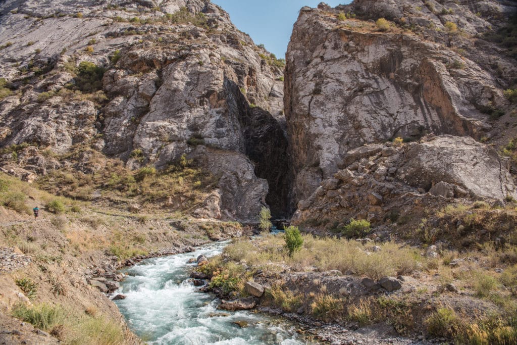
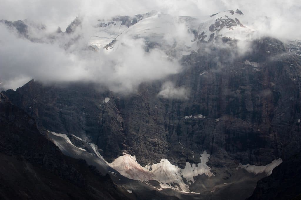
Though most Western tourists center their Tajikistan travel on the Pamir Highway, the Fann Mountains in the northwest of the country is full of tempting trekking routes and high alpine lakes, most of it admist landscapes far more lush and welcoming than the Pamirs. The hiking is beautiful (on par with any Central Asia trekking) but the infrastructure underdeveloped, so this is a region for the independent backpacker ready to be totally self-sufficient.
Trekking in the Fann Mountains
We’ll look first at the most popular hikes in the Fann Mountains, many of which center around the Haft Kul Lakes and the Kulikalon Lakes and surroundings, and then at some of the practical considerations like where to stay and how to get there.
- Fann Mountains Itinerary
- Haft Kul Lakes
- Mogiyon to Haft Kul
- Haft Kul to Alauddin
- Artuch Alplager to Chukurak Pass
- Kulikalon Lakes
- Kulikalon to Iskanderkul
- Yagnob Valley Loop
- Getting to the Fann Mountains
- Where to Stay and Eat
Fann Mountains Itinerary
Assuming you want to do quite a bit of trekking in Tajikistan and hit all the best treks in the Fann Mountains, plan on spending at least two weeks in just the Fanns and an additional week or more to explore the Yagnob Valley. Public transportation in the region is limited and often slow, so travellers on a time crunch may want to make arrangements with a tour operator ahead of time.
- Day 1: Penjikent to Mogiyon to Rogich
Catch a ride in the morning from Penjikent to the village of Mogiyon and the start of the Mogiyon to Haftkul trek. It’s a 15km day of walking up and over one pass en route, so you’ll want to get an early start to make the most of your hiking time once you arrive.
- Day 2: Rogich to Marguzor
Continue the remainder of the way to Haftkul, ending in the village of Marguzor at the top of the 6th of Haftkul’s Seven Lakes. Make the quick daytrip to Seventh Lake and back, overnighting at a homestay in Marguzor for an early start the following day.
- Days 3-8: Marguzor to Alauddin Lake
Head over less-trodden territory between the Haftkul to Alauddin Lake trail, typically skipped by tourists. This incorporates both the Chukurak Pass and the traditional Kulikalon Lakes hike, and can also detour via the Artuch Alplager rather than the Chukurak Pass if you need to resupply and want to arrange a food drop or just buy from the basic supplies for sale at Artuch.
It’s possible to arrange a private pickup from the end of this route as well, via the Vertical Alauddin basecamp, which may be more efficient if you plan to continue onwards to Yagnob and don’t mind skipping the Chimtarga section here.
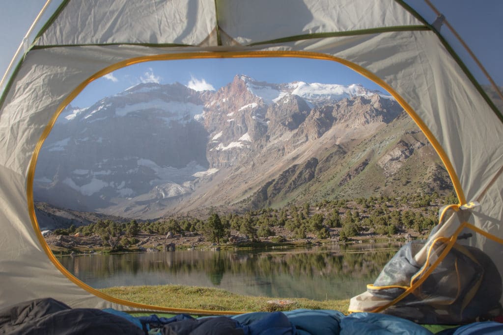
- Days 9-14: Alauddin Lake to Iskanderkul
Pick up from day two of the Kulikalon Lakes to Chimtarga and Iskanderkul Lake trail, starting from Alauddin Lake and climbing over the Chimtarga Pass. That route ends in Sarytag, from which the small resorts on the shores of Iskanderkul are just a few kilometers away. From here it’s possible to arrange a transfer back to Dushanbe on public or private transport, or continue onwards towards the Yagnob Valley.
- Days 15-21: Yagnob Valley
While the Yagnob Valley Loop is only five days of trekking, accounting time for transfers in each direction it’s basically a weeklong commitment. There’s some potential to carry on by foot down towards Dushanbe or to enter the Yagnob over high passes instead of a vehicle transfer – read the information at the end of that trek write-up for more info.
Haft Kul Lakes
Total Km: 9.6km
Total Days: 1
Elevation Gain/Loss: 457m+ / 457m-
Start/End Point: Marguzor
The classic Haftkul trek transfers by car up the main valley and then begins hiking from Marguzor village up to the seventh (and final) of the lakes here. It’s a lovely and easy walk, though a considerably drive from Penjakent to the trailhead.
Mogiyon to Haft Kul
Total km: 38.5 km
Total days: 2
Elevation gain/loss: 3,159m+/2,825m-
Start/End point: Mogiyon/Padrud Villages
The Mogiyon to Haft Kul route adds an extra two-day crossing from the village of Mogiyon directly down to Marguzor. In addition to taking in several less-touristy areas, it’s also a much more convenient transfer from Penjakent and so makes a good starting point for treks in the region.
Haft Kul to Alauddin
Total Km: 63 km
Total Days: 6
Elevation Gain/Loss: 5429m+ / 4654m-
Start/End Point: Marguzor/Alauddin
Explore the highlights of the Fann Mountains on the Haftkul to Alauddin hike, connecting the Haftkul lakes to the Kulikalon and Alauddin lakes (all three popular destinations in themselves) via several rarely-visited valleys and villages in between.
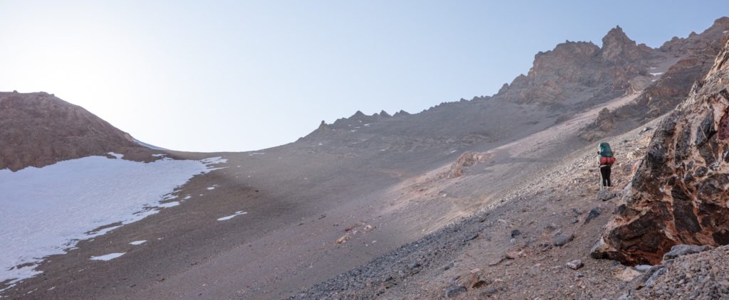
Artuch Alplager to Chukurak Pass
Total Km: 8.5km
Total Days: 1
Elevation Gain/Loss: 1057m+ / 1057m-
Start/End Point: Artuch Alplager
The easiest of the Kulikalon routes, and except for Haftkul probably the easiest trekking in the Fann Mountains, the short walk from Artuch Alplager to the Chukurak Lake and Pass still offers big views and beautiful landscapes in a short time.
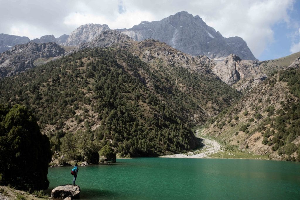
Kulikalon Lakes
Total Km: 19.5km
Total Days: 3
Elevation Gain/Loss: 2070m+ / 1590m-
Start Point: Artuch Alplager
End Point: Vertikal Alaudin Alplager
The classic Fann Mountains multi-day. The Kulikalon Lakes really are one of the most beautiful landscapes in the Fanns, and Alauddin at the end is no slouch either. The three-day version is doable for most capable trekkers, while more-fit hikers could easily squeeze it into two if time is short.
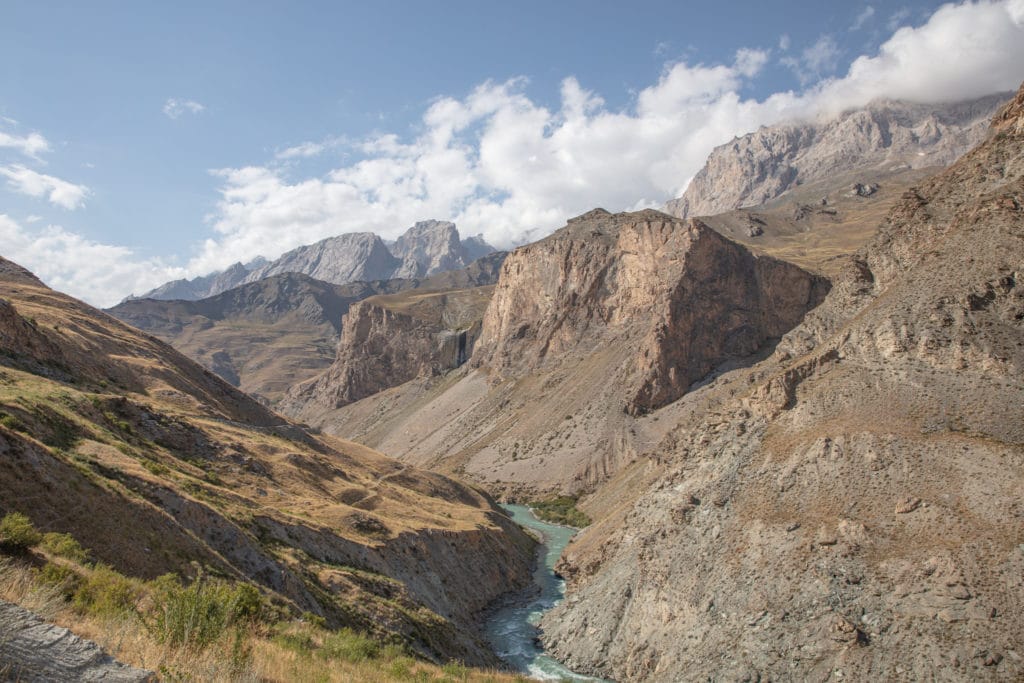
Kulikalon to Iskanderkul
Total Km: 84km
Total Days: 8
Elevation Gain/Loss: 7626m+ / 6567m-
Start/End Point: Artuch / Iskanderkul
This one really squeezes in the whole Fann Mountains experience, especially if combined with the Mogiyon or Haftkul connections mentioned previously. Kulikalon to Chimtarga and Iskenderkul is by no means an easy one, but experienced trekkers will probably find it one of their best experiences of hiking in Tajikistan.
Yagnob Valley Loop
Total km: 44.3 km
Total days: 5
Elevation gain/loss: 2626m+/2643m-
Start/End point: Yagnob Canyon
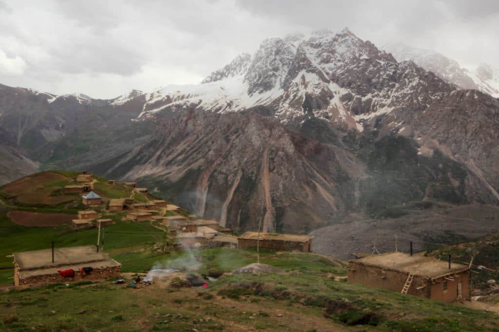
Though not within the Fann Range, the remote Yagnob Valley lies along the border of the Fanns and offers an opportunity for adventure and exploring rarely-touristed areas of an already rarely-touristed country. The classic five-day Yagnob Valley Loop Trek is a great primer for the region, but really you’re only limited here by the scope of your imagination and the amount of food you’re willing to carry. Access is off the road between the Zeravshan Valley and Iskanderkul, so keep it in mind as you plan your itinerary.
Good To Know
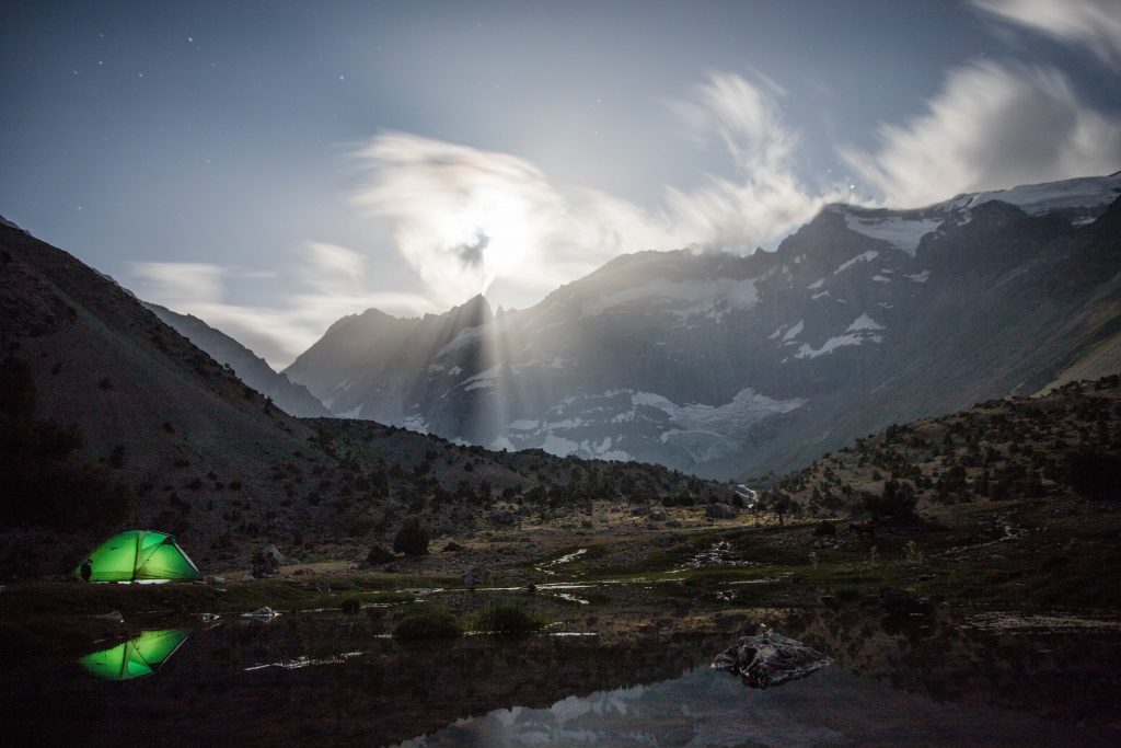
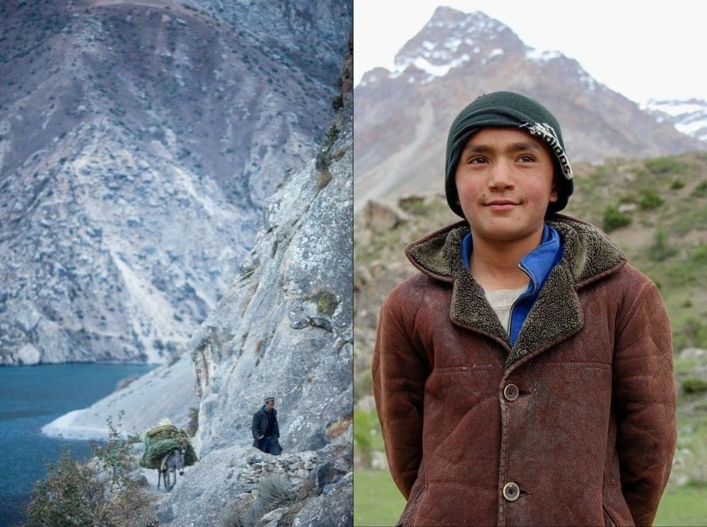
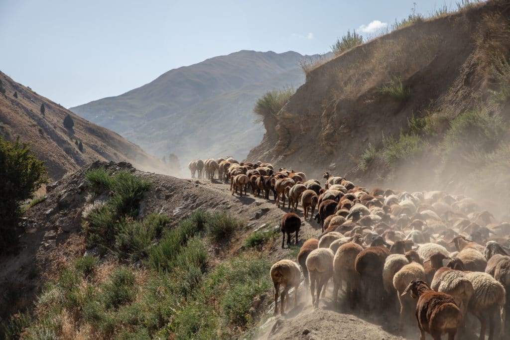
Once you’ve left a trailhead in the Fann mountains, there are basically no shops and limited guesthouses unless otherwise noted, so plan on mostly being self-sufficient throughout your hikes. However, the hills are full of shepherds in summer and they’re often extremely friendly, so don’t be afraid to say hi and accept a cup of tea when offered!
Getting to the Fann Mountains
Dushanbe to the south and Penjikent to the west are the main cities from which to launch into the Fanns, and are connected by quality roads via the midpoint village of Sarvoda. Sarvoda Bazaar is really the transit point for Iskanderkul, Vertical Alauddin base camp, or the Yagnob Valley; basically every other trek will start with a share taxi in Penjikent. Overall the region is much more efficiently explored with private transfers, but see the notes in each trek write-up if you’d like to do it all independently via public transportation.
Where to Stay and Eat
There are just enough guesthouses and tourist camps in the mountains that you could string together a tentless trek if you wanted, but options open up much more for the self-sufficient. With that in mind, plan to stock up on supplies in Dushanbe or Penjikent before hitting the trailhead, and carrying with you everything you need.