
Tajikistan: Kulikalon Lakes to Chimtarga and Iskanderkul
Таджикистан: Куликалон до чимтарга и Искандеркуль
This long route over the Chimtarga Pass combines some of the most stunningly beautiful sections of the Fann Mountains with challenging passes and cultural highlights in rarely-touristed settlements. It is a physically, and outside of the warmest summer months technically, challenging hike that amply rewards those who attempt it.
Total Km: 84km
Total Days: 8
Elevation Gain/Loss: 7626m+ / 6567m-
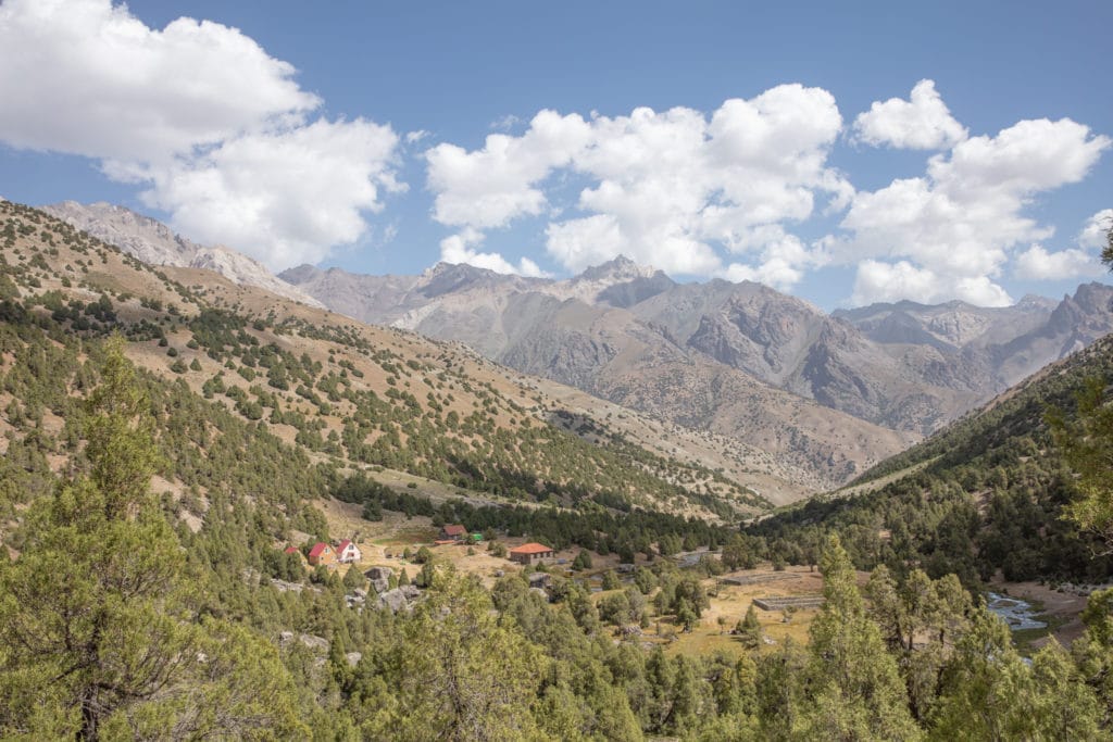
Start Point: Artuch Alplager
End Point: Iskanderkul
GPS Files
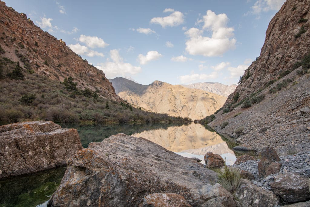
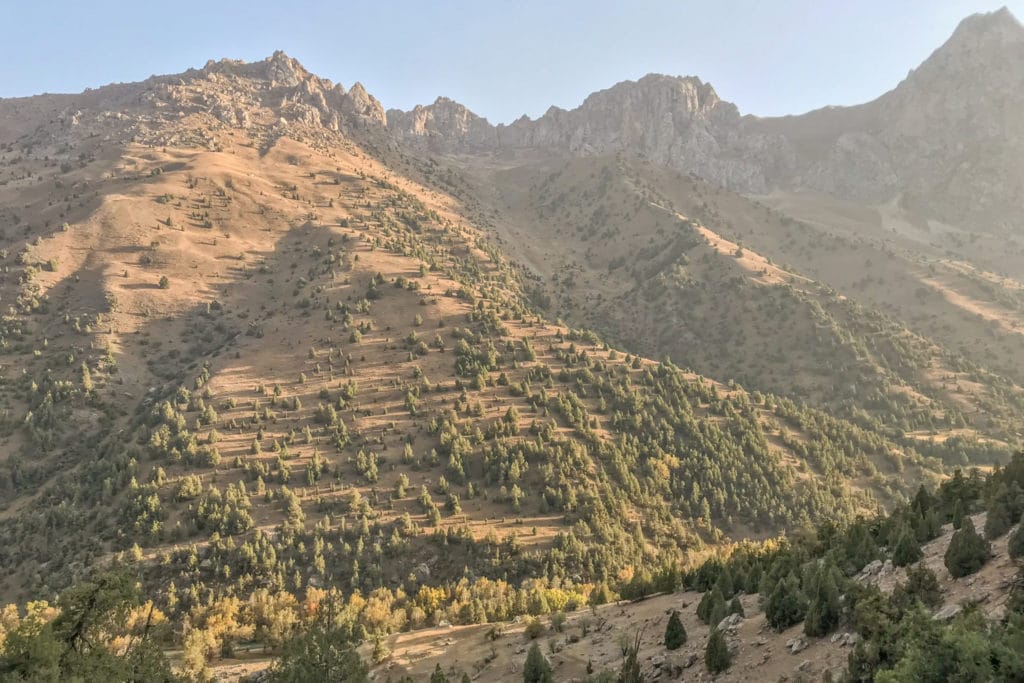
Starting from the Artuch Alplager, this trek follows the popular Kulikalon Lakes Loop to the shores of the beautiful Kulikalon Lakes and Alovaddin Lakes before entering the sparse and steep terrain en route to Lake Mutnyi.
From Mutnyi begins a demanding climb to 4,750m Chimtarga Pass and, from the top, jawdropping panoramic views of the Fann Mountains.
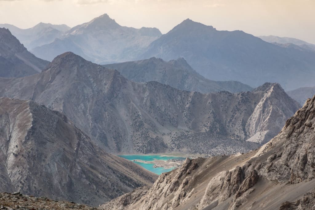
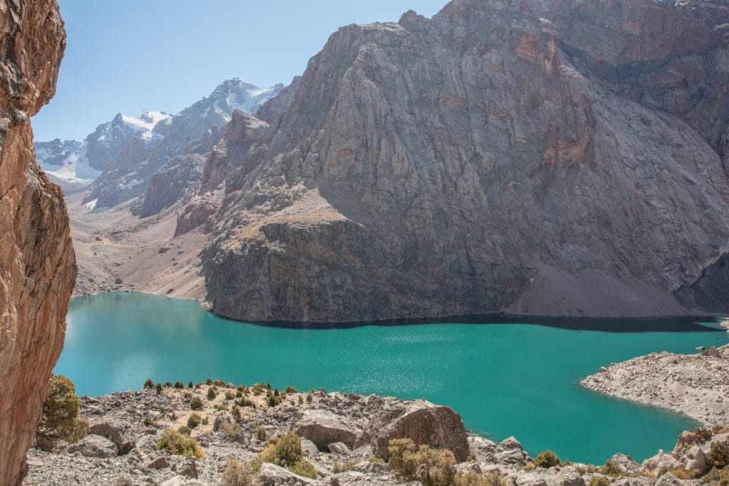
The oddly shaped but beautifully teal Bolshoi Allo lake leads the descent into the Zindon Valley to the Archamaidon River, where the trail turns south to offer sweeping views of the next challenge, Dukdon Pass.
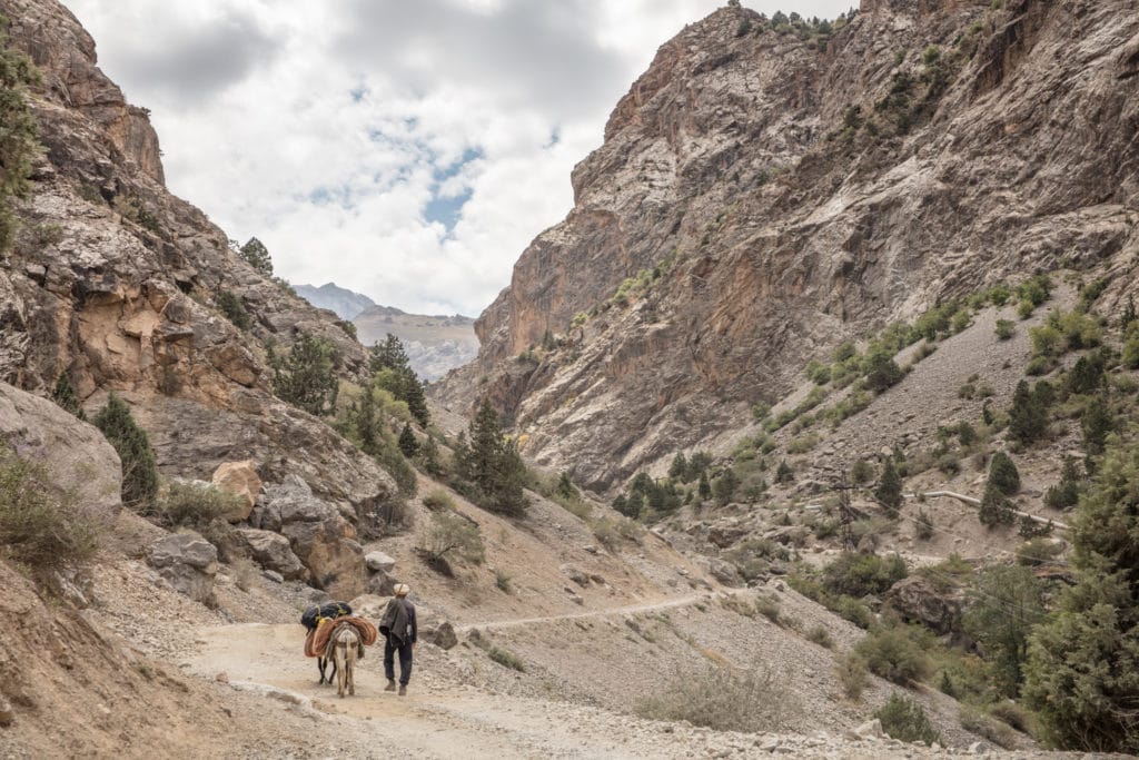
Up and over 3,810 meter Dukdon Pass, the trail makes a final descent to the Karakul River Valley that meanders to the village of Sarytag, just a few kilometers away from the shore of Iskanderkul Lake.
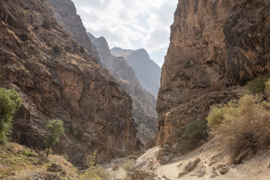
Kulikalon Lakes to Chimtarga and Iskanderkul: Stage 1
Artuch Alplager to Kulikalon Bowl
Total km: 6.5 km
Walking time: 4 hours
Total time: 4 hours
Elevation gain/loss: 799m+/71m-
From the Artuch Alplager trailhead, follow the dirt road for about 2 km before it ends, where you’ll need to cross a bridge over the Urech River. Beyond the bridge the trail climbs quickly up toward the Kulikalon Bowl, switchbacking uphill and passing a waterfall en route. The walking time to the base of the bowl should be roughly 3 hours.
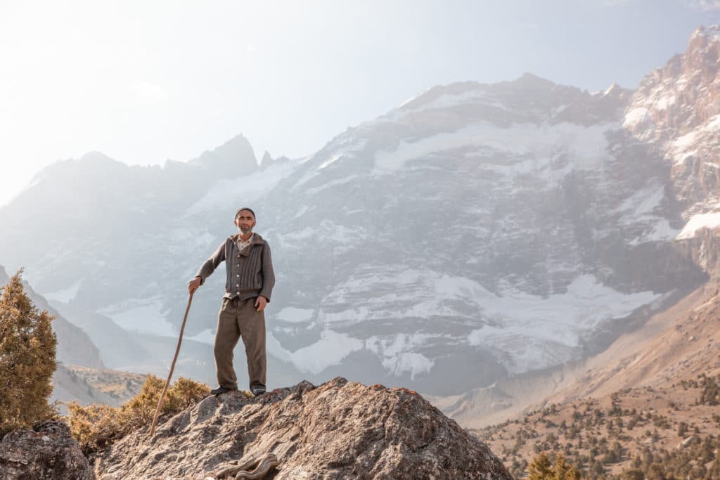
Once you reach the Kulikalon Bowl, search for the best camp spot. Several families live here in the summer months as shepherds, and there are countless little lakeside and streamside campsite – you’ll have a hard time finding anything that’s Leave No Trace compliant, so just do what you can.
It’s conceivably possible to loop up through the Chukurak Lakes for some nice views down to Kulikalon from the pass, but with full packs at this point it’s a considerable addition to the first day of the trek.
Kulikalon Lakes to Chimtarga and Iskanderkul: Stage 2
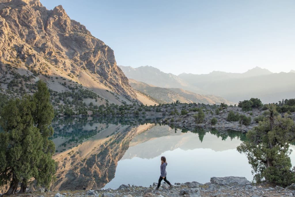
Kulikalon Bowl to Alovaddin Lake
Total km: 17.3 km via Laddin Pass | 8.1km via Alovaddin Pass
Walking time: 7 hours
Total time: 8.5 hours
Elevation gain/loss: 1049m+/954m-
There are two routes from Kulikalon to the next destination at Alovaddin Lakes. One is over the higher 3,780 meter Alovaddin Pass, the other is over the lower, but longer distance-wise 3,630 meter Laddin Pass. The route here follows the more direct Alovaddin Pass, but see our review of the Haft Kul to Alauddin Lake Trek for instructions to follow the Laddin Pass path.
Via the Alovaddin Pass
Take any path that heads southeast, passing Bibijonat Lake then following the stream that feeds the lake – look out for a shallow stretch of the stream to wade or rock-hop across.
After crossing the stream, the trail’s incline increases as it climbs towards a scattering of juniper trees. To the south are the two small Dushakha lakes of some distance below, visible from along the trail. From this point the trail switchbacks its way up to the top of Alovaddin Pass. Walking time to the top of the pass will take about 4 to 5 hours, depending on where you camped in Kulikalon.
From the Alauddin Pass, the path is straightforward to the bottom. There are a couple of good resting points with springs on the way down, incredible views all along the the way of the peaks to the east, and quite often the jewel-toned Alovaddin Lake will come into view below.
Once to the level ground approaching the lake, you will reach Ali’s Chaikhana where it’s possible to get simple meals and drinks and many trekkers camp in the trees nearby. It’s possible to head 1.5 km northeast to Vertical Alovaddin base camp, but you’ll need to retrace this section in the next stage.
If you arrive early afternoon to Alovaddin, it’s worth considering continuing onwards to Stage 3 as the distance and elevation gain are both quite minimal.
Kulikalon Lakes to Chimtarga and Iskanderkul: Stage 3
Alovaddin Lake to Mutnyi Lake
Total km: 5km
Walking time: 3 hours
Total time: 3 hours
Elevation gain/loss: 757m+/20m-
Today is a short day in both distance and elevation gain, beginning your ascent toward the mighty Chimtarga Pass, the highest in the Fann Mountains.
An obvious path meanders through an archa (juniper) forest to the south of Alovaddin. After about 1.5 kilometers the landscape becomes barren as it continues past the small lake of Piola about 1 hour walking from Alovaddin. From here, the trail zigzags a bit as it ascends around 300 vertical meters.
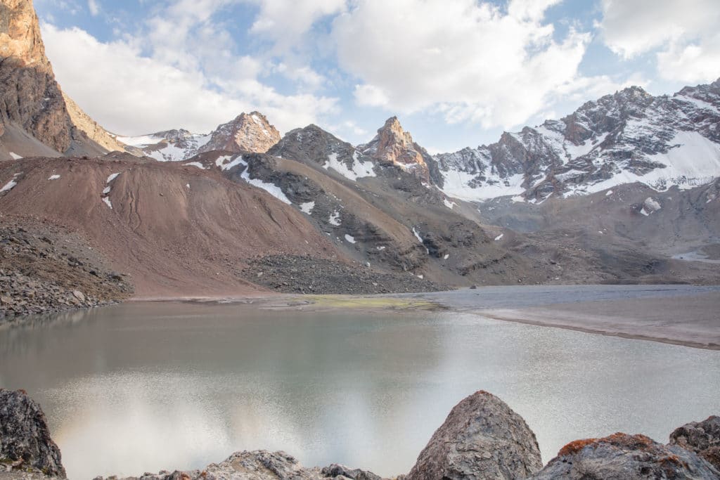
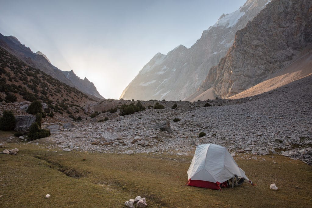
The incline then tapers off a bit with a few ups and downs before muddy-colored Mutnyi Lake comes into view. There are a few good places to camp a short walk from the lake that are protected from the wind by boulders. It will feel substantially colder here, especially once the sun disappears.
Kulikalon Lakes to Chimtarga and Iskanderkul: Stage 4
Mutnyi Lake to below Chimtarga Pass
Total km: 3.8km
Walking time: 4 hours
Total time: 6 hours
Elevation gain/loss: 671m+/38m-
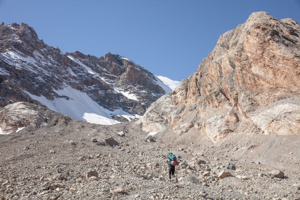
From Mutnyi Lake, follow the stream that heads south from the lake and then follow a path leading to the SSW as you begin to ascend the right side of the moraine in front of you. Be careful to not follow the trail that meanders to the southeast as this is the approach to Kaznok Pass.
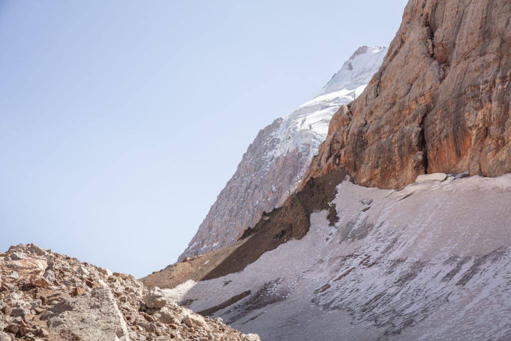
The axis of the moraine eventually begins to curve, bending westward. Here the terrain becomes quite steep and the trail consists entirely of scree, so trekking poles are recommended. Eventually, when you reach 4,160 meters in elevation ,you can find nice flat spots where you can pitch a tent for the night. There are piles of snow or meltwater trickling down nearby to use for cooking.
Some may opt to do a long strenuous day from Mutnyi to Bolshoi Allo in one day, combining Stage 4 and Stage 5. While it’s quite a short lateral distance the elevation gain is almost 2000m and the descent over 1600m of vertical, so you’ll want to be in shape and get a very early start if you intend to attempt it.
Kulikalon Lakes to Chimtarga and Iskanderkul: Stage 5
Chimtarga Pass to Bolshoi Allo Lake
Total km: 9km
Walking time: 5 hours
Total time: 6 hours
Elevation gain/loss: 1292m+/1636m-
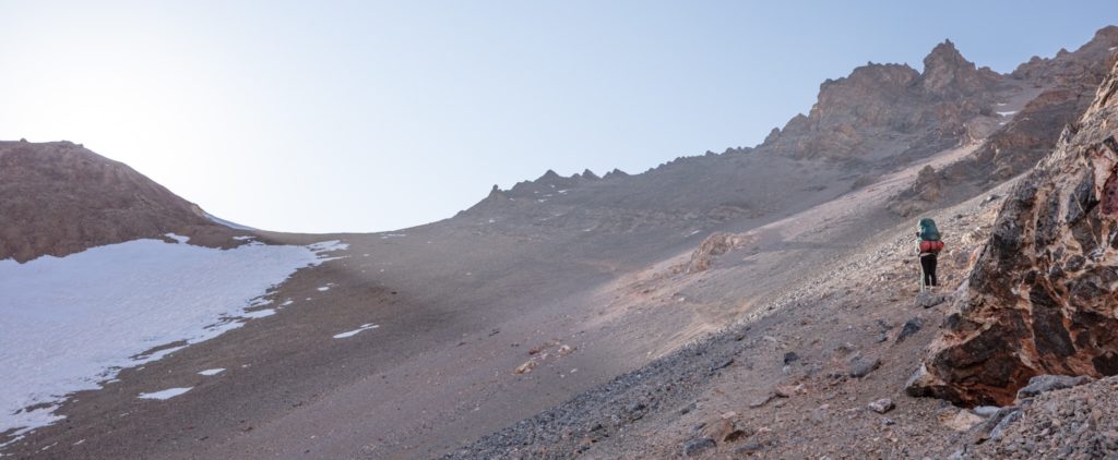
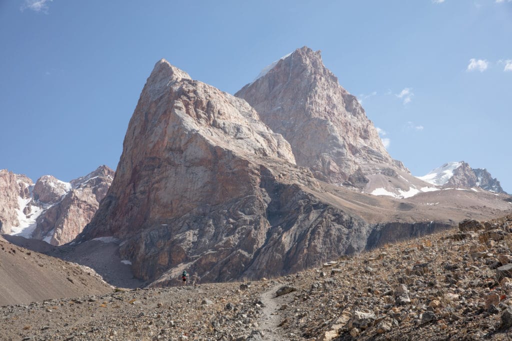
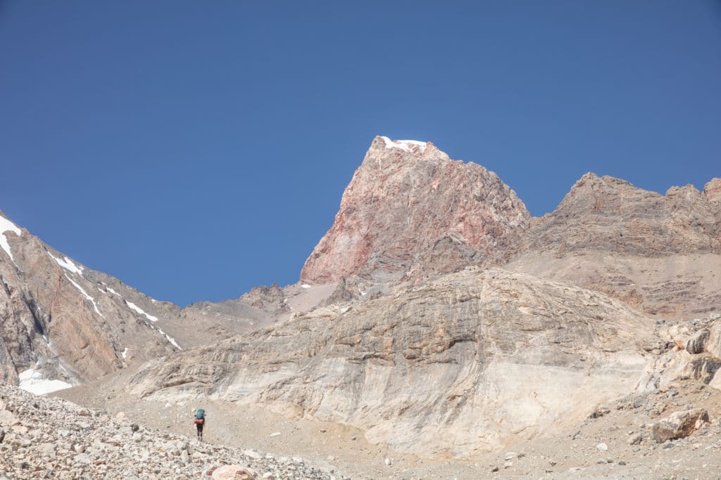
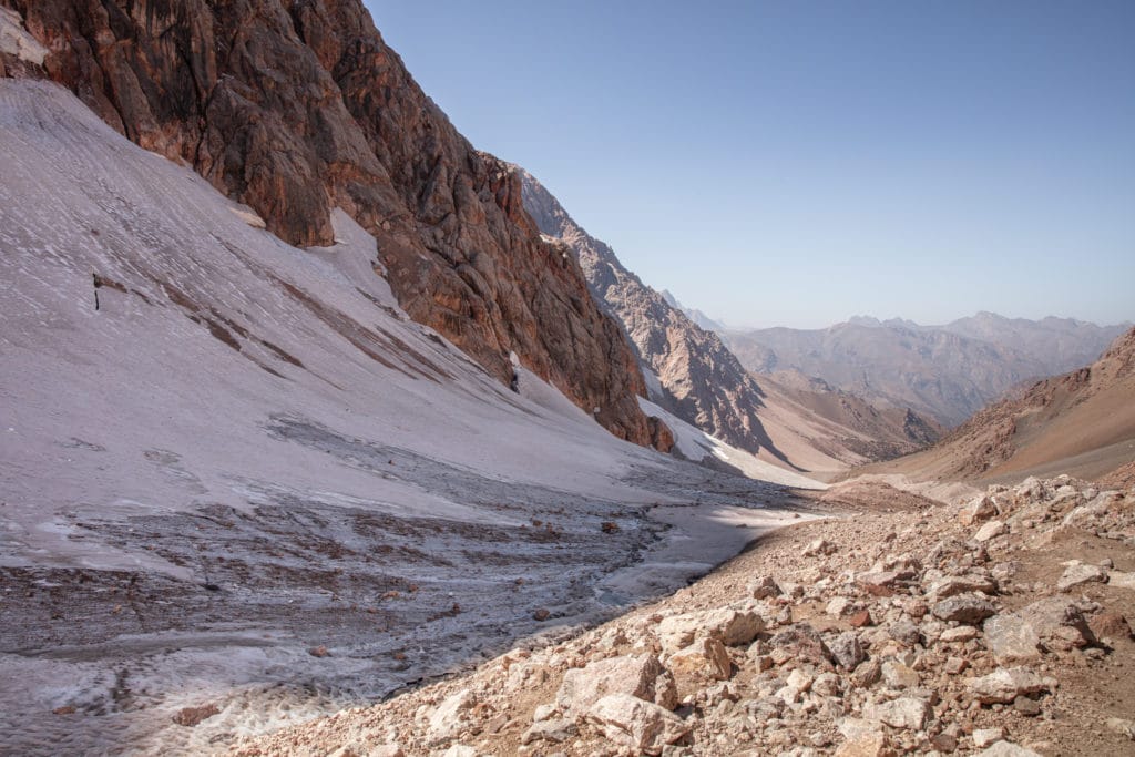
Right away you will be making the nearly 600 meter ascent into Chimtarga Pass. This should take about 2 hours. Take a moment to enjoy the panoramic views of the Fann Mountains from the east and west before beginning your descent.
From atop the pass, you’ll be following a path on loose scree that can disappear at times as it zigzags down steeply into the Zindon Valley. Gaiters can prove helpful here to prevent rocks from getting into your boots, as well as trekking poles to help steady yourself.
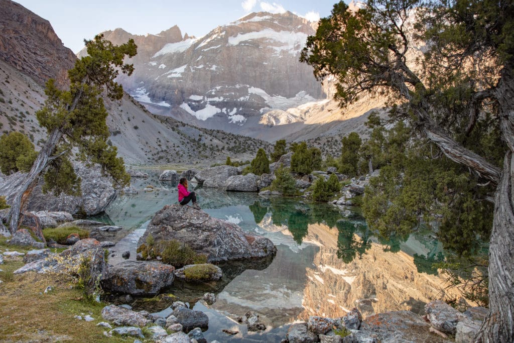
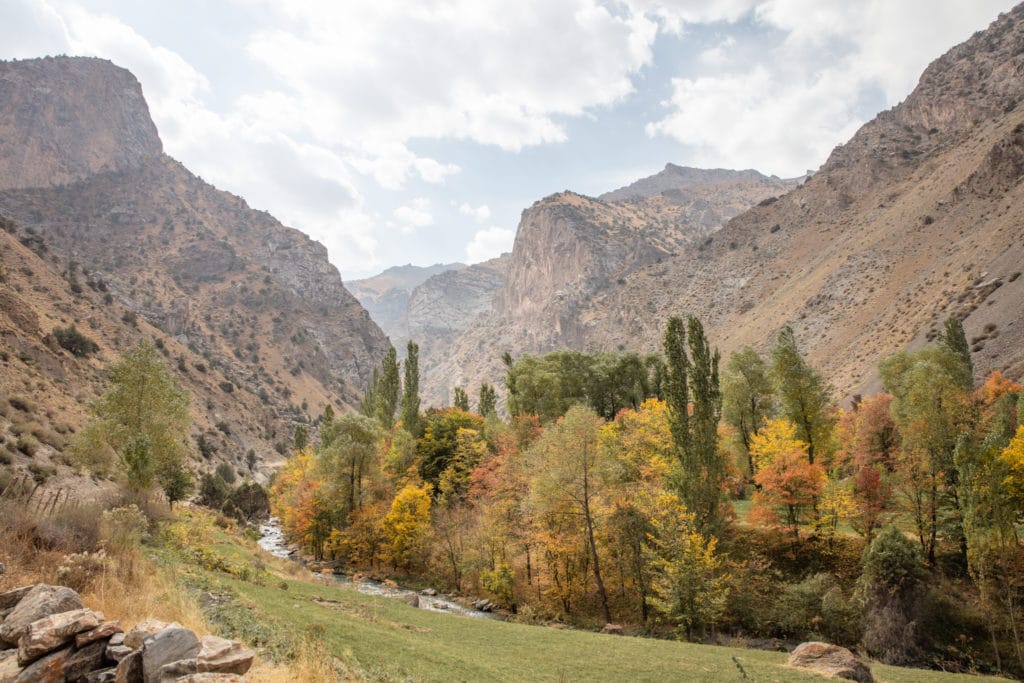
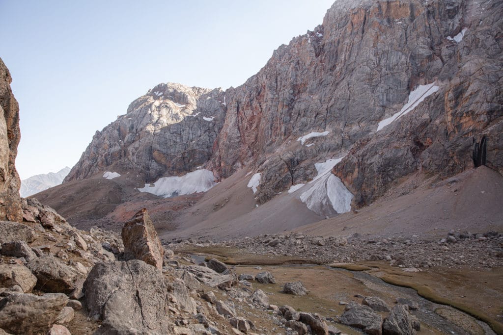
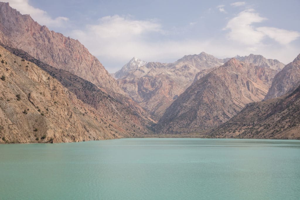
After about 1.5 hours you will arrive down into the Zindon Valley. From here the trail bends toward the northwest into a section of easy walking along a path that leads to the northern shore of Bolshoi Allo Lake. There are numerous camping spots along Bolshoi Allo (Big Allo) set amongst the archa groves.
Kulikalon Lakes to Chimtarga and Iskanderkul: Stage 6
Bolshoi Allo Lake to Sarymat Valley
Total km: 14.7km
Walking time: 6 hours
Total time: 7.5 hours
Elevation gain/loss: 553m+/1869m-
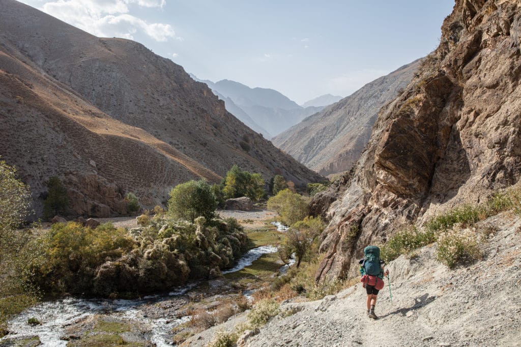
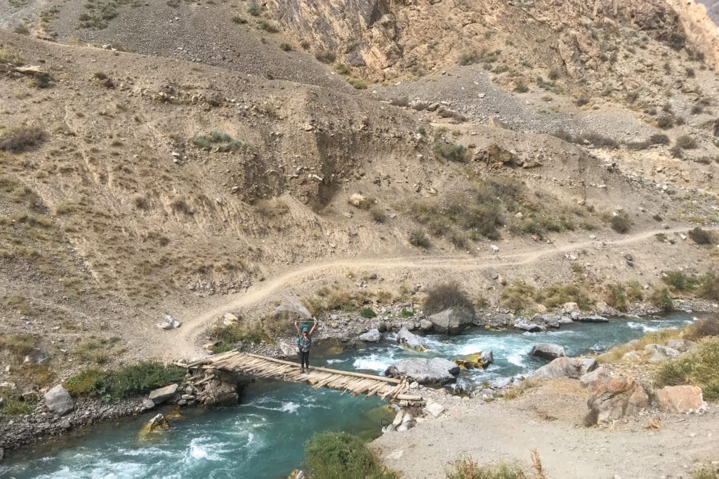
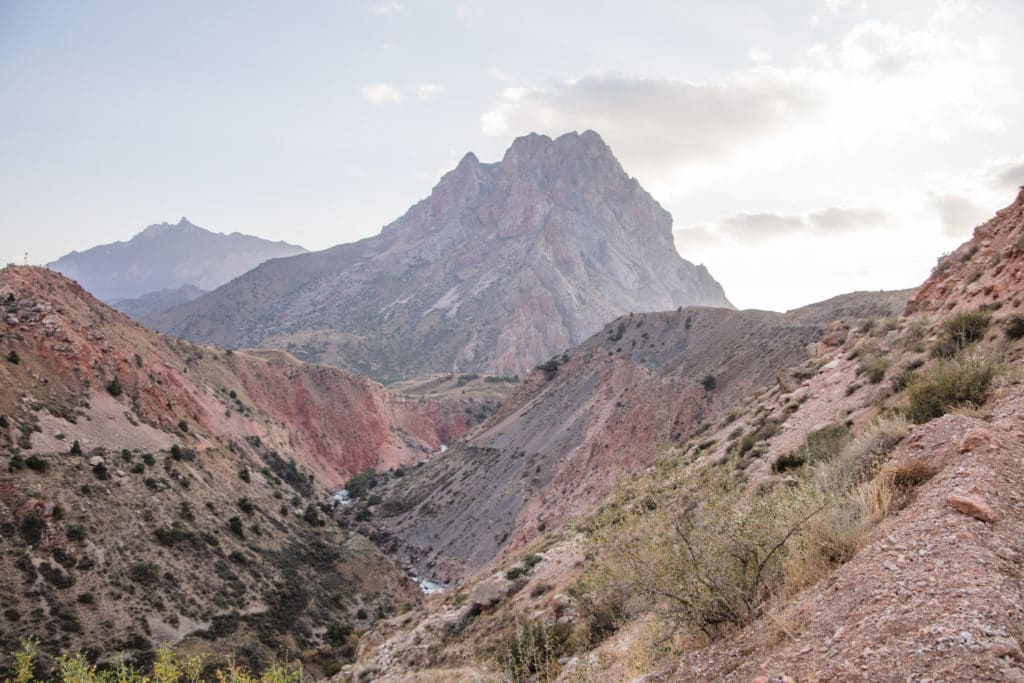
The path from camp continues westward to leave Bolshoi Allo behind, descending along the rock dam that helps to form the lake’s western shore. It winds among a juniper grove for a bit before the walls of the valley narrow after about 1 hour of walking, making the Zindon Valley feel like a tight canyon. The Zindon River dips underground for a while before reappearing again – if you end up on the southern side of the river, you’ll eventually need to find a good spot to wade across.
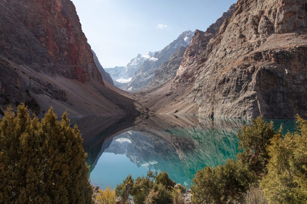
Right arounf 5.5 km from Bolshoi Allo, the path arrives at a small but gorgeous lake called Maloye Allo (Little Allo) that makes for a great resting point.
Beyond Maloye Allo the path climbs up high above the valley, zigzagging a couple of times before dropping back down to the valley floor after about an hour. This entire area can get a little confusing as shepherds use this area frequently to graze livestock so many paths exist.
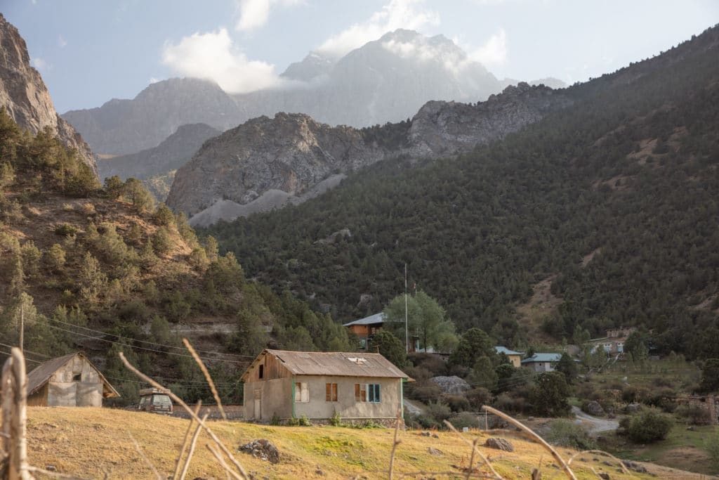
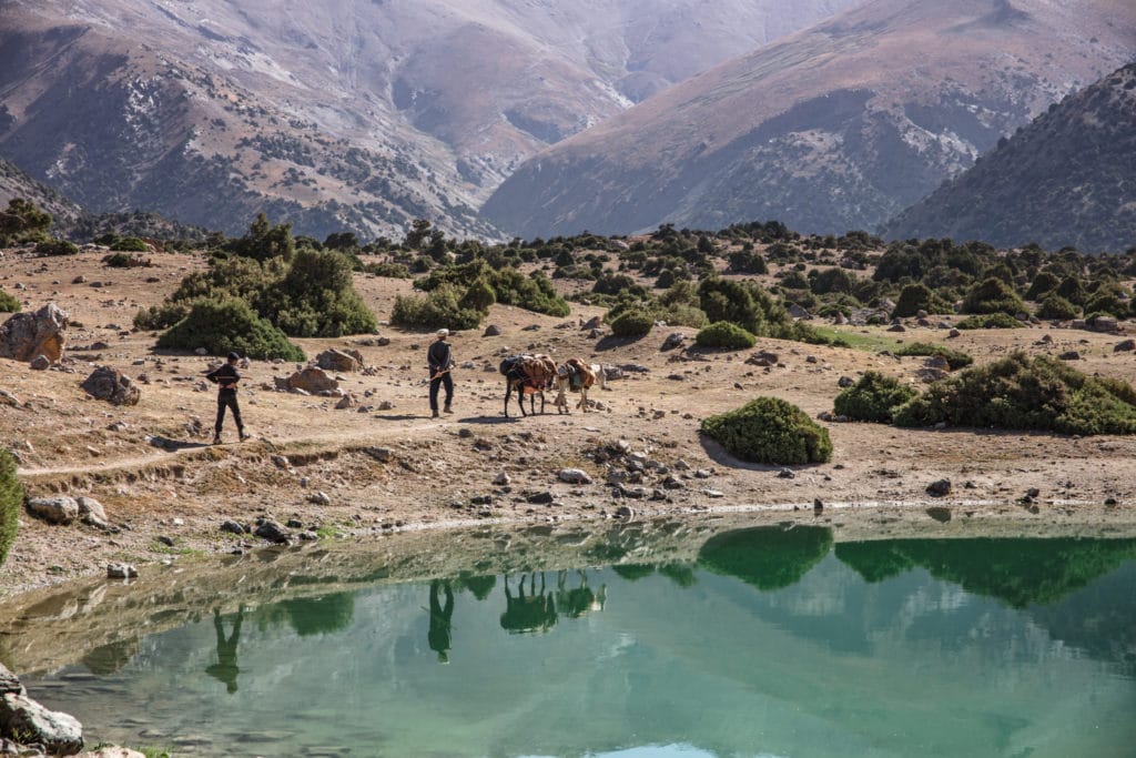
Following the course of the river, the valley descends and eventually passes a bridge crossing to the south side. Usually, there is a family’s summer camp just beyond, right at the confluence of the Zindon and Amshut Rivers.
At this point, continue following the Amshut River to the west. The trail will take a sharp turn toward the north just before the Amshut River meets the Archamaidon. You’ll soon pass a summer home of a lovely family who may invite you to camp on their property. From here, it’s about a 500 meter walk to the north to cross a bridge to the other side of the Archamaidon River. Once across follow this roadbed to the south. After about 1 kilometer this road reaches the confluence of the Archamaidon and Sarymat Rivers. This is a good area to start looking for a spot to camp.
Kulikalon Lakes to Chimtarga and Iskanderkul: Stage 7
Sarymat Valley to below Dukdon Pass
Total km: 16.6km
Walking time: 7 hours
Total time: 8 hours
Elevation gain/loss: 1551m+/407m-
From camp, continue to follow the roadbed to the south along the west shore of the Archamiadon as the path enters a narrow gorge. After about 1.3 kilometers, on the far side of the gorge, cross a bridge to the eastern shore of the river. The valley widens here and there’s a beautiful summer shepherd settlement.
After about 2 kilometers from the first bridge, the trail crosses another bridge back to the western shore to bypass a cliff. Another kilometer on, a third bridge crosses to the eastern shore again.
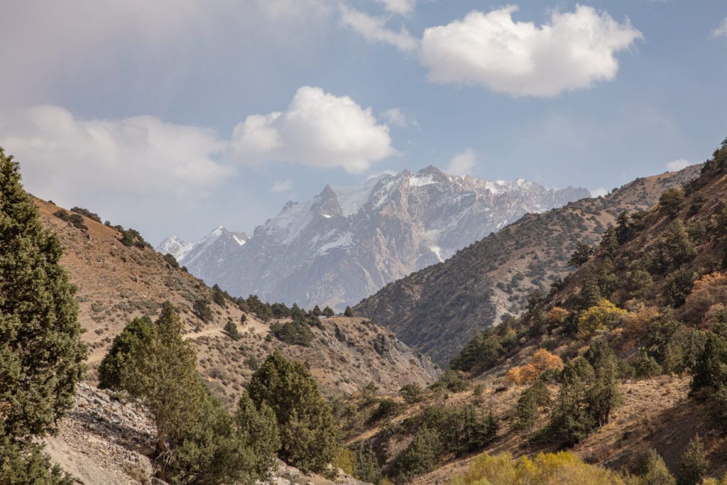
The roadbed begins to swing to the southeast here, opening up stunning views of the Dukdon Range in the distance as the road arrives at a summer settlement just across the valley from the Nagnut River.
Continuing onwards for two more kilometers, cross a bridge back to the southwestern side of the river. The path climbs steeply from here into an archa forest high above the valley. The path does split in a couple of different areas as this is a commonly used route by shepherds, so just make sure that you continue to parallel the general course of the river below.
The way crosses the Kshtutdak River, a small and shallow tributary that flows into the Arachamaidon below, about 2 kilometers after the last bridge. One kilometer beyond the Kshtutdak River is another shepherd’s camp in a nice flat area that makes for a perfect area to break or camp; sometimes an overnight in this area is a necessity if the Sarykhodan is quite high.
One kilometer beyond the shepherd camp is another tributary river called the Sarykhodan that tumbles down from Sarykhodan Peak and Glacier. Either find a good spot with a boulder jam to cross the little gorge that the Sarykhodan flows through, or walk along the river upstream to find a good spot to wade.
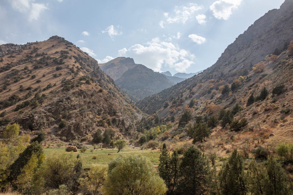
After crossing the Sarykhodan the path continues high above and parallel to the Archamiadon River, walking over a tree-dotted hill that avoids a rocky outcrop. From here, the path descends back down to the Archamaidon for a kilometer of pleasant forest walking. The Archamaidon forks near here, becoming the Pushnovat River as it heads to the WNW. Stay along the true Archamaidon as it continues to the SW, looking for an ideal spot to hop across to the other side. Beyond here the valley widens into a lush green pasture with plenty of great camping spots to choose from below the foot of the Dukdon Pass.
Kulikalon Lakes to Chimtarga and Iskanderkul: Stage 8
Sarymat Valley to Sarytag Village
Total km: 20.2km
Walking time: 7 hours
Total time: 8.5 hours
Elevation gain/loss: 954m+/1572m-
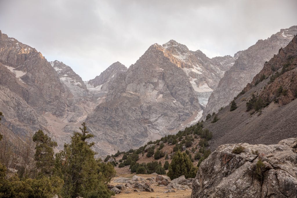
This is the final push to the top of Dukdon Pass and down to your endpoint at the village of Sarytag. The path is fairly clear the whole way up, staying mostly to the north side of the valley. As it climbs higher it becomes surrounded by impressive glaciers on either side.
At around 3,400 meters in elevation, cross a snowfield that eventually spits out onto a glacier for the last bit of the climb to the top of the pass. The glacier crossing is pretty easy, requiring no special equipment, but trekking poles can be helpful here. From camp it should take around three hours to arrive at the top of Dukdon Pass.
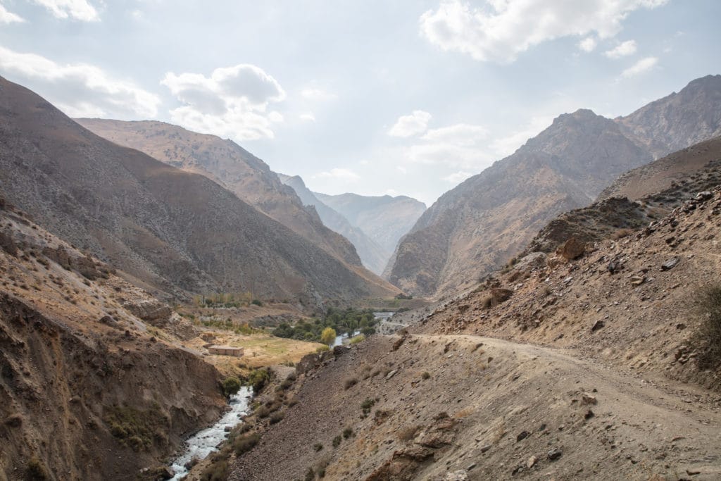
Descending Dukdon Pass, stay on the path that clings to the left of the valley, staying pretty high to the north to avoid a moraine in the center of the valley. The path does eventually curve to the south to descend to the Dukdon River in a beautiful pasture with a lot of great places to break or camp.
Follow the course of the Dukdon River until the path reaches about 2,900 meters in elevation, where yitu will drop nearly 400 meters very quickly. This section of the trail is badly eroded, so carefully find a way down between the archa to finally arrive at the shore of the Karakul River. From the top of Dukdon Pass, expect to arrive at the Karakul River after about 2.5 hours.
At the confluence of the Dukdon and Karakul Rivers, the path bends to the east following the course of the Karakul to Sarytag village. The path meanders through a forest along the river for the first part of this section but then climbs up a rocky face briefly to descend back to the edge of the river and opening up into a nice green pasture. After about 4.5 kilometers after the confluence, cross the bridge to the south side of the Karakul River. From here, the way will mostly follow a roadbed the last distance to Sarytag.
In Sarytag there are a handful of homestays to choose from. Those wanting to continue on foot to Iskanderkul can also continue directly to the lake, nine (fairly boring) kilometers away along the road.
Alternate Options for Kulikalon Lakes to Chimtarga and Iskanderkul
There are countless ways to alter the route between Artuch and Iskanderkul. Making it possible to fit shorter time frames or even to extend the trek further. Especially easy to incorporate is an extension of the starting point further to the west to include the Haft Kul to Alauddin trek, or all the way to Mogiyon.
Good to Know
The best time of year to do the Kulikalon to Iskanderkul trek is mid-June through late September. This is the time of year that Chimtarga Pass is most likely to be mostly ice and snow-free.
There is a park ranger that can be found around Kulikalon Bowl and Alovaddin Lake that will collect a 19 TJS camping fee per person, you may run across him or you may not.
Those that want to hire a local guide and pack animals in advance should contact ZTDA or ZTB to make arrangements. These organizations can also help you book homestays throughout the Fann Mountains.
No special gear is needed for this trek. Beyond the usual camping equipment, you will find trekking poles to be handy. Some guidebooks recommend crampons for Chimtarga and even Dukdon Pass. They’re not necessary if you’re doing the hike in the normal summer-fall window, but you may find them quite helpful on snowfield crossings.
Getting to the Kulikalon Lakes and Iskanderkul
The hike starts from the Artuch Alplager, about 7km beyond the village of Artuch (which is reachable by shared taxi from Penjikent). If you don’t want the risk of schlepping all your gear up to the alplager you’ll need to hire a private car, most likely from a local tour company in Penjikent, but if you don’t mind the possibility it’s also sometimes possible to pay a driver in Artuch village to carry you up the rest of the way.
From Iskanderkul, there’s typically a once daily (or so) shared taxi from Sarytag to the highway junction at Sarvoda and onwards to Dushanbe. Expect to pay around 80 TJS per person, maybe a little more if you have excessive baggage.
Where to Stay and Eat
You will need to camp on this route so bringing camping gear is necessary. Basic homestay-style accommodation is available in the Kulikalon Bowl, Alovaddin Lake, and Iskanderkul and can provide simple meals. You’ll want to purchase provisions for the trek as well, most easily done at the Panjakent Bazaar before starting off for the mountains. Other than the very most basic supplies in small settlments and Kulikalon, count on being self-sufficient throughout.
![]()
Pingback: Tajikistan: Fann Mountains Trekking Guide - Asia Hikes