
Tajikistan: Haft Kul to Alaudin Lake
Таджикистан: Хафт-Куль – Алаудин
The Haft Kul to Alovaddin trek combines some of the best the Fann Mountains have to offer, bringing you to camp on the shores of many of its most stunning lakes. Though not as popular as the shorter Kulikalon Lakes hike, the additional days and effort reward visitors with some of the most scenic hiking in Western Tajikistan.
Total Km: 63 km
Total Days: 6
Elevation Gain/Loss: 5429m+ / 4654m-
Start Point: Marguzor, Haft Kul
End Point: Vertical Alovaddin
GPS Files
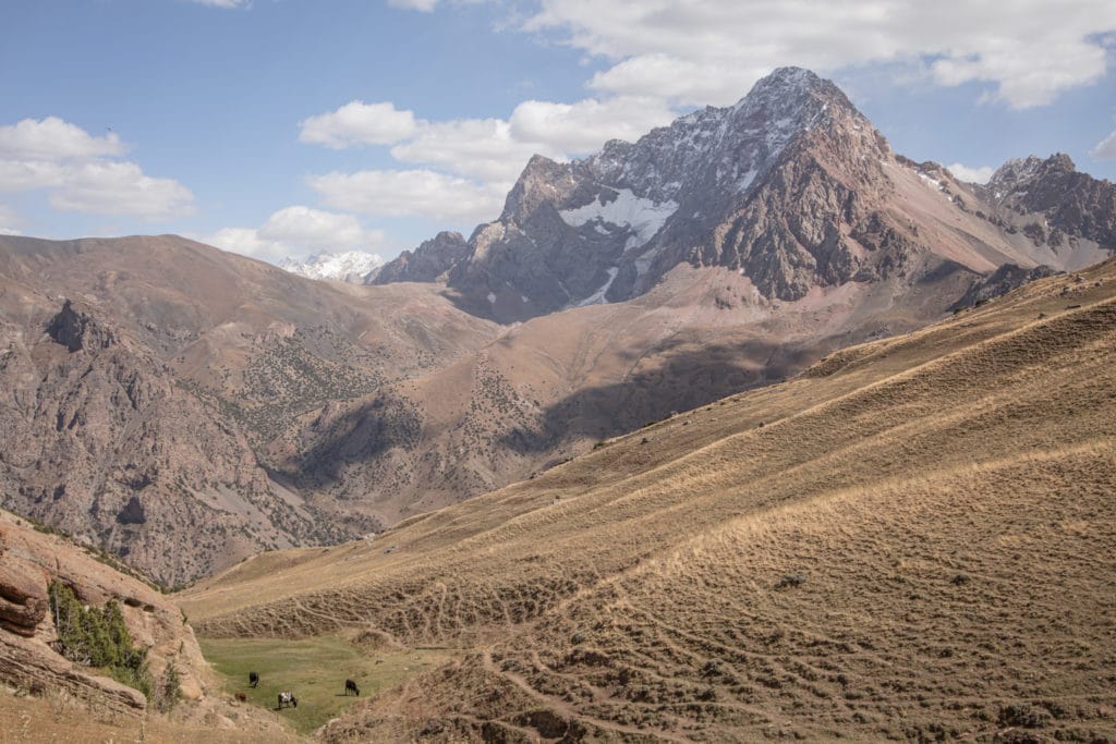
Starting from string of seven beautiful lakes known locally as Haft Kul, the Alaudin trek heads up and over Tavasang Pass from the eastern shore of Marguzor lake to bring you to a superb camping spot along the Sarymat River. The path then continues north to follow the Archamaidon River to the village of Zimtut and from Zimtut turns east, passing through Guitan village on the way up Igrok Pass. From Igrok Pass, it descends into an amphitheater of mountains at Chukurak Lakes.
From Chukurak, continue east across Govkhona Pass to the fantastic lakes of the Kulikalon Bowl, which offer countless picture-perfect spots to camp. Finally the last leg of the trek heads over either Alovaddin Pass or Laddin Pass to arrive at Alovaddin Lake.
(Note that the name Alovaddin is more common amongst Tajik-speakers while Alaudin is more widely-used among Russians – we’ve used them interchangeably throughout this article, but tend to find Alaudin more commonly used within the tourism sector.)
Haft Kul to Alaudin Lake Trek: Stage 1
Marguzor to Sarymat River Valley
Total km: 13.8 km
Walking time: 6 hours
Total time: 7 hours
Elevation gain/loss: 1432m+/1240m-
The Haft Kul to Alovaddin trek from begins the shores of Marguzor Lake, the sixth lake of the Haft Kul’s seven lakes. A dirt track ascends the steep valley to the southeast of the lake, zigzagging quickly to reach the little village of Kiogli.
From Kiogli the track continues along rolling green hills, finally entering a gorge before reaching the top of 3,305m Tavasang Pass after about 3.5 to 4 hours of trekking.
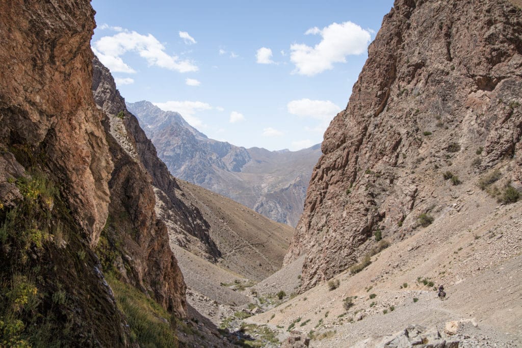
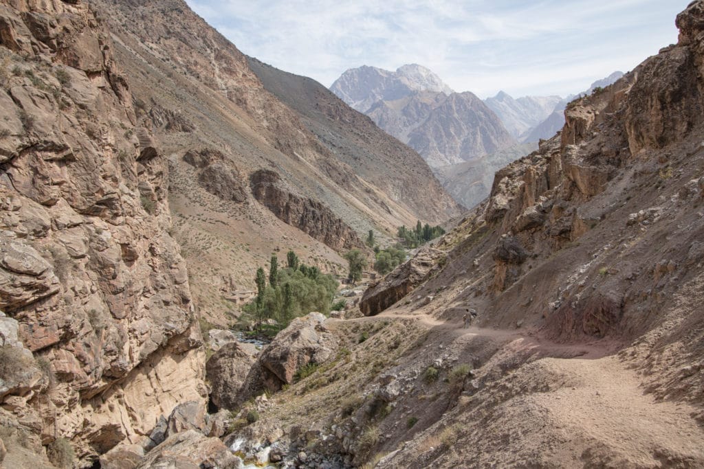
The trail descends from Tavasang Pass to the east. About 3 km from the top of the pass, follow the path that bends toward the north along the Sarymat River. A little over 2.5 kilometers from this northwards turn, you should arrive at an excellent spot to set up camp for the night. From the top of the pass down to camp should take around 2 hours.
Haft Kul to Alaudin Lake Trek: Stage 2
Sarymat River Valley
Total km: 8.2 km
Walking time: 3 hours
Total time: 4 hours
Elevation gain/loss: 204m+/688m-
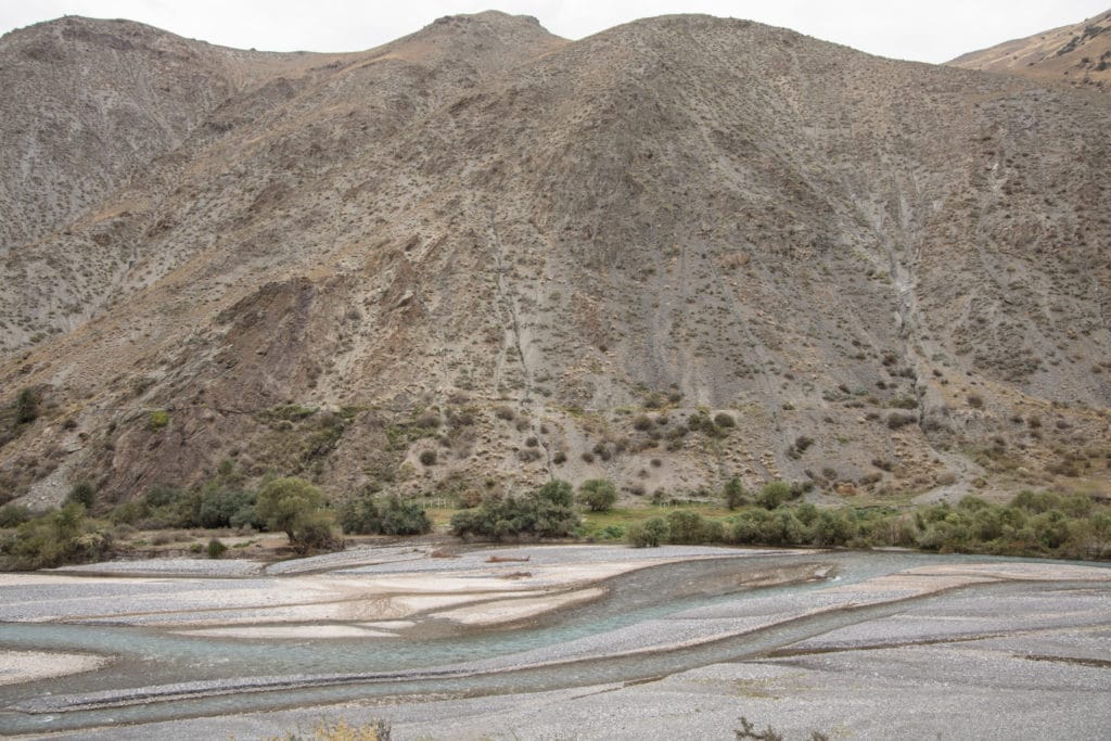
The walking today is easy, following a clear path that is mostly downhill. About three kilometers out of the morning’s camp, cross a bridge to the southeast side of the Sarymat River. The trail remains along the bank of the river for most of the day. Just before reaching the confluence of the Sarymat and Archamaidon Rivers, you should find a good spot to camp.
Quite a short day of walking, some hikers will prefer to combine Stage 2 and Stage 3 to continue to Zimtut or Guitan villages in the same day to save time.
Haft Kul to Alaudin Lake Trek: Stage 3
Sarymat River Valley to Zimtut
Total km: 15.3 km
Walking time: 5 hours
Total time: 6 hours
Elevation gain/loss: 733m+/741m-
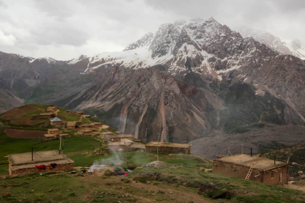
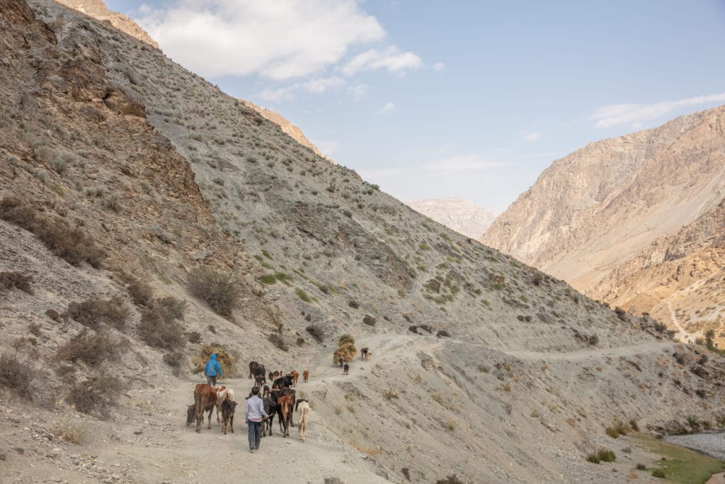
From the campsite near the confluence of the Sarymat and Archamiadon rivers, cross a bridge over the Sarymat River just south of the confluence to end up on the west side of the Sarymat. The majority of today’s trek is on a dirt road that follows along the course of the Archamiadon River in a northerly direction. After approximately 5 hours of hiking you should reach the village of Zimtut, from which the journey will bend east towards the Igrok Pass. Spend the night in either Zimtut or 3km further on at Guitan, both of which have informal homestays if you’d like to skip the tent for then night.
Haft Kul to Alaudin Lake Trek: Stage 4
Zimtut to Chukurak Lake
Total km: 10.2 km
Walking time: 5 hours
Total time: 6 hours
Elevation gain/loss: 1227m+/649m-
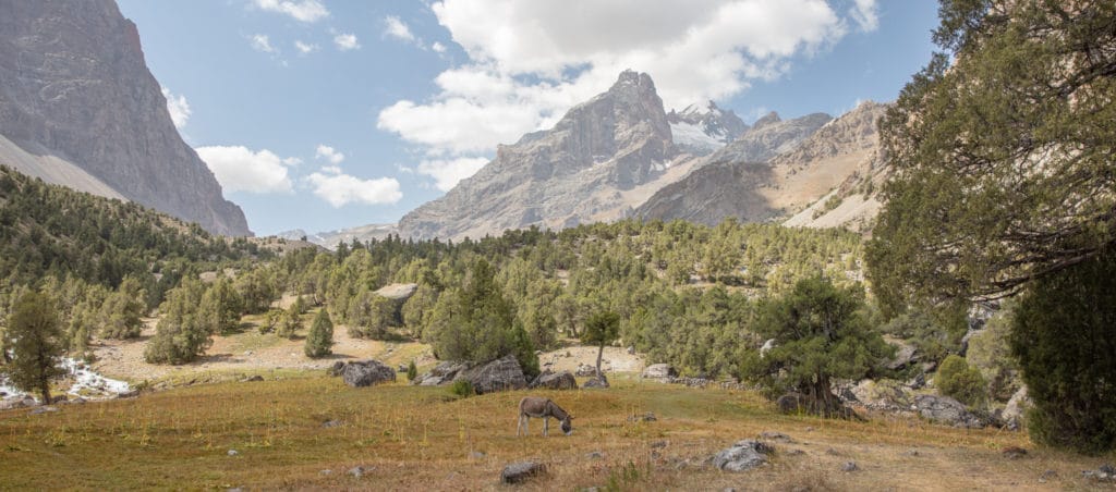
Beyond Guitan village, the Chukurak Lakes are about 10 kilometers to the east. The path to 2,640m Igrok Pass is steep, zigzagging through fields of wildflowers on the way up, gaining 800 vertical meters over 5 kilometers in around 3 hours.
Luckily, the descent to Chukurak is gradual. Pass carefully when you approach the shepherd’s settlement on the way down, as some of the shepherding dogs you can run across here can be a bit aggressive.
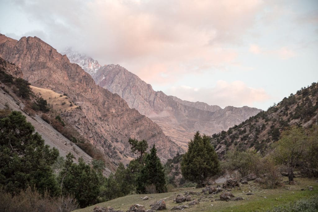
Past the settlement, the trail winds through a forest of juniper (locally known as archa) before crossing a stream tumbling down from the Zurmech Pass that feeds the lake. Once to Chukurak, pick a good spot to camp – there are certainly no shortage to choose from in this small but lovely valley.
Haft Kul to Alaudin Lake Trek: Stage 5
Chukurak to Kulikalon
Total km: 5.7 km
Walking time: 3 hours
Total time: 4 hours
Elevation gain/loss: 792m+/382m-
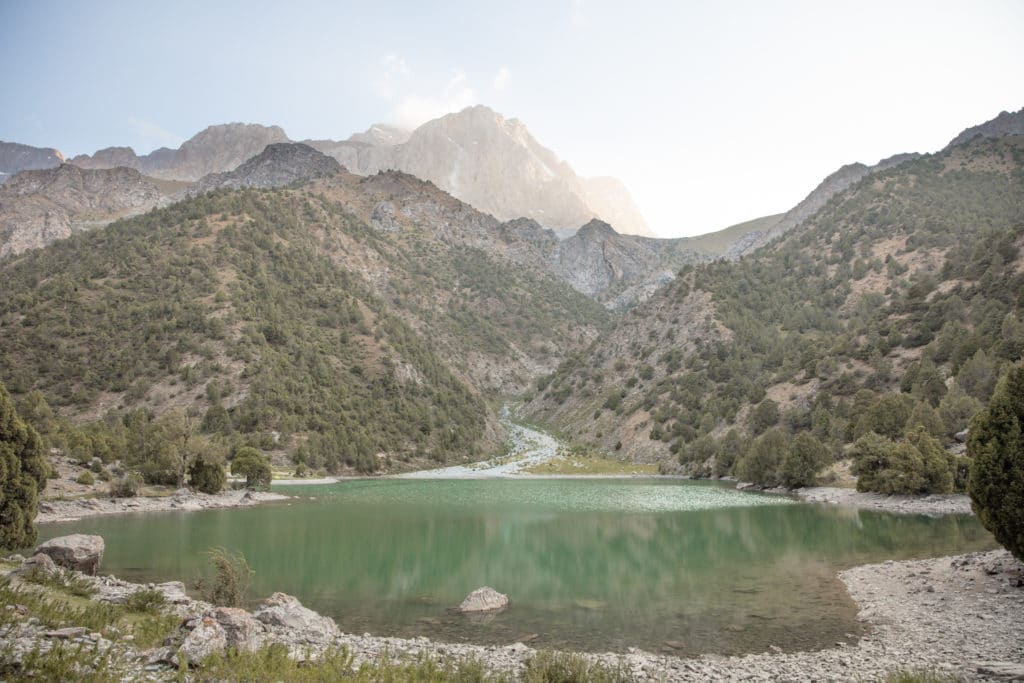
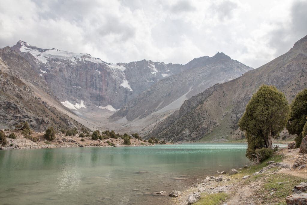
From camp on the shore of Chukurak Lakes, follow the path up 3,180 meter Chukurak Pass, zigzagging a bit as the route gains elevation along the way. From the top of the pass, you will have sweeping views of the Kulikalon Bowl ahead of you. The descent to Kulikalon is steep, carrying right down to the largest lake’s western shore.
There’s no shortage of great spots to camp in the Kulikalon Bowl. Near the junction of Kulisiyakh and Bibijonat Lakes is Chaikhana Siroj, run by a local family that serve up simple meals as well as coffee, tea, and beer. They also have pre-set-up tents nearby for tourists to rent, so it’s the busiest section of this quiet little valley.
Haft Kul to Alaudin Lake Trek: Stage 6
Kulikalon to Alauddin Lake
Total km: 10.1 km via Alovaddin Pass | 17.3 km via Laddin Pass
Walking time: 7 hours
Total time: 8 hours
Elevation gain/loss: 1049m+/954m-
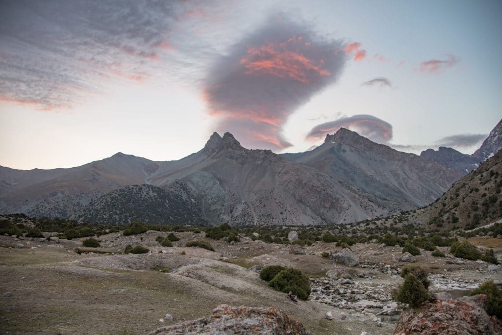
The final stage of the Haft Kul to Alovaddin trek. From camp in the Kulikalon Bowl, either take the more direct but slightly higher Alovaddin Pass right to the shore of Lake Alovaddin or the longer and slightly more gradual Laddin Pass that arrives at Vertical Alovaddin Base Camp before continuing to the lakeshore. [The GPS trail linked in this article follows the former.]
Option 1: Alovaddin Pass
Take a path that heads southeast, passing Bibijonat Lake then following the stream that feeds the lake – look out for a shallow stretch of the stream to wade or rock-hop across.
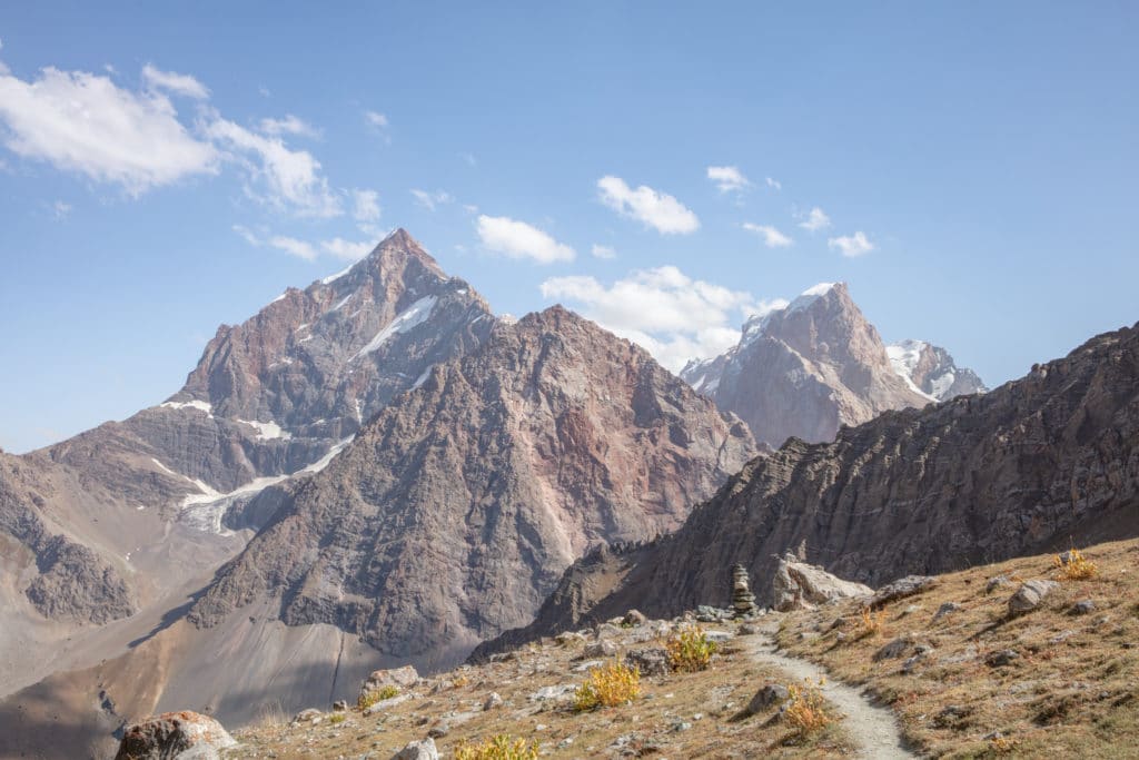
After crossing the stream, the trail’s incline increases as it climbs you to a scattering of juniper trees. To the southe are the two small lakes of Dushakha some ways below, visible from along the trail. From this point the trail switchbacks its way up to the top of Alovaddin Pass. Walking time to the top of the pass will take about 4 to 5 hours, depending on where you’d camped in Kulikalon.
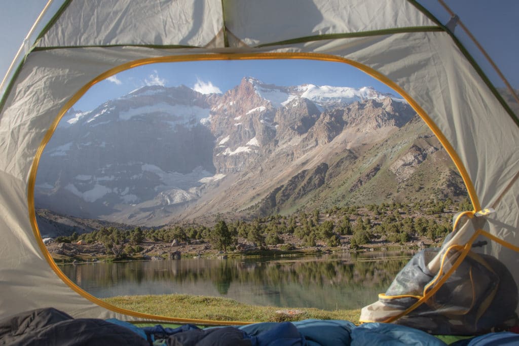
From the top of the Alauddin Pass, the path is straightforward to the bottom. There are a couple of good resting points with springs on the way down, incredible views all along the the way of the peaks to the east, and quite often the jewel-toned Alovaddin Lake will come into view below.
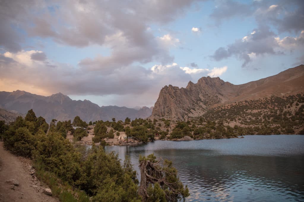
Once to the level ground approaching the lake, you will reach Ali’s Chaikhana where it’s possible to get simple meals and drinks. Some trekkers camp in the trees nearby the chaikhana, others continue south to camp on the other side of the lake, while a few may head 1.5 km northeast to Vertical Alovaddin base camp.
Option 2: Laddin Pass
The trail to Laddin Pass climbs more gradually than at Alovaddin Pass, but covers a substantially longer distance; overall 720 vertical meters over 2.5 kilometers, meandering along a stream much of the way.
From the Kulikalon Bowl, follow the path to the northeast toward Laddin Pass. After it crosses a green meadow, head for the foot of Laddin Pass. From the top of the pass continue to the west, descending along the north shore of the Pasrudarya River; though an alternative “short cut” des exists from the top of the pass to the southwest, crossing False Laddin Pass steeply down to Vertical Alovaddin.
Following the Pasrudarya, you will eventually reach the confluence of it and the Chapdara River. There is a homestay at the confluence for those that may want to split this section into two days. Otherwise, continue 3.5 kilometers along a dirt road to arrive at Vertical Alovaddin. To camp at Alauddin lake, continue to climb along a clear path for 1.5 more kilometers to get to Ali’s Chaikhana. There are great places to camp on the northern and southern sides of the lake.
Alternate Options for Haft Kul to Alaudin Lake Trek
Numerous alternate routes exist for the trek. It’s also possible to reverse this trek, starting from Alovaddin and ending in the Haft Kul.
After descending from the Tavasang Pass, rather than head north along the Sarymat River, you can follow the Tavasangsoi River due southeast, soon becoming the Abusafedsoi River. This leads up and over 3,505m Munora Pass that descends to the Nagnut River. Follow the Nagnut to the north where it flows into the Archamaidon River. From here continue along the Archimaidon to the north to arrive at the confluence of the Archamaidon and Sarymat Rivers.
From just north of the confluence of the Archamaidon and Sarymat Rivers, you can continue east into the Zindon Valley via the Amshut River. The Zindon Valley will lead you to Bolshoi Allo and the backward crossing of Chimtarga Pass, bringing you to Mutnyi Lake and then Alovaddin. Of course, you could end the trek at Alovaddin from here, or go slightly in reverse, heading over to Kulikalon and onto Chukurak to end at the Artuch Alplager.
Another option would be to take Zurmech Pass from the Archamaidon River Valley to Chukurak Lakes. From the confluence of the Archmaidon and Sarymat rivers, continue about 2 kilometers beyond the village of Gazza. At this point, the Zurmech River flows into the Archamaidon. Follow the Zurmech River to the east, crossing 3,260 meter Zurmech Pass to arrive at the west side of Chukurak Lakes.
Finally, it is also possible to link this trek to other routes in the immediate vicinity such as the Artuch Alplager or Hazor Chasma lake, especially if you need to start or end elsewhere along the trail.
Good to know
There is no special equipment needed for the Haft Kul to Alovaddin Trek, aside from the usual camping gear. Do be aware that you may meet a man in either Kulikalon or Alovaddin who works as a ranger and collects a 19 TJS fee per person.
Getting to the Haft Kul to Alaudin Lake Trek
Getting to Haft Kul is most easily done from the Panjakent Bazaar in the mornings. Shared taxis leave throughout the earlier part of the day. Let the driver know you would like to go all the way to Marguzor. A seat will cost 60 TJS roughly to Padrud, so do expect to haggle a bit for the extra 5.5 kilometer ride, likely coming in around 70 TJS in total.
Getting away from Vertical Alovaddin is easiest done by arranging a 4WD to pick you up at the end of the trek. There aren’t really any shared taxis that come up here, so if you don’t make advance arrangements you’ll have to try and catch a driver dropping off travelers to Vertical Alovaddin and negotiate a price back to Sarvoda or beyond. If you have good bargaining skills you may be able to get a driver to agree on taking you to Sarvoda on the fly for 200 TJS, but typically plan to settle somewhere around 300 TJS.
Where to Stay and Eat
In the Haft Kul, there are homestays at Padrud and Nofin, as well as a turbaza at the north end of Marguzor. Zimtut and Guitan each have homestays available as well. Tents are set up for rent by Chaikhana Siroj in the Kulikalon Bowl and there is the Vertical Alovaddin Base Camp at the end of the trek. All homestays, basecamps, and chaikhanas mentioned above can also prepare simple meals and drinks. If you’d prefer to make bookings in advance, the Zerafshan Tourism Board in Penjakent can help either via email or at their office in Penjakent.
For the Sarymat River camp, the confluence of the Archamaidon and Sarymat Rivers, and Chukurak Lakes you should plan to camp so bring your camping gear. Food can be purchased at the Panjekent Bazaar or the Sarvoda Bazaar before the start of your trek.
[All photos courtesy of Adventures of Nicole]
![]()
Pingback: Tajikistan: Kulikalon Lakes to Chimtarga and Iskanderkul - Asia Hikes
Pingback: Tajikistan: Mogiyon to Haft Kul Trek - Asia Hikes
Pingback: Tajikistan: Fann Mountains Trekking Guide - Asia Hikes