
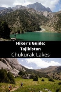
Tajikistan: Artuch Alplager to Chukurak Pass
Таджикистан: Альплагер Артуча до перевала Чукурак
This short dayhike from the popular tourist base at the Artuch Alplager climbs to the Chukurak Lakes and Chukurak Pass, from where there are excellent views of the Kulikalon Lakes below. Although it can easily combined with the longer Kulikalon trek, this is a good option for visitors who are limited by the time they can spend in the area, which remains among the most popular places for trekking in Tajikistan.
Total Km: 8.5km
Total Days: 1
Elevation Gain/Loss: 1057m+ / 1057m-
Start Point: Artuch Alplager
End Point: Artuch Alplager
GPS Files
The Chukurak Pass trek is an interesting option for visitors planning to overnight at the Artuch Alplager Base Camp but who don’t have time to tackle the full Kulikalon Lakes route. Those with even less time to hand can even cut this trek to visit only the Chukurak Lakes, though missing the views from the pass would be quite the loss. The route is fairly easy walking, though inexperienced hikers may find the path to the pass a little strenuous.
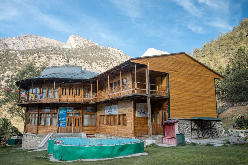
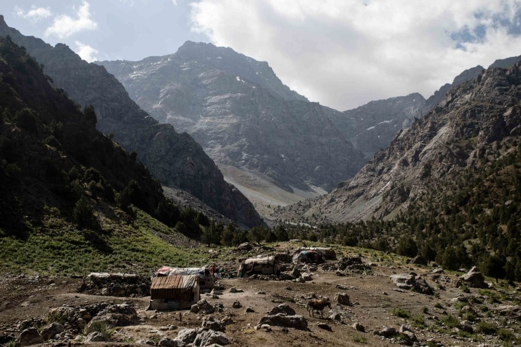
The Chukurak Pass treks begins from the Artuch Alplager, a popular hiking base deep in the Fann Mountains of Tajikistan. From the main building of the alplager, simply turn south and follow the obvious path up the hillside behind the camp. An easy to follow trail snakes through the tree cover to climb a little over 250m of elevation over 1.3km to reach the edge of the first of the Chukurak Lakes.
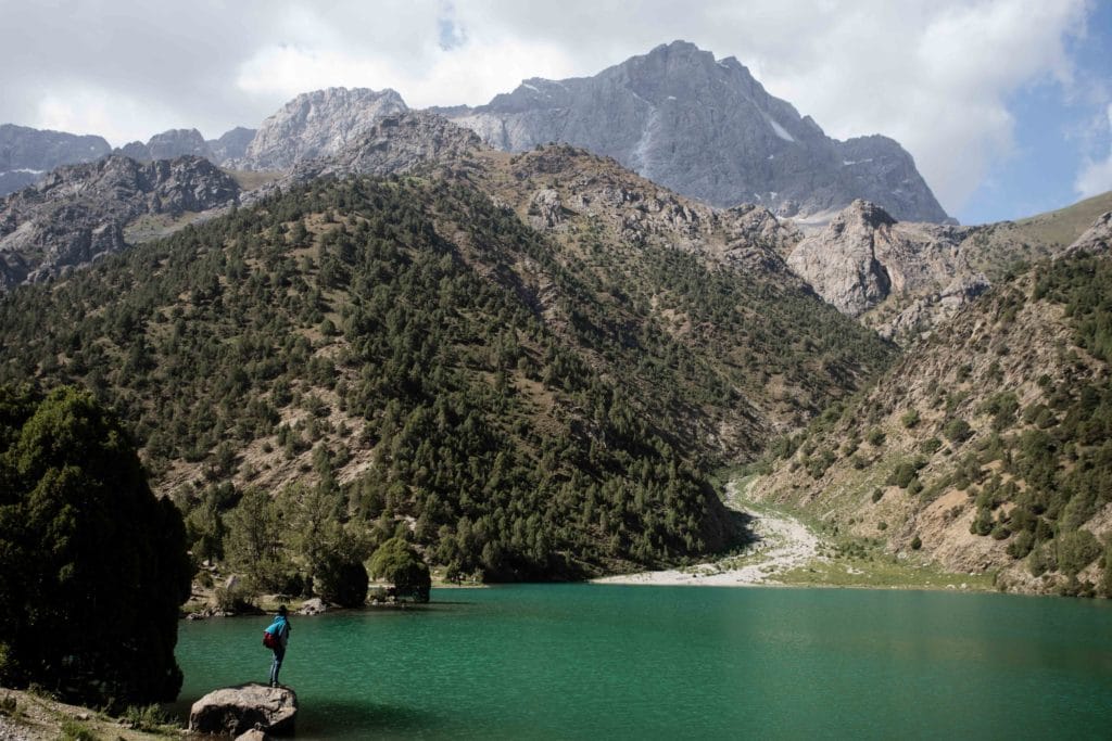
The first and largest lake, the one actually known by the name Chukurak Lake, is set in a relatively open valley just at the foot of several small ravines and would make a superb campsite if not for the proximity of Artuch and all its facilities just down the hill. Like all the Chukurak Lakes, this is fed primarily by snowmelt and so the water level remains quite seasonal. This largest is always your more reliable source of water, though, so if for some reason you didn’t carry up enough water from Artuch this is the best spot to refill.
Just another half kilometer uphill from the largest lake is another small lake called Beloye Lake. From the Russian for ‘white’, the name comes from the high mineral content of the water that leaves a salty white layer on the ground as the summer progresses and the lake recedes.
If you don’t intend to carry on to the Chukurak Pass, perhaps consider diverting south from the Beloye lake to a third lake that locals describe as Ziyorat Lake – we’ve never gone looking for it, but it should be about 1.5km due south of Beloye about 70m higher.
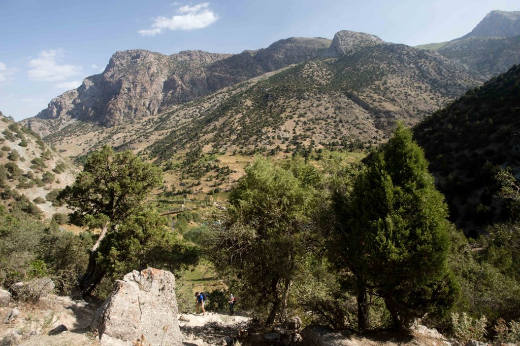
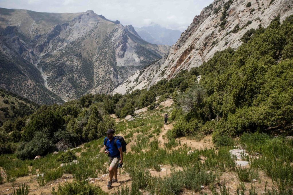
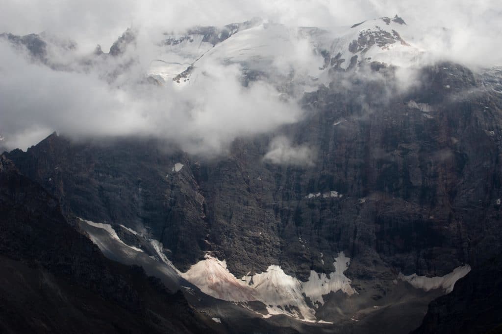
For the Chukurak Pass, however, carry onwards along the obvious trails that climb to the east. The path begins with a fair amount of forest cover but about halfway up the remaining 2.5km from Beloye the trees give way to an open green hillside, with beautiful mountain views back across the Chukurak Lakes to the Igrok Pass opposite.
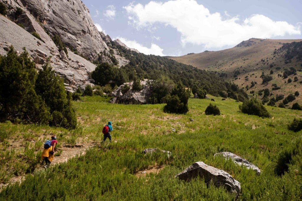
You’ll pick up a touch under 700m of vertical elevation between the lakes and the 3180m Chukurak Pass, nothing to steep or strenuous, and the moment of stepping atop the pass to take in the views beyond makes it all very much worth the effort.
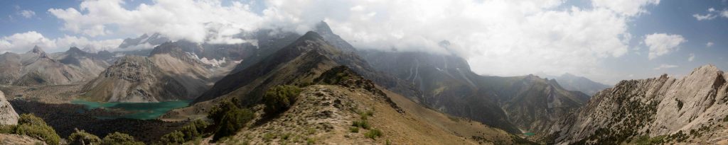
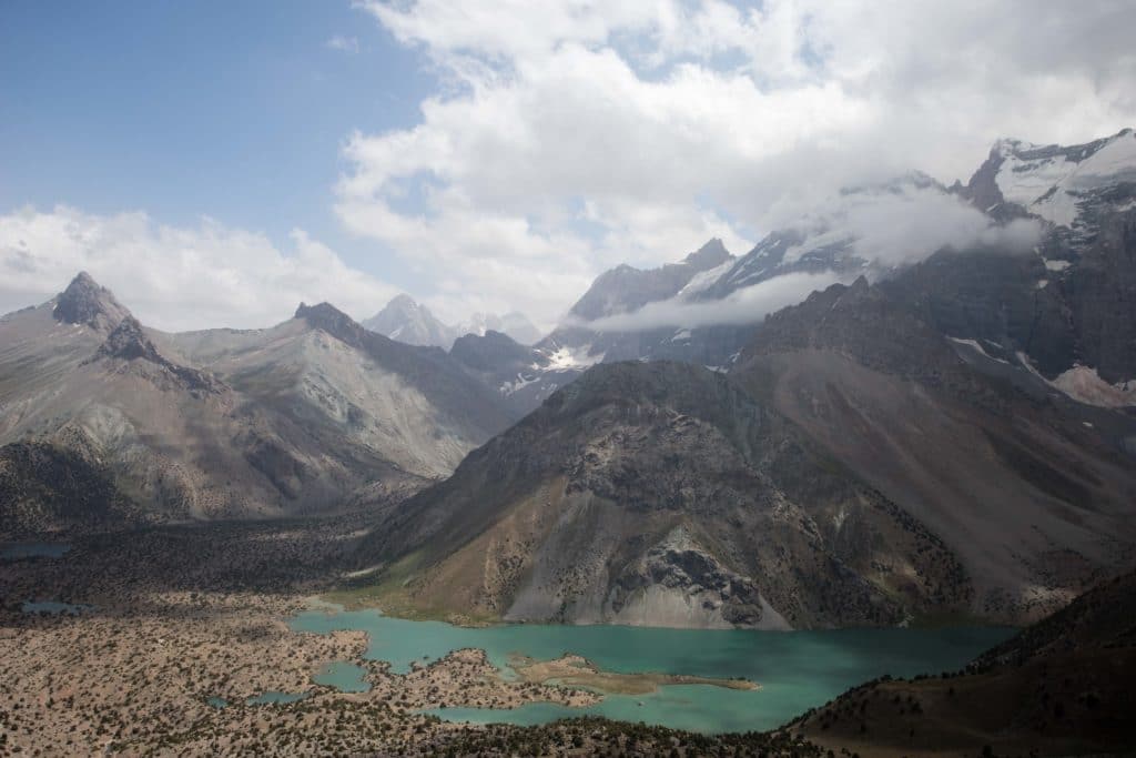
Just a touch higher than the pass itself is a small rise, from which there is an unobstructed 360 degree view to the mountains all around. Just to the southeast is the main Kulikalon Lake, due south is an impressive rock wall, and back to the west a succession of attractive Fann Mountains peaks poke out above the Chukurak Lakes.
From the Chukurak Pass, the quickest way back down to Artuch Alplager is to retrace the same path you arrived on. However, it’s only a little longer to circle down to the Kulikalon Lakes and then loop back down to Artuch from there – you’ll only get to see the first few lakes of Kulikalon, but if you have time to spare this is a good option, particularly if you won’t be able to spend the time to explore the entire valley.
Alternate Options for Chukurak Pass & Lakes
The Chukurak Pass and Lakes are quite easy to tag on to longer treks through the Fann Mountains. This exact route makes a nice alternate entrance to the Kulikalon Lakes trek, and has been included in the GPS info for that hike, and additionally it’s possible to approach to here on a long route from the popular Haft Kol area.
Good To Know
If you’ll be doing a significant amount of trekking in Tajikistan, consider buying the Cicerone Guide to Tajikistan by Jan Bakker and Christine Oriol, both of whom are very experienced hikers in the country.
For more general advice look for the Lonely Planet: Central Asia guide, to which we contributed the Kyrgyzstan chapter and a fair bit of information on trekking in Kyrgyzstan.
No unusual gear is necessary for this hike in summer, just the standard trekkers’ kit. You’ll also not need to pay any entry fees along the way.
Getting to the Artuch Alplager
The Chukurak Pass hike starts from the Artuch Alplager, about 7km beyond the village of Artuch (which is reachable by shared taxi from Penjikent). If you’re visiting one a one-day trip to Artuch you’ll absolutely need your own vehicle, most likely from a local tour company in Penjikent.
Where to Stay and Eat
The trailhead Artuch Alplager can be contacted online to arrange accommodation plus meals or transportation, or any tour operator in Penjikent or Dushanbe can do the same. It’s also possible to camp in the surrounding area, but most visitors who do so will be heading off for the longer Kulikalon Lakes hike.
![]()
Pingback: Tajikistan: Haft Kul to Alaudin - Asia Hikes
Pingback: Tajikistan: Kulikalon Lakes to Chimtarga and Iskanderkul - Asia Hikes