Tajikistan: Kulikalon Lakes Hike
Таджикистан: Куликалонские озера
The straightforward Kulikalon Lakes Hike, a three-day route in the Fann Mountains, is among the most popular treks in Tajikistan (particularly those outside of the Pamirs). Starting and ending at trailhead alplagers (mountain huts) and taking in several beautiful strings of mountain lakes, it remains a tourist favorite for very good reason.

Kulikalon Lakes Hike: Overview
Total Km: 19.5km
Total Days: 3
Elevation Gain/Loss: 2070m+ / 1590m-
Start Point: Artuch Alplager
End Point: Vertikal Alaudin Alplager
GPS Files
Starting from the Artuch Alplager, wind up the back path to the Chukurak Valley to the small namesake lake and then continue up a side valley to the 3180m Chukurak Pass. Descending into the Kulikalon Valley, pass a succession of magnificent alpine lakes as you head towards the head of the valley, and then climb onwards towards the 3860m Alaudin Pass.
From the namesake Alaudin lake far below, numerous options exist for further hikes. This route follows the downstream route to the Alplager Vertikal Alaudin trailhead, but options exist from here to carry on as far as popular Iskender Kul lake on the far side of the Fann range.
(Note that we took this hike at a fairly relaxed pace, focused more on photography and fun than on crunching out the kilometers. You may find these distances pass by far more quickly.)
Though occasionally strenuous, the Kulikalon Lakes Hike is not technically challenging at all during the warmer months of the year. While possible to follow in winter, heavy snows on both the Chukurak and Alaudin passes mean that hikers will want to go in parties that are equipped with both the technical knowledge and the gear to do so safely.
Kulikalon Stage 1
Total Km: 10km
Walking time: 6h
Total time: 10h
Elevation Gain/Loss: 1080m+ / 370m-
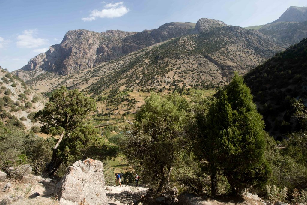
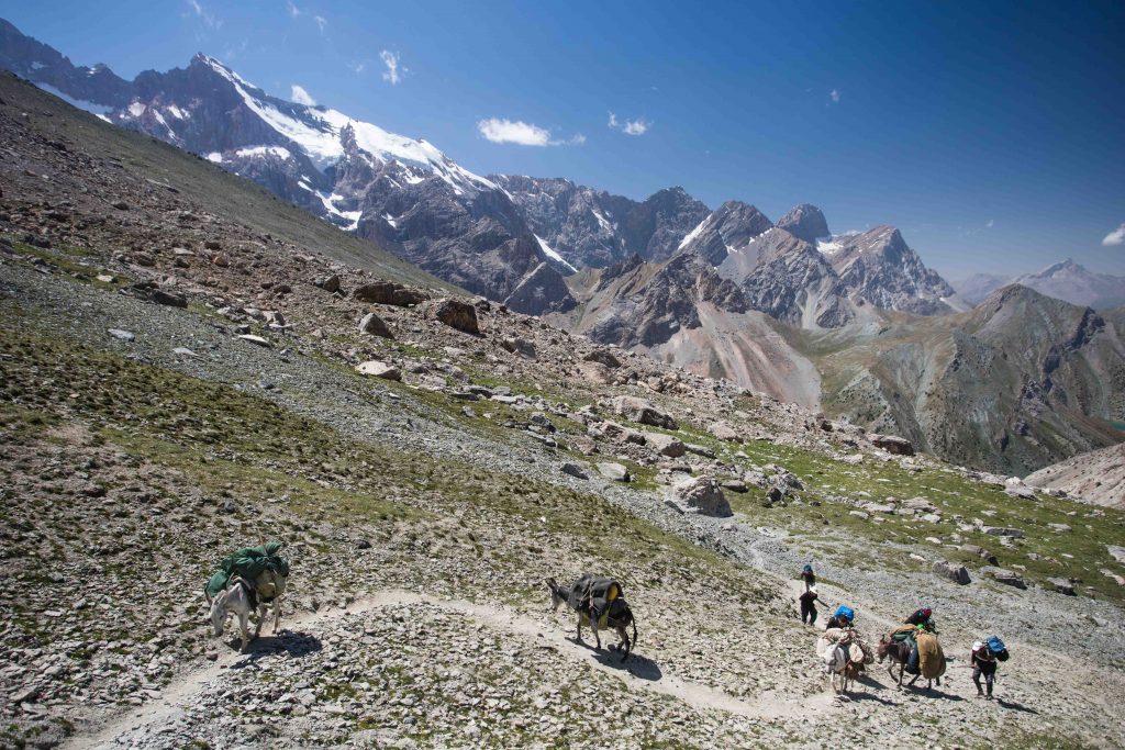
Starting from the Artuch Alplager, an obvious choice for an overnight before starting the trek, there are two options to reach the Kulikalon Valley. The most direct is the obvious jeep track the leads past the entrance to the alplager, climbing to the bottom of the Kulikalon Basin over about 4.5km of distance. More impressive, though also more difficult, is the route we pursue here.
From the Artuch alplager, look for the dirt track that leads up the Chukurak Valley to the southwest. The climb is largely shaded in the early morning, with a nice amount of tree cover, and some decent views open up back down towards Artuch during the climb. After just about one kilometer, the track levels off just before the Chukurak Lake (which dries up late in the season, when snowmelt has run dry from the surrounding mountains).
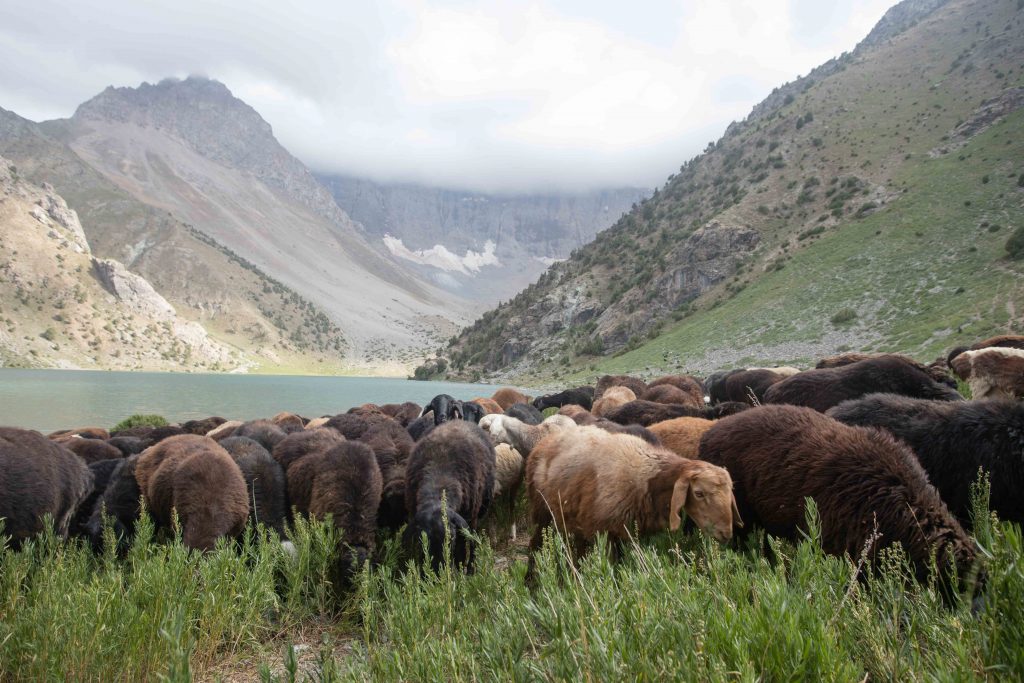
After a brief stop by Chukurak lake, climb to the southeast to a small runoff lake and then nearly due east to continue up the valley. The trail climbs for around 3km from the lakeside to the top of the Chukurak Pass at 3180m, first through a stand of evergreen forest and then into an open plateau used for grazing in the summer by Artuch locals (in-season, you’ll likely pass a temporary shepherd camp somewhere along the way).
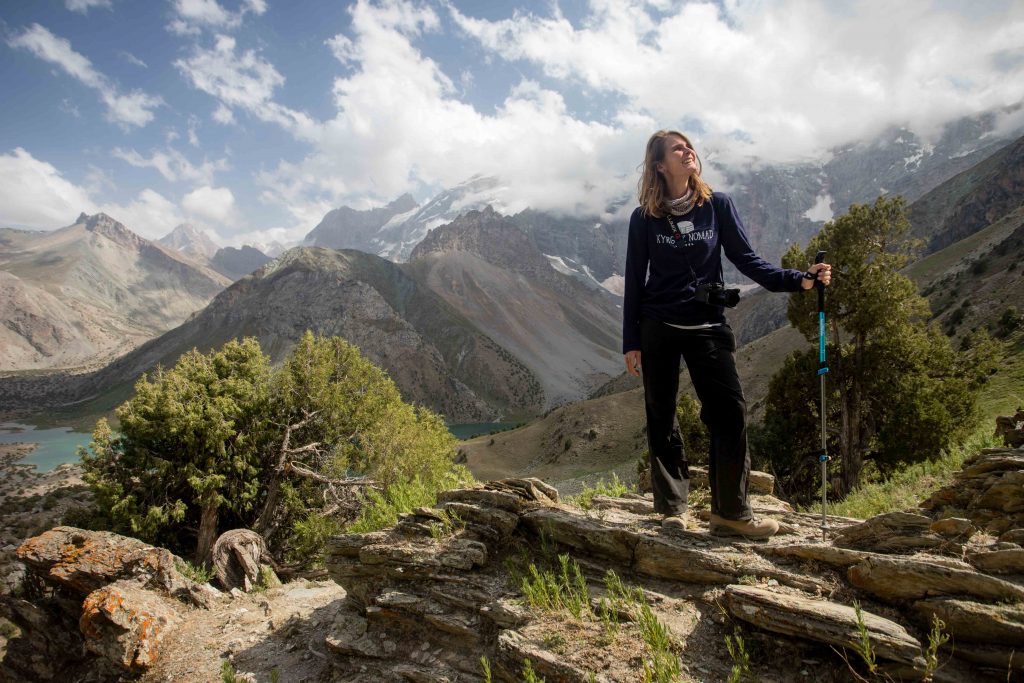
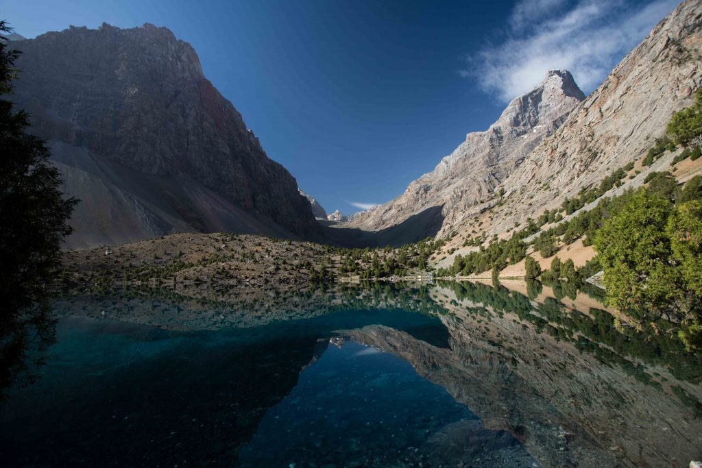
Stop at the pass for lunch – views over the Kulikalon Valley and namesake lakes are magnificent, and with clear weather there are views to the Alaudin Pass and Chapdara Peak beyond, along with a host of other peaks in the Fann Mountains.
From the pass, the trail angles down the slope towards the largest of the Kulikalon Lakes, with several promising viewpoints just off-trail along the way. At the lake shore (from which there are excellent views up the face of 4970m Peak Maria) the trail runs sharply to the northeast and across nearly the complete width of the valley at this narrow point, passing along the way the dirt track that runs up directly from the alplager.
A maze of trails criss-cross each other through this section, though it doesn’t matter much which you take. Continue generally across and then up the valley, passing en route on or two small semi-permanent camps signposted as chaikana (teahouses) where it’s generally possible to camp, purchase basic supplies (including beer for ~20 somoni), or perhaps pick up a hot meal (from ~30 somoni). It’s best not to be absolutely dependent on these, but they can be a nice option if you’re traveling light.
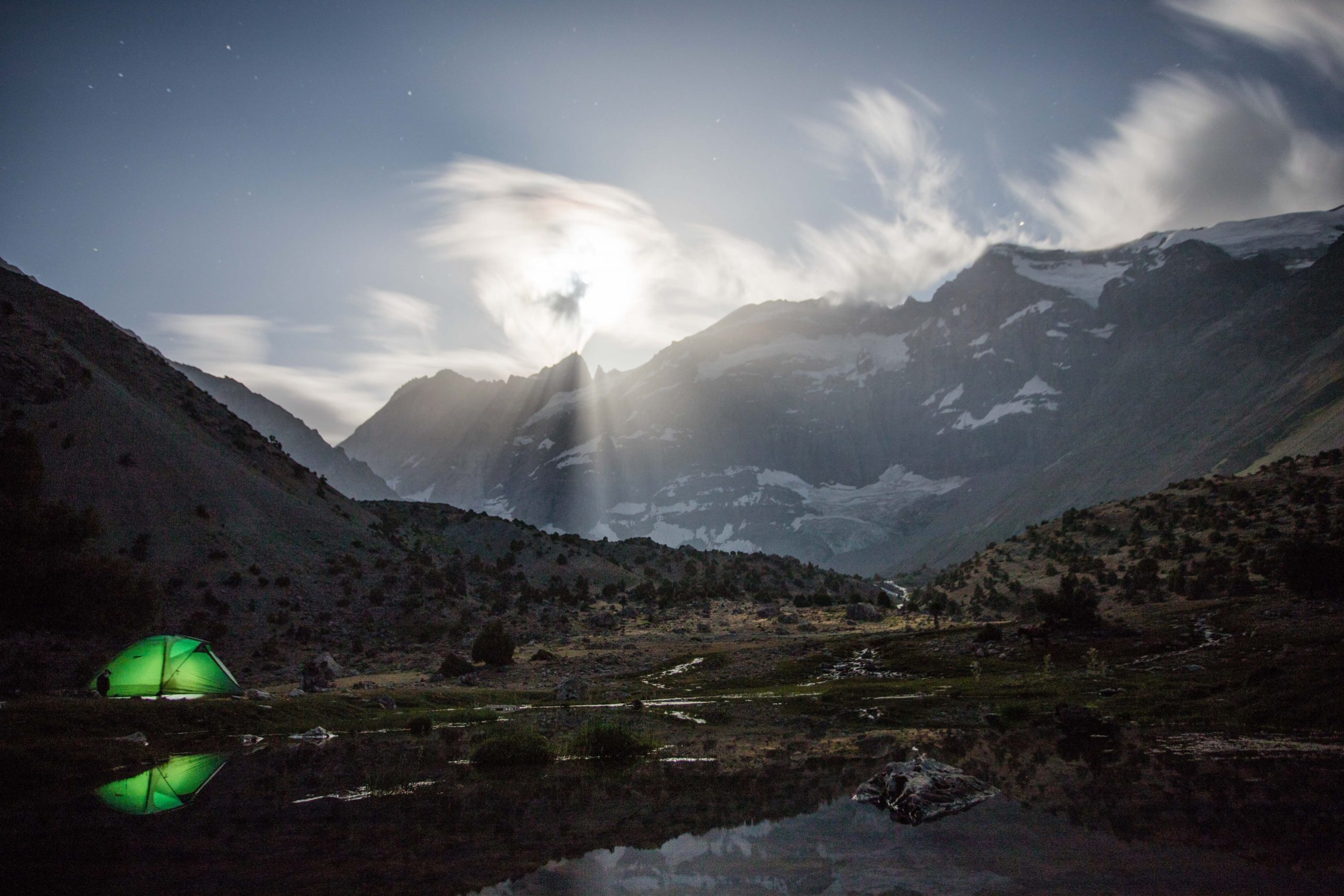
It’s possible to camp really anywhere in the valley, though do try to be mindful of proximity to water as you select a campsite (though, in reality, rivulets cut through so much of the Kulikalon Valley that it’s nearly impossible to maintain the recommend 60m distance from a water source).
We camped towards the northern end of Bibikhonat Lake, in large part for the photography potential, but this is largely a choice that comes down to what’s available when you arrive and any personal campsite preferences.
Kulikalon Stage 2
Total Km: 7km
Walking time: 5h
Total time: 8h
Elevation Gain/Loss: 990m+ / 1070m-
Stage two of the Kulikalon Lakes hike is by far the most strenuous of the three, mostly because it starts with a long climb under the sun and transitions into a steep descent under the sun. Pack a hat and sunscreen.
From your campsite, continue up the Kulikalon Valley towards the Chimtarga ridge, sticking to the eastern side of the valley as it slowly begins to climb. As the path ascends out of the main valley towards the path, enjoy fine views over the twin Dushakha lake, the final two of the Kulaikalon Valley, until they disappear behind a fold in the ridge the signifies you’ve reached most of the way to the 3860m Alaudin Pass.
Views from the Alaudin Pass are magnificent in every direction, with Kulaikalon and beyond to the west (the largest Kulikalon lake just visible) and Alaudin Lake and Chapdara Peak dominating to the east. It’s the literal and figurative high point of the trek, so take some time to enjoy the views and even break out lunch if it isn’t too windy.
From here, the trail continues east over the pass for a long and unremitting descent to Alaudin Lake directly below.
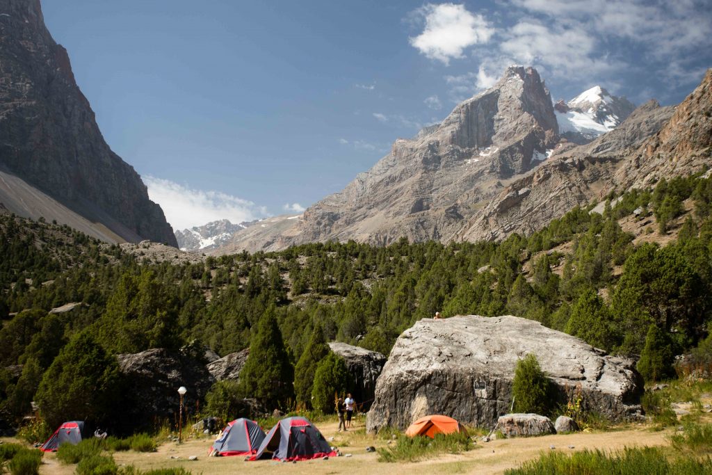
Arriving to Alaudin Lake, ideally with plenty of time to savor the peace of the lake shore after a long day of hiking, there are two semi-formal campsites directly along the trial. The first is a large area of open ground directly beside what first looks like a cabin – this is by far the best for large groups.
The other is across a small bridge just on the northernmost edge of the lake – this is better for small groups as tent sites are quite scattered. Locals who run small shops ‘manage’ both campsites – again, they can generally provide canned/bottled goods and sometimes hot meals.
It would be no trouble to tack Stage 3 onto the end of Stage 2, but in doing so you would miss an afternoon by the lake shore and sunrise over the lake. Unless you’re extremely short on time, try to spend the night here.
Kulikalon Stage 3
Total Km: 2.5km
Walking time: 1h
Total time: 1h
Elevation Gain/Loss: -150m
Stage 3 is mostly a formality – packing up and heading down to the trailhead for transfer on to Dushanbe or Khojand. It’s a quick and easy 2.5km from Alaudin lake to the Vertikal Alaudin Alplager, passing a string of small but pretty lakes along the way and fording one stream.
No public transportation runs to here, so you’ll want to have arranged a ride in advance or discuss the possibility of hiring one through the alplager. Otherwise, it’s a long 28km slog down a jeep road to the town of Sarvoda and more options.
Alternate Options for Kulikalon Lakes Hike
It’s possible to loop back to the Atruch Alplager over the 3630m Laudan (Kulikalon) Pass from a side trail off the Chapdara Valley about 5km downstream from Alaudin Lake (past the alplager).
Trails also take off from both Artuch Alplager and Alaudin Lake for various other points in the Fann Mountains. It’s even possible to go as far as Iskander-Kol with just a little technical climbing experience. There’s a lot of scope for exploring around here.
Good To Know
If you’ll be doing a significant amount of trekking in Tajikistan, consider buying the Cicerone Guide to Tajikistan by Jan Bakker and Christine Oriol, both of whom are very experienced hikers in the country.
For more general advice look for the Lonely Planet: Central Asia guide, to which we contributed the Kyrgyzstan chapter and a fair bit of information on trekking in Kyrgyzstan.
No unusual gear is necessary for this hike in summer, just the standard trekkers’ kit. You’ll also not need to pay any entry fees along the way.
Getting to the Kulikalon Lakes Hike
The Kulikalon Lakes hike starts from the Artuch Alplager, about 7km beyond the village of Artuch (which is reachable by shared taxi from Penjikent).
Alternatively, it’s also possible to start the route from the opposite end, at Alaudin, for which you’ll need to hire a taxi from the roadside town of Sarvoda for around 200 Somoni – bargain hard – to the Vertikal Alaudin Alplager at the end of the road around 28km away.
Where to Stay and Eat
The trailhead Artuch Alplager can be contacted online to arrange accommodation plus meals or transportation, as can Vertikal Alaudin (Russian-only). Trailside shops are in-person only, and while they tend to operate through the summer it’s best to carry at least basic necessary supplies yourself in case you’re not able to procure something from them. Up at Kulikalon and Alaudin lake you’ll need a sleeping system, but at Artuch and Vertikal you can hire a bed or a room at the prices listed on their websites.