
Tajikistan: Yagnob Valley Loop Trek
Таджикистан: Поход в Ягнобскую Долину
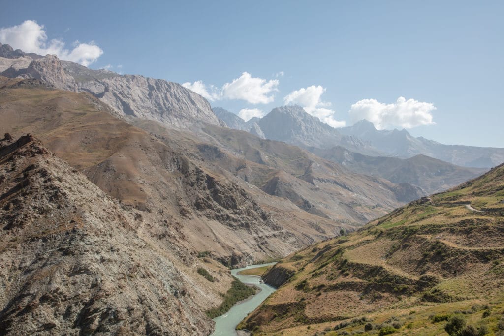
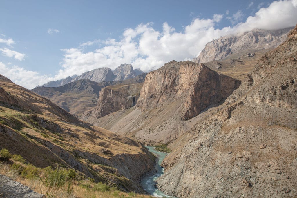
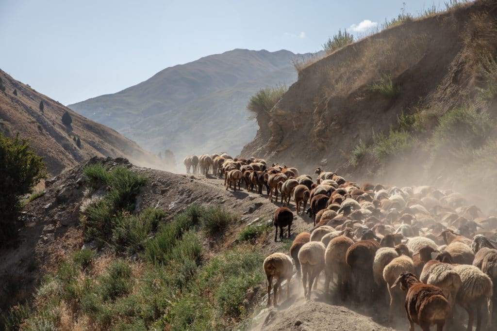
Trekking in the Yagnob Valley is special not just for the stark mountain sceneries, but for the ancient culture of the Yagnobi people you will experience long the way. Numerous routes exist in the Yagnob Valley, giving trekkers a plethora of options for exploring the unique valley and connecting it to treks beyond in the Zeravshan Valley, Ziddi Valley, and the Romit Nature Preserve. This is an offbeat area even for trekking in Tajikistan, but the overall lack of tourists make the experience of exploring here even more profound.
The Yagnobi people are descendants of ancient Sogdiana, originally hailing from the Panjakent area a bit northwest of the Yagnob Valley. During the Arab conquests and spread of Islam throughout Central Asia, many Sogdians fled their ancestral homelands fearing for their lives. Their leader, Divashtich, lead the way to the Zeravshan Valley where people briefly began to re-settle. The Umayyad general leading the conquest through modern-day Tajikistan finally found Divashtich here in the Zeravshan Valley and captured him. Divashtich would be taken to Rabanjan, in modern-day Uzbekistan to be beheaded.
The Sogdians knew that they couldn’t stay in the Zeravshan Valley knowing that they would be converted or killed. So they made the treacherous journey over the high mountain passes that separate the Zeravshan and Yagnob Valleys, knowing that they would be safe from invasion in the narrow valley cut by the Yagnob River.
Blending their practices from ancient Sogdiana into their new home, they became known as the Yagnobi and remained relatively isolated until the 1920s, when Russian expeditions first arrived. By the 1930s, many Yagnobi were forced from their homes under Stalin’s Great Purge that brought many into forced labor in the cotton fields in the Fergana Valley, killing many Yagnobi in the summer heat. Almost every family was forced out of the valley by the 1970s.
During the Perestroika of the 1980s, numerous Yagnobi families returned to their abandoned and ruined villages to start back over. Not all villages in the present Yagnob Valley are Yagnobi speaking, but several are. Yagnobi is directly derived from the ancient Sogdian language. Some Yagnobi people still practice their traditional religion as well here in the valley- a unique blend melding elements of Zoroastrianism and Islam.
Total km: 44.3 km
Total days: 5
Elevation gain/loss: 2626m+/2643m-
Start point: Yagnob Canyon
Endpoint: Yagnob Canyon
GPS Files
Starting from the village of Margib, you can arrange a ride to the canyon beyond Bidev where the trek along the Yagnob River begins from. Those that don’t mind the extra 28km of walking can also hike in from Margib along the valley road.
The path starts from inside the canyon, bringing you to the south shore of the Yagnob river. After crossing the Tagobikul River as you continue east you will head up toward the Yagnobi village of Pskon. From here the path meanders down to the river, crossing to the northern side of the Yagnob Valley to limb high above the river once more past the ruined villages of Qiriyonte and Qiansi, and finally arriving at the abandoned village of Navobod.
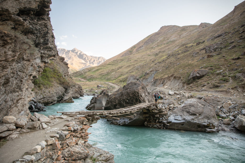
At Navobod, it follows a narrow path back down to the Yagnob River and a bridge that crosses to the southern shore, on which, the trail stays close to the Yagnob River for about 4 kilometers, heading back west until it makes a bend south to cross a stream. For the next 7.5 kilometers, the trail gains altitude to eventually arrive at 2,950 meter Maydon Pass.
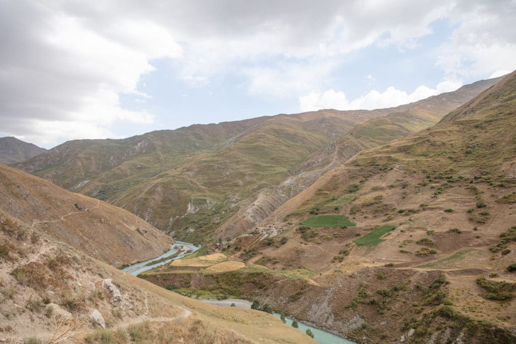
Coming down Maydon Pass, the way parallels the Kumarh River before it joins the Tagob River near an abandoned village of the same name. From here, bend back north to see the Yagnob River come back into view and follow it to the west and the side-by-side Yagnobi villages of Dehbaland and Padipast. From Dehbaland it’s less than 2 kilometers to Pskon, and the closed end of the loop
Those wanting to visit a few more Yagnobi villages can turn south at the Tagobikul River near Pskon to visit Upper and Lower Garmen, Sokan, and Qul.
Yagnob Valley Loop Trek: Stage 1
Margib to Pskon
Total km: 5.2 km
Walking time: 2 hours
Total time: 3 hours
Elevation gain/loss: 361m+/294m-
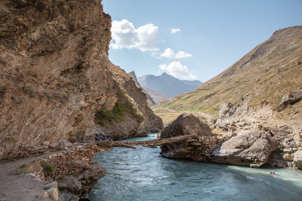
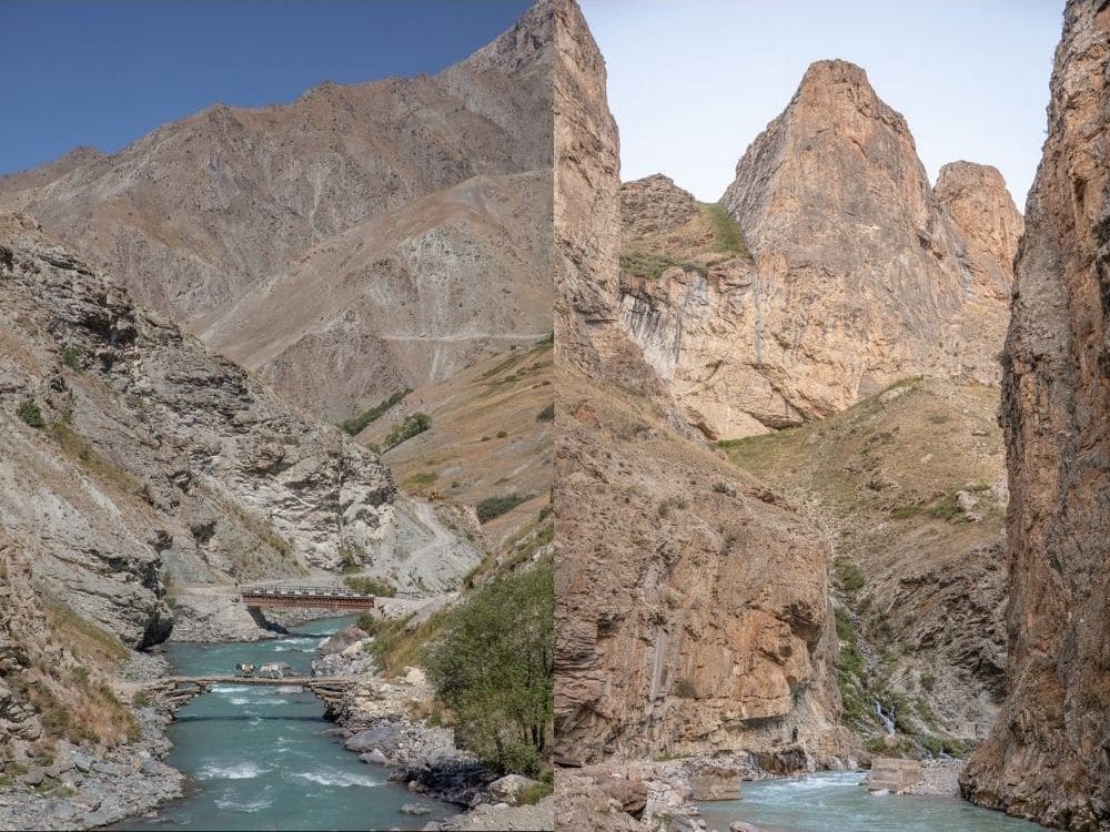
A car from Margib can drop you off off inside a rugged and narrow canyon, just beyond where an old vehicle bridge is snapped in half in the river. The path stays right along the canyon, where it appears to be cut right into the rock wall. You’ll pass a small stone building before crossing a wooden bridge over the rushing Yagnob River below. At this point the canyon opens into a wider valley with a view of a pyramid-like peak in front of you.
Continuing east, you will cross another small bridge over the Tagob River around 0.6 km from the start. The path continues uphill along a roadbed surrounded by rolling green hills.
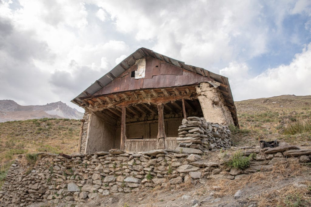
This roadbed leads to the Yagnobi speaking village of Pskon after about one hour of walking. There is a homestay in Pskon which you can arrange in advance, but likely the kids in the village will find you and bring you there if you show up unannounced.
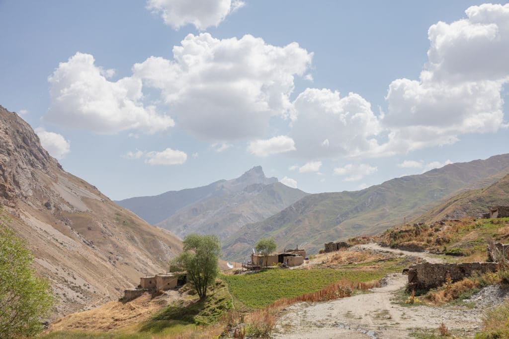
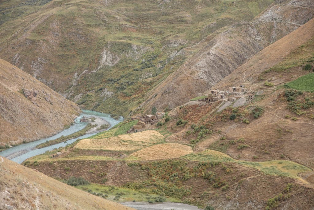
From Pskon, the trail descends steeply to a wooden bridge crossing the Yagnob back to the northern shore. The trail gradually gains elevation as it heads east beyond the bridge. About 3 kilometers from the bridge, not far from the beautiful terraced village of Dehbaland across the river, you will find nice areas to camp alongside the trail.
As stage 1 and stage 2 of this trek are short, you can opt to combine them into a single day for those on a shorter timeframe.
Yagnob Valley Loop Trek: Stage 2
Pskon to Qiansi
Total km: 4.9 km
Walking time: 2 hours
Total time: 3 hours
Elevation gain/loss: 295m+/130m-
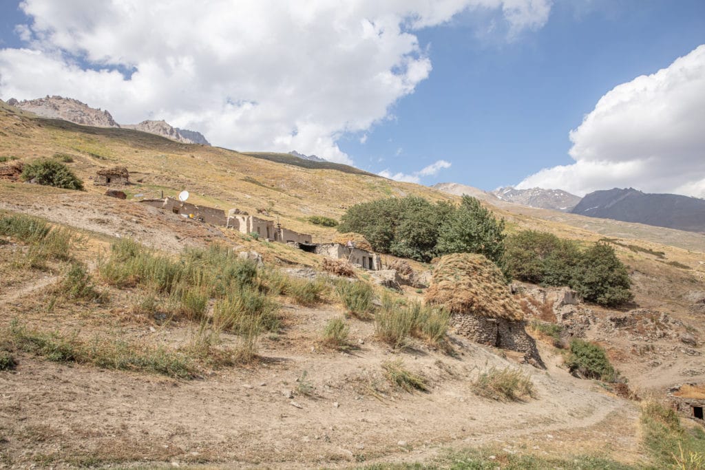
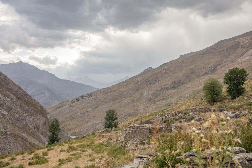
Beyond camp, the scenery becomes more arid as the trail wraps around craggy mountain faces, paralleling the Yagnob River from high above. After nearly 1 hour of walking, a 2.5 kilometers distance, comes the ruined village of Qiriyonte and a green landscape once again. The village isn’t completely abandoned though, as a couple of families do use it as a summer shepherd camp.
Another 5 kilometers to the east i sanother stretch of green landscapes as you reach Qiansi after an hour or so of walking. Qiansi is also a ruined village that is used as a shepherding camp for locals headed with their flocks further into the valley. There is a spring here, making it a perfect campsite for the night.
Yagnob Valley Loop Trek: Stage 3
Qiansi to Below Maydon Pass
Total km: 12.2 km
Walking time: 4.5 hours
Total time: 5 hours
Elevation gain/loss: 910m+/773m-
From Qiansi the trail splits a bit, so select one that continues east paralleling the Yagnob River, staying decently high above the river for the first hour of walking, covering a distance of 3.2 kilometers until you reach the settlement of Dehkalon.
Beyond Dehkalon, the trail does drop a little closer to the river and continues to the abandoned village of Navobod about 5 kilometers (nearly 2 hours) further. Navobod makes a great place to break for lunch.
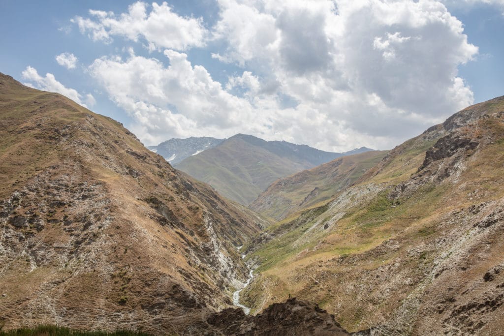
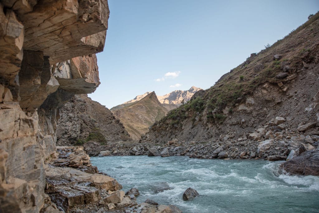
From the abandoned village here, follow the path down to the river to find a wooden bridge crossing to the southern shore. Once across, you will need to find a good spot to wade across the smaller Kalontimur River. Staying close to the river for roughly the next 1.5 hours, the obvious path continues west until about 4 kilometers past the bridge, where it dips south to begin the ascent toward Maydon Pass. Start looking around here for a nice spot to camp.
Yagnob Valley Loop Trek: Stage 4
Maydon Pass to Dehbaland
Total km: 16.8 km
Walking time: 6 hours
Total time: 7 hours
Elevation gain/loss: 776m+/1029m-
The trail bends south for about 1.5 kilometers before it begins to zigzag heading west. After about 7.5 kilometers of gradual incline, you will reach Maydon Pass around 3 hours from the start. The final approach to Maydon Pass is sprinkled with large boulders, which can be treacherous if you’re attempting this route after heavy rainfall as this area can be prone to rock falls.
From Maydon Pass the trail drops down to parallel the Kumarkh River, following its course back toward the Yagnob. Another 9 kilometers will bring you to the Yagnobi village of Dehbaland, which has a homestay for travelers. If you’d prefer to camp, there are plenty of good sites the last couple of kilometers between the Timurkan River and Dehbaland.
Yagnob Valley Loop Trek: Stage 5
Dehbaland to Margib
Total km: 5.2 km
Walking time: 2 hours
Total time: 4 hours
Elevation gain/loss: 284m+/417m-
From Dehbaland, take the path that descends a bit over roughly 300 meters to visit the beautiful terraced village of Padipast before heading west again for less than 2 kilometers to Pskon. This section will take about one hour of walking.
Once to Pskon you will take the same route back to the canyon to end the trek, unless you plan to extend by walking along the road back to Bidev or Margib, or visiting more Yagnobi villages along the Tagobikul River.
Alternate Options for the Yagnob Valley Loop
Numerous alternate options exist for this Yagnob Valley Loop trek. A popular and challenging option is to start from the village of Langar in the Zeravshan Valley to the north. A path ascends, heading south over 4,040 meter Tabaspin Pass. Eventually, you will meet the Galirud River to join the Yagnob Valley.
Another variation from the Zeravshan Valley is to follow a dirt track by 4WD from the main valley to the village of Ghuzn. From Ghuzn, continue on foot, due south to cross the 3,993 meter Rost Pass to join the Yagnob Valley at the abandoned village of Navobod.
Those wanting to combine the Yagnob Valley with the Romit Nature Preserve, it’s possible to cross the bridge at Navobod to the south side of the Yagnob Valley as outlined in the main route. However, once across, follow the path to the east-southeast up and over Honi Pass, which descends into the village of Rufigar – will be your jumping-off point into the Romit area.
The Tagobikul River, which is mentioned as an add-on at the end of the main trek flows to the south giving access to the Yagnobi villages of Upper & Lower Garmen, Sokan, and Qul. From just south of Qul, the path bends west to eventually meet the Mushatif River. Once to the Mushatif, it’s possible to follow the river north back to the Yagnob Valley at Vausaut. Alternatively, head southeast to cross Tagrich Pass. This eventually will loop back to Margib by way of the Pindar River.
Good To Know
No special equipment is needed for the Yagnob Valley Loop trek and there are no entrance fees for visiting. The usual camping gear is recommended unless you plan to stay in homestays all along the way, in which case ZTDA and ZTB can help make arrangements for homestays.
The Yagnob Valley is best explored between June and early October. Outside these months there can be quite a bit of snow. In winter months you can expect downright frigid temperatures.
For those that want to hire a guide for their trip, contact Paramount Journey as they know the Yagnob area quite well.
Getting to the Yagnob Valley Loop
You will need to get to the village of Margib, the main jumping-off point for adventures in the Yagnob Valley. If coming from Dushanbe, go to the Cement Zavod Taxi Stand north of the city and find a shared taxi bound for Sarvoda. It should cost about 50 TJS per seat. From Tajikistan’s northern cities (Panjakent, Istaravshan, Khujand, etc.) you can take any Dushabe-bound shared taxi and let the driver know you want to get out at Sarvoda Bazaar.
On arrival in Sarvoda, plan to be accosted by drivers offering their services. Just say Margib and you will be pointed out to a driver who is headed to Zeravshan II or Takfon who will make arrangements with another driver to take you the remainder of the way. Plan to pay 300 TJS to charter a car to Margib. Another option is to call a man named Murzor who lives in Anzob to pick you up in Sarvoda at +992 928240153, however he only speaks Tajik and Russian.
You can sometimes find a shared taxi departing Sarvoda Bazaar in the afternoon to Margib, taking some of the sellers home for the day. The cost should be about 75 TJS per seat.
Getting from Margib to the canyon where you will begin the trek can be arranged by your homestay in Margib. It’s a long and slow drive along rough tracks to the canyon from Margib, despite its meager 28 km distance. You can expect the ride to cost 300 TJS with some negotiating. You can walk the 28 kilometers if you’re keeping to a tighter budget, or try your thumb at hitching. There isn’t much traffic between Margib and the canyon, but it may be possible with some patience to hitchhike.
Where to Stay and Eat
There are three CBT homestays in Margib, Veterok, Zaminkaror, and Saroy. All three are marked with CBT signs and most locals know where they are at. Each comes in around $10 USD per person, per night. Meals cost $5 each.
Along the trek, there are homestays in Pskon and Dehbaland. You will need to bring camping equipment to the main trek, however it is possible to make arrangements to trek homestay to homestay in a shorter variation of the Yagnob Loop trek.
Purchase any other food and provisions at the bazaars in Dushanbe, Sarvoda, or Penjikent before your departure into the Yagnob Valley.
[All photos courtesy of Adventures of Nicole]
![]()
Pingback: Tajikistan: Fann Mountains Trekking Guide - Asia Hikes