
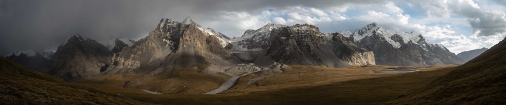
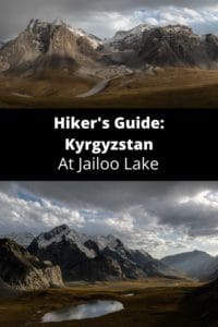
Kyrgyzstan: At Jailoo Lake
A tiny alpine lake with big mountain views, At Jailoo Lake is an offbeat alternative to the already offbeat Enilchek Valley, but one with big payoffs for lovers of beautiful peaks and peaceful nature. This entire region of Issyk-Kol is hard to reach and travel, but those who make the effort won’t regret it.
Total Km: 22km
Total Days: 2
Elevation Gain/Loss: 1185m+ / 1185m-
Start Point: Enilchek Valley
End Point: Enilchek Valley
GPS Files
The At Jailoo Lake hike is technically straightforward and navigationally simple. There are a handful of river crossings that could be dodgy if you encounter them late in the day at the wrong time of year, but overall it’s a simple pleasant walk to a beautiful mountain lake and pasture.
While the Enilchek Valley gets a fairly steady flow of group tours who come for trekking to Kyrgyzstan’s highest peaks, Khan Tengri and Peak Pobeda, At Jailoo sees relatively few travelers. It’s a great warm-up to the Enilchek Valley, can be done as a one-day out and back, and chances are you’ll have it all to yourself.
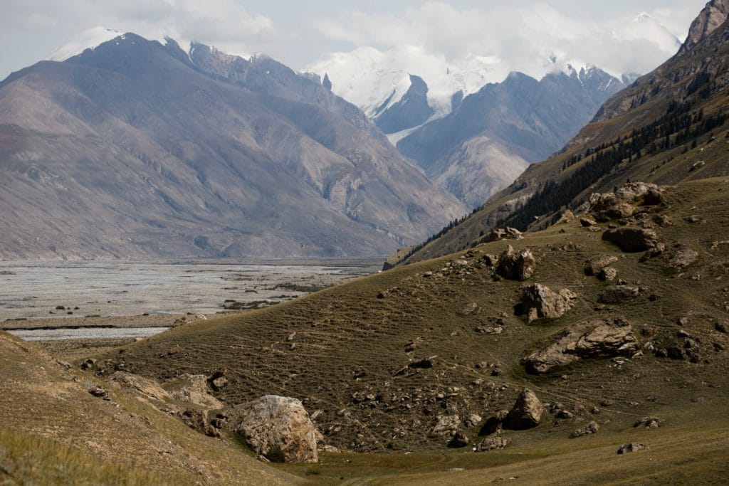
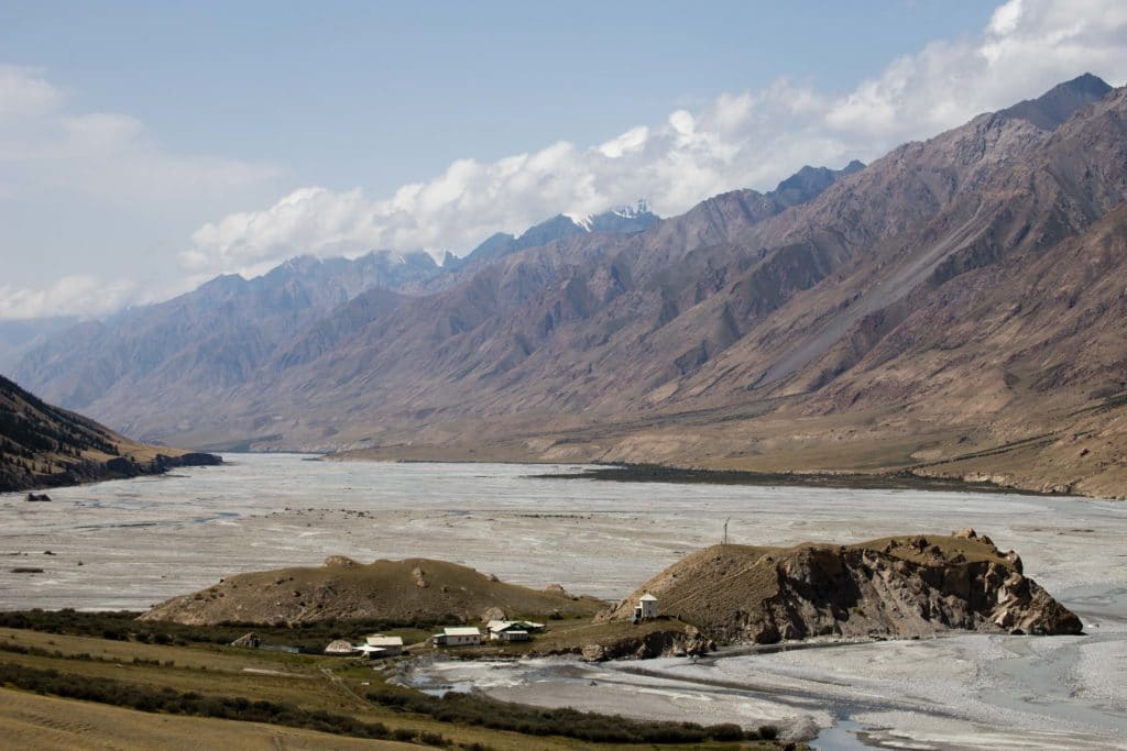
The At Jailoo hike starts from the Enilchek Valley, where the At Jailoo river flows into the wide Enilchek. The GPS linked above starts from the the Tur Khan Tengri hunting lodge, but the trek could just as easily begin from the plain where the two rivers meet – if so, you’ll have already covered the first 2.5km of the route.
As the trail approaches the At Jailoo valley, it climbs slowly up the hillside between the lodge and the river itself, climbing about 85m along the way before it curves around one last rise to run parallel to the At Bashi river below. There are any number of animal tracks to follow here, and it’s not really important which you choose, but look for the obvious turnoff 3.7km into the route where the trails converge to turn sharply downhill to the river, in order to avoid the large gorge cut into the hillside by a side stream a little further on.
The trail reaches the riverbed just above the junction of the At Jailoo river with a tributary noted on old Soviet maps as Kanjailoo (or ‘Blood Pasture’ – though perhaps that should actually be ‘Khan Jailoo’). Though not immediately visible, there is a sturdy bridge a little higher up the At Jailoo, which the trail follows across the river and then begins climbing the lushly forested hillside opposite.
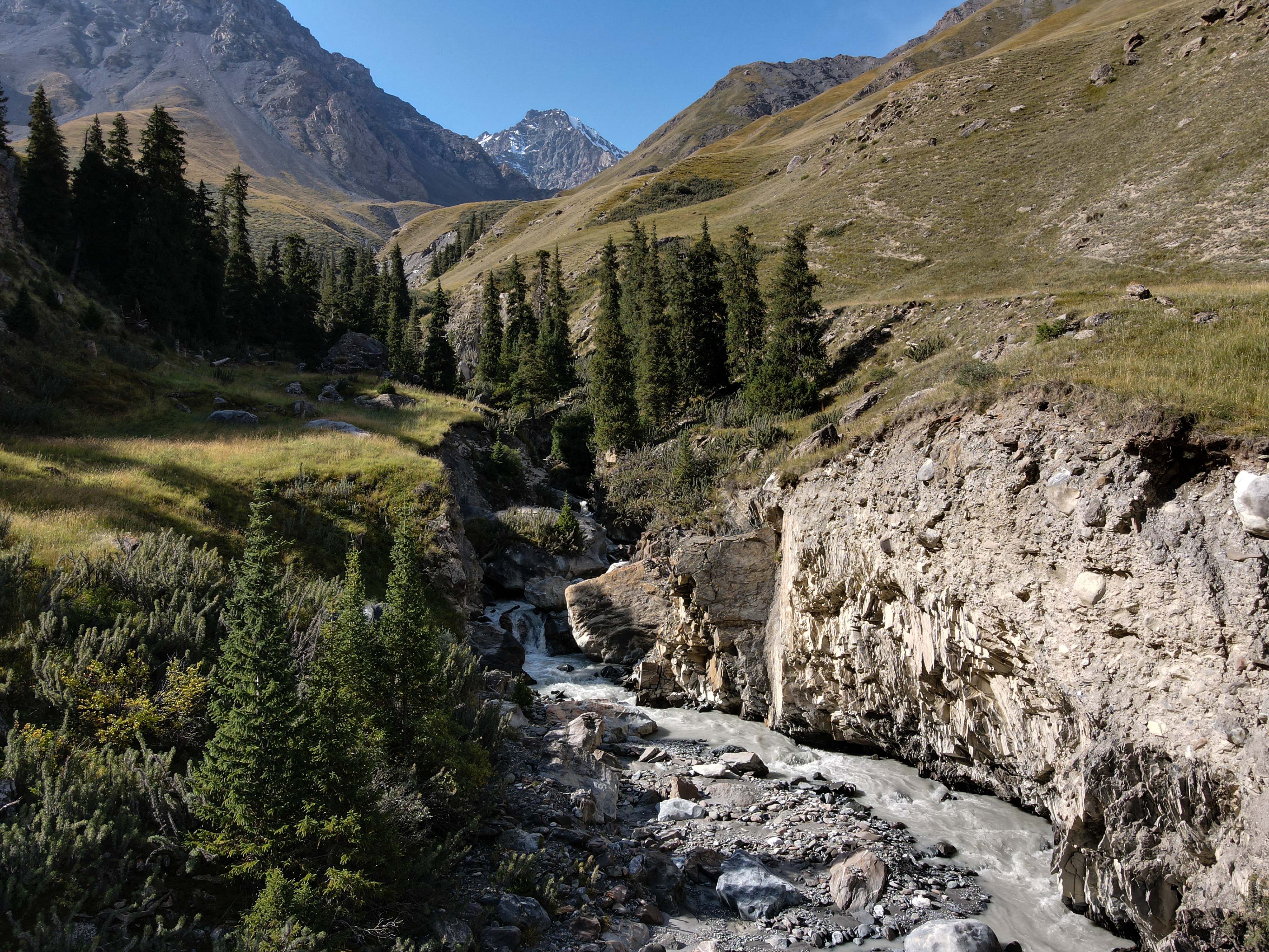
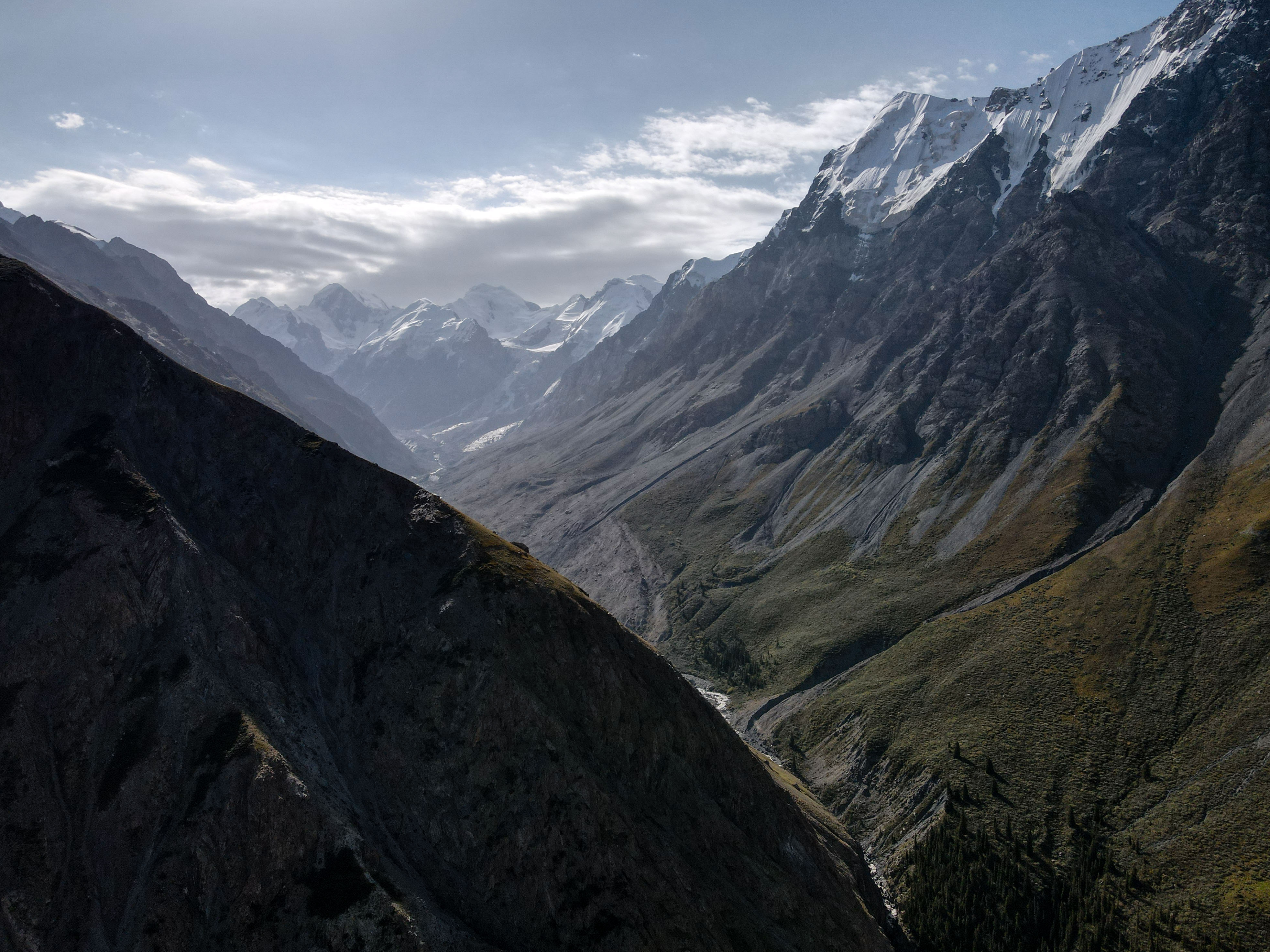
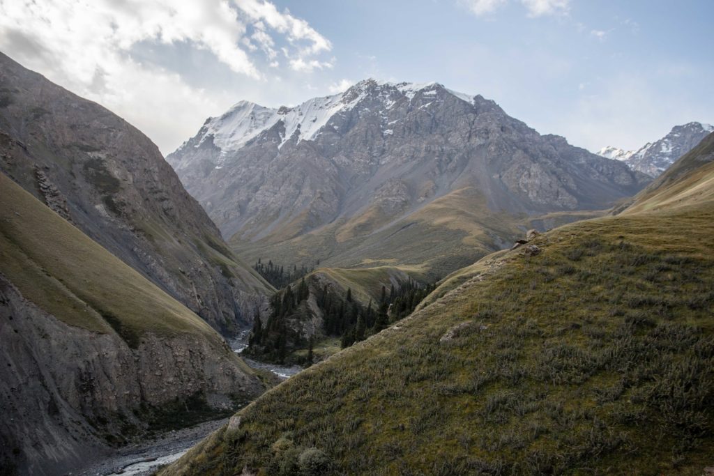
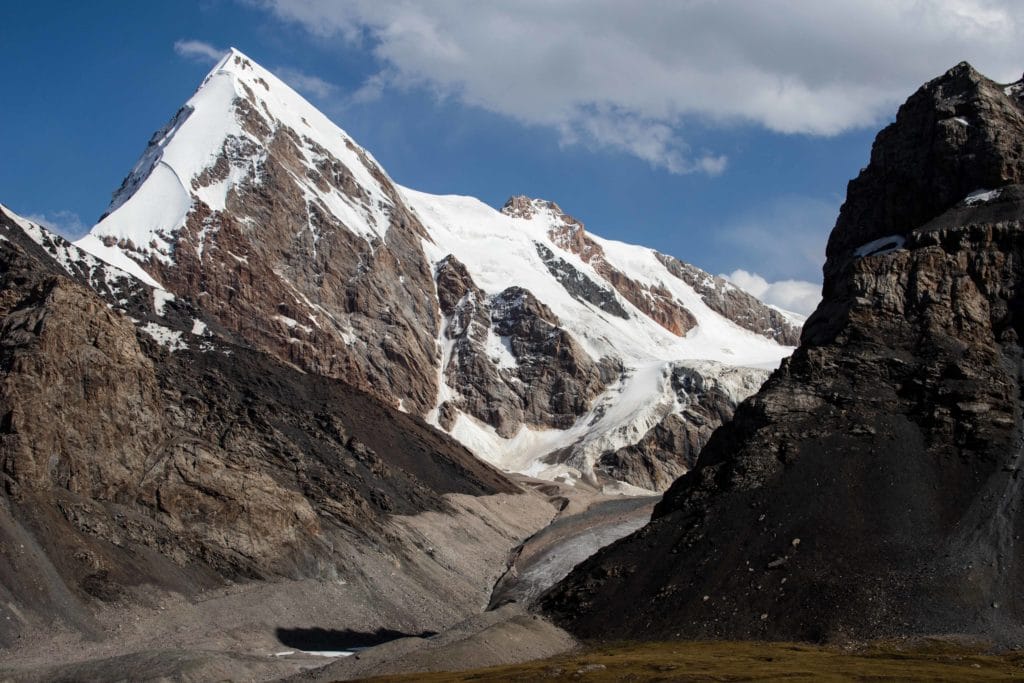
After just a couple hundred meters, the path exists the forests and climbs to a grassy ridge that separates the Kan Jailoo and At Jailoo rivers. As the trail climbs this small ridge, nice views open up down the Kanjailoo and towards lovely 5697m Peak Nansen. Going up through some deep muddy trenches apparently carved by horses over the year and then through a bit of dense vegetation, the trail begins to angle slowly westwards into the At Jailoo valley itself.
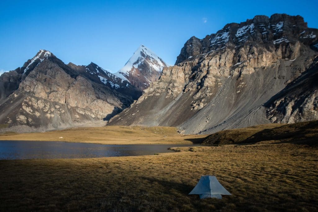
Just after crossing a section of dodgy scree high above the river, the trail descends to first one stream at 7.1km and then a second at 8km, both of which are fed by the glacier runoff of Peak Humboldt and surroundings. Beyond the second stream, the path continues up one very short rise and then rolls gently until At Jailoo Lake comes into view a little further on.
Much of the shore is a bit of a moist mess, even in summer. It’s not terribly hard to walk, but you may have to search a bit for a dry spot to set up camp. We prefer the western end of the large At Jailoo lake, on a small rise between it and the tiny lake (read: pond) just beyond, but you can also angle up towards the ridge to the north and there are a handful of spots that are both flat enough and dry enough to comfortably put up a few tents.
The return trip to the Enilchek Valley follows exactly the same route back – though of course will be considerably quicker as it’s almost entirely downhill.
Alternate Options for At Jailoo Lake
If camping on the northern or western side of the larger At Jailoo lake, look for a small saddle along the ridge to the northeast. It’s a fairly easy walk to this quite open area atop the ridge, around 2.5km one-way and 155m of vertical elevation, which offers excellent views of the Enilchek Valley and beyond the next ridge to Sary Jaz. A little further to the east is a ~3940m small peak that appears to be accessible by a non-technical ascent. We weren’t able to try it because the weather was changing as we hit the saddle, but it should offer excellent views from the top immediately to Nansen Peak and Peak Vit and perhaps all the way to Khan Tengri and Peak Pobeda.
It’s further possible to continue down from At Jailoo to the south to Kaindy Valley, instead of looping back to Enilchek. The descent from the lake gets quite steep in places, and you’ll need to arrange a driver to pick you up from the trailhead at the end of a fairly dodge road.
Good To Know
Khan Tengri National Park is one of the few areas in Kyrgyzstan where you’ll need an entrance fee. Officially that’s 150 som per tent per day plus 300 som per foreign tourist plus at least 50 per vehilce per day. However, as in many things in Central Asia, these costs may be negotiable.
To even get here, you’ll need a ‘border zone permit’ to get through the two border posts at the Sary Jaz Valley turnoff and just before the entrance to Khan Tengri National Park. It’s possible to arrange this yourself for around $15, but you’ll need a couple weeks in Bishkek and another in Karakol. Save the hassle any pay a tour operator, who will charge you somewhere between $35 and $50.
The good news is that once you’re here, you’re here. Rather than hiking just At Jailoo, we’d really suggest to combine the trip with the trek along the Enilchek Valley either to Merzbacher Lake or all the way to Khan Tengri Base Camp. This is a wide, wild, beautiful region; if you’re making the effort to get all the way out here, try to spend absolutely as much time as you can.
Getting to At Jailoo Lake
The real difficulty with basically the entire Enilchek region is access. No public transportation runs here at all, the only shared taxis possible are *maybe* to Enilchek village if you get lucky enough to find a local coming home, and anywhere beyond the village is basically a complete lottery of whether there are and cars and whether they are willing/able to take you. Unless you really have all the time in the world to wait and hope, this is really a region to hire a guide and driver.
We quite like Kyrgyzstan Tourism and Kyrgyz Life for this part of the country, as their owners and guides know the region well and are mostly local. They can also arrange Merzbacher Lake, Khan Tengri Base Camp, trips up the Kuylu Valley, or exploring Sary-Jaz. There’s really quite a lot to do in this area, none of it easy to get to unless you have your own wheels, so this is a place we’d absolutely recommend going with a guide/driver.
Where to Stay and Eat
The Tur Khan Tengri hunting lodge at the trailhead has a large pleasant meadow for tent camping beside a small spring, but will ask some money for the privilege – you’ll need to negotiate, and the price goes up depending on whether the owner are around or just the caretaker. If you’d prefer to wild camp, you can do so just below the At Jailoo Valley – the only real tradeoff is having to walk to the river for water, which is sometimes quite gritty from glacier runoff.
Pingback: Kyrgyzstan: Merzbacher Lake and Enilchek - Asia Hikes