Tajikistan: Sarez Lake Trek
Таджикистан: Сарезское озеро
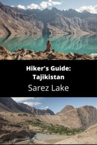
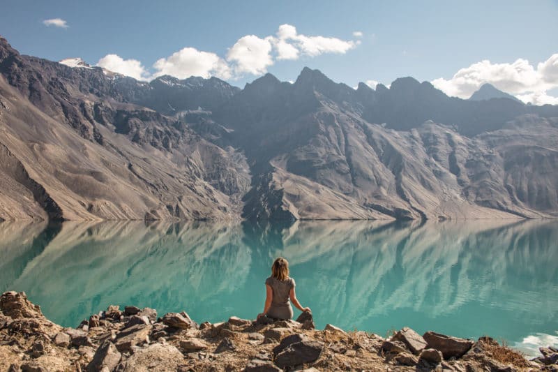
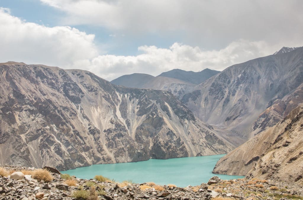
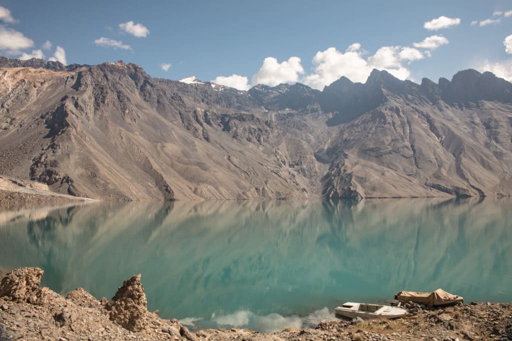
Among Tajikistan’s largest lakes, Lake Sarez was formed by disaster: in 1911 a 7.4 magnitude earthquake rocked the Bartang Valley, rattling down the entire face of the mountain, blocking the Murghab River with what is now known as the Usoi Dam. As years passed, the deep valleys cut by the Murghab River began filling slowly with water, and Lake Sarez has now grown to a massive 75 km in length and nearly 500m deep.
The Usoi Dam, which you will pass over on your way to visit the lake, is the only thing preventing a massive wall of water from hurtling down the valley and effectively wiping out everything in its path. Because of this, there are scientific stations situated around Lake Sarez that monitor the lake and the dam, and the area therefore requires special permits to visit.
Total km: 37.06 km
Total days: 2 days
Elevation gain/loss: 3099m+/3099m-
Start point: Barchidev
Endpoint: Barchidev
GPS Files
Quite different from any other trek in Tajikistan, the hike to Sarez Lake requires special permits and a guide to visit, making it one of the more expensive trips you could take in the country.
The trekking route from Barchidev to the monitoring station at Lake Sarez is pretty straightforward, requiring hikers to cross the Murghab River twice by cable bridge, but remains obvious as the monitoring station staff use this route to rotate in and out of the scientific stations every two weeks.
Once to the monitoring station it’s possible to charter a small boat to bring you to the southwestern corner of the lake to another station at Irkhut, from where the trek can be continued to other mountain lakes ending elsewhere in the Pamir at Yashilkul or Bachor.
Sarez Lake Trek: Stage 1
Barchidev Village to Sarez Lake
Total km: 18.53 km
Walking time: 6 hours
Total time: 7 hours
Elevation gain/loss: 1,883m+/1,216m-
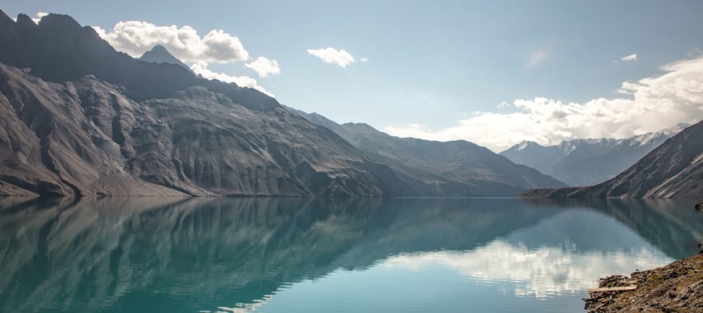
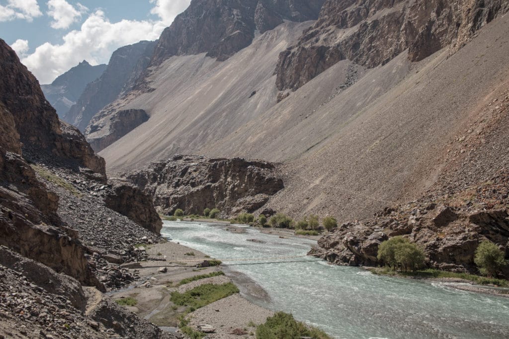
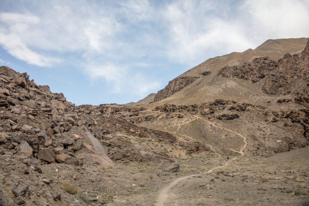
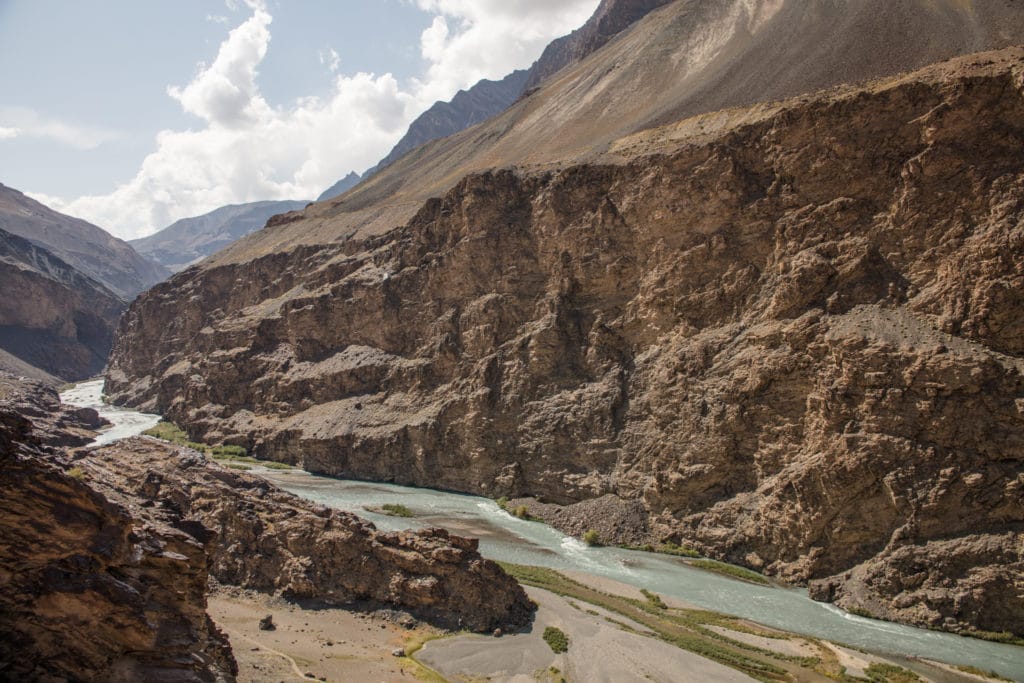
Starting from the village of Barchidev, descend a bluff into the Murghab River Valley. At the bottom of the valley, the trail crosses a sturdy cable bridge to reach the north side of the river. From here, the path ascends gradually to the east to bypass a cliff that seemingly drops sheerly into the river. This path stays high above the water for about 3 km after the bridge before descending once more toward the river after about 1 hour walking. At around 4.75 km beyond the first bridge, look for and cross a second back bridge to the south side of the river.
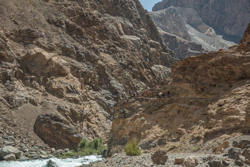
The path stays quite close to the river until about 13 kilometers into the trek (roughly 4 hours out of Barchidev), until it begins to climb up the Usoi Dam. Once the climb begins, it gains nearly 650m of elevation in a fairly short 3km – expect it to remain steep, if not punishingly so.
Finally, reaching the top of the Usoi Dam, you’ll be able to see the much smaller Shadau Lake to your south before the mighty Lake Sarez finally comes into view.
It’s a gradual and gentle descent to the lake shore near the Sarez Lake Risk Monitoring Station. As the permit requirements dictate that you’ll have come with a guide, you’ll be invited for a guided tour of the station and to learn a bit about both the catastrophe that formed Lake Sarez and ongoing efforts to monitor the situation and prevent further disaster here. The station also has tents and beds set up just outside where you’ll be sleeping for the night.
Sarez Lake Trek: Stage 2
Lake Sarez to Barchidev
Total km: 18.53 km
Walking time: 5 hours
Total time: 6 hours
Elevation gain/loss: 1,216m+/1,883m-
Make it a priority to wake up before sunrise and see Lake Sarez as a perfect mirror, reflecting the clouds and jagged peaks on the far banks in its unbelievably turquoise waters. For a place formed by and portending disaster, it’s an alarmingly peaceful scene with which to start a day of trekking.
You will follow the same route back to Barchidev from which you arrived, unless you’ve made more complex itinerary arrangements with your tour operator as noted below. The trek today is mostly downhill, making it much less effort than the trip getting here, and you’ll be back to Barchidev before you know it.
Alternate Options for Sarez Lake Trek
From the Risk Monitoring Station, it’s possible to hire a boat to take you to the Meteorological Station at Irkhut where the trek can be continued onwards towards the Mountain Lakes of Bachor. However, you’ll of course need to arrange this is advance with your tour agent.
Good To Know
A Lake Sarez Permit and guide are mandatory to take on this trek as mentioned previously. We’d recommend hiring Sarez Travel or Bartang & Sarez Tours to make arrangements. The rate per person will decline the larger the group you can band together for this trek, so try your best to come with a crowd, as you’ll have small hopes of putting one together on the ground.
Additionally, visitors will need a GBAO permit (easily applied for along with your e-visa), a Tajik National Park permit (can be bought at PECTA in Khorog for 20 TJS per day, or paid directly to a Tajik National Park ranger should you meet one along the way), and a Lake Sarez Permit (your guide will set this up for you, permit cost is $50 US per person per day).
Getting to the Sarez Lake Trek
Every few days a shared taxi will depart Khorog bound for Barchidev or beyond in the Bartang Valley. Ask around at the main taxi stand in Khorog to find out when the next one is leaving and plan for a cost of 65 TJS per seat. For those on shorter time either Sarez Travel or PECTA can help arrange transport for you at a cost of approximately $320 US for the car.
Where to Stay and Eat
There is a homestay in Barchidev run by Nurmohammed Roziq. A night including dinner and breakfast will cost about 200 TJS per person. They also have a hot shower.
For any other provisions like small snacks make sure to grab anything you need at the Khorog Bazaar before departing. As this trek requires a guide, your operator will handle meals, pack animals, etc.
[All photos in this post courtesy of Adventures of Nicole]