
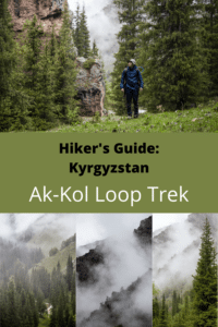
Kyrgyzstan: Ak Kol Loop Hike
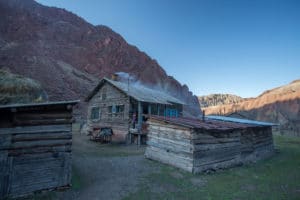
This Ak Kol Loop route begins and ends in the quaint log-cabin village of Ak-Kol in Naryn oblasts’ rarely-visited Jumgal region. Though access to the village isn’t easy (requiring a private transfer from the nearest village at Chaek), the surroundings are beautiful and the village itself a charming look back at Soviet-era constructions from when this area was a small mine and sanatoria complex alongside the pretty manmade lake.
Overview: Ak-Kol Loop Hike
Total Km: 19.73km
Total Days: 1
Elevation Gain/Loss: 947m
Start/End Point: Ak-Kol Village
GPS Files
Starting from the Western edge of Ak-Kol village, this route loops over the 2720m Sastyn-Kuru Pass (accessible June-October) and back up a parallel valley to the Eastern side of Ak-Kol village in a 19.73km daytrip. Rivers are swollen in summer with glacial meltwater, so consider horse trekking instead of hiking at this time of year.
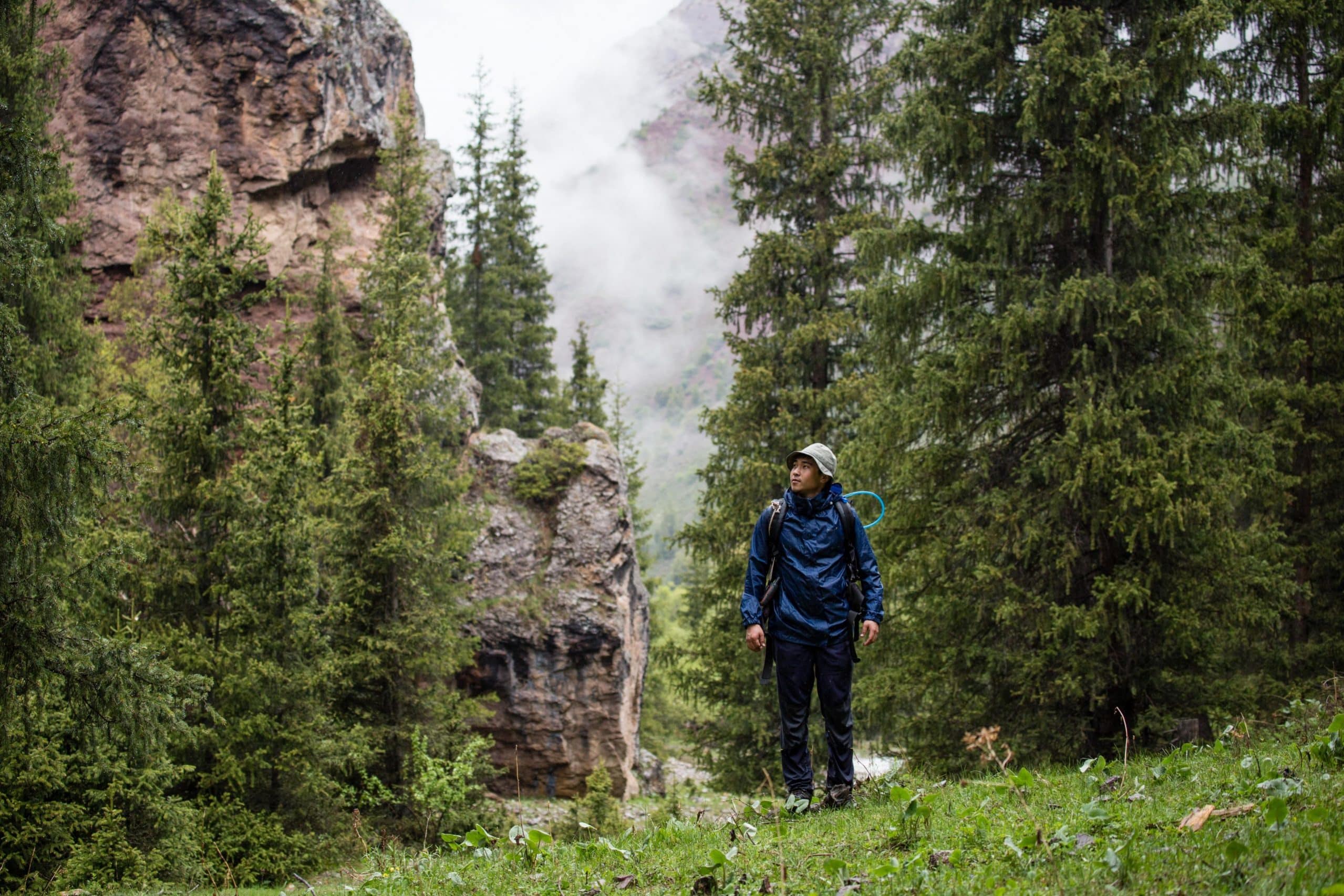
Hiking the Ak-Kol Loop Hike
From the wooden houses of Ak-Kol, home to seven families, head south from the western side of the village for the ascent up the Kang-Sai Valley. Turn right at the village’s only intersection to cross the bridge just beyond. To your right is a small cave that was part of the local lead mine – the impetus behind the village’s creation during the Soviet era. Stretching along the valley just above the village are some ruined buildings of the same origin; locals say they’ve been abandoned since at least the 1940’s.
Beyond the last ruins, the Kang-Sai Valley remains in a fairly natural state, with only a few shepherds’ camps to break the spell. Continue up the valley along the main path; most of the possible alternatives lead up side-valleys that are ripe for exploration but for which a one-day loop leaves little extra time.
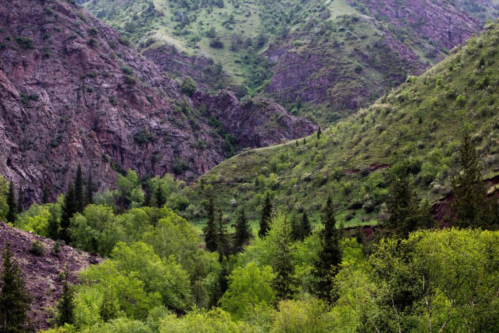
Just over 3km after the start of the route, the main valley takes a sharp left turn to nearly due south. After a further half kilometer, look for where a small side trail climbs to the left (East) to avoid two deep fords. Around 700m past the second, the main trail bears left at the foot of the beautiful Shili Valley and just beyond passes the foot of the equally attractive Kaiyndy-Bulak Valley; both of which would be excellent candidates for further exploration if you have more time in the area.
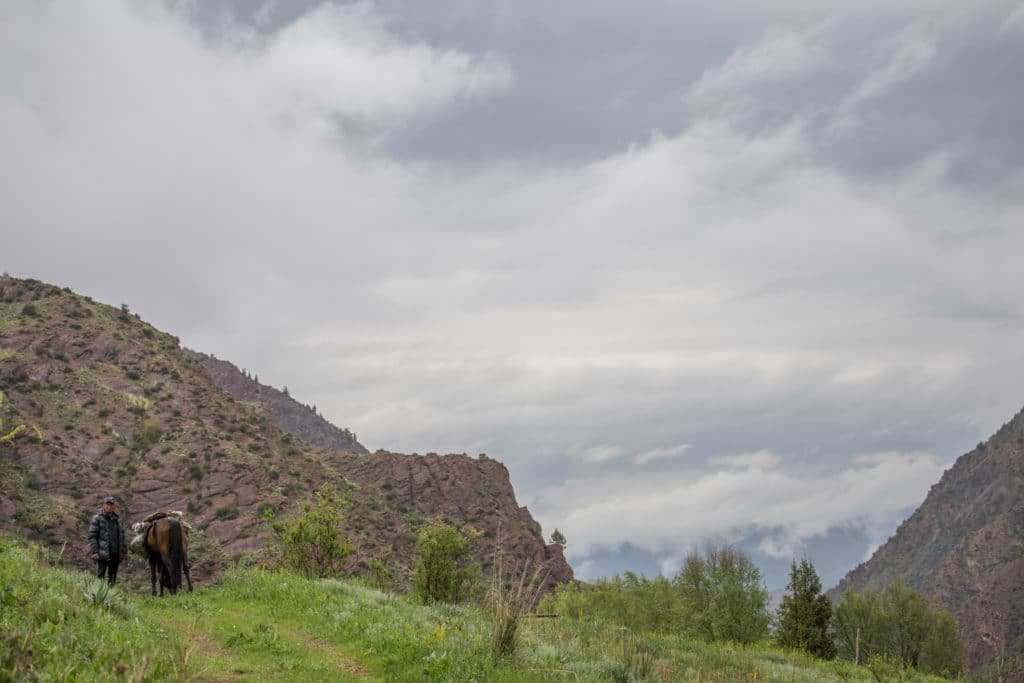
Passing through two more easy fords (though prepare for high water in early summer, as snowmelt swells all the streams in the area) and a small bridge, a rudimentary fence crosses the trail. The the Kang-Sai Valley is an important grazing area for the shepherd families of Ak-Kol, who leave their livestock high in the valley during summers and occasionally drive them over the 3524m Ken-Aryk pass to the town of Kazarman and the livestock market there. Be sure to leave the fence in the same state you found it in after you cross through – if it was originally closed, close it after you pass through.
A little over 1.5km after the fence, at a small clearing beneath a large rocky outcrop, the Ak-Kol Loop trail diverges from the main path up the valley and over the pass towards Kazarman. Look for a fork where the Loop trail climbs into a stand of trees while the valley trail descends briefly towards the Kang-Sai River.
From the fork at around 2427m, the trail switchbacks steadily through a small forested copse and then above the trees up a rugged hillside thick with vegetation – expect some difficulty in gaining a foothold after a heavy rain. What starts as a trail quickly deteriorates into little more than livestock runs, but luckily the climb is short and the end goal of the 2720m Sastyn Kyry Pass is a visible target to aim for.
Take a moment to enjoy the view from the pass, particularly the nice sightline up the Kang-Sai Valley to a cluster of small peaks at around 3900m, before descending East in trail-less zigzags to the valley floor at 2393m. Once again, prepare for wet conditions, particularly in the summer months. Luckily this small valley is generally wider than the Kang-Sai, and through most of the year it should be no trouble to pick out a fairly dry line along the 7.8km descent back towards the village.
Expect more livestock here, particularly scenic when bands of semi-feral horses gallop alongside your party, but also don’t be surprised to see more shepherds and yurts as access up the valley is facilitated by an old jeep road that makes moving people and supplies somewhat easier. Continue down the valley on an obvious path until you return to the Eastern section of Ak-Kol village, in which homestays are available, or to return by private transportation to Chaek and beyond.
Good To Know
The best season to trek in Kyrgyzstan is July-September, though you can explore these mountains year-round with proper equipment and training.
It’ll still be cold at night, often, but snow should be off all but the highest of trails and water will be available in valleys with rivers. You won’t need any special equipment and there are no entry fees. However, we’ve heard that hikers who don’t overnight in the village have received cold treatment from locals in the past.
Getting to the Ak-Kol Loop Hike
There is no public transportation to Ak-Kol, so the only access is on foot or by private transportation. Ak-Kol is accessible by a 10km dirt road that leads off of the new highway section from Kazarman to Chaek. To hire a private transfer, inquire at the bus station in Chaek, but expect to bargain hard and to pay 5000 som or more unless you meet others heading the same direction.
Where to Stay and Eat
Private homestays are available in Ak-Kol Village (ask around, somebody will point you to whoever currently has a spare room or a yurt out back) but expect fairly basic conditions and bring with a tent and sleeping bag in case you have to make alternate arrangements.
As an aside, we’ve also published a quick and dirty guidebook to show tourists around for their first few days in Bishkek. If you’re headed towards Kyrgyzstan and expect to need some help getting around, consider our Unanchor: Bishkek guide. Additionally, we contributed the Kyrgyzstan chapter to the most recent Lonely Planet: Central Asia guidebook. If you’re looking for more help than that, consider reaching out to our friends at Feel Nomad to organize a tour to the country.
This walk looks beautiful, so lush and green! I would love to try this.
I very much recommend it!
Thanks for the detailed instructions and tips for navigating weather during different seasons. Super helpful info.
Glad it’s of use!
Wow, this hike sounds amazing! I love to see it when the clouds come rolling in below. It sounds like this trek would be a real adventure and back to basics in the best way!
A lovely experience, to be sure, and one of many in the country.
Wow, it’s sooo stunning! The rolling hills are beautiful, and a good hike works wonders on your health
Agreed, it’s my fav form of exercise. 🙂
What a beautiful hike! Thanks for putting together such a detailed guide with everything we need to know.
Glad you found it helpful!
What a beautiful walk in stunning surroundings, many thanks for this detailed guide. I’d love to visit Kyrgyzstan and surrounding countries one day!
I hope you’re able to, Central Asia is wonderful!
We’re so glad to learn that the best time to hike the Al Kol Loop is between July and September, as this is the only time we can travel far (outside of Europe). Besides, Kyrgyzstan is on top of our bucket list, we almost went there last summer, but decided to postpone it to next year.
It’s really a great time of year in the country, particularly if you’re hoping to do much hiking. Hope you’re able to make it soon!
Wow, these photos are so beautiful! I live in Dubai and really miss the greenery – the nature in Kyrgyzstan looks definitely appealing to me. Would love to visit!
It’s really a lovely country – and definitely very different landscapes from what I’ve seen of the Emirates!
Such an adventurous hike this would be…up in the mountains of a very foreign land Kyrgyzstan!
Everywhere is foreign till you’ve visited once. 🙂
This sounds like a perfect hike! I have wanted to hike in Kyrgyzstan for a while, and this just makes me want to visit even more. I will totally have to ask your advice once some of these travel restrictions are lifted.
19km and just under 1000m elevation gain make this sound pretty doable for any vaguely fit hiker, and loop hikes are always fab.
Yep, it’s a pleasant stretch of the legs but not strenuous, with lovely landscapes and views along the way. Please do feel free to reach out with questions and keep checking back – there’s a long list of hikes in Kyrgyzstan on the to-do list for this site.
I would like to visit this wonderful country , hope to be there after this pain has passed away
It’s a lovely place to travel, hope you’re able to visit!