Kyrgyzstan: Chon Kaindy Valley
Kyrgyzstan’s Chon Kaindy Valley (sometimes transliterated as Chong-Kaindy of Chong-Kaingdy instead) is not among the well-known trekking routes in the Chuy Oblast surrounding Bishkek, and therein lies much of the appeal. There are no epic peak panoramas, but an abundance of beautiful verdant nature away from the crowds of places like Ala-Archa.
Total Km: 11km
Total Days: 1
Elevation Gain/Loss: 446m+ / 446m-
Start Point: Kara Bulak Village
End Point: Kara Bulak Village
GPS Files
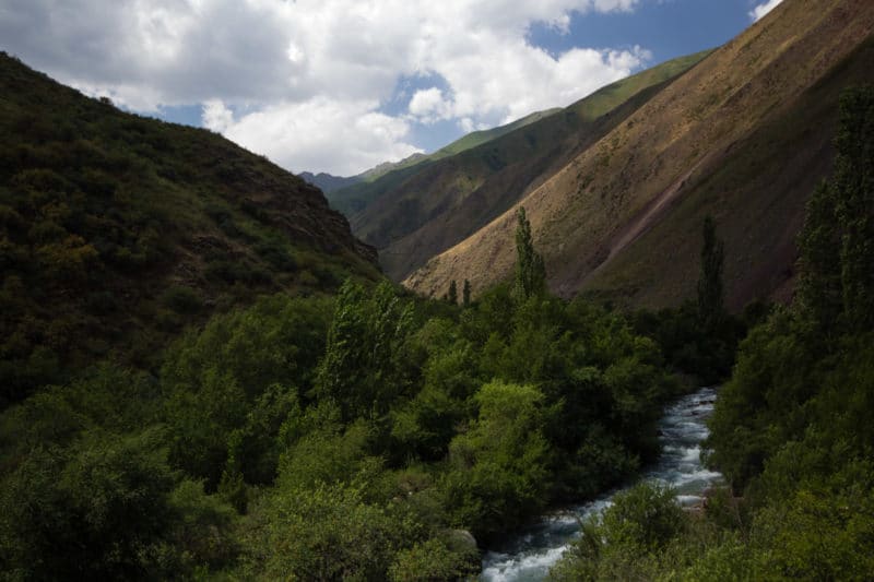
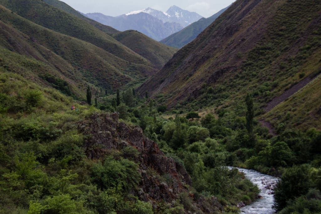
The Chon Kaindy Valley (Чоң Кайыңды in Kyrgyz, literally ‘Big Birch’) is a rarely-visited hiking destination in Chuy oblast. The trail here, insomuch as it can be called that, is used almost exclusively as a shepherds’ path to move livestock up and down the valley to graze – expect occasional scrambles and several stream crossings. The way is certainly slow and rough; but then the reason to come here is to get away from more manicured routes and into wild nature. For this Chong Kaingdy definitely delivers.
Chon Kaindy Valley Route Description
The first four or five kilometers into the Chon Kaindy Valley are along an old road that remains fairly navigable until it abruptly ends. Assuming you’ve hired transportation to get you to the trailhead, you’ll want to take it all the way to the end of the road to avoid a fairly monotonous walk to begin the day.
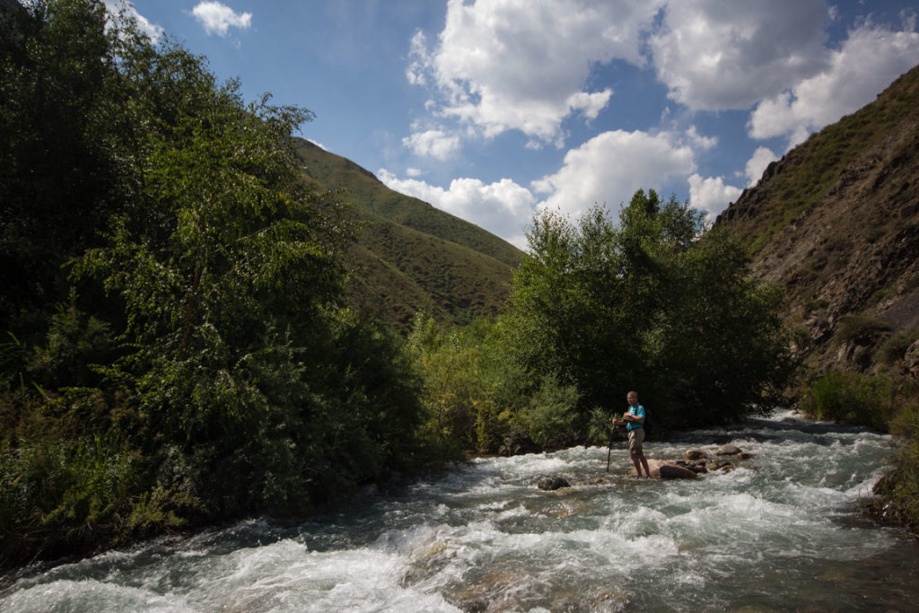
From the end of the rough road, on the western bank of the Chong Kaingdy stream, continue due south. An easy-to-follow shepherd track soon plunges into the stream – the first of three crossings in the initial stages. It isn’t particularly deep through most of the year, though it can be quite cold. Wary hikers may want to pack a pair of stream sandals along to wear through the crossings.
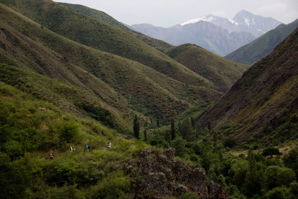
Continue south alongside the stream for around the first three kilometers past the end of the road, keeping an eye out for a large rocky outcrop looming ahead on the eastern bank that narrows the stream considerably and forces you back to the western shore – any semblance of a formal trail ends at this point. From here, animal tracks begin to climb out of the cover of greenery and up an exposed hillside, a somewhat loose and steep scramble up the western bank, gaining a quick 100m of vertical elevation over 300m of lateral progress.
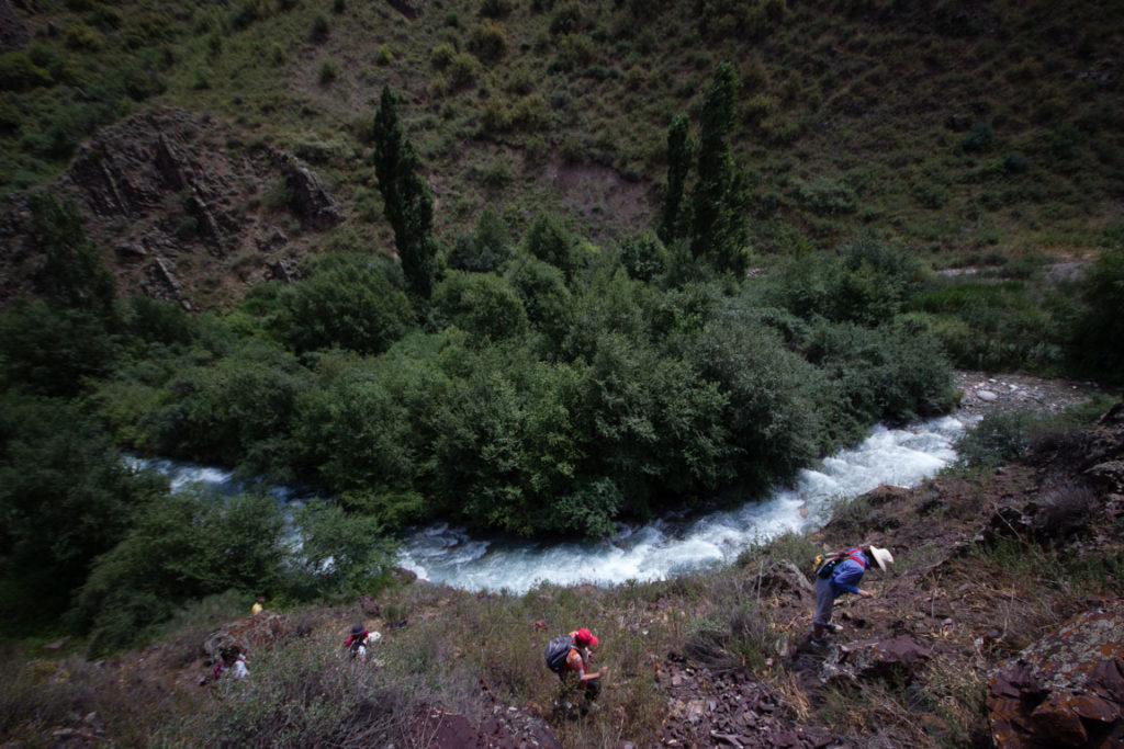
Along the Chong Kaingdy Valley
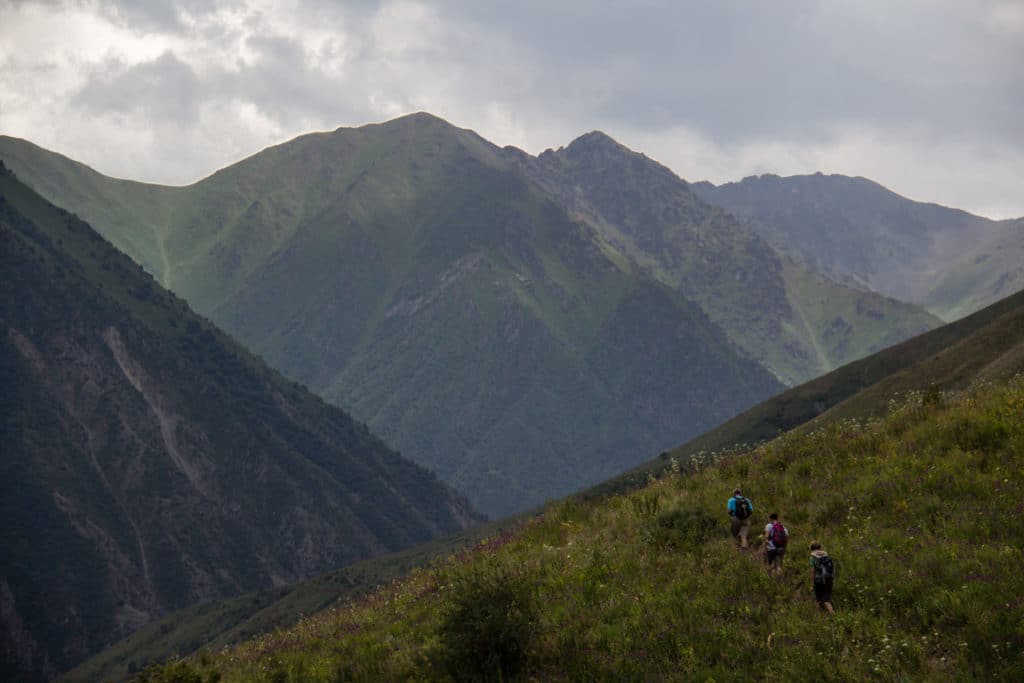
From the top of this brief climb, though, views open up a bit along a more exposed hillside. Expect nice vistas across the valley to the east and occasionally towards the top of the valley to the south. Carry on as far as you like, at this point. Our exploratory hike with the Trekking Union of Kyrgyzstan only progressed another 1.5km or so before breaking for lunch and then heading back to the trailhead. A combination of a slow group and rough trails, presumably. The topography of the valley appears to remain quite gentle continuing onwards, though. Local shepherds certainly make use of the higher sections to quarter livestock. It’s worth exploring further if your party has the time and motivation.
Alternate Options for Chong-Kaindy Valley
Soviet-era maps of the area show some glaciation in elevated bowls at the top of the valley, and a few small glacial lakes scattered through the same area. Additionally, these maps give a 3880m Mazar-Ashuu Pass (open July-Sept) from which the path continues down through the Ashuu-Tor and Chok-Mazar valleys before meeting the main Kara-Balta Valley and the highway there. We’ve not explored these possibilities at all, so do your own research and consult local experts before attempting to do so.
Good To Know
There are no entrance fees for the Chong-Kaindy Valley, and on-site there are no facilities of any kind. You’ll not need any specialized equipment. However, a pair of long pants would be even more highly recommended here than elsewhere in the region. Rough trails and high grasses mean you’ll be in for a lot of thorn stabs otherwise.
Getting to the Chon Kaindy Valley
Public transportation departs regularly from Bishkek’s West Bus Station to the town of Kara Balta for 100 KGS. From Kara Balta, you’ll need hire a taxi to cover the 22km to Kara Bulak, or beyond along the road into the valley.
It will save you much time and frustration to arrange private transportation to the trailhead. Either arrange through a tour company or with a self-drive.
Where to Stay and Eat
The nearest formal accommodation or dining options are in nearby Kara-Balta. Most visitors will elect to visit as a daytrip from Bishkek instead.
We’ve also published a quick and dirty guidebook to show tourists around for their first few days in Bishkek. If you’re headed towards Kyrgyzstan and expect to need some help getting around, consider our Unanchor: Bishkek guide. Additionally, we contributed the Kyrgyzstan chapter to the most recent Lonely Planet: Central Asia guidebook. If you’re looking for more help than that, consider reaching out to our friends at Feel Nomad to organize a tour to the country.